2016 is the 100th anniversary of the National Park Service. Each of the past three years I have had the opportunity to visit at least two National Parks on my drive out of Florida road trips. I’d love to make my writing career focused on parks, but that kind of topical writing does not pay my bills. Still, I visit and write about parks and the outdoors whenever I have the opportunity to visit some place new.
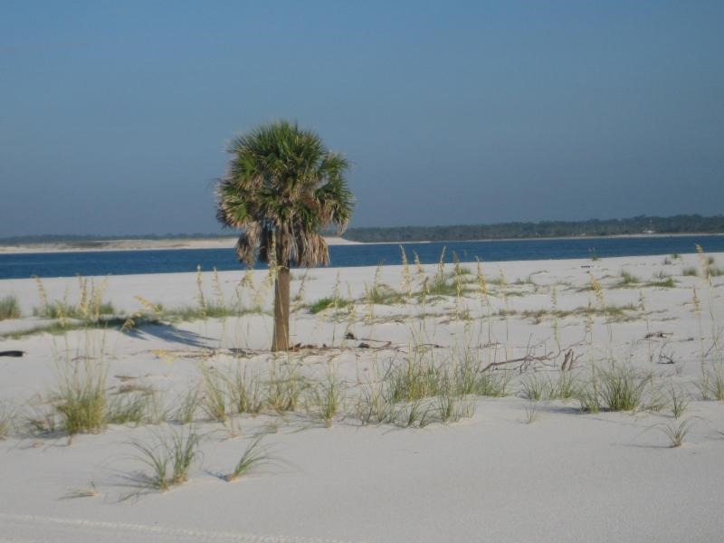
Beach on Santa Rosa Island, Florida National Park Service photo
Gulf Islands National Seashore park center at Davis Bayou is a mainland visitor center three miles east of Ocean Springs, Mississippi. This was an unanticipated find for me as I drove U.S. 90 from Mobile, Alabama to New Orleans. Visitors can access West Ship Island off the coast of Mississippi from a ferry concessionaire in Gulfport, MS. There are four other islands off the Mississippi coast that are part of the Gulf Islands National Seashore, however, they are accessible only by private boat.
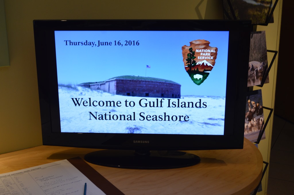
Gulf Islands National Seashore, Davis Bayou Visitor Center, Ocean Springs, Mississippi
As soon as I was out of the traffic congestion of Mobile, Alabama on Interstate 10, I saw a sign for “Beaches†and exited the interstate for U.S. 90, the road that hugs the white sand beaches of Mississippi. Unknown to me and unplanned was an excursion at Ocean Springs, Mississippi into Gulf Islands National Seashore, the largest national seashore in the USA stretching 160 miles east to west. There are six park areas in Florida for the National Seashore with two eastern park visitor centers in the Florida Panhandle around Pensacola and a western park center in Ocean Springs, Mississippi.
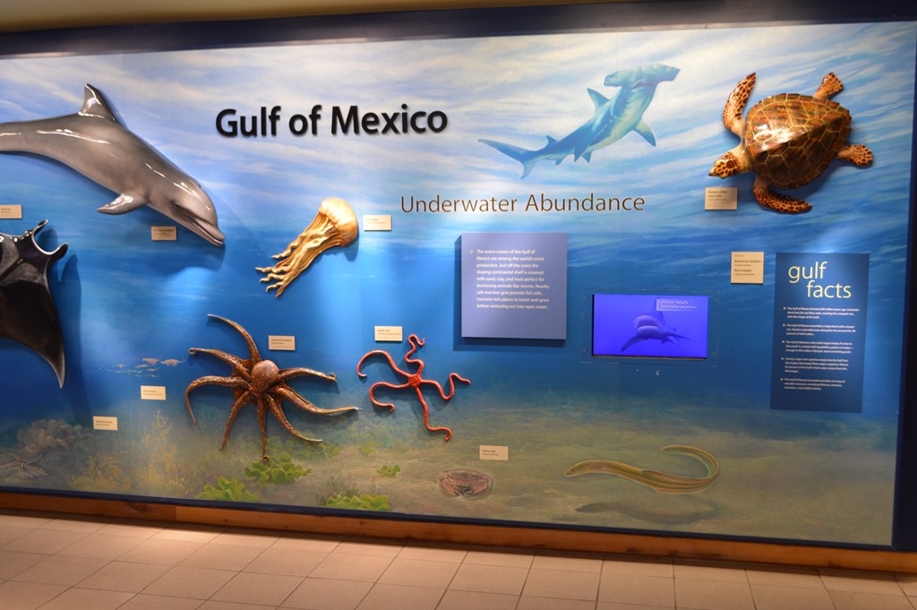
Gulf Islands National Seashore was created to protect the barrier islands off the Florida and Mississippi coast. These islands are actively shifting sands in the sea and home to sea turtles, some of the highest concentrations of dolphins in the world and decaying military fortresses that served to protect the mainland harbors for more than two hundred years.
These barrier islands serve as the main line of defense protecting the mainland from tropical storms. Â Barrier islands were also strategically important militarily in the past as the main line of defense against enemy attacks on Gulf Coast ports in Florida, Alabama and Mississippi.
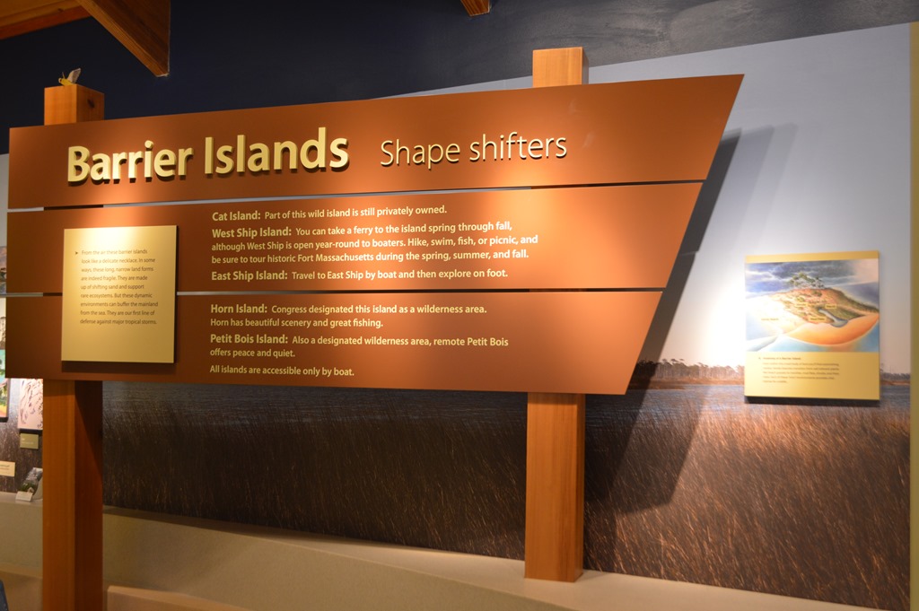
The barrier islands are still shifting sands in the Gulf of Mexico. Sea charts from 200 years ago for the coastal region show some islands have shifted as much as 6 miles to the west in the past two centuries.
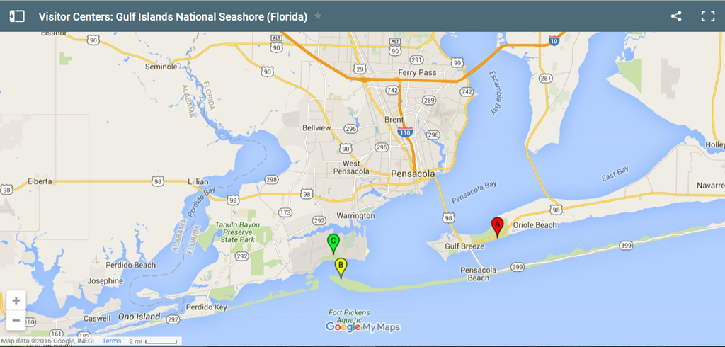
Gulf Islands National Seashore operating hours and seasons for different park areas in Florida and Mississippi
A – Naval Live Oaks Park Headquarters – Gulf Breeze, Florida
B – Fort Pickens Visitor Center – Pensacola, Florida
C – Fort Barrancas Visitor Center – Pensacola, Florida
Mississippi coast region of Gulf Islands National Seashore
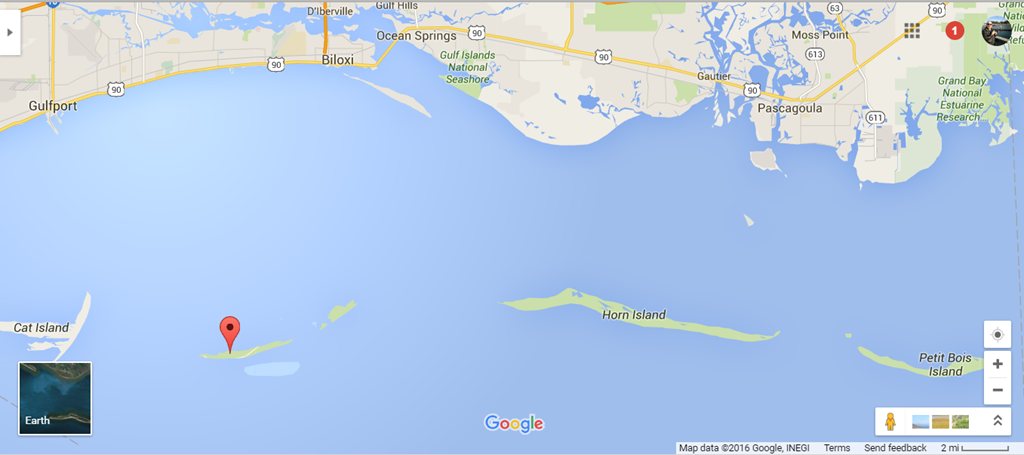
Pin shows location of West Ship Island, the only island accessible by National Park Service concessionaire ferry “Pan Isles†at Gulfport, MS from March to October. The park facilities and restrooms on the island were destroyed by Hurricane Katrina in 2005 and never rebuilt. Access to other islands may be arranged through private boat charter licensed as National Park Service operators for Cat Island, East Ship Island, Horn Island and Petit Bois.
Gulf Islands National Seashore Davis Bayou Visitor Center
The temperature was hot and humid outside the visitor center in Davis Bayou. Fewer than 10 cars were in the parking lot and I found a spot in the shade of a tree. After the Orlando alligator drowning of the two year old the day before at Walt Disney World, I looked around the natural spaces by my car to make sure there weren’t any gators or snakes waiting for me.

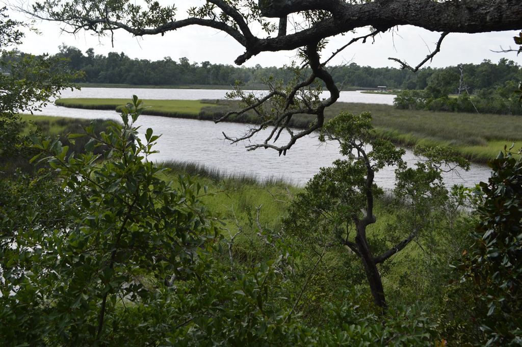
I find bayou country and the estuaries of the Gulf Coast to be scenic places despite the oppressive late spring/summer heat. This area seemed very similar to areas of Jekyll Island, Georgia and Cape Romain National Wildlife Refuge in South Carolina I visited over the past two years in May and June.

Scenery seen from couple miles drive on the park road to Davis Bayou Visitor Center.
The film in the park center introductory focus was on the struggle for endangered sea turtles. There is an irony in the fact that every resort hotel I have visited on the Gulf Coast, places like St. Regis Bal Harbour and Westin Jekyll Island offer all kinds of sea turtle education activities and information, yet these resorts and massive condo complexes built directly on Gulf Coast beaches are precisely why sea turtles are endangered. The film also covers the military history of the barrier islands and shares the story of Walter Anderson, an environmentalist and local artist who spent time on the barrier islands and painted them in watercolors.
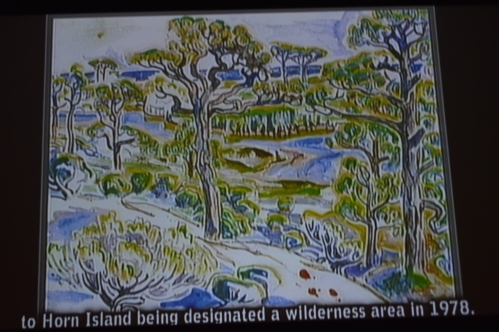
Walter Anderson (1903-1965) watercolor of Horn Island, a wilderness area of Gulf Islands National Seashore. There is the Walter Anderson Museum of Art in Ocean Springs. The wikipedia article states many of his paintings and murals were damaged in the 2005 storm surge of Hurricane Katrina that flooded Ocean Springs and most of the Gulf Coast of Mississippi.
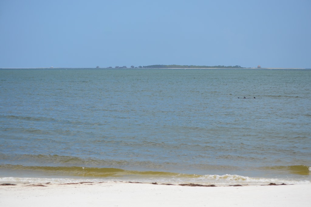
Although I had not noticed at the time, I photographed a pod of dolphins near the shore when I stopped at Carrabelle Beach in the Florida Panhandle the day before.
When people talk about the connectedness of ecosystems, I am always amazed at how different parts of the USA face many of the same challenges.

An exhibit at the Gulf Islands National Seashore Davis Bayou visitor center explained how the least tern make their nests in beach sand. The endangered birds winter in Brazil and Central America, then in summer season they come to sand beaches in North America to lay their eggs. There are two Gulf coast subspecies and a California subspecies. On a trip last month to Guadalupe Sand Dunes in Santa Barbara County, California I learned the time to visit the park there is in the winter when the California least tern is way down south in Central America. Visitors are allowed to walk into the dune areas that are closed during spring and summer months for California least tern nesting on barren sand dunes near the coast. Federal protection in California since 1970 allowed this subspecies to repopulate from about 600 breeding pairs in 1973 to nearly 6,500 in 2010. All it took were rope barriers to keep people away seasonally from nesting grounds located in the beach sand dunes.
The truth of the matter is,
the birds could very well live without us,
but many – perhaps all – of us
would find life incomplete,
indeed almost intolerable
without the birds.
Roger Tory Peterson (1908-1996), naturalist and ornithologist
War Dogs on Cat Island
I grew up as an “army brat†spending most of my childhood around military bases in many US states and West Germany. Military history is not a particular interest of mine, but I kept finding myself in places all around Florida, Alabama, Mississippi and Louisiana on this trip where I learned about military history connections to the land and sea.
One of the stories from Gulf Islands National Seashore is Cat Island received its name from Spanish Explorers who charted the island in the 1500s and named the island for the raccoons living there, which looked like a species of wild cat to them. Cat Island has forests, alligators and migratory birds too.
During World War II the island was home to a top secret base – Cat Island War Dogs Training and Reception Center. The mission objective was train dogs for the U.S. Army Signal Corps and a special experimental program happened there for training dogs to sniff out Japanese by their scent for Pacific island theater battles. There is an interesting 2011 History Detectives about the 1942-43 activities on Dog Island and how Japanese-American U.S. Army soldiers were sent to Cat Island as ‘bait’ for dog training. The project was a failure since it was determined Japanese did not have a distinct racial scent from other people to the dogs.
These days the western and southern tips of Cat Island are owned by NPS, while the eastern portion of the island is owned by BP, who used Cat Island as an operations center for the Deepwater Horizon Cleanup Effort in 2010.
After touring the visitor center I was ready to see some white sand beaches of Mississippi. The beach scenery from US 90 in the western portions of the Mississippi coast did not disappoint.

View from Beauvoir in Biloxi, Mississippi, last home and shrine to Confederate President Jefferson Davis.
June 2016
Florida Road Trip Orlando to New Orleans and Louisiana Tour
- Rough Start for Drive Out of Florida road trip to New Orleans
- Orlando to Pensacola road trip notes and photos
- Hotel Review: Holiday Inn Express Pensacola West–Navy Base on PointBreaks
- Beautiful Sweet Home Alabama driving U.S. 98 and U.S. 90
- Gulf Islands National Seashore at Ocean Springs Mississippi
- Road Trip Photos Gulf Coast Mississippi to New Orleans 9th Ward
- Dispatch from New Orleans-Huge Ass Beers, NOLA Gay Pride, June Mardi Gras
- Hotel Review-Hyatt Regency New Orleans
- Airline History: Why Delta Air Lines HQ was in Monroe, Louisiana until 1941
- Best Western Low Rate Guarantee success and Cracking Hotel Confusion in Krakow
