Writing a trip report while it is happening is one way I get my initial impressions of a place imprinted before memory obscures the details. After an initial rough start to my road trip, I was driving I-75 north after spending a couple hours at Orlando Airport. My main plan for a rental car drive out of Florida to New Orleans road trip was visiting beach resort towns of Panama City Beach, Destin and Fort Walton Beach on the Florida Panhandle.
If you want to really see America, get off the Interstate Highways
After driving hundreds of miles across Florida in three spring season road trips over the past three years, my realization is Florida is not very scenic from the Interstate when traveling north of Orlando. The view is basically a straight road through long stretches of forests, an occasional bridge with a water view and highway rest areas with fast food and gas. Making a long-haul drive along Interstate-75 after a red-eye flight was putting me to sleep and I found myself exiting I-75 every 30 minutes or so to walk around a rest area.
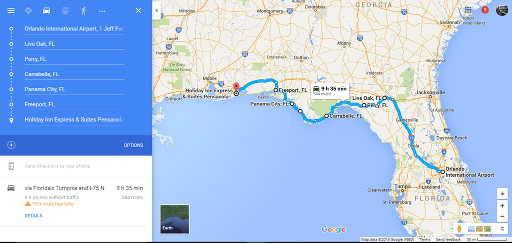
One problem I have with iPhone maps is the lack of route options when plugging in destinations. After driving about 160 miles north on I-75, I exited a few miles south of Interstate 10 to Tallahassee at US Route 90 driving west.
Google Maps shows this route to be 311 miles for a 6 hr. 40 min. drive. I was in Live Oak, Florida at 12:30 afternoon.
 Â
 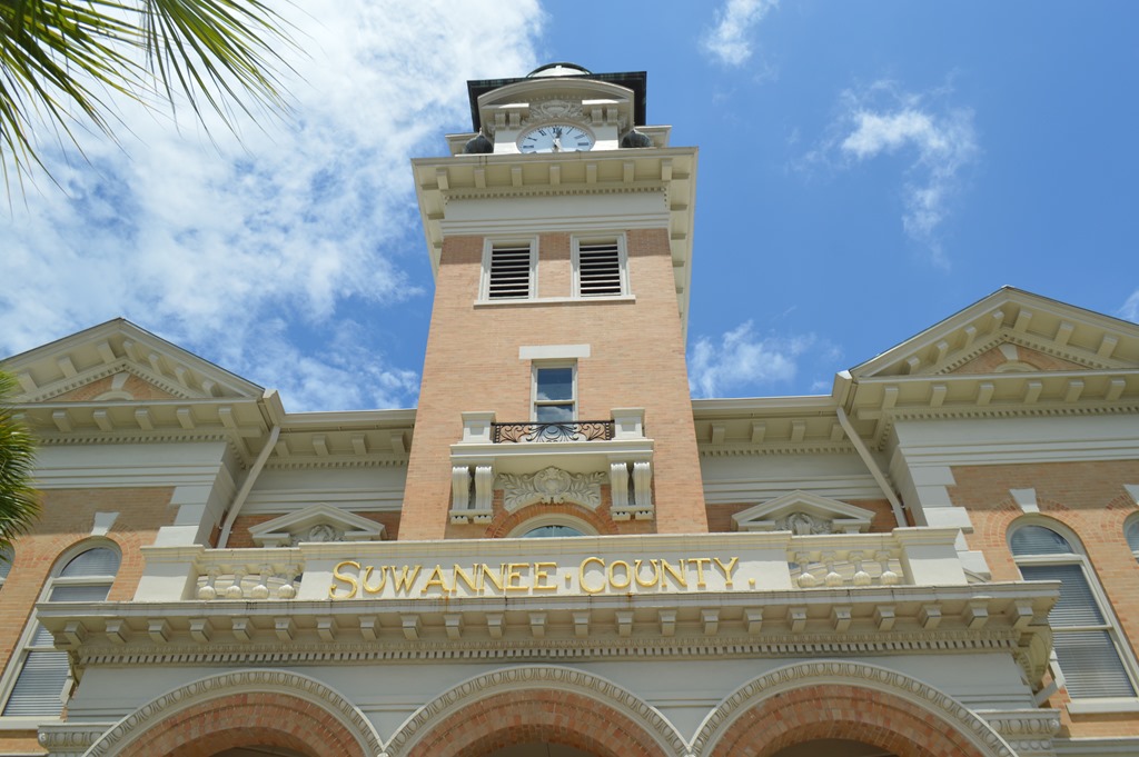
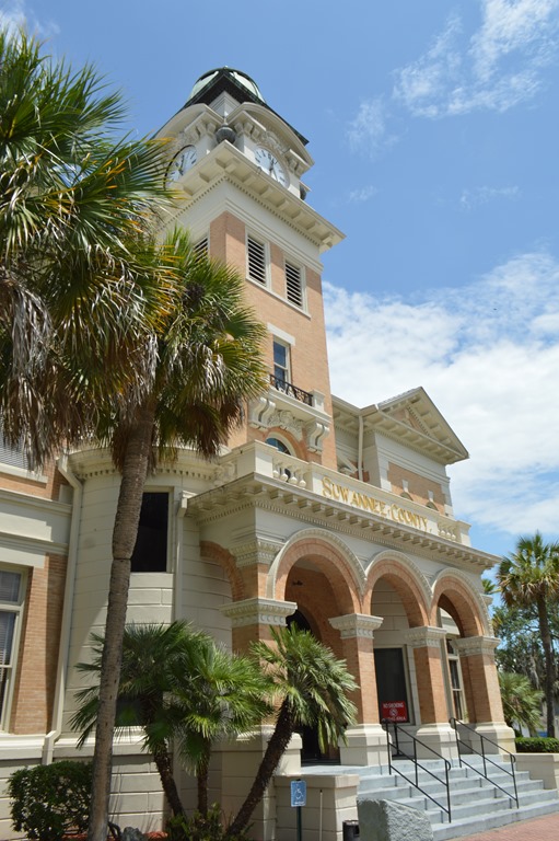
I stopped to photograph Suwannee County Courthouse in Live Oak and learned about the Stephen Foster 1851 song, Old Folks at Home (Swanee River). It is the official State Song of Florida since 1935. Here is an interesting 2008 article from the Tampa Bay Times on how the original racially charged lyrics, from the viewpoint and dialect of a plantation slave, were amended to remove the word “darkeysâ€. Apparently, Stephen Foster never visited Florida.
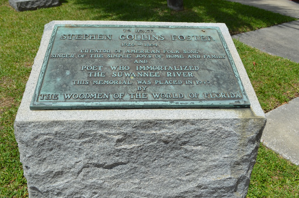
Stephen Foster 1949 Memorial in front of Suwannee County Courthouse. Live Oak became the Suwannee County seat in 1868. Suwannee County, Florida is bounded by the Suwannee River on the North, West and South.
In the town of Live Oak, I plugged in Perry, Florida to get me to US 98, the highway that hugs the Florida Panhandle coast to Pensacola, Florida.
Next stop was another 50 miles in Perry, Florida where I stopped at a Winn-Dixie supermarket to buy some fruit and vegies for car snacks. Winn-Dixie is the main grocery store chain I saw in towns along the way. The only thing more prevalent than Winn-Dixie markets were all the Dollar Tree Stores I saw between Florida and New Orleans.
Perry, Florida (pop. 7,000) is a name that seemed familiar to me for some reason. I was sure I had read or heard about this town sometime before. A quick check of Wikipedia while at Winn-Dixie refreshed my memory. The town was founded in 1858 and named for Madison Starke Perry, the 4th Governor of Florida (1857-1861). Perry was also a Confederate Colonel during the Civil War, but that is not the reason Perry, Florida was familiar to me.
Perry Race Riot Dec 14-15, 1922
The Perry Race Riot of 1922 is what triggered my familiarity with the name. A young white school teacher was found murdered at the railroad tracks of Perry in December 1922. This area of Taylor County was in the plantation cotton belt and racially segregated at the time. While Rosewood is probably best known among the Florida race riots of the 1920s, Perry happened a few weeks before the Rosewood Florida Massacre in January 1923.
The Perry race riot was a racially motivated conflict on 14 and 15 December 1922, in which whites burned Charles Wright at the stake and attacked the black community of Perry, Florida after the murder of Ruby Hendry, a white schoolteacher. Wright, a 21-year-old escaped convict, and Albert (or Arthur) Young, his alleged accomplice, were arrested and jailed for Hendry’s murder. A mob, several thousand strong, made up of local and out-of-state whites seized the accused from the sheriff, and extracted a confession from Wright by means of torture.[1] Wright claimed to have acted alone and was subsequently burned at the stake and the crowd collected souvenirs. Following this two more black men were shot and hanged; whites then burned the town’s black school, Masonic lodge, church, amusement hall, and several families’ homes. – Wikipedia.
This University of Florida article references the Perry Race Riot in a detailed piece on the Rosewood Race Riot. Lynching of black men for alleged crimes against white women were a common occurrence across Florida and many other places in the US at this time as the Ku Klux Klan had become a major political party during the previous decade with over 4.5 million members in the U.S. by 1924.
No more talk of places known for infamous race riots. I drove on westward to the touristy Florida Panhandle beaches.
Pine Forests, Prisons and Road Crews
For the next couple hours I drove west through pine forests on rural U.S. Route 98 with only sightings of prisons in the middle of nowhere and several stops and delays due to one lane traffic for road construction work crews. Then, as I drove through the Apalachicola National Forest, the rain started to fall – alternating between showers, hard rain and torrential rain with little visibility even in high speed windshield wiper mode.
Miles from nowhere
I guess I’ll take my time
Oh yeah, to reach there
I wondered if I would ever reach the sea along the Gulf Coast?
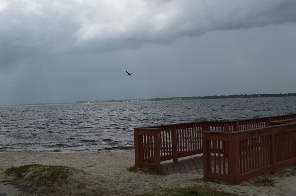
West shore of Ochlockonee Bay, Florida looking east, in the direction I had come from.

My good fortune was to have driven out of the storm just at the moment I crossed the bridge over the Ochlockonee Bay to reach Franklin County, Florida and see the ocean for the first time on my drive. Skies were clear and sunny to the west.
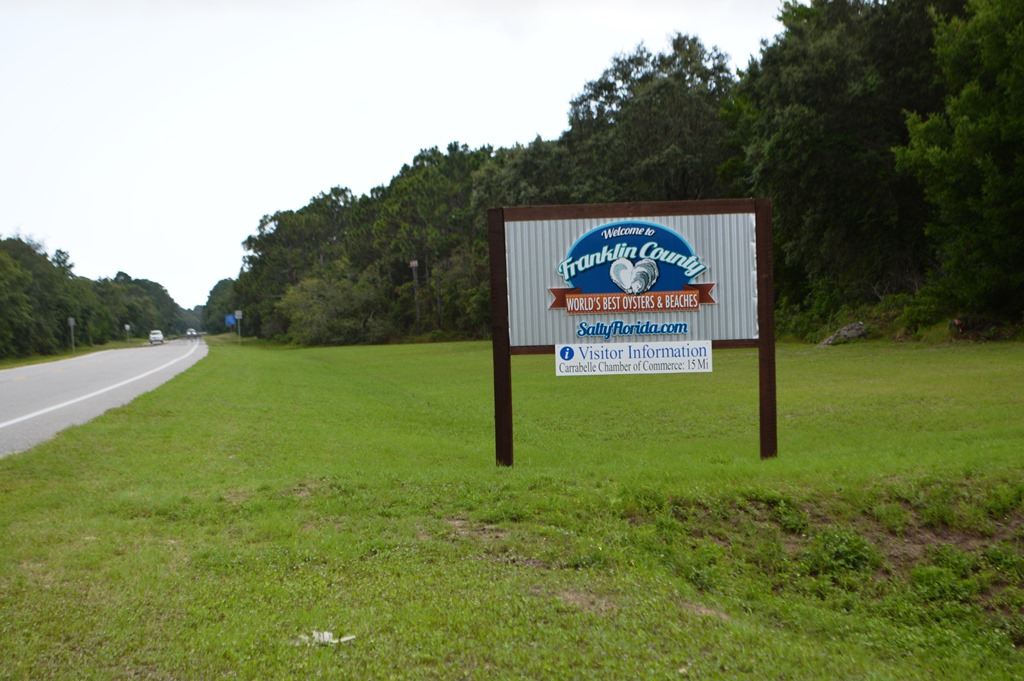
Welcome to Franklin County Florida – World’s Best Beaches and Oysters – SaltyFlorida.com
Another 20 minutes driving west and this was my clear skies sea view.

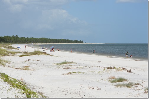
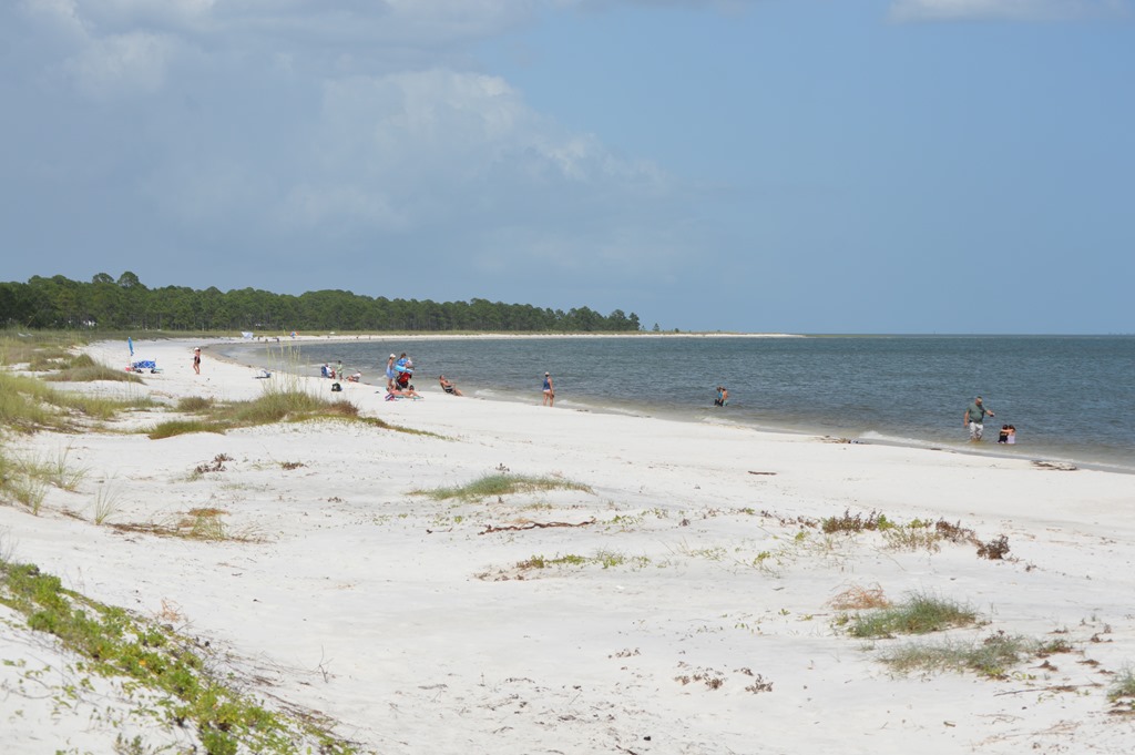
And another 15 minutes driving west along U.S. 98 and this was my view from the white sand beach of Carrabelle, Florida.

Three dolphin pod dorsal fins visible about 50 meters off Carrabelle beach. In the distance is Dog Island.
I was in Gulf Coast water for the first time since 1977. The air temperature was 93 degrees at 4pm and the water temperature was warmer than any ocean water I have ever felt in California.
I noticed a sign as I was leaving the beach at Carrabelle with a fascinating historical fact about Carrabelle Beach and Dog Island. This area was part of Camp Gordon Johnston during WWII and used by the U.S. Army 4th Infantry Division from late 1943 as training ground for the Normandy Invasion. Amphibious training preparation for Normandy was conducted on these beaches as the last step prior to shipping out to England. The amphibian infantry assault teams of 4th Infantry were the first American troops to reach France on D-Day June 6, 1944 at Utah Beach.
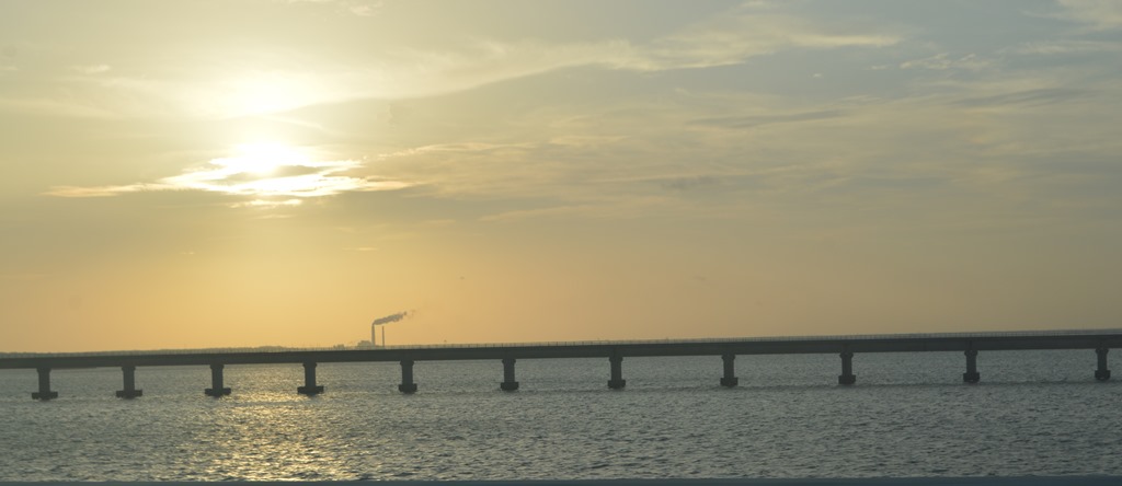
I ended up taking an unplanned detour in Eastpoint, Florida when I saw a long 4-mile bridge and drove over to St. George Island. I soon realized I was on an island with no way off except to backtrack. The detour was interesting anyway due to all the birds soaring along the wind currents above the bridge. Believe me when I say that I was driving 60 mph and not gaining at all on a brown pelican cruising overhead in front of me. It may have been a visual illusion, but at one point I swear the pelican was flying backwards at that speed as its long beak was facing me.
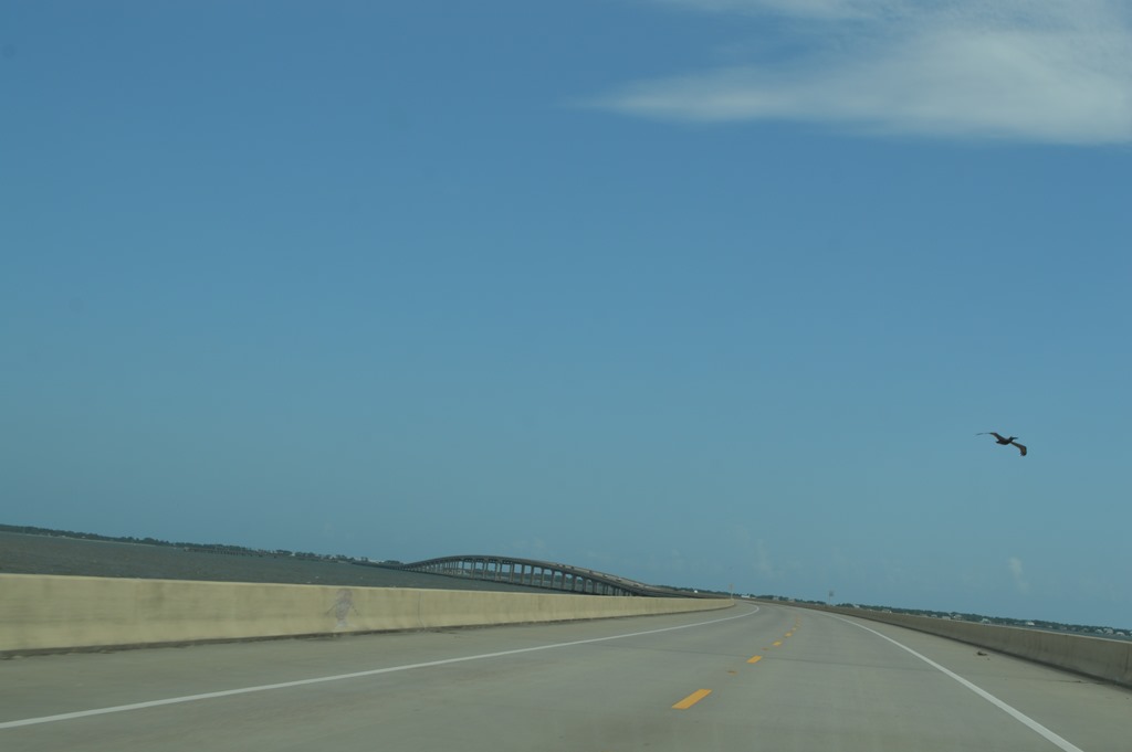
St. George Island, Florida
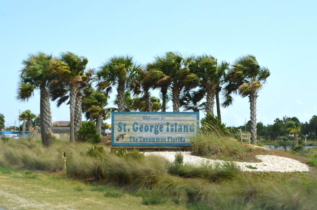
St. George Island, Florida is a barrier island 28 miles long and about one mile wide at its widest point. The island is known for The Plantation on the west end, a private gated community of 1,200 acres with 500 homes, of which, about half are available as vacation rentals. Folks like me are more likely to hang out on the undeveloped nine miles of the eastern end of the island where you camp in St. George Island State Park. In 2013 Forbes ranked St. George Island State Park beach as the 3rd best in the U.S. I drove west into The Plantation, only to turn around again and drive off the island once I realized there was no other way back to the mainland.
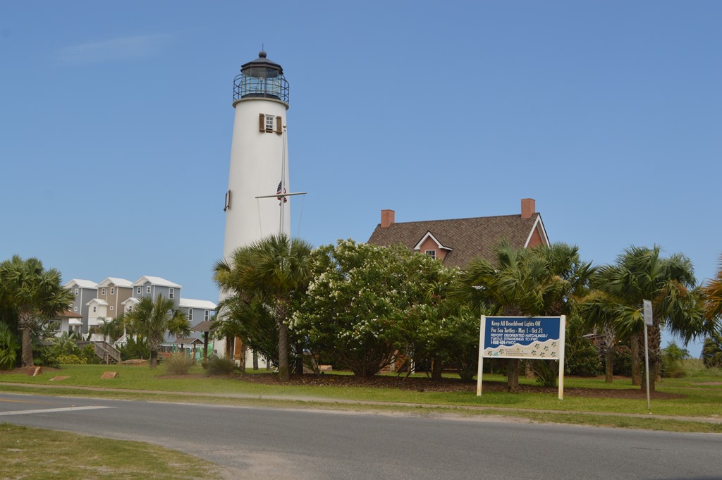
Cape St. George Lighthouse stood for 153 years until it toppled in 2005 after its foundation was undermined by Category 4 Hurricane Opal in 1995 that created a 10-degree tilt from vertical and then further damaged by Hurricane Georges in 1998. The lighthouse marks the narrow entrance to Apalachicola Bay between St. George Island and St. Vincent Island.
Apalachicola looked like an upscale town to me. Port St. Joe has the Florida Constitution Convention Museum State Park, where the first meeting of delegates to draft a Florida State Constitution was held in Dec-Jan 1838-39. Florida gained statehood in 1845 as the 27th state of the Union.
Another 90 minutes to drive 65 miles to Panama City and my iPhone maps was telling me I had 3.5 hours left to drive to Pensacola if I stayed on US 98. Radio traffic reports kept repeating heavy traffic delays along US 98 and I spent about 30 minutes to travel less than 10 miles through Panama City.
My objective for this drive was to explore the Emerald Coast beach resort towns from Panama City to Pensacola, but I was far too tired at 6pm to spend another four hours driving, although I learned once I reached Pensacola that I had crossed into Central Time Zone, so it was actually 5pm in Panama City and I was driving in rush hour traffic. I accepted my iPhone Maps advice to get my car to I-10 and cut an hour off the drive to Pensacola, even though it was an extra 45 miles in distance. Based on my observations of the extended strip mall appearance of Panama City, I figured I had already seen some of the best scenery along Florida’s Panhandle driving U.S. Route 98 along the Big Bend Scenic Highway of Florida’s Forgotten Coast. I doubt there are road sign warnings for bears along the Emerald Coast section of U.S. 98 in Florida.
I am not a big fan of coastal development. I reached the Holiday Inn Express Pensacola West before sunset. It had been 36 hours since I had last been horizontal.
Blinded by sleep and in need of a bed
I came in from the East with the sun in my eyes
Escambia Bay, Pensacola, Florida
June 2016
Florida Road Trip Orlando to New Orleans and Louisiana Tour
- Rough Start for Drive Out of Florida road trip to New Orleans
- Orlando to Pensacola road trip notes and photos
- Hotel Review: Holiday Inn Express Pensacola West–Navy Base on PointBreaks
- Beautiful Sweet Home Alabama driving U.S. 98 and U.S. 90
- Gulf Islands National Seashore at Ocean Springs Mississippi
- Road Trip Photos Gulf Coast Mississippi to New Orleans 9th Ward
- Dispatch from New Orleans-Huge Ass Beers, NOLA Gay Pride, June Mardi Gras
- Hotel Review-Hyatt Regency New Orleans
- Airline History: Why Delta Air Lines HQ was in Monroe, Louisiana until 1941
- Best Western Low Rate Guarantee success and Cracking Hotel Confusion in Krakow

3 Comments
Comments are closed.