Nature.org calls Guadalupe-Nipomo Dunes the “largest intact coastal dune ecosystem on Earthâ€. These are sand dunes at the Santa Maria River estuary, some dunes 500 feet in height, along 18 miles of Central California coastline. Guadalupe-Nipomo Dunes are the large sand dunes visible from U.S. Route 101 when driving south and coming to the coast at Pismo Beach. In the distance, south of Pismo Beach, are immense dunes visible from more than a dozen miles away. I’d seen these dunes many times from the highway. Earlier this month was my first detour west of the highway to actually experience the dunes up close.
Guadalupe Dunes is a place I learned about a couple years ago after spending a day at Avila Beach, a town about 20 miles north by beach and 25 miles by road. The connection between these two locations in my mind is one I will share later, after the travel guide information from my road trip detour earlier this month.

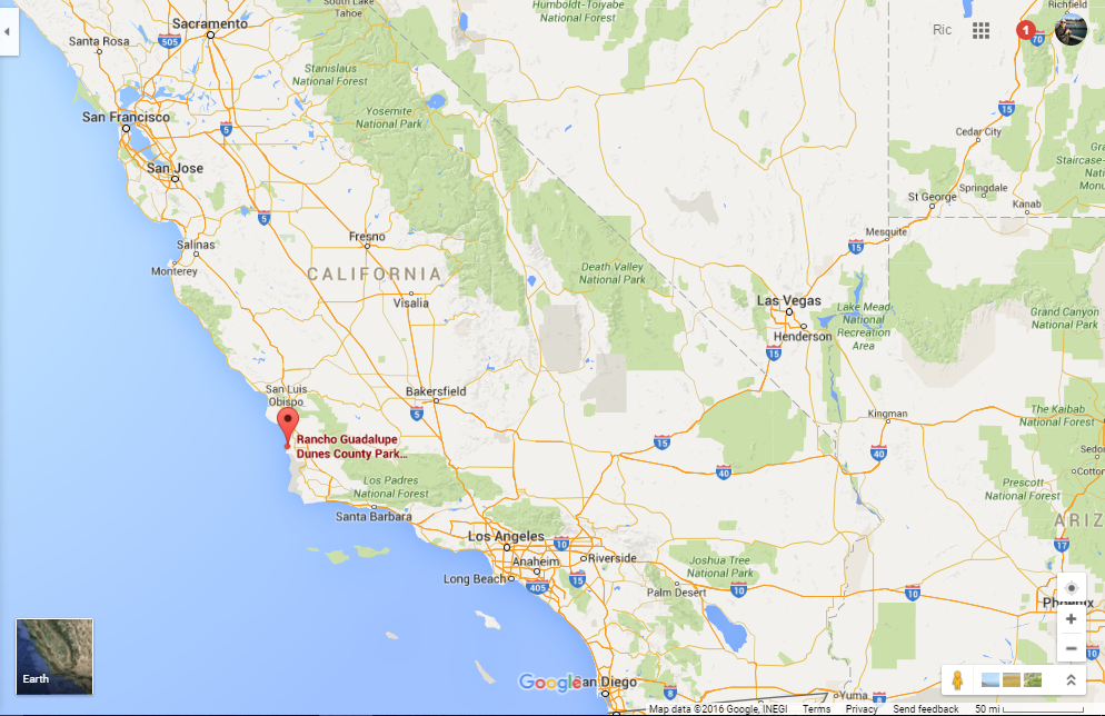
Rancho Guadalupe Dunes, near northern Santa Barbara County line at Santa Maria estuary.

Google Maps Pin at Rancho Guadalupe Dunes (also Highway 1 and 101 from San Luis Obispo in north to Santa Maria, California in south).
The car windows are rolled down on an early May morning as I drive out of the Fairfield Inn Santa Maria parking lot, sunglasses on and morning temperature approaching 70 by 10am in Santa Maria. My aim I to drive west, but my iPhone is taking me through all kinds of agricultural fields for mile and I feel like I am driving north. I feel disoriented in the flat fields of the Santa Maria Valley river plain.
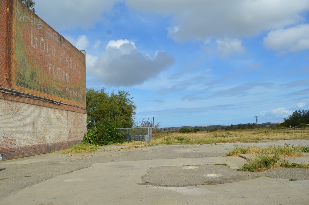
After my drive about ten miles through agricultural fields between US 101 and Highway 1, I reach the small town of Guadalupe. There is a Guadalupe Dunes Visitors Center in an old 1910 period house in this small central coast town.

9:50am and the center opens at 10am. I walk Highway 1 South to check out the architecture of this quaint town. The place seems a picture of what many towns in California probably looked like in 1950. Most California places have lost that old town main street look in today’s age of big brand fast food and shopping centers.
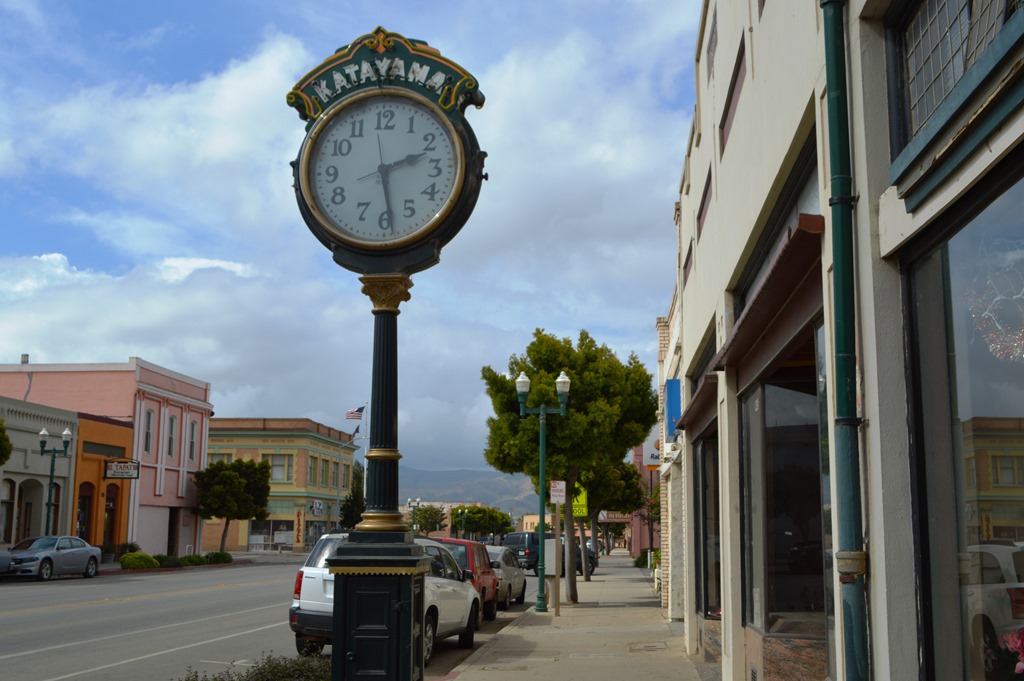
Guadalupe, a place lost in time. Actually around 10am on Friday morning in this sleepy California town.
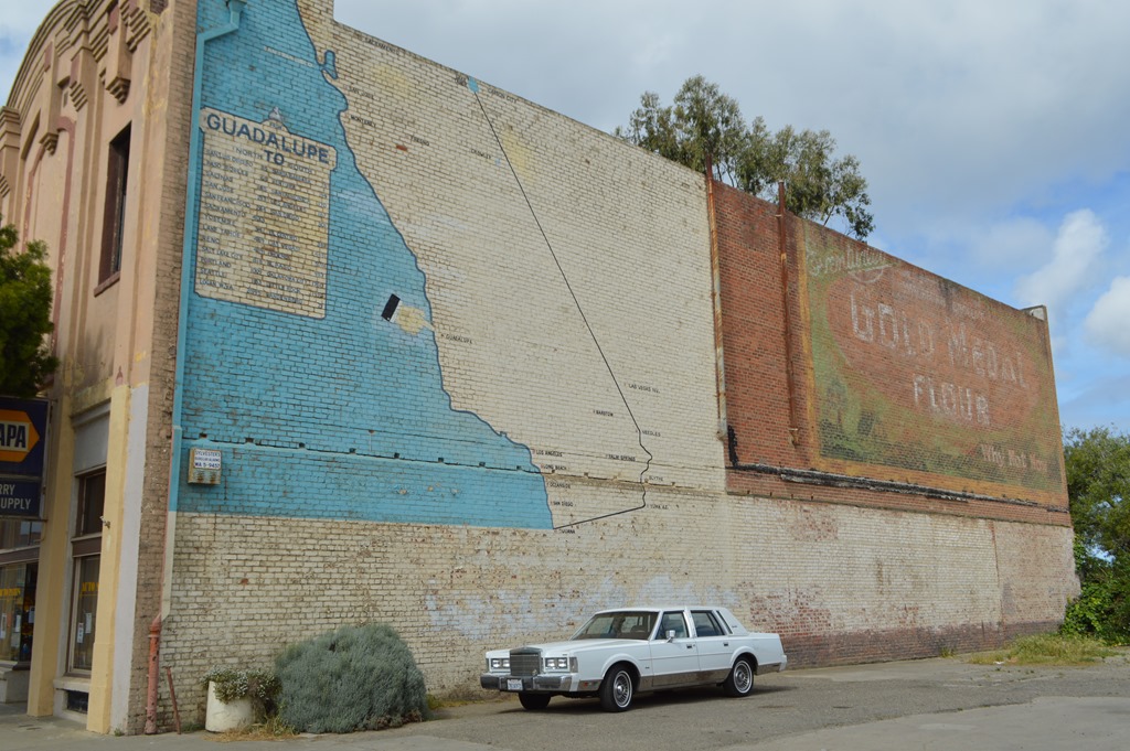
Highway 1 Guadalupe – Finger shows where I am in central coast California.
My plan to visit Guadalupe Dunes Center changed as I got back to my car and saw the sign on the house had changed to Open. I was bored and headed out to explore the dunes blindly without a whole lot of knowledge where I was going and only my cell phone for a map, if I found reception. I could see Guadalupe Dunes from Highway 1 in Guadalupe. They were a few hundred yards away from the lot where I photgraphed the California map.
All I needed was a road tomake a right turn off Highway 1 and drive west to the beach. My iPhone was not too helpful in directions, since Guadalupe Dunes is a big place and I did not know a more specific place name to enter for directions.
I spotted a road sign to Rancho Guadalupe Dunes County Park, one mile south on Highway 1 from the Dunes Center, pointing right at East Main Street road. Main Street in Guadalupe and Santa Maria is also Highway 166, the west-east road between Guadalupe, California on the coast and Central Valley’s Highway 99 at Mettler, California, 20 miles south of Bakersfield.
A vivid memory still with me three weeks after driving beside an agricultural field for the first mile or so.were all the small birds by the dozens swooping around low to the road and within a few feet of the ground in many places over the fields. A beautiful image in a way. The horrifying aspect of the scenery were the number of bird carcasses on the road rivaled the rotting vegetables and fruit pieces also stuck flat to the pavement as I drove to the beach.
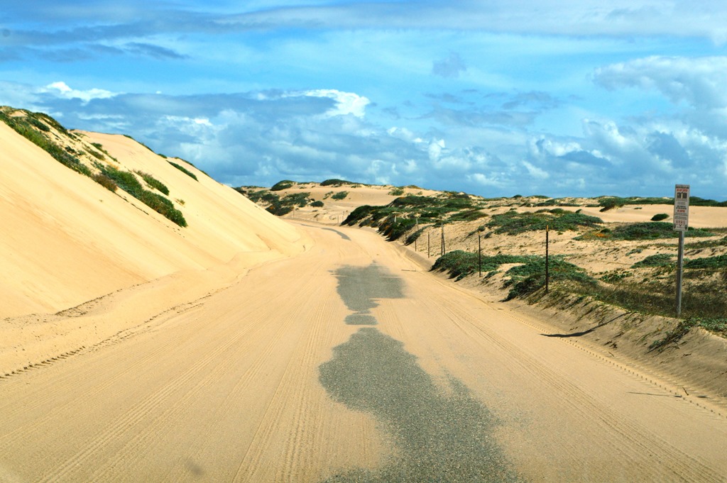
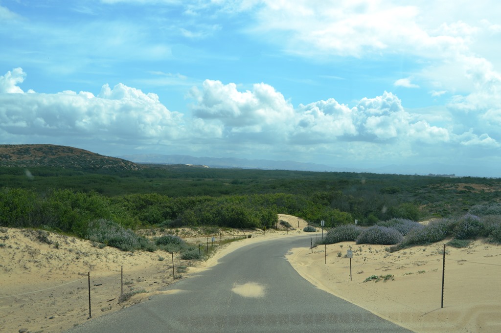
There is slow speed sign and open metal gated entrance with a kind of tiny cabin ranger station. Two guys in construction mode are fiddling around the little house project. I did not know if I was driving into a free park or not. Nobody asks for money or waves. Most of the State Park beaches nearer Santa Barbara and 50 miles to the south require $5 to $10 to park and walk the beach. I drive on and within a few hundred yards come to the dunes.
This can be other worldly if you have never experienced a significant sand dunes environment. I lived several years in the dunes of Monterey Bay. I got my 4-wheel drive stuck in deep California beach sand in the past before I learned. I am kind of Dune.
Best advice I can give you from experience is do not go driving to loose sand dune places on windy days, unless you are prepared for consequences.

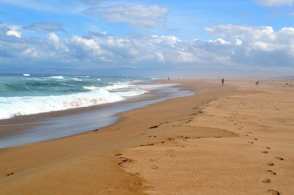
I was at Rancho Guadalupe Dunes County Park on a light breezy day.
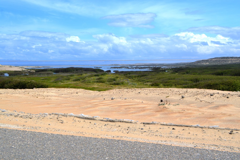
Santa Maria River estuary is where the water from surrounding coast range mountains drain to the sea in this part of central coast California.
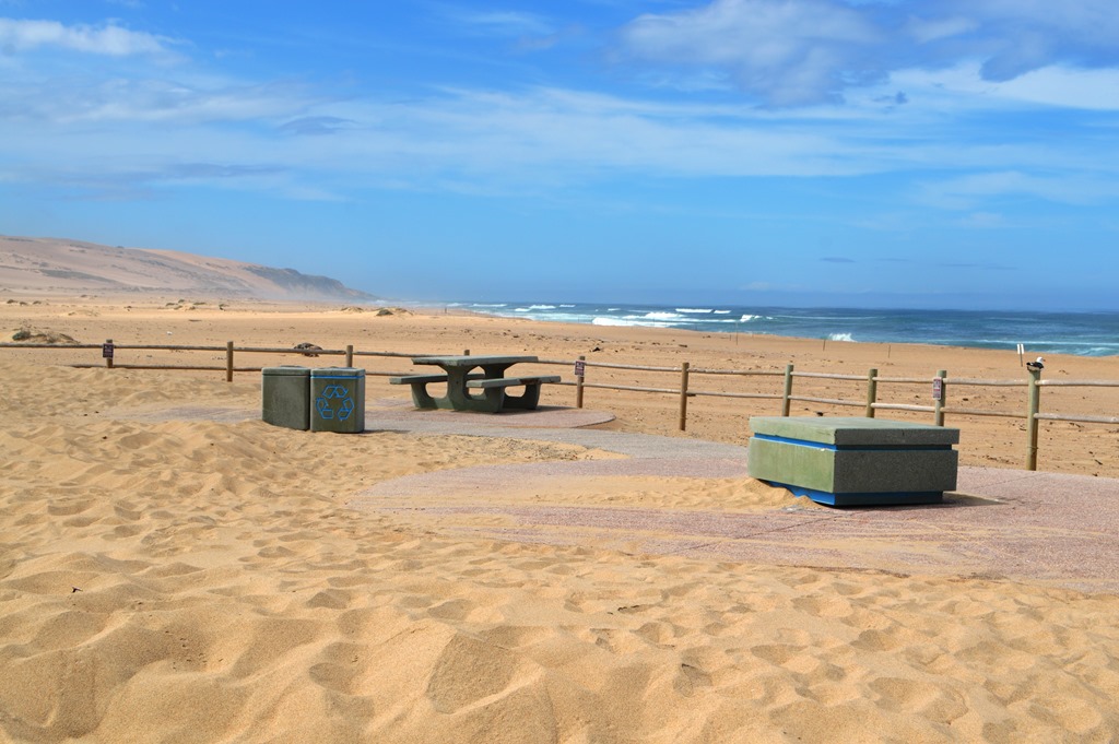
There is a parking lot at the beach with modern concrete bathroom facilities and a picnic table area. There was one ranger vehicle and around ten other vehicles in the parking area with plenty of empty spaces. Off-season early May meant concrete tables at the beach were awaiting one good wind storm to become buried beneath the grains.
A few surfers, a few fishermen, a few empty cars and a few parked cars with gazers from inside their vehicles.
The Rancho Guadalupe Dunes County Park parking lot at the beach west of Guadalupe has a 4-mile round trip hiking route as one of two access points to Guadalupe-Nipomo Dunes National Wildlife Refuge.
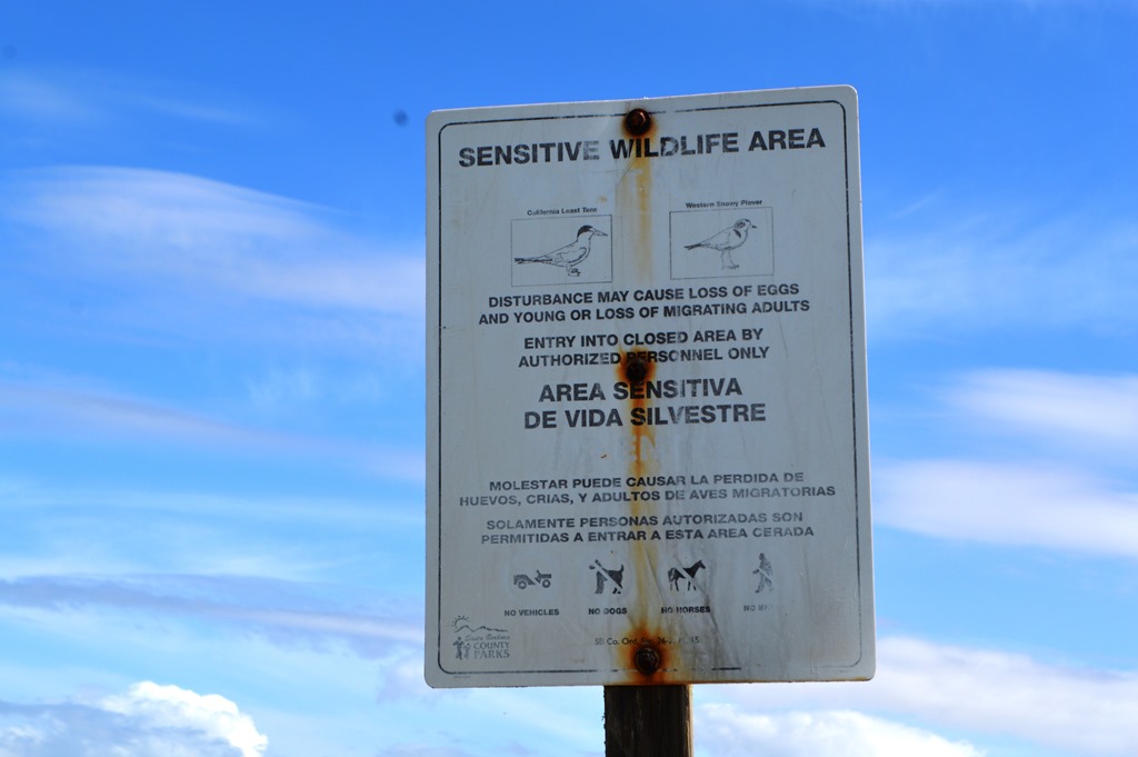
Turns out the best time to come to Rancho Guadalupe Dunes is fall/winter months. Nearly all the rural dunes habitat in the area is off-limits to hikers during bird breeding season and that is seven months of the year from March 1 to October 1. The place is fenced and posted all over prohibiting trespassing.
Rancho Guadalupe Dunes County Park in Santa Barbara County is an interesting place to get out in the sand. The experience is unique if you have not been surrounded by sand before. Just be sure to come in season from October to February if you want to explore more than the beachfront.
Another memory I came away with after Rancho Guadalupe Dunes is seeing more different kinds of birds in such a brief period of time than just about any place I have been during that five mile, one hour detour to the beach from Highway 1. Elkhorn Slough on Monterey Bay is one my closest comparisons. There were small birds, large raptors, loads of songbirds and apparently, off in those sand dunes are some pretty rare birds of California.
There Will be Blood Oil in California
As a tourist walking the desolate and wild beach sands at Rancho Guadalupe Dunes, a Santa Barbara County Park, there are few indications this beach is near the area of California’s largest massive environmental disaster – still in clean-up phase after more than 20 years.
If you recall the 2007 movie There Will Be Blood, one of the central storylines of the movie was the lead character, played by Daniel Day-Lewis, is an oil man seeking to build a pipeline from California’s Central Valley to the coast and remove the stranglehold on rail transportation costs imposed on oil producers across the state. That pipeline was an actual project in 1909 when Unocal Oil opened a pipeline from Kern County oil fields in the central valley, east of the California Coast Range to Port Avila, today’s Avila Beach in San Luis Obispo County.
Avila Beach at the north end of San Luis Obispo Bay and Guadalupe Dunes, about 20 miles south, are two of the most significant coastal ground contamination oil spills in California in the past century.
Sacramento Bee – Avila Beach remakes itself, from disaster to destination (July 6, 2014).
San Luis Obispo Tribune – ‘Another 10 years’: Guadalupe dunes still recovering from oil spill (June 27, 2015).
Guadalupe Dunes are California’s largest coastal dunes ecosystem. The expansive dunes reputedly attracted a counter culture in the 1920s to 1940s. Then oil companies started exploration and bought up local lands. Oil was discovered in 1948 and the area was placed in production. Construction and production over the next 50 years created 158 miles of pipeline servicing 200 wells in the coastal dunes oil production zone.
The story is surfers in the 1970s and 80s complained about oil on their skin after surfing local beaches. Eventually, a massive spill of oil and other petroleum solvents from 50 years of petroleum production in the dunes came to the attention of regulators and the public. The wetlands of the Santa Maria River estuary, the border between Santa Barbara and San Luis Obispo Counties, was recognized as one of the worst environmental disasters in California history. A 1999 LA Times articles states an estimated 9 million gallons of toxic petroleum byproduct waste flowed beneath the Guadalupe Dunes with some seeping into the Pacific Ocean. Worst of all is documents and testimony revealed management knew there was a significant environmental issue. Unocal was fined $44 million in penalties for the disaster in 1998.
In comparison, the Gulf Coast Deepwater Horizon disaster, the largest oil spill disaster in the industry’s history, was estimated at 210 million gallons.
There is a storied California industrial history here in these Central Coast regions of California, where you still find sleepy fishing village beach towns like Avila Beach and relics of California’s agricultural past in small rural towns like Guadalupe. Your camera is more likely to encounter Santa Barbara County and San Luis Obispo County vineyards than oil pump jacks from the Highway 1 or 101, the main roads through this region. Dig a little beneath the surface and you’ll find many signs of California’s oily past around these parts.
