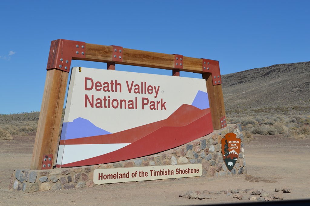
Death Valley called to me again yesterday. I made my first ever trip to Death Valley National Park just two weeks ago. The mountains and valley did not have much appeal for me on a mostly cloudy, mostly 103 F degree day. My initial impression of Death Valley was a place with an abundance of mountain rocks, dust, hot wind and little unique beauty not seen in countless other locations of the Mojave Desert, like driving Interstate 15 to Las Vegas.
Furnace Creek Inn and Scotty’s Castle are attractive oases with captivating architecture, but that should not be the highlight of a National Park.
My four hour drive through Death Valley yesterday, arriving in the afternoon and leaving at sunset revealed much more of the park’s inspiration, majesty and wildlife to me.
Heading North
Normally driving from Monterey to Las Vegas is 515 miles via the year-round open Tehachapi Pass on Highway 58 to Interstate 15. This is a southerly route that requires driving north on the Interstate to Las Vegas.
I used to think there was no reason anyone would go to Death Valley, California on the way to anywhere else. Death Valley is remotely located in the northern Mojave Desert east of the Sierra Nevada.
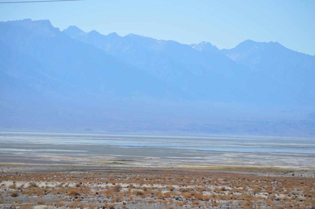
Eastern Sierra rising up from the valley floor of US Route 395 to 10,000-14,000 feet seen in the glare of afternoon sun looking west from California Highway 190, the main road across Death Valley.
While there may be few people who live in the harsh environment of the Eastern Sierra, there is a significant amount of land between the Sierra Nevada range and the Nevada border.
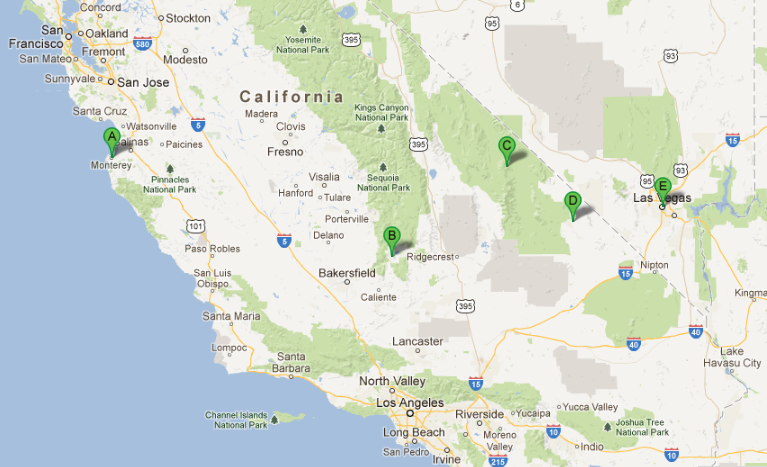
Google Maps showing (A) Monterey; (B) Lake Isabella- Walker Pass Road CA178; (C) Death Valley Furnace Creek; (D) CA178 Shoshone, CA for southern road through Death Valley; (E) Las Vegas. Once again Google Maps could not calculate a route for this 600-mile road trip just like my previous trip two weeks ago into Death Valley.
One of my travel objectives is to drive every paved Sierra Nevada mountain pass. I think I have three left to drive. There are also several roads into the high mountains of the Eastern Sierra that do not cross all the way over the mountain range to the central valley.
Entering the Sierra Nevada on CA 178 outside of Bakersfield on the way to Lake Isabella.
California has weeped for me every long distance road trip I have taken in 2013. Hard to believe California is in its second year of a potentially severe drought.
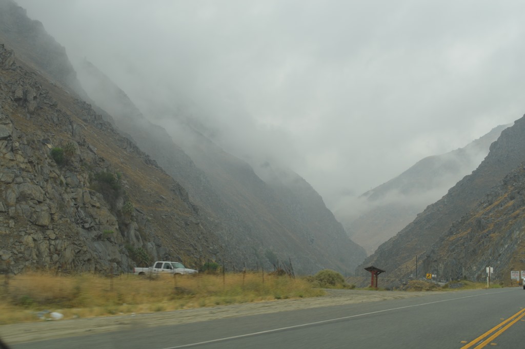
CA178 is quite different from the other Sierra Nevada roads that gradually climb across the western foothills. The Lake Isabella road follows the Kern River and seems to go directly into the mountains.
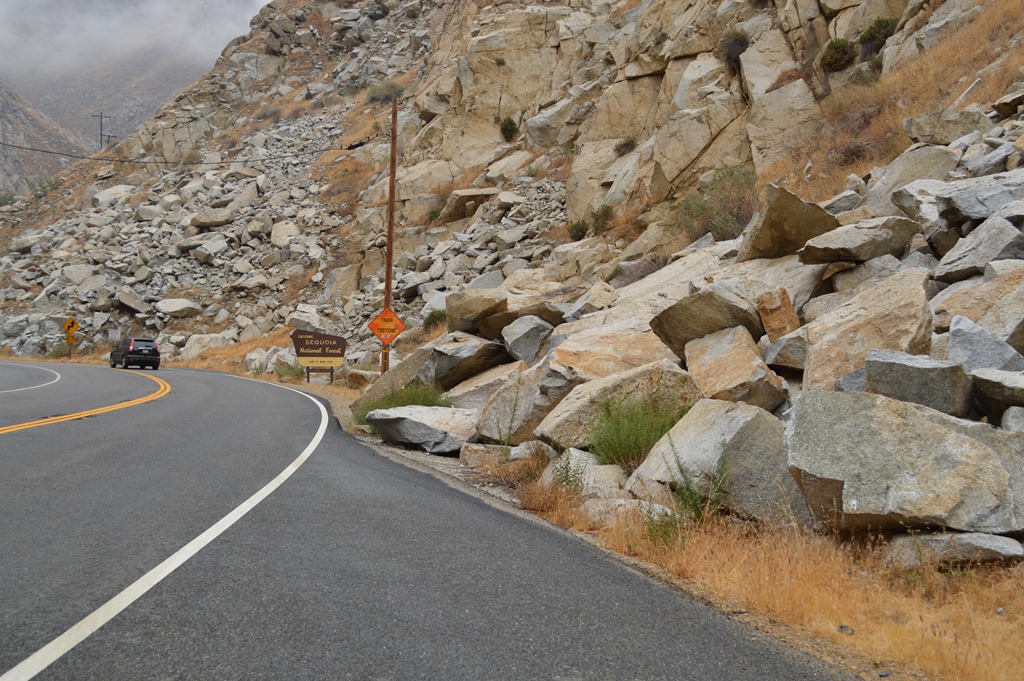
The first 20 miles or so are winding road with lots of rocks to avoid.
Lake Isabella is one of the largest reservoirs in California and supplies Bakersfield with its water. Unfortunately, according to Wikipedia, geological and engineering studies indicate the 1953 dam is not structurally sufficient to keep the reservoir at more than 60% capacity and the reservoir is located near an active earthquake fault.
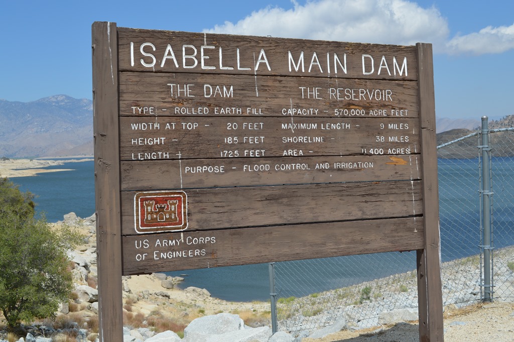
I was thinking about earthquakes as I stood on top of the main dam yesterday.
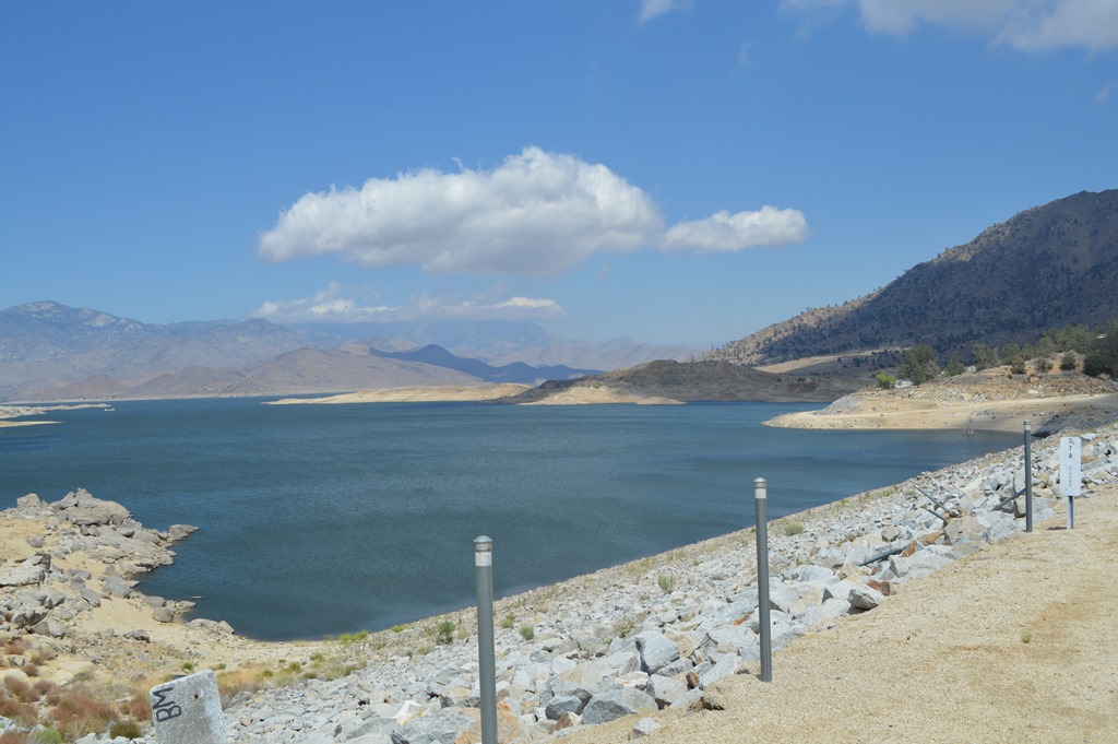
Lake Isabella Reservoir, 40 miles east of Bakersfield, California.
The wind at Lake Isabella was roaring. There was a windsurfer cruising across the waves.
One of the coolest features of driving this road were the extensive forests of Joshua Trees. I’ve not yet been to Joshua Tree National Park in the southern Mojave Desert. The Walker Pass Road, CA178, showed me the largest Joshua Trees I have seen.
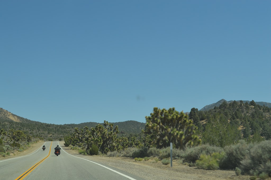
Joshua Trees grow alongside Highway CA178 for several miles west of Walker Pass 5,250 feet. CA178 connects the San Joaquin Valley to the Mojave Desert. This is a popular route for motorcycles.
The Pacific Crest Trail crosses Walker Pass and hikers traveling north traverse the longest section of the Mexico to Canada trail without paved roads through the Sierra Nevada.

Walker Pass (5,250 feet) was charted in 1834 by Joseph R. Walker, guided by Native Americans, for the Bonneville Expedition. The survey was financed by John Jacob Astor to chart land routes to Oregon and California. Walker led emigrants to California via the pass in 1843 and led John Fremont’s military surveying team across the pass in 1845. Fremont suggested the route be named Walker Pass.
The wind was so fierce on Walker Pass blowing west to east that I thought my car door was going to break when it was flung open by wind gusts as I got out to take photos.
Highway 178 east drops down into the Mojave Desert. Stay on 178 and the road leads to Death Valley. I missed that road since the GPS directed me north on US Route 395, the main eastern Sierra highway to take Highway 190 into Death Valley.
The temperature changed from the western Sierra at 65 degrees and rain clouds to the eastern Sierra and Mojave Desert sunny skies at 88 degrees.
Death Valley was forecast to be 102 F.
Death Valley National Park west entrance on Highway 190. Temperature 81 F at 3:00pm.
And it was even hotter at Furnace Creek. But, not on the west side of the National Park, still 50 miles from Furnace Creek.
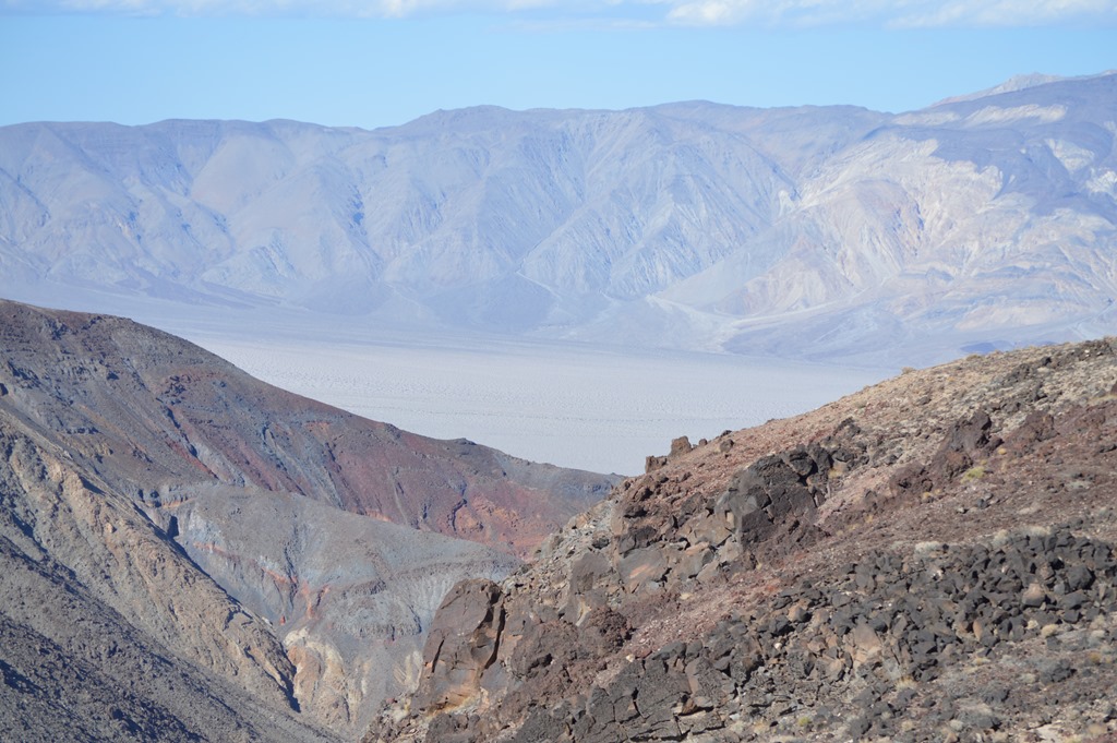
Padre Crowley Point, Death Valley National Park. Looking down to Panamint Valley from Padre Crowley Point Overlook (4,000 feet). Death Valley is east of the mountains in the distance.
Death Valley is far more interesting in my opinion when entering from CA190 and traveling west to east.
The temperature was 81 F at Padre Crowley Point at an elevation of 4,000 feet.

The twisting road descending into Panamint Valley is an intimidating drive with rocks on one side and a small guardrail being the only thing between your vehicle and a long drop off the cliffs.

Panamint Valley floor is below sea level. Telescope Peak at the upper right is the highest point in Death Valley National Park at 11,049 feet.
Panamint Springs, about 50 miles from Lone Pine, is the first area with services on the west side of Death Valley National Park. There is a small motel, restaurant/bar, gas station, and market.
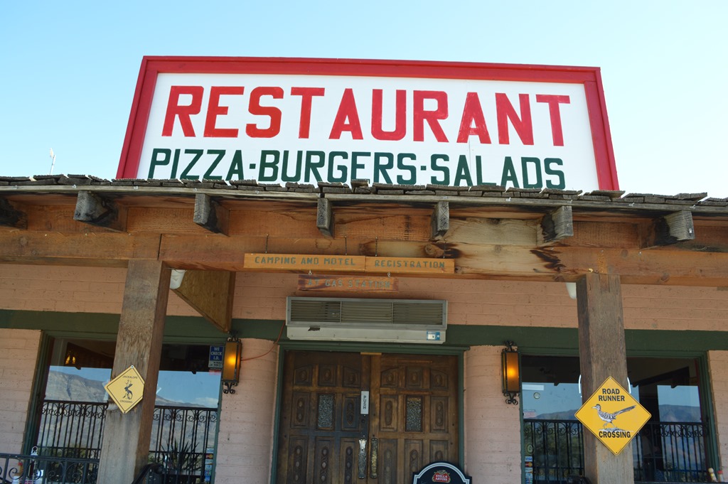
Panamint Springs, Death Valley National Park.
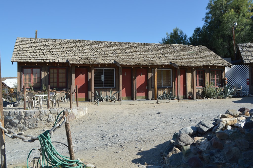
Panamint Springs Resort is a privately owned park motel. Resort is a relative term in Death Valley. Apparently this property predates the National Park since it is private property within the park.
I did not see a swimming pool here for the 14 rooms and one cabin. Rates are as low as $79 for one Queen and that is the best rate in the park besides camping. Rates go from $79 to $109 and $149 for the two-bedroom cottage.
A $9.50 prickly pear margarita sounded good, but not with 200 miles still left to drive. The bar at Panamint Springs gets good Yelp Reviews.
Panamint Springs temperature at sea level was 100 F.
There was still the climb over the Panamint Mountains to reach Death Valley.
My trickster friend Coyote was there on the road to greet me before my drive into Death Valley.
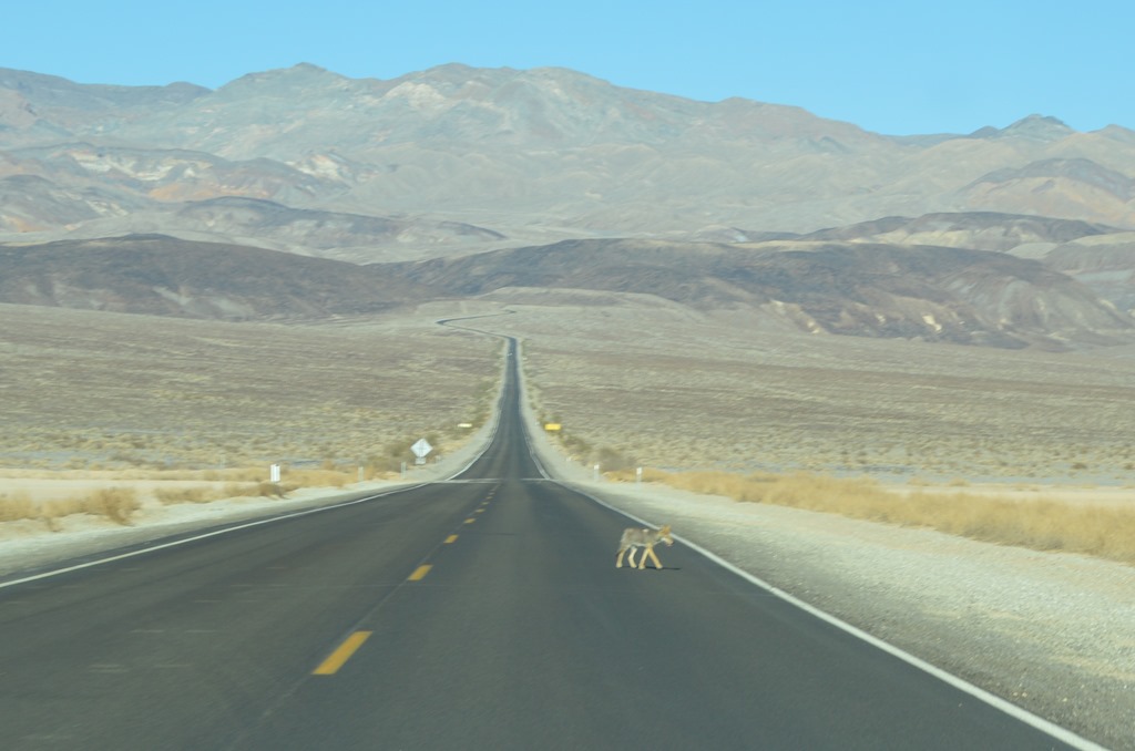
And coyote means part 2 of this Death Valley National Park driving tour.
Toronto TBEX via Death Valley – Part 2.
Resource: Death Valley National Park website.
Ric Garrido, writer and content owner of Loyalty Traveler, shares news and views on hotels, hotel loyalty programs and vacation destinations for frequent guests.
You can follow Loyalty Traveler on Twitter and Facebook and RSS feed or subscribe to email newsletter on the upper left side of this page.

4 Comments
Comments are closed.