Murphys Irish Day is the 3rd Saturday in March and most recently happened Saturday, March 16, 2019.
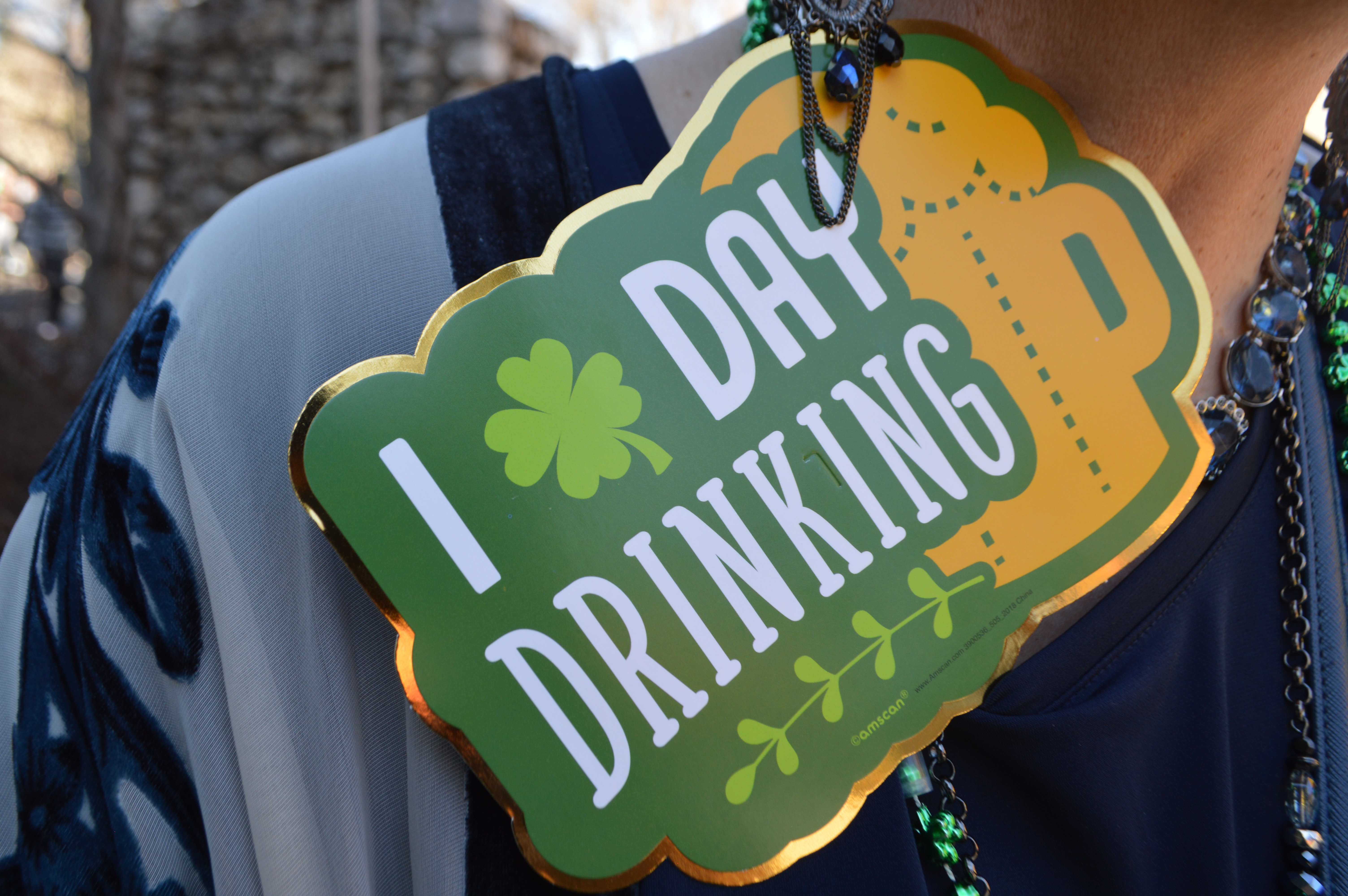
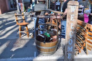
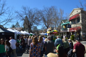
Murphys Irish Day probably saw more than 20,000 visitors to the small Sierra foothills town of Murphys in Calaveras County. About 600 yards of Main Street, where most of the commercial businesses in town are located, were blocked off on either end by sheriff patrol cars. In this historic gold rush town, for the hours of 10 to 5:30pm on Saturday, Main Street’s space flowed with wine and beer as laissez-faire attitudes allowed a day of open container alcohol in plastic cups drinking on the streets of Murphys. There was a parade in the morning, but by the time we arrived around 1pm the streets were predominantly festive drinkers sporting all kinds of Americanized secular St. Patrick’s Day kitsch.
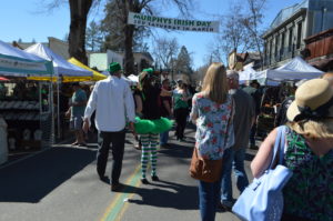


Crafts and food booth vendors lined the street with several band stages along the route and plenty of places to lay down some green cash or even credit cards for drink, if you hadn’t BYOB your trip.
Murphys, California
Murphys, California is a California gold rush town founded in 1849. Murphys (no apostrophe) is still authentically small town at fewer than 2,500 residents in Calaveras County, one of California’s most rural counties at only 45,000 residents.
Rural is a relative term in California. For those not too familiar with the demographics of California’s 40 million residents, our state is comprised of 58 counties spread over 900 miles of Pacific Ocean coast and driving west to east is 200 to 400 miles from the Coast Redwoods to the Giant Sequoias, from the Pacific Ocean to the High Sierra across mid-state or to the Cascade volcanic range in the north or Los Angeles and San Diego through the vast deserts of southeast California to the state line with Nevada and Arizona.
Calaveras County at 45,000 residents is #44 of 58 counties in population size, meaning 14 other counties in California have fewer than 45,000 residents. That is why many of us in California can’t imagine living our lives in Los Angeles County surrounded by 10 million other residents. So much of California is truly rural, and many of those rural spaces are serenely gorgeous.
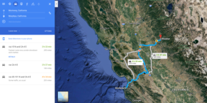
Road Trip Monterey, California to Murphys, California 200 miles one way.
We drove 200 miles from Monterey on the Pacific coast on March 16 to reach Murphys in Calaveras County in the Sierra Nevada foothills.
March is when most of California is prettiestÂ
A conclusion I reached, probably a decade or so ago, is California is prettiest in the month of March for road travel across the state. In California, as long as a Pacific rain storm is not passing to mess up the drive and the view, then March is gloriously colorful with grasses in a variety of green shades and wildflowers growing in many other brilliant colors all across the state. ‘Golden’ California is visually many shades of brown from May to October, the dry season for most of the state each year.
Good rain, like this current rain season, brings spectacular wildflower blooms. And fills the state’s water reservoirs. San Luis Reservoir at Highway 152 Pacheco Pass in San Benito County is full at 100% capacity. Pacheco Pass is the southern Santa Clara Valley corridor for highway access across the Diablo Mountains range. These mountains separate the central coast of California from the wide Central Valley of California. The Central Valley is generally perceived as flatlands for miles and miles across the state. California’s Central Valley is about 50 to 60 miles across, depending on where you cross the valley along the 440 miles between Bakersfield and Redding. The valley is not much to look at, but I certainly enjoy living near the world’s most agriculturally productive landscape.
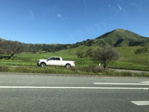
The whole vibe of driving across California from the Pacific Ocean of Monterey and across the coastal hills to the central valley is a dramatic change in scenery. From Monterey, it takes about an hour to get over Pacheco Pass to the Central Valley. Santa Nella at 77 miles has fast food services and gas, including In-n-Out Burger. Then North on Interstate 5 for 70 miles from Santa Nella to the population center of Stockton, California where California Highway 4 East heads out of the city to foothills country. The drive from Stockton into the orchards of Farmington, California is the first leg to Murphys on 55 miles of two lane road. A stop sign in Farmington at the crossroads of eastern San Joaquin County slowed us down enough to gaze out at Lagorio’s Grill & Bar with about 20 motorcycles parked outside the building before noon in this rural outpost surrounded by orchards in a town of 250 residents with 79 households, and only a few seen from Highway 4.
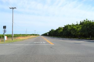
Flat lands start to fold into small hills as vast orchards give way to the vast cattle country of the foothills. A 49ers kind of throwback lifestyle is still prevalent through the foothills and mountains and the whole scenery for me emanates Woody Guthrie and Bruce Springsteen songs in my mind.
I worked in your orchards of peaches and prunes
I slept on the ground in the light of the moon
On the edge of the city you’ll see us and then
We come with the dust and we go with the windWoodie Guthrie – Pastures of Plenty
Well Miguel came from a small town in northern Mexico
He came north with his brother Louis to California three years ago
They crossed at the river levee when Louis was just sixteen
And found work together in the fields of the San JoaquinBruce Springsteen – Sinaloa Cowboys
Between Highway 4 Stockton and Angels Camp only a couple of tiny towns are passed as the San Joaquin Delta changes to miles of orchards before heading into rolling oak-covered hills in sparsely populated cattle country. The livestock feasting on the green grasses from a lush winter of rainfall will be herded and moved to the Sierra high country in a few months as the valley green grasses turn brown during the no rain months of summer across most of California.
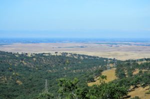
The Mother Lode is cattle country – The way of the rancher – Sierra Lodestar is a good article about the cattle rancher way of life in these parts of California.
Driving Highway 4 through cattle country, I could not help but wonder how such a beautiful landscape had escaped commercial development. Turns out this is the real ‘Big Valley’ country, where cattlemen have ruled the land for more than 150 years. Highway 4 passes through Orvis Ranch, an active cattle ranch since 1873. The Big Valley 1960s TV show was based on Hill Ranch, an even older cattle ranch started in 1855 about 15 miles north of Snow Ranch, today’s Orvis Cattle Ranch. The historic Hill Ranch is now covered by Camanche Reservoir. Many of the state’s reservoirs are located in the foothills region where the major rivers flowing out of the Sierra Nevada were dammed in the 20th century.
Today these foothill cattle country lands are protected by family land trusts to preserve the lands in their current cattle grazing conditions. Thus, there is very little development to be seen on the country road drive of Highway 4 from Stockton to Angels Camp, California.
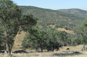
The photo above from my 2014 trip to Murphys shows the typical dry grass conditions of early May. This past weekend the hills were green as Ireland for Murphys Irish Day after an above average rainfall season over the past two months.
Murphys
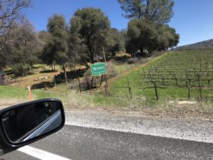
California State Route 4 passes through gold country towns in Angels Camp and Murphys. These places are referred to as ‘foothills towns’ in Calaveras County. Murphys is at an elevation of 2,200 feet along.
Sierra Foothills is actually a designated AVA vineyards region. Sierra Foothills AVA vineyards at elevations of 1,500 to 3,000 feet produce primarily red wine varietals for over 100 wineries in several counties along the western foothills of the Sierra Nevada range in California.
Angels Camp (also no apostrophe), 7 to 11 miles downhill from Murphys depending on route, clocks in at about 4,000 residents and is the only incorporated town in Calaveras County. Angels Camp is the place for services like a Best Western hotel, where we stayed the night, a major supermarket and competitively priced gas stations.
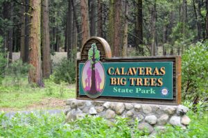
Highway 4 ascends up into the High Sierra past Murphys with Arnold (4,000 ft.) and Calaveras Big Trees State Park (4,800 ft.), then continues up into the mountains to near 7,000 feet before Highway 4 changes to Alpine County, California.
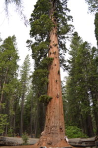
Alpine County is California’s least populous county with only around 1,200 residents, many associated with ski resorts work at Kirkwood and Bear Valley. Alpine County is situated almost entirely in the High Sierra at elevations of 5,000 to 11,000+ feet between Lake Tahoe and Yosemite National Park and the border of Nevada. Highway 4 peaks out in Alpine County at Ebbets Pass 8,730 feet. Ebbets Pass is seasonally open once snow can be cleared for summer travel on Highway 4 across the Sierra Nevada.
Murphys Irish Day in Calaveras County Wine Country
In 2014, I participated in a sponsored press trip to Calaveras and Tuolumne Counties. As I drove along Highway 4 from Angels Camp to Murphys, I said to Kelley as we passed Twisted Oak Winery, “I remember going to that winery”, then we passed Ayrael Vieux Winery and I said, “I went to that winery too.” Then, as we came to a halt on Highway 4, still a couple miles from Murphys, we saw a sign for Ironstone Vineyards in Murphys, one of the largest wineries in the U.S. and a destination spot in itself. Ironstone invited Irish Day visitors to park at the winery and take a free shuttle 1.5 miles into town. I said to Kelley, “I’ve visited that winery too”.
Ironstone Winery was definitely the easiest place to find parking. All streets and parking lots within a mile of Murphy’s Main Street were filled with parked cars.
On Murphys Irish Day I drank a few beers beer and a tiny bit of wine. On my last trip to Murphys and Calaveras County, I drank bottles and bottles of wine and only a couple of beers. Murphys and Highway 4 spots around Angels Camp are actually one of the best Sierra Nevada foothill towns for wine tasting.
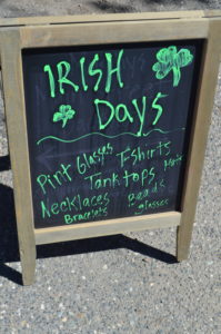
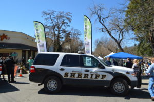
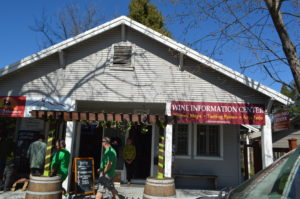
Looking back over my photos from the Calaveras tourism trip, I realized I had been to several more wineries in Calaveras I had forgotten.
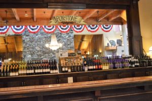
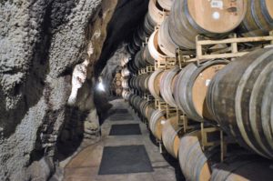
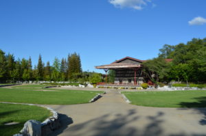
Basic fact is Murphys is a town known more for attracting wine drinkers than beer drinkers.
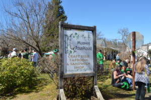
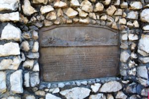
One of the principal mining communities in Calaveras County, named for the discoverer of gold on the flat in 1849. The objective of many of the immigrants coming over the Sierras by Ebbets Pass, Murphys Flat and surrounding mines produced $20,000,000 in gold. Early regulations restricted claims to 8 ft. square…
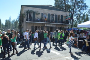
Several tablets posted on the wall outside of Murphys Hotel describe its history as one of the oldest hotels in California.
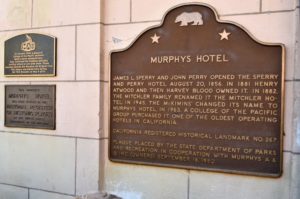
This property Murphys Hotel has been placed on the National Register of Historic Places by the United States Department of the Interior.
***
Murphys Hotel – James L. Sperry and John Perry opened the Sperry and Perry Hotel August 20, 1856. In 1881 Henry Atwood and then Harvey Blood owned it. In 1882, the Mitchler Family renamed it the Mitchler Hotel. In 1945, the McKimins’ changed its name to Murphys Hotel. In 1963, a College of the Pacific group purchased it. One of the oldest hotels in California.
California Registered Historic Landmark No.267
Plaque placed by the State Department of Parks and Recreation in Cooperation with Murphys A. & Q, Inc (owners) September 18, 1980.
Another 1948 tablet on Murphys Hotels erected by Native Sons and Daughters of Golden West reads,
Old Sperry Hotel
This hostelry originally built in 1855 by J.L. Sperry of Sperry Flour fame and his partner John Perry. Among early guests whose names appear on old register are Mark Twain, Horatio Alger, Thomas H. Lipton, Henry Ward Beecher, the Rothchilds General U.S. Grant, and C. E. Bolton (Black Bart). The quaint old hotel, according to tradition, is one referred to in Bret Harte’s “A Night in Wingdamâ€. Murphy’s Camp founded in early ’49 by John and Daniel Murphy, brothers. Millions of gold taken from Camp and vicinity.
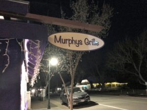
All in all a good day of fun and drink in Murphys for Irish Day 2019. By 5:30 the streets were clearing and by 9pm after a boisterous dinner with 10 of our friends at Murphys Grille, we walked out onto a dark Main Street where the streets had rolled up for a Saturday night.
We rolled back down the hill from Murphys to Angels Camp for a bed and dreams of finding gold and green in the hills underneath our California Stars.
Travel resources for Murphys and other attractions near Highway 4 in Calaveras County.
Loyalty Traveler - Mark Twain’s legacy in Calaveras County, California (May 23, 2014)
Loyalty Traveler - Rafting the Tuolumne River Wilderness (May 24, 2014)
Loyalty Traveler – Just Juanita #YesAllWomen 1851-style (June 6, 2014). #MeToo might be a better hashtag now.
Loyalty Traveler -Â 1859 Historic National Hotel Jamestown, California gold country (June 24, 2014)
Loyalty Traveler - Calaveras Big Trees State Park, California’s first giant sequoias tourist attraction (May 16, 2015)
Loyalty Traveler -Â Small towns, old hotels and new wineries in Calaveras County (June 2, 2014)
Other Sierra Nevada road trips
Loyalty Traveler - Kings Canyon National Park – The mountains are calling and I must go (May 15, 2011)
Loyalty Traveler – Yosemite’s Tioga Pass Road across the Sierra Nevada Mountains (Jul 13, 2011)
Loyalty Traveler – Carson Pass Highway 88 over the Sierra Nevada to Monterey (Sep 29, 2011)
Loyalty Traveler – Tioga Pass Road Yosemite National Park (May 19, 2013)
Loyalty Traveler – On the Road to Earth’s largest tree in Sequoia National Park (Nov 3, 2013)


