Bats are one of the main icons for Halloween imagery. I know a place not too far from Monterey, California known for its bats. They are a species named Townsend’s big-eared bats. These bats breed in talus caves of Pinnacles National Park.
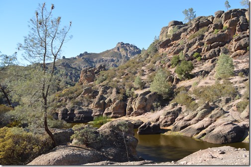
Talus caves are a unique type of cave formation resulting from large rocks and boulders falling into narrow canyons. The rock formations have openings, many large enough to hike through standing up. In the 1930s there were stairs and trails built through Pinnacles National Monument in one of numerous public works projects. To this day, the work of the Civilian Conservation Corps established the infrastructure millions of visitors to U.S. National Parks rely on for casual public access to nature. Pinnacles National Park is largely central coastal California wilderness.
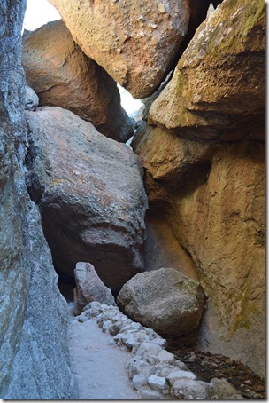
Bat breeding season is primarily mid-May to mid-July in the Pinnacles Bear Gulch caves and the caves are closed seasonally. The upper half of Pinnacles Bear Gulch Caves closes November 1, 2015 for the winter. There is danger that flash flooding may occur in California rain events. There is a major California rain storm forecast in this area for tomorrow, October 31, Halloween day.
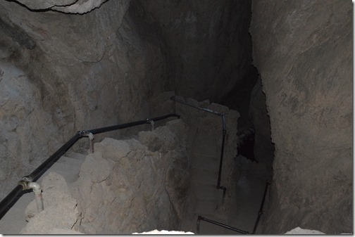
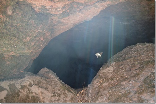
I was able to spend a spooky afternoon before Halloween hiking alone in Bear Gulch talus caves of Pinnacles National Park, California. There may have been bats in the caves, but honestly, hiking alone in the dark, with my iPhone flashlight as my primary tool for watching my steps, I really was not looking around for bats and I did not see any, unless I find some in my flash photos.
Pinnacles National Park is located beside California’s San Andreas fault. Pinnacles are the remnants of the western half of a 25 million year old volcano. The eastern portion of the volcano is about 200 miles southeast of Pinnacles National Park. Besides having talus caves, the significant feature of Pinnacles National Park is its geological evidence supporting plate tectonic theory.

Pinnacles National Park has more significance for me than being the newest park in the U.S. National Parks system, created January 10, 2013. Pinnacles has been a local attraction for people on the Central Coast of California for more than one hundred years, since it was designated by President Theodore Roosevelt in 1908 as a National Monument. The best feature of Pinnacles National Park for me is I can drive to either the west side or the east side park entrances in 90 minutes or less. There are no roads that cross the Gabilan Range through the park, although hiking trails through the National Park allow passage from one side of the Gabilan coast mountain range to the other.

Pinnacles National Park had 238,000 visitors in 2013. That is near the low visitor end for National Parks in the lower 48. North Cascades in Washington, Congaree swamp in South Carolina and Voyageurs in Minnesota are National Parks with smaller park visitor counts, but those are remote places to visit. There are more than 7 million people residing within a 2.5 hour drive of Pinnacles National Park in the San Francisco Bay Area, Silicon Valley and Monterey Bay.
Where is Pinnacles National Park?
Pinnacles National Park is 26,605.73 acres (107.7 km2) in San Benito County, California. The Gabilan Range within the park is mostly designated as wilderness. The western entrance to the park is located east of Soledad in Monterey County and the eastern entrance is south of Hollister, California west of Highway 25.
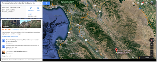
Pinnacles National Park is about 120 miles south of San Francisco. The west entrance is 60 miles from Monterey and the east entrance about 70 miles from Monterey.

The rock formation pictured above is the image used on most of the Pinnacles National Park souvenir items, along with a California condor. There are around 25 California condors residing in the Pinnacles park area. There were numerous birds in Bear Gulch during my hike, but I did not see a single raptor soaring in the skies. Perhaps the record high temperatures for the late October date, near 90 degrees in the afternoon, kept the condors out of the skies.
In the spirit of Halloween stories, what actually motivated me to visit the eastern side of Pinnacles National Park is my iPhone earlier this week kept showing Paicenes or Hollister as my location, rather than Monterey. I took it as a sign that I should go hike in the Gabilan Range of Pinnacles National Park.
My phone has since gone back to showing Monterey as my location.
Related Loyalty Traveler post: Pinnacles National Park west side entrance (April 18, 2013) was my last trip to Pinnacles. This post has many more vista photos.


4 Comments
Comments are closed.