Flying British Airways London LHR to San Francisco in late June 2017 meant I was flying over Greenland at a latitude a few hundred miles south of the Arctic Circle. It was probably around 4pm local time in Greenland as the plane flew over the southwest coast.
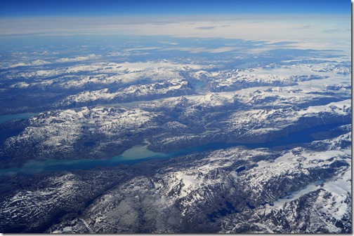
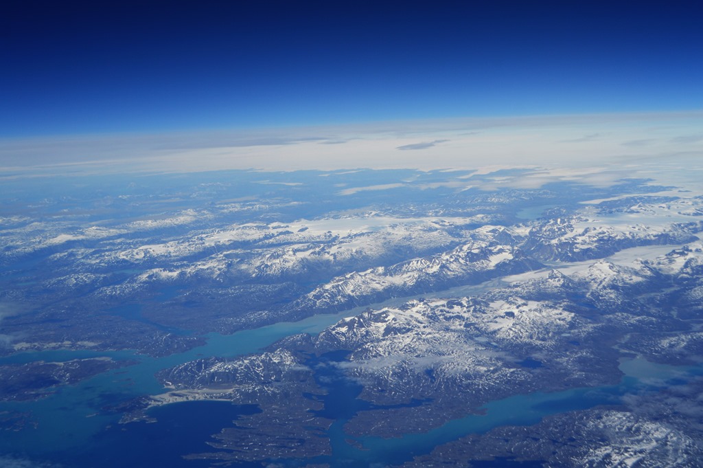
After watching two inflight movies and eating dinner, I looked out the window to a beautiful sight of fjords, mountains and glaciers on the southwest coast of Greenland.

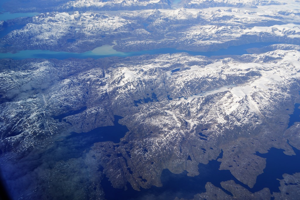
The plane had just passed over the vast Greenland ice sheet at around 63.5 N degrees latitude as we crossed the southwestern coastline of the massive island. Greenland has a land mass larger than Alaska and California combined, yet a population of fewer than 60,000 residents. The southwestern coast of Greenland is the most ice-free and populated part of the island.

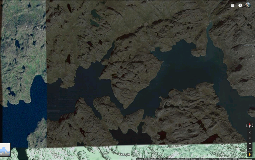
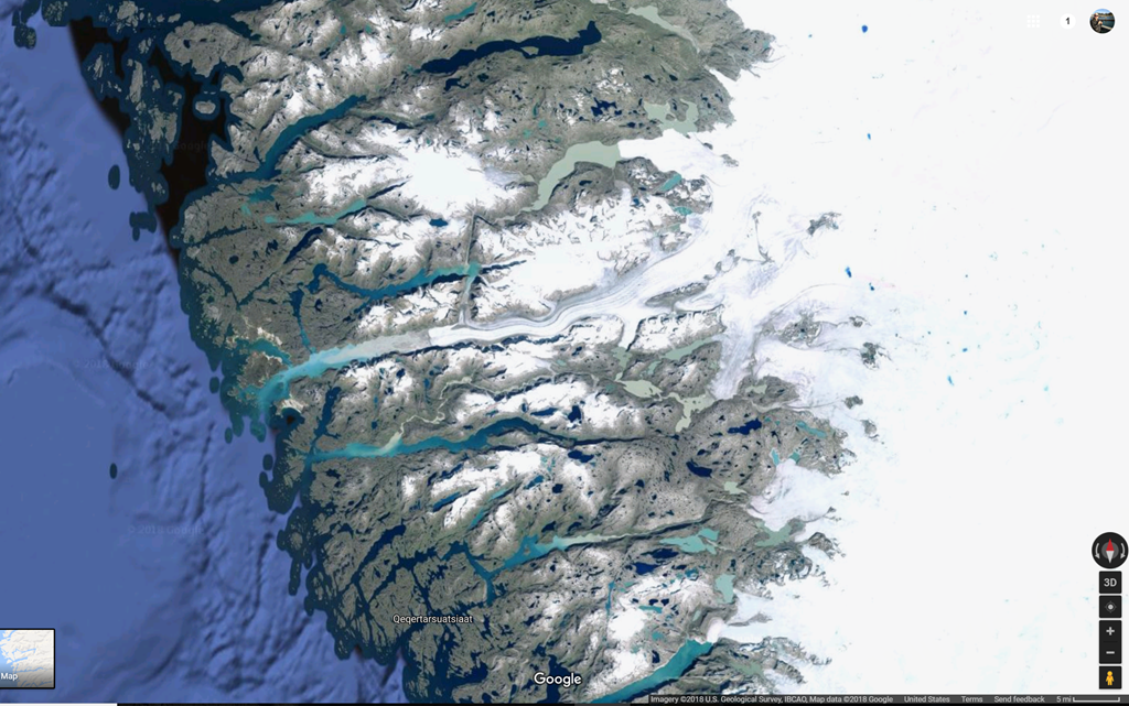
Pinpointing the exact location of my photos was possible due to a distinctive triangular land form creating a narrow fjord channel that I looked for on Google Maps in satellite mode.

Google Maps at a similar resolution had several dark shaded portions on its satellite imagery, but the landform is clearly visible.
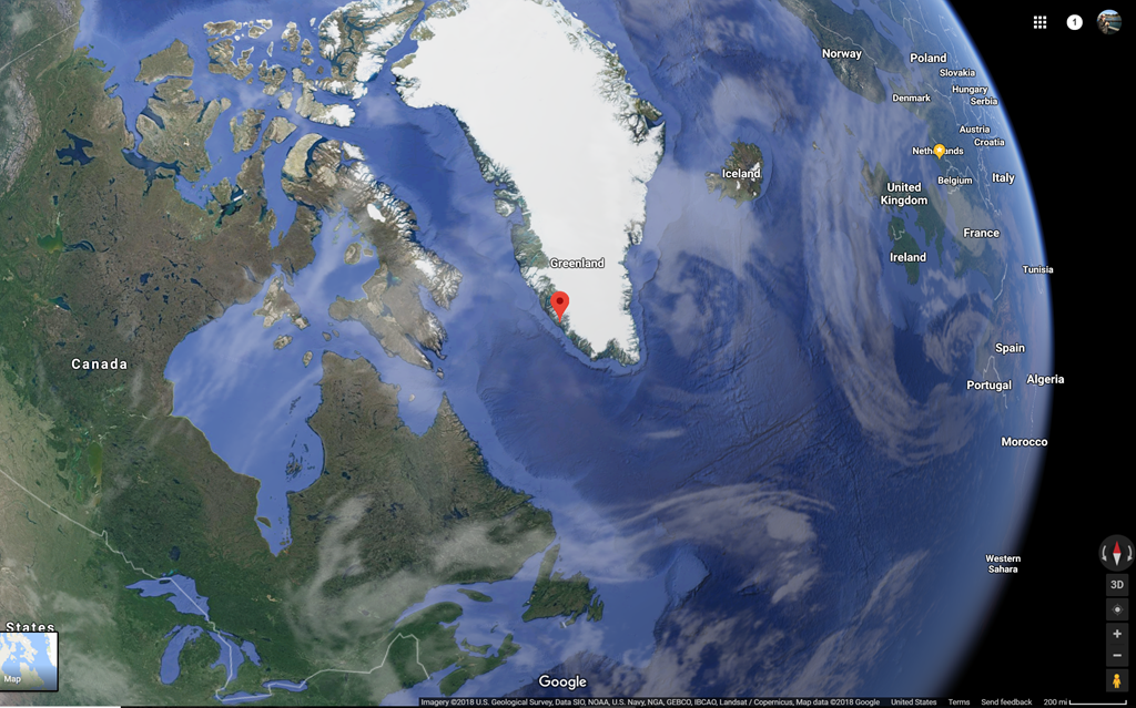
Google Maps location 63.2, –50.7
The closest port town to this location is Qeqertarsuatsiaat, a village of fewer than 300 residents about 10 miles south and just outside of my photo frame.
Greenland ice sheet seen on Google Maps with pin on Qeqertarsuatsiaat.
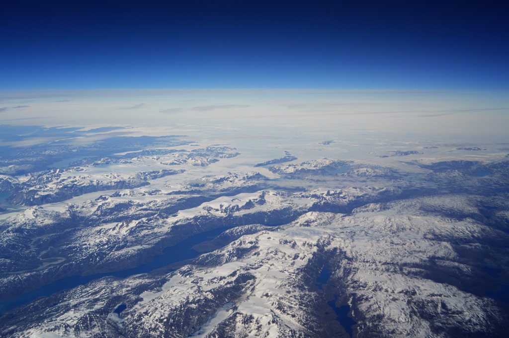
Another distinctive landform is the winding channel from the fjord in the lower part of the photo below meandering through the mountains to the fjord in the upper part of the photo showing a glacier extending through the eastern portion of the fjord. A distinctive wide channel cut through the mountains in the northerly fjord is visible in Google Maps.
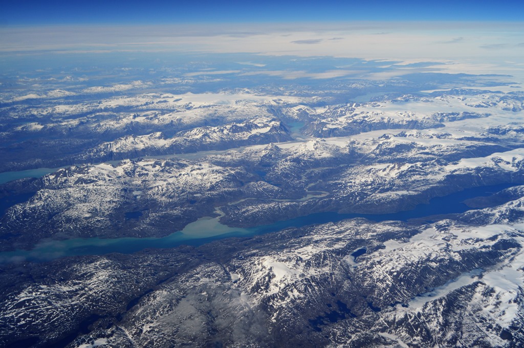
The massive Greenland ice sheet is seen at the top of the photo in the distance.
Recently there were news stories about the North Pole’s record breaking high February temperatures. While scientists are concerned about the impact of diminishing ice in the Arctic Ocean, there is more concern about the impact of warmer temperatures on the Greenland ice sheet. This is the factor that is far more significant in terms of sea level rise for the world’s coastlines.
A recent scientific study of Greenland’s glacial ice melt analyzed 40 years of measurable meltwater discharge from specific sites on the southwest coast of Greenland. The paper claims that data from 1975-2014 shows an 80% increase in meltwater discharge over the past decade compared to earlier observations.
We find that an abrupt 80% increase in runoff occurring between the 1976–2002 and 2003–2014 periods is due to a shift in atmospheric circulation, with meridional exchange events occurring more frequently over Greenland, establishing the first observation-based connection between ice sheet runoff and climate change.
From the time I looked out the window to notice Greenland and start taking photos to the point where the aircraft passed over the ice-free southwestern coastline of the island was only about three minutes of flight time.
I snapped nine photos of Greenland’s coastline on a clear summer day. Those three minutes and nine images provided an inflight learning moment and deeper understanding of one of the world’s great environmental mysteries locked in ice.
Â
