Slovakia is a country where hiking is part of the national culture with a well developed network of marked and maintained trails across the country. The High Tatras of northern Slovakia are the smallest region of alpine peaks in Europe and a year round resort area. Next to Bratislava, this area of Slovakia receives the most international tourists, however, relatively few Americans.
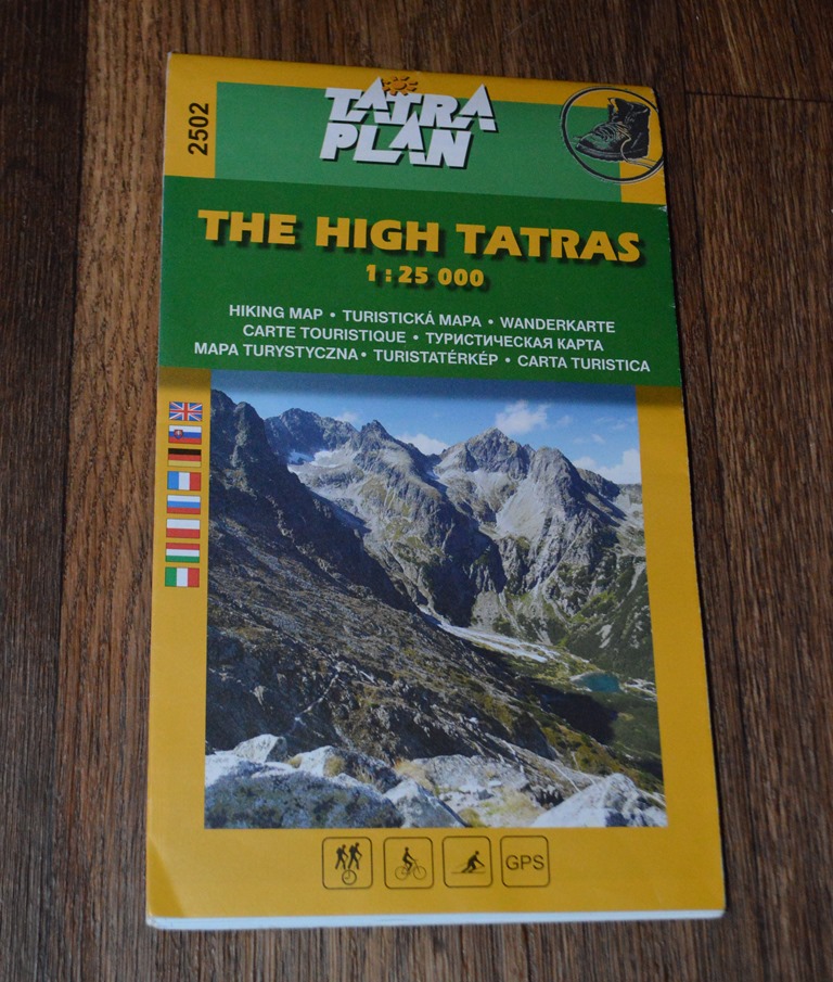
Upon arriving in the High Tatras, my first activity was a visit to the Tourist Information Center in Stary Smokovec where I purchased a high quality 1:25,000 hiking map of High Tatras for 4.50 EUR.
I plotted a route to hike about 7 hours from my hotel west on a foothills trail through the forest and then east along a higher elevation mountain ridge trail back to my hotel.
A big breakfast at Grand Hotel Stary Smokovec loaded me up with fuel for the hike. Then I laced up my hiking boots, loaded my pack with clothes, food, water and walking poles. I walked out of the foothill village of Stary Smokovec, walking west along the street looking for the trail marker into the hills.
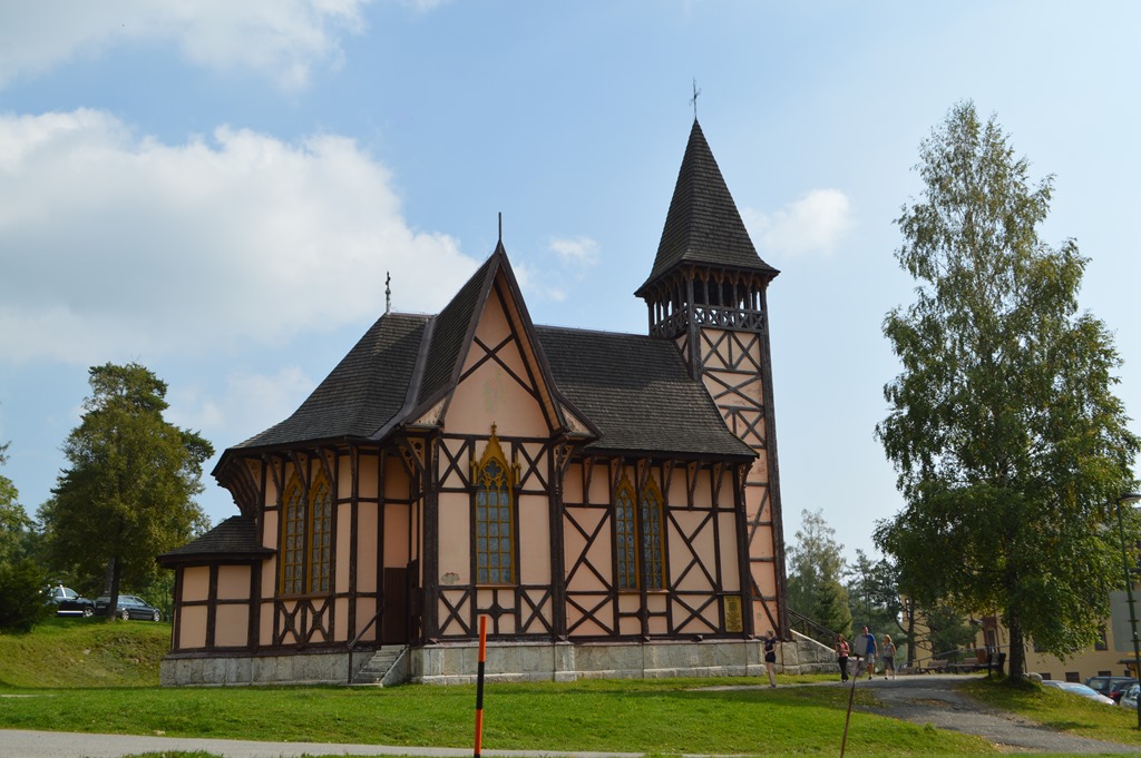
Church behind Grand Hotel Stary Smokovec
I don’t want readers to think I am some kind of self-sufficient outdoors man at home in the mountain wilderness. There was a time in my life when I chose to live outdoors, however, I was never sufficiently proficient to live off the land and I gave up that lifestyle in the early 1990s. The last time I camped overnight in a tent was more than 20 years ago. I enjoy going out and walking six to eight hours during the day, but at night I want to be indoors sleeping on a thick mattress without bugs and insects bothering me or wild animals stirring around and keeping me awake. I’ve never had to battle a bear or coyote, but I have tangled with quite a few raccoons over preserving my food supply when living outdoors.
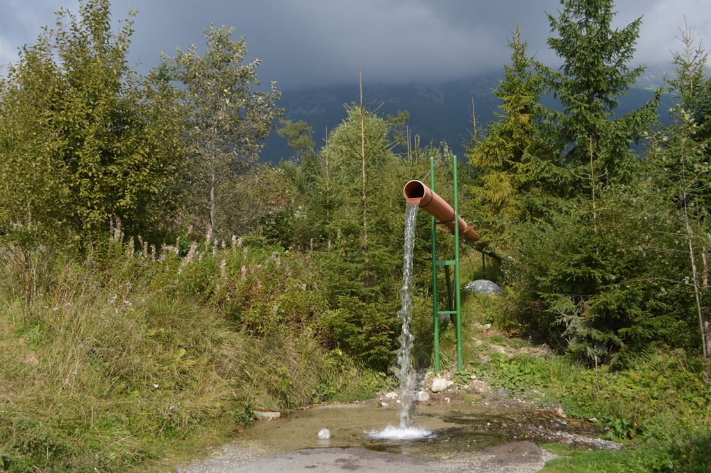
I planned a trip to the High Tatras of Slovakia specifically for the proximity of hotels to a well-developed network of mountain hiking trails. The High Tatras map I purchased shows four levels of trails with estimated times to hike point to point. I only hiked the easiest category trails in places where I thought there would be other hikers. Those easy trails were sufficiently challenging for my fitness level. After three days of hiking in the Tatras, my analysis is an easy trail means you can likely hike the trail without using your hands to climb rocks. Hiking boots are highly advisable due to the rocky and wet terrain. On this hike I walked for an hour where the trail was basically in the downhill water stream path from the mountains to the valley. Walking poles are a good piece of equipment to bring. You will likely come across an establishment serving beer and food somewhere along the trail within one to three hours.

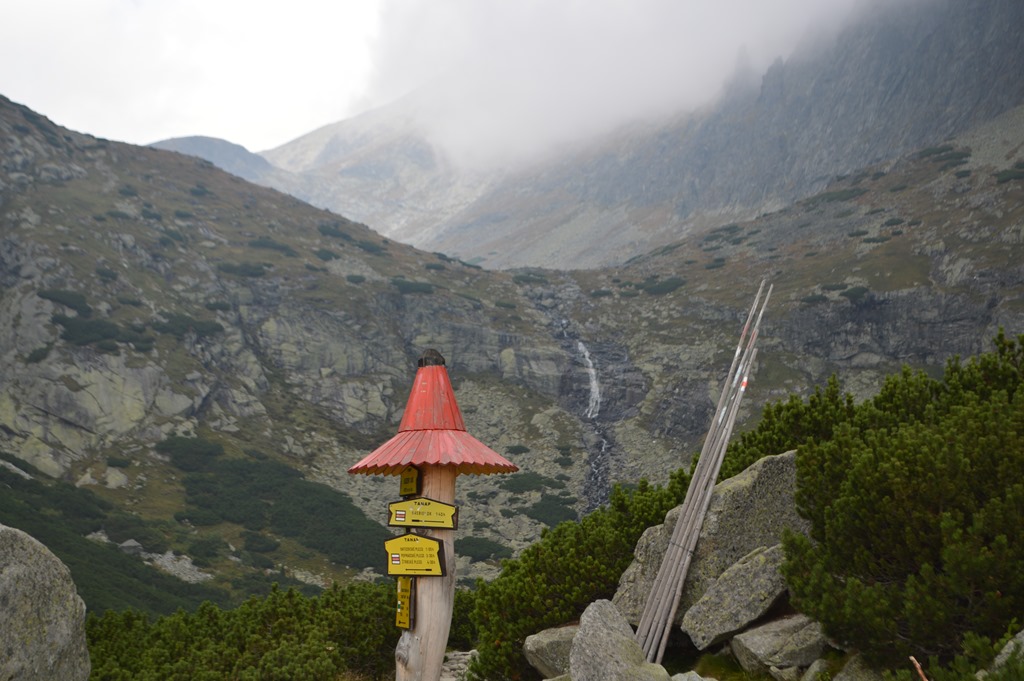
Tatras trail signpost. Sliezsky Dom 2:15 was my westerly destination.
Trails tend to be well-marked and color coded.

The temperature was in the lower 70s in the morning when I started. There was no forecast for rain, however, the High Tatras had been shrouded in clouds for the previous two days I had been in the area and the mountains create their own micro-climate weather. Goretex raincoat and pants were in my pack.
Stary Smokovec is 985 meters/3,232 ft. elevation. I hiked uphill from the town on this trail.
 Â Â
  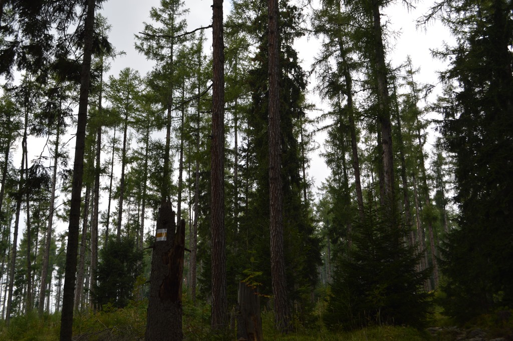
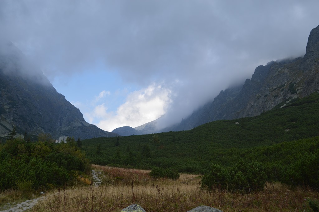
One of the reasons I picked this hiking trail is the map showed it traversed miles of forest. A fascinating thing I learned after arriving in the Tatra foothills area is a devastating windstorm on November 19, 2004 with several hours of 100+mph winds knocked down most of the trees in a 2.5km wide swath on the foothills of the Tatras along a 50 km stretch around most of the resort towns. As I hiked the trail a mile or so above the rail tracks, I walked through alternating areas of forest with hundreds of stumps and sparsely spaced trees and other times I was in thick forest of Norway spruce.
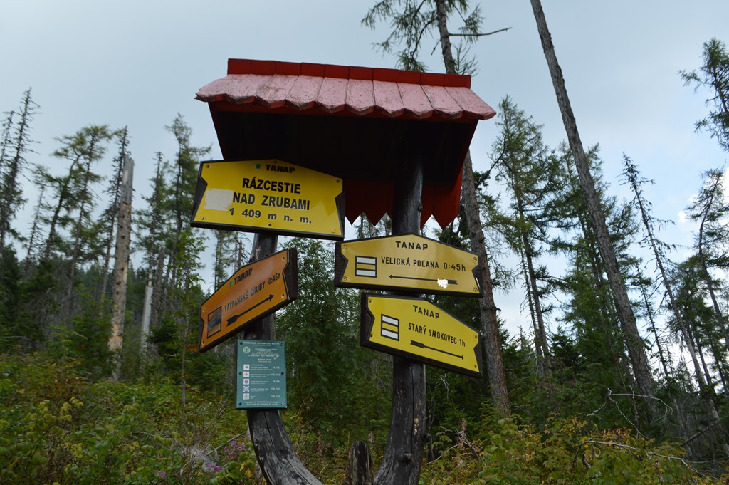
Razcestie nad Zrubami 1,409 meters/4,622 ft. One hour on the trail and the signpost here is in the forest zone devastated in 2004.
I stopped at the signpost to catch my breath and send a selfie to my parents after my father suggested I photograph myself by signs to show where I am rather than just having a mountain or forest backdrop. Flies and mosquitoes moved me along pretty quickly from the spot. T-Mobile worked great in the High Tatras by the way.

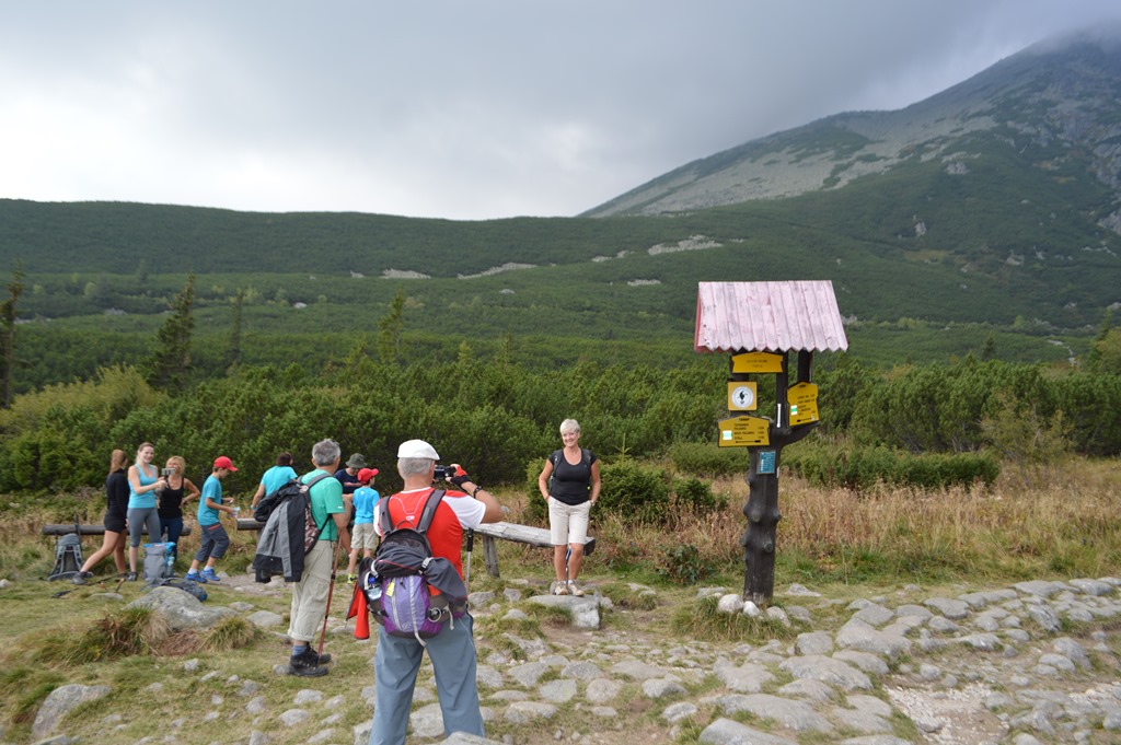
I talked to a few Slovakian hikers during my ten days in the country who say they do not like the High Tatras because there are too many tourists. I’d been on this trail for over an hour without seeing anyone. I was kind of hoping I would encounter other people on the trail to make me feel a little more comfortable knowing I was not heading into the mountains on a trail nobody else was hiking. Not long after taking the photograph above, other hikers started passing me walking the opposite direction toward Stary Smokovec; some solo hikers, mostly two hikers together and small groups of three to five hikers.
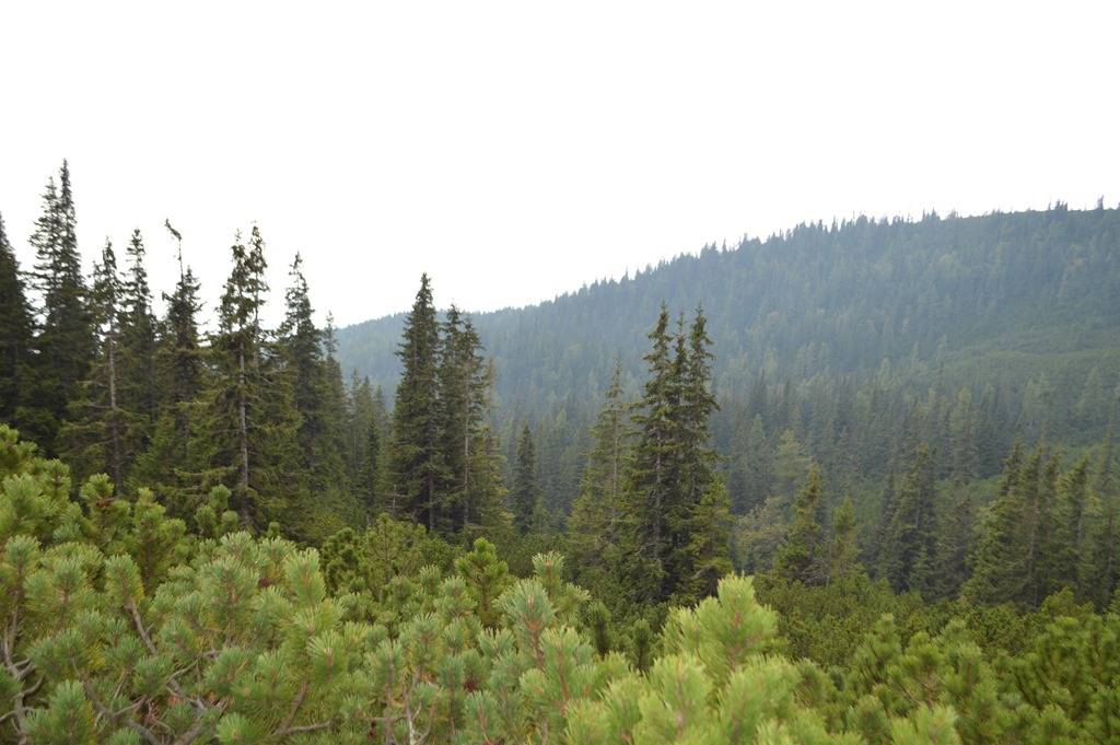
This photo is probably more representative of the Tatra views as they looked before the 2004 windstorm with thick forests of Norway spruce and Swiss pine covering the foothills.

In the distance I spy the mountain lodge Sliezsky Dom (Silesian House).

Velická dolina (Velická Valley).
Velická dolina (Velická Valley).
Velická Polana 1,562 meters / 5,125 ft.
At Velická Polana, a trail crossroads, the sign shows 15 minutes to the mountain lodge. The trail is a rocky uphill hike. The last 15 minutes of the trail to the hotel were the toughest part of the three hour hike.

Sliezsky Dom 1,670 meters / 5,479 ft.

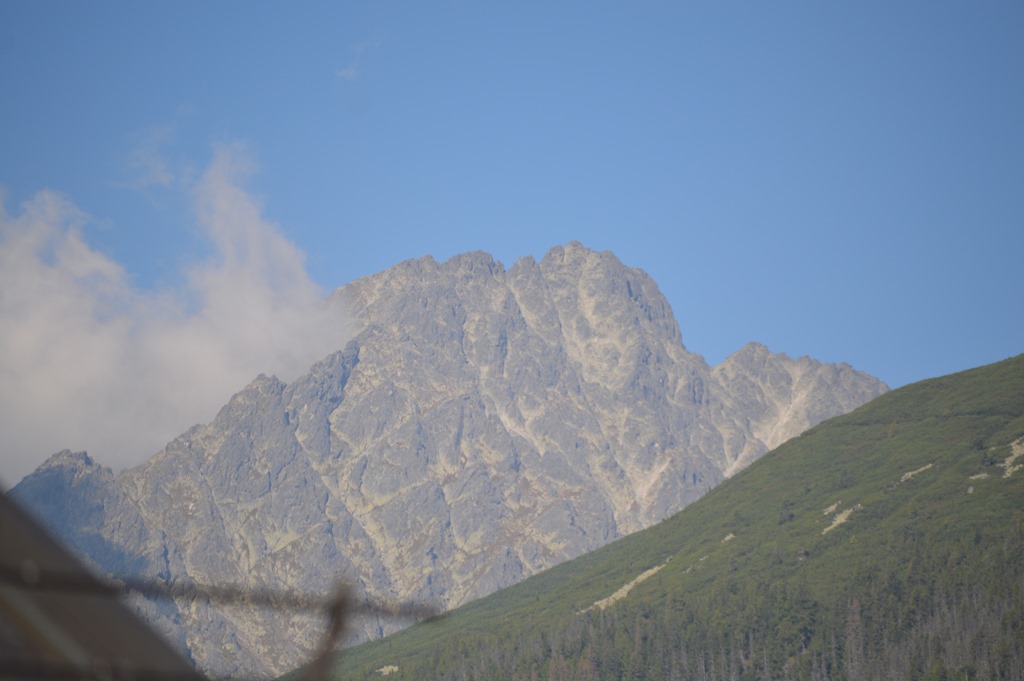
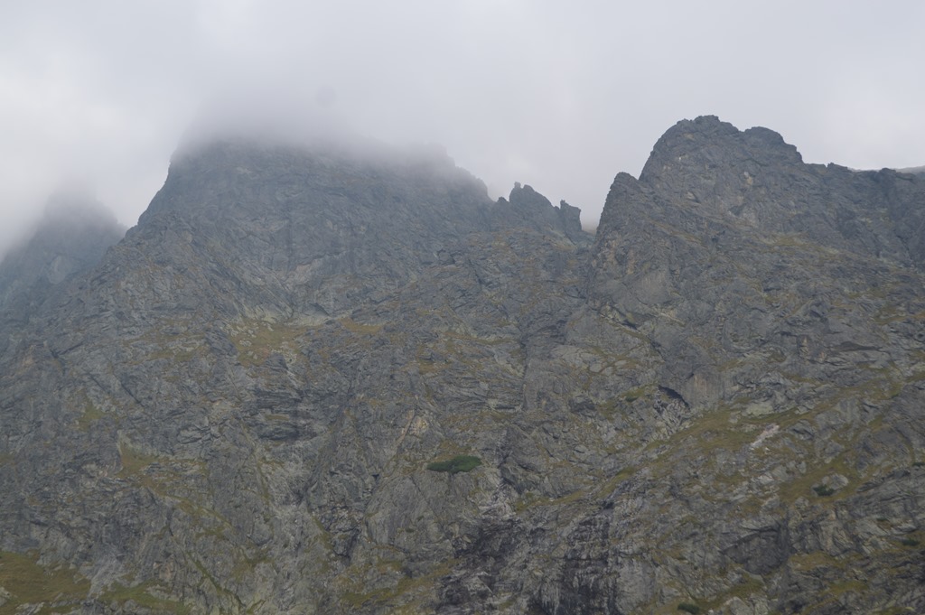
The real High Tatras are in this direction beyond the waterfall with the trail to Gerlachovský Å¡tÃt – Gerlach Peak 8,711 ft, the highest mountain of the High Tatras and the entire 1,500 km of the Carpathian Mountain Range. A mountain guide is required for climbs on Gerlach Peak. Two hours deeper along the trail into Velická Valley and there are views of the mountains in Poland.
I snapped a photo of Gerlach Peak the following morning from the Grand Hotel Stary Smokovec when I saw the skies clear for the first time in four days. Within minutes of snapping this picture the clouds covered Gerlachovský Å¡tÃt once again. I felt blessed to briefly see the peak before I departed the High Tatras.
Sliezsky Dom (Silesian House)
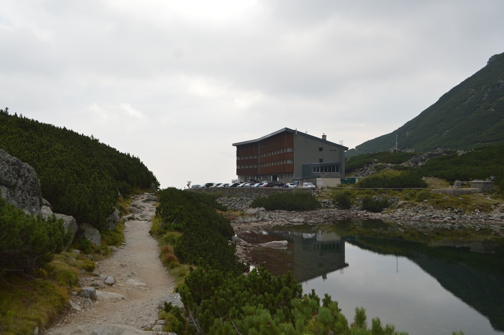
Sliezsky Dom is a mountain lodge accessible by road. The current hotel was built in 1966-69 and remodeled in 2010. There are 43 rooms and one 9-bed dormitory room. I did not see room rates listed on the website. The hotel arranges mountain guides, if you choose to ascend Gerlach Peak.
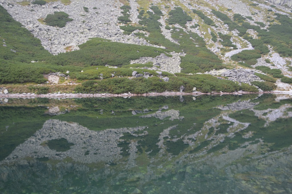
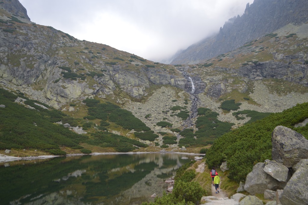
The mountain lakes in the High Tatras are called ‘tarns’ in English.

After three hours hiking and then stopping to take photos around the tarn, I got chilled. I realized the temperature had dropped from the 70s to the 50s and my t-shirt was drenched in sweat. I changed into pants and a long sleeve shirt. Pleasant feature of the colder air was the absence of annoying flies when I stopped to take photos.
I rested for a while in the lobby of Sliezsky Dom. Sad to say that I was not in a beer drinking state after 2,250 feet elevation gain on my 3 hour uphill hike. I rehydrated with my water bottle and looked at a book in Slovakian about geotagging brown bears in the High Tatras. There were plenty of informational tables in the text I could somewhat interpret and lots of color photos of brown bears. I was able to determine that brown bears spend much of September at lower elevations and late summer is the time of year they most actively roam the region covering many kilometers each day.
Unfortunately for my peace of mind, I made it to the last couple pages of the 200 or so page book to find English text summarizing the High Tatras brown bear study. I learned there are an estimated 100 brown bears in the area and they tend to come out of the high mountains in September more than any other time of year to hang around the forest just above the foothill villages. This was not the best book for me to read as I was preparing myself to hike back out of the mountains alone through the forest on my way back to the foothill towns.
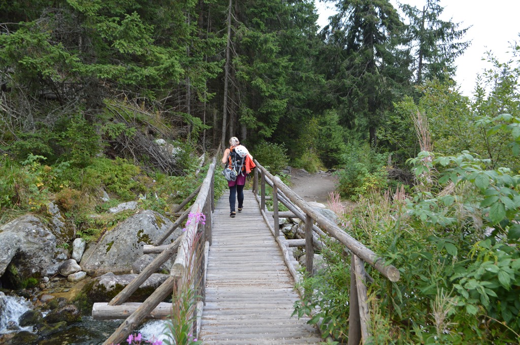
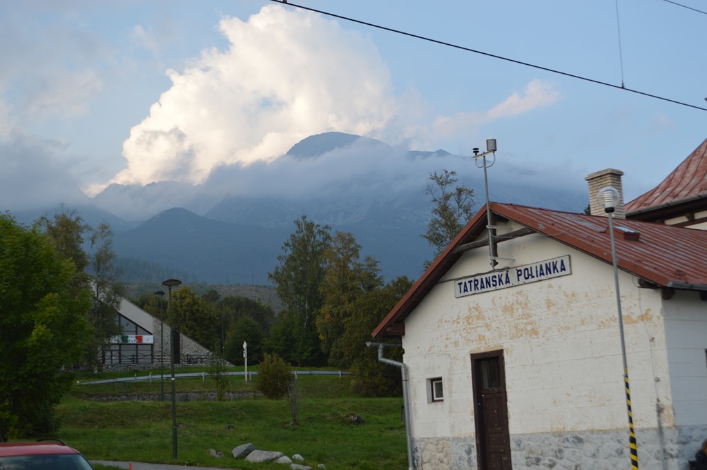
The lateral hiking trail along the ridge was in sight from Sliezsky Dom, but I changed my plan and headed straight out of the mountains downhill to reach the town of Tatranska Polianka. That trail knocked an hour off the return journey hike and I rode the electric train from Tatranska Polianka back to Stary Smokovec.

Much of the trail going downhill followed a creek bed. This kind of trail is why hiking boots are a good idea rather than sneakers. I hiked a lot of time through the creek, but walking mostly on rock surfaces and in shallow water that did not flow into the top of my boots.
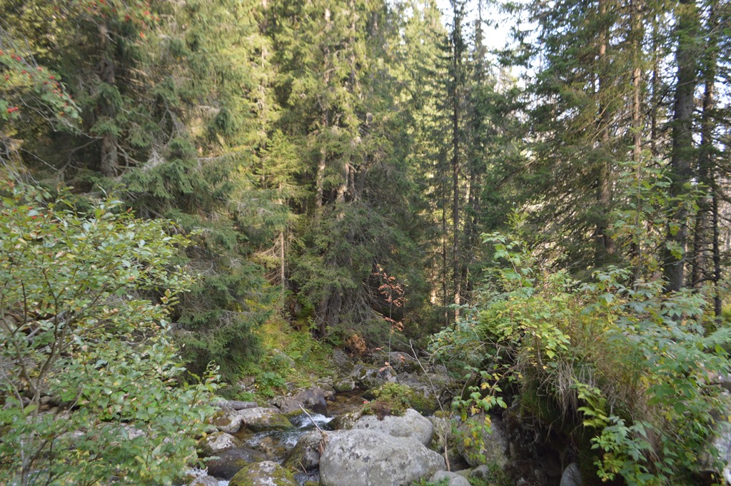
There could have been 100 bears all around me, but my eyes were so focused on where I placed my foot with each step that I could not bother looking around for bears. The only way I was going to see a brown bear is if it was in the middle of the creek too. I kind of wondered if I was even on the trail?
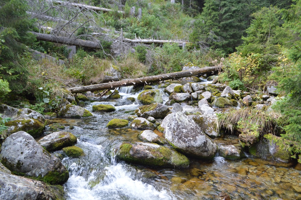
There was a stretch of 30 minutes or so before I spotted a trail marker showing me I was on the correct path.
I walked for about an hour before I came across another person coming down the trail who quickly passed me by walking more surefootedly. Knowing another person was on the trail in front of me significantly reduced my concern about brown bears. Before too much longer another six or eight people passed me on the trail. Half of them were packing hard helmets and some had ropes. I was most definitely the slowest hiker on the trail.
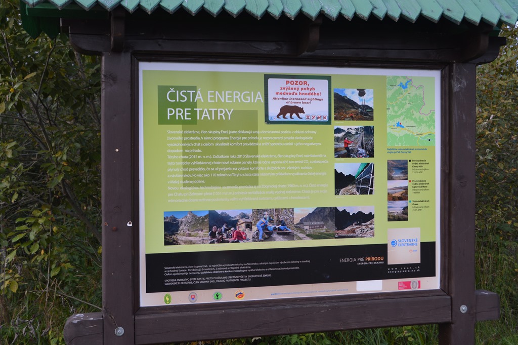
Out of the mountains and probably only about 15 minutes out of Tatranska Polianka I came across a sign,
“Attention increased sightings of brown bear!â€
By then I felt safely out of the woods in Tatranska Polianka.
London – Slovakia – Austria trip report, September 2016
- Slovakia on my mind
- My late summer trip Kosice, Slovakia to Salzburg, Austria
- Hotel Review Holiday Inn London Commercial Road (East End London)
- London East End impressions from a one day stay
- East London Canal Walk Holiday Inn Commercial Road to Wapping, St. Katherine Docks and Tower of London
- Wizz Air London Luton to Kosice, Slovakia
- Two cozy days in Košice, Slovakia
- Kosice, Slovakia – The Singing Fountain Spievajúca fontána
- Hotel Review DoubleTree Kosice
- Hotel Review Suite Boutique Hotel Chrysso Kosice Slovakia
- Lomnické sedlo, Slovakia – Roof of the High Tatras
- Hiking High Tatras Slovakia
- High Tatra Peaks Slovakia on a Clear Sky Morning
- Grand Hotel Stary Smokovec Slovakia 1904, Historic Hotels of Europe
- Slovakia as a tourist destination? I’m lovin’ it!
- See the world through ‘We Are Happy From’ videos
- Levoca UNESCO World Heritage Site medieval town
- Hotel Review U Leva Hotel, Levoca
- Spis Castle UNESCO World Heritage Site 12th century castle ruin was one of Europe’s largest castle complexes
- Slovakia recap after 10 days
- Bratislava, Slovakia highest SPG reward redemption rate I recall finding (I had a reservation here, but ended up canceling to stay two nights at DoubleTree Slovakia for 4,000 HHonors points + 30 EUR).
- Hotel Review DoubleTree Bratislava Slovakia
- Bratislava, Slovakia where you can afford real life one hour from Vienna
- Slovakia and Austria cheap travel on buses and trains
- Hotel Review Ramada Salzburg City Centre
- Salzburg – Mozart was here
3 Comments
Comments are closed.