How many times have you driven by a road and thought to yourself, “One of these days I am going to drive that route and find out what is there?â€
Highway 58, an east-west route across California, happened to be where I had stayed the night before in SpringHill Suites Bakersfield, right off Highway 99, the major California Central Valley north-south route connecting major valley cities. Interstate 5 was built through empty California space decades after Highway 99. Still, decades after I-5 has been the major west coast traffic artery from Mexico to Canada, the freeway in the Central Valley only has exits with hotels, gas stations and fast food restaurants every 20 miles or so for several hundred miles. There are few real towns around Interstate-5.
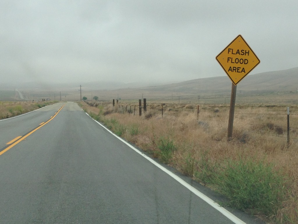
SpringHill Suites Bakersfield was only one of a dozen hotels all in the same location at Highway 99 and Highway 58, with just about every major U.S. hotel chain represented. Driving to Monterey from Los Angeles via Interstate-5 North normally means exiting at Lost Hills and driving Highway 46 west to Paso Robles. The drive takes 5 to 6 hours, depending on traffic. I was driving from Orange County, so another hour longer. Bakersfield would normally be too short a drive for a hotel night, however, El Nino 2015-16 rain storms meant flash flood warnings across Kern County Saturday afternoon kept me in Bakersfield for the night.
California Highway 58 West
For several years I have yearned to take a leisurely detour and drive Highway 58 all the way from Bakersfield to U.S. 101 for my drive home to Monterey. I had read driving west is the preferable direction for Highway 58, although I don’t share that opinion now after my weekend road trip. Either way should be a wonderful road trip, if conditions are right.
California State Route SR 58 is a 241-mile road from Barstow in the east, a town of 23,000 and the primary business city in the vast Mojave Desert of California to the tiny California hills town of Santa Margarita, population 1,259 to the west, located in the Santa Lucia coastal mountain range of San Luis Obispo County at U.S. Route 101, some 20 miles inland from the Pacific Ocean.
Santa Margarita, California was my primary interest for driving Highway 58 due to learning a few years ago that this is the town near the source of the Salinas River, the primary freshwater source for Monterey County. These lands of the Santa Lucia Range transcend the political boundaries of San Luis Obispo and Monterey County. The two counties share mountain and water resources and the same Pacific Ocean in one regional ecosystem that creates the environment of Central Coast California.
The Salinas River allows Monterey County to produce an abundance of vegetables and fruits, including many square miles of vineyards in the southern parts of the county as the fastest growing agricultural sector in the past decade for wine production.
Anyway, my aim in driving Highway 58 was to see this land around Santa Margarita and the source of the Salinas River.
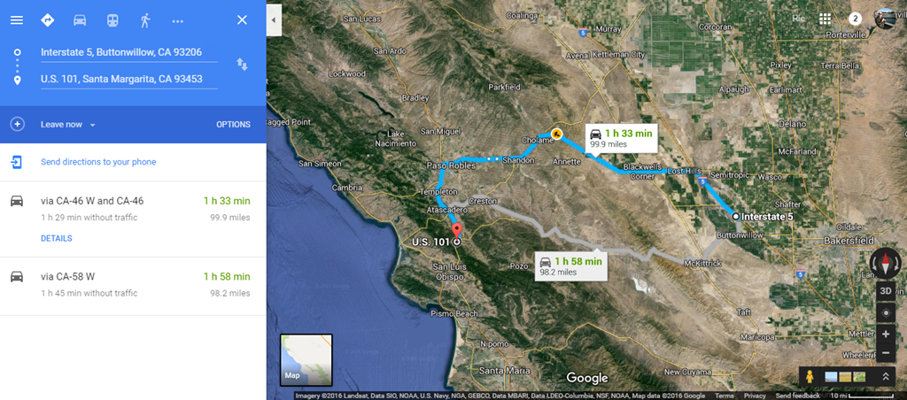
Google Maps recommends driving Highway 46 between Interstate 5 Buttonwillow and Highway 101, of course.
Highway 58 is the road far less traveled.
Don’t less those Google Maps driving times fool you. I rate Highway 46 as a 5 of 5 for quickest route connecting I-5 and U.S. 101. Highway 46 is the truck route. Highway 58 is a 2 of 5 route for speed. Highway 58 is mountain driving on paved roadway. That 25 minute time difference between driving Highway 46 and Highway 58 shown on Google Maps could easily be an hour or more depending on conditions and what kind of vehicles you encounter hindering your potential speed.
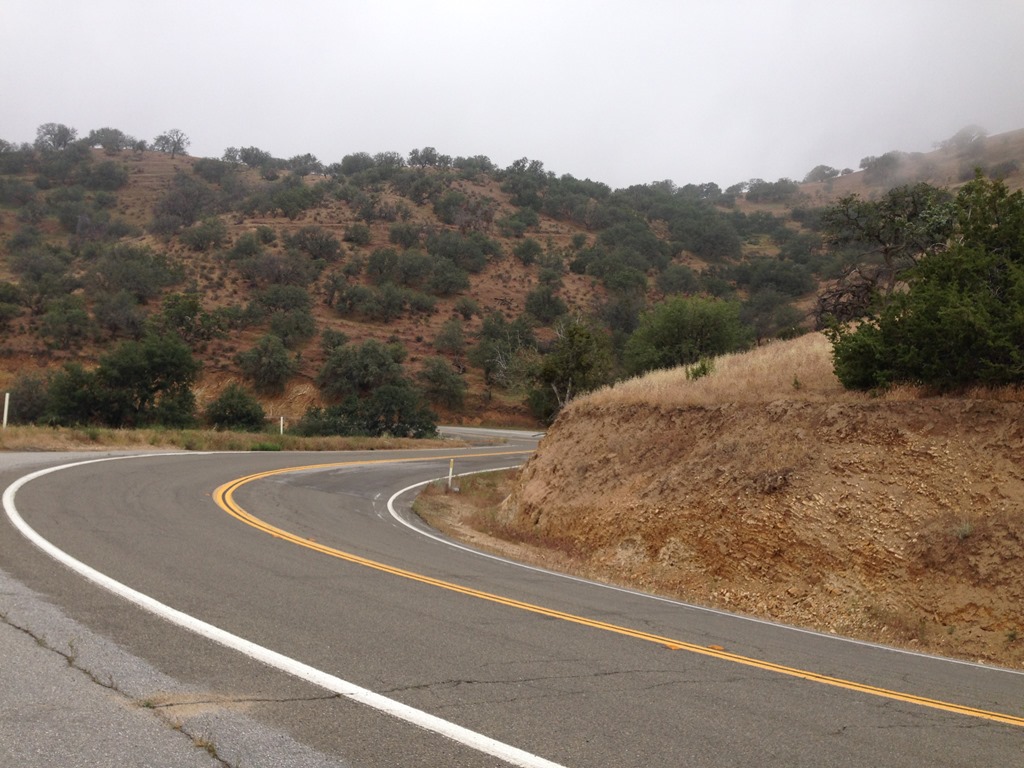
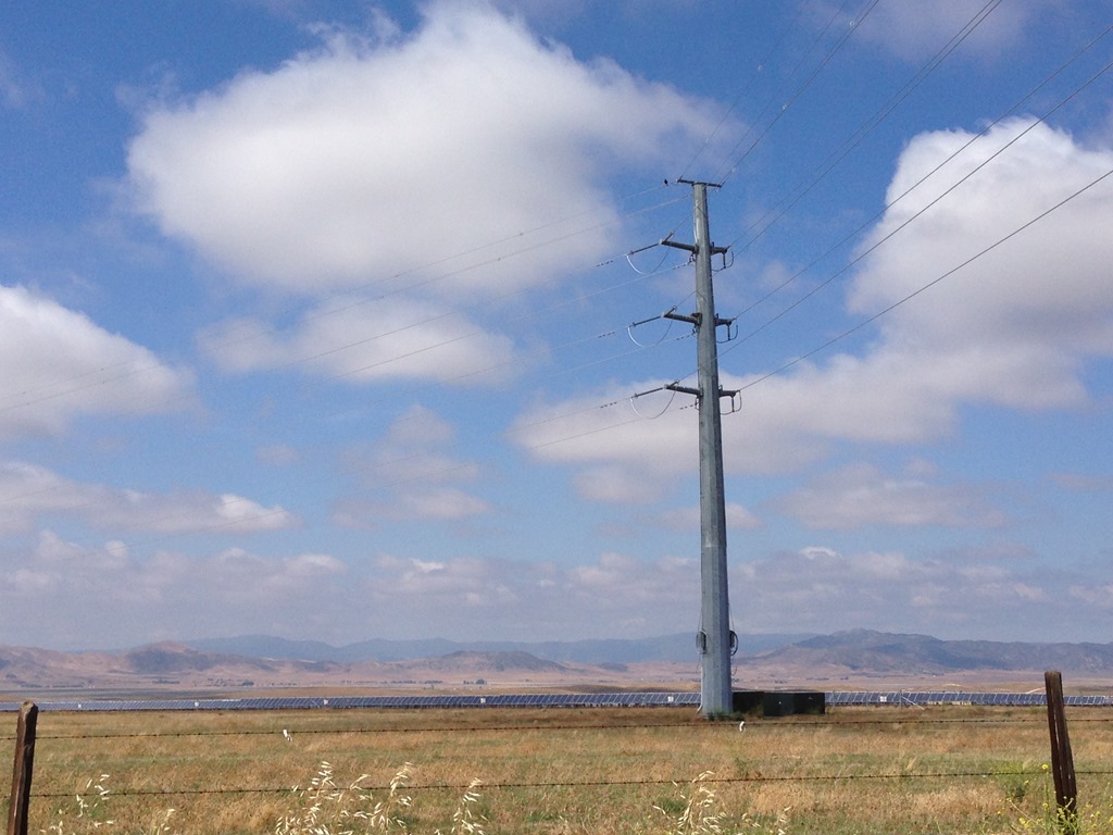
Highway 58 hill country Kern County, California
I drove the road less traveled Sunday and it blew my mind.
This is a very long piece about driving California Highway 58 west from Bakersfield to U.S. 101, along a very winding road, in parts, to a very special place in California. This is a place you can get to with a little bit of driving effort, but I never actually got there since I did not know at the time where ‘there’ was, or “where am I?†or ‘I am within a few miles of a National Monument†after I had driven 27 miles through hairpin turns along steep and crumbling hillsides on a well-paved two lane road along just another one of thousands of miles of California highways lined on a map, but in reality, representing a cross-section of wilderness across this state.
What I saw when I came down from the cattle grazing hills after an hour of driving was a valley that looked unique and distinctive to me as someone from Monterey, California. Turns out what I saw is truly a special place in California. Until two days ago I had never even heard of this place less than 200 miles from my Monterey home.
I travel the world looking for new places to explore and sometimes there are incredibly fascinating places nearby that I have always overlooked.
Highway 58 west dropped me from the hills of the Temblor Range (Spanish for earthquake) in western Kern County into the Carrizo Plain of eastern San Luis Obispo County.
What is the Carrizo Plain and how is this a place in California I never heard of before?
Driving Highway 58 west about 115 miles from SpringHill Suites in Bakersfield to U.S. 101 revealed to me the Carrizo Plain, a place in San Luis Obispo County I had never heard of before. The Carrizo Plain is about 50 miles long and 15 miles wide in a remote part of eastern San Luis Obispo County, about 150 miles northwest of Los Angeles and 175 miles southeast from where I live in Monterey, California.
I might have driven Highway 58 all the way to San Luis Obispo and never researched the area in this rural part of California were it not for thousands of solar panels concentrated in tight grids, but also spread out over a large area of the valley. As I descended the Temblor Range, some 27 miles west and about an hour after leaving McKittrick in the central valley, I looked upon a valley covered with immense tracts of solar panels.
This area is the largest remaining native grassland in California and the best surviving example of what California’s San Joaquin Valley once looked like, before the solar panel installation on the Carrizo Plain, of course.
A portion of the region was designated Carrizo Plain National Monument in the final week of President Bill Clinton’s term in office January 17, 2001. The 250,000 acres of grassland and hills are said to have more endangered animals and plants than any other region of California.
Carrizo Plain is such a unique place in California that it was considered for nomination as a World Heritage Site a decade ago, a status given to fewer than 1,000 places on the planet. California’s Redwood National and State Parks on the North Coast of California and Yosemite National Park are currently the only two World Heritage Sites in California. The U.N. designation was not pursued due to lobbying efforts from local communities and business interests, dominated by oil industry and cattle ranchers, whose primary concerns with World Heritage Site status were potential impacts on their future ability to use the area for energy resource development (i.e. no solar panels) and cattle grazing.
California State Route 58
California State Route 58 is a 241-mile road I have driven several times as the most direct route from Monterey to Las Vegas across the Mojave Desert of California. Up until yesterday I had only driven the 150 miles along the eastern portion of Highway 58 from Interstate 5, about 20 miles west of Bakersfield, California to Interstate 15 in Barstow, the largest city in the Mojave Desert of California.
Driving Highway 58 east of Interstate-5 to Bakersfield, Tehachapi, Mojave Desert, Barstow
The road traveling east from north-south Interstate-5 passes along 20 miles of road surrounded by immense fruit orchard tracts in the southern San Joaquin Valley farmland.
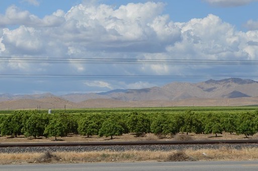
Orchards off Highway 46, east of I-5 and west of Bakersfield, 20 miles north of Highway 58.
[While not relevant to this story, I recommend you take the opportunity to check out César E. Chávez National Monument when driving Highway 58 east of Bakersfield.
About 30 miles east of Bakersfield on Highway 58 is Keene, California, accessed from an exit on the Tehachapi grade, is César E. Chávez National Monument. I stopped there in 2013. Loyalty Traveler – http://loyaltytraveler.boardingarea.com/2013/05/07/cesar-chavez-national-monument/.]
Bakersfield, California Pop 348,000, Elevation 404 feet.
The industrial farming sized orchard fields for miles between I-5, west of Bakersfield and the city’s urban sprawl westward encroachment often makes me think about John Steinbeck’s The Grapes of Wrath. Farmworker abuse has occurred for eighty years with economic migrants, even when they were native white Americans seeking better life opportunities in California during the Great Depression and Dust Bowl.
The urban sprawl of Bakersfield (> 500,000 people) is an area known for the worst air pollution in the United States as smog gets trapped in the valley. From Interstate 5, Highway 58 east takes you across Bakersfield for a quick ascent over the Tehachapi Mountains through Tehachapi Pass (3,793 ft.), then drops steeply down into the Mojave Desert, where 100 miles into the desert California Highway 58 ends and Interstate 15 in Barstow, California is the freeway for the remainder of the drive to Las Vegas.
Driving Highway 58 west of Interstate-5 Buttonwillow to McKittrick to California Valley-Carrizo Plain to Santa Margarita – Highway 101
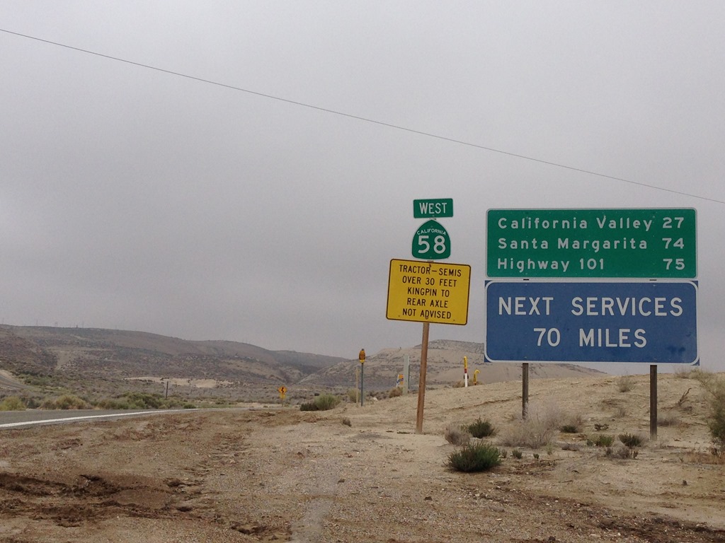
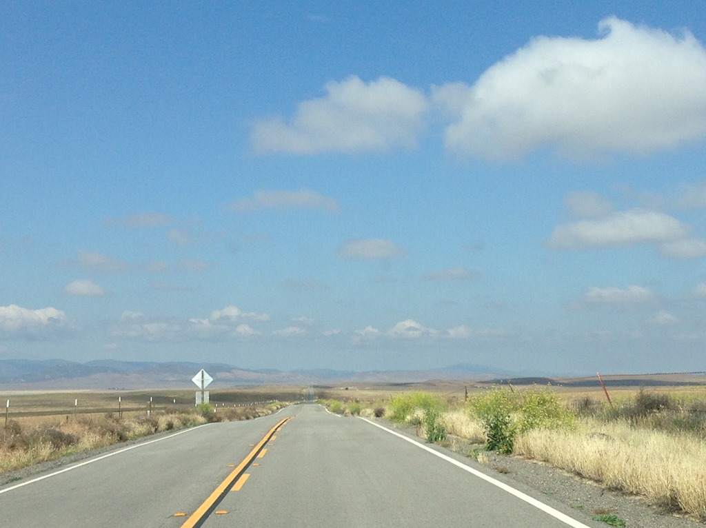
98 miles of Highway 58 West from Interstate 5 to Santa Margarita, one mile from U.S. 101 is a road not too traveled. On a Sunday from 9:00am to noon, I only saw three other cars over 90 miles of road traveling west and perhaps 25 or 30 cars traveling east over a 2.5 hour driving period with about 30 minutes of stop time along the way. No cars passed me on the road driving west during those 30 minutes of stop time.
The main highway for travel to Monterey is Highway 46, about 30 miles north of Highway 58. The two highways are separated by hills and connected by few paved roads.
Be prepared when you drive Highway 58 west since it can be some time before another vehicle passes and there are no services for over 70 miles.
Hwy 58 West in Buttonwillow, California, Pop 1,600, Elev 268
Buttonwillow has been an I-5 stop for me for over 30 years to eat before or after driving from Monterey over the Grapevine to and from Los Angeles or Highway 58 over the Tehachapi Pass to and from Las Vegas. For the first time ever I stopped at the Outlets at Tejon on this trip to eat and shop after driving north off the Grapevine. Outlets at Tejon are 44 miles south from Buttonwillow off Interstate 5. There are all kinds of food places and shops there. I noticed just before passing under I-5 on Highway 58 there is still an Indian food restaurant at I-5 Buttonwillow, a place I have eaten at before and enjoyed.
Most of us in California think of this state in terms of its big cities, since most Californians live around big cities. On my road trips around California I have passed through hundreds of small towns that dot the rural landscape of this vast state far removed from any other place .
Buttonwillow is the largest population town of the three towns Highway 58 passes by over 98 miles driving west of I-5.
 Â Â
  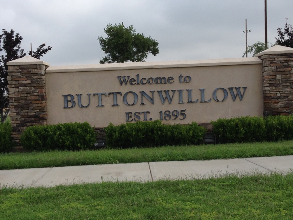
Buttonwillow is the best town to gas up and grab supplies if you need anything for the road trip west. You get one more chance for food and drink at McKittrick, 12 miles west of Buttonwillow, before heading into the hills.
California Aqueduct

California Aqueduct water diversions irrigate about 750,000 acres of San Joaquin Valley farmland.
California Aqueduct is the main water transportation corridor for the Central Valley. Most of us think of the Central Valley as a hot scrub brush desert with its summer temperatures usually over 100F. The Central Valley at the time of the California Gold Rush in 1849 held Tulare Lake, the largest lake west of the Mississippi River. The lake was fed by the snow melt of the Sierra Nevada into several great rivers which fed into the Central Valley. The land was occupied by tule elk, grizzly bears and black bears and other large mammals.
The abundance of water in California’s Central Valley, along with the abundance of laborers who did not strike it rich in the gold fields, allowed back-breaking canal irrigation to reshape seasonally arid portions of the valley into arable farmland to develop one of the world’s most productive agricultural centers. Today, where there was once a great lake in the 19th century filled and surrounded by wildlife, most of the mountain water is funneled across the state through large aqueducts and pipes for our fields and homes.
Western Kern County sits atop some of largest oil fields in U.S.
There Will be Blood, the 2007 film with Daniel Day-Lewis who won the Best Actor Academy Award for his role, depicts the story of the 1890s oil boom in California. After oil was found in Los Angeles County, oil exploration occurred throughout the state with one of the most significant finds in California’s Central Valley Kern County in 1894, west of Bakersfield.
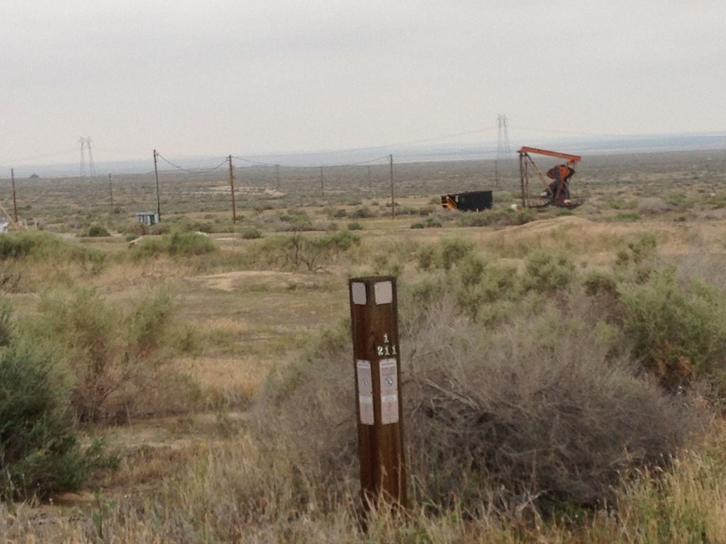
Midway-Sunset oil field is the largest known oil field in California and the third largest in the United States. Over 3 billion barrels of oil have been extracted over the past 120 years. This is the land area west of Interstate 5 and the landscape is dotted with oil pumpjacks. Highway 58 passes through the northern end of the 20 mile oil field. The southern end is near Maricopa along Highway 166. Highway 33 runs along the length of the oil field and through the oil towns of Maricopa, Taft and McKittrick. I noticed most pumpjacks were not pumping as I drove past hundreds on Highway 58 west.
There are still an estimated 500 million barrels of oil in the ground around here. I assume those oil jackpumps located behind posted land with names like Chevron on the signs are machines waiting to be turned on when higher oil prices return and production picks up again.
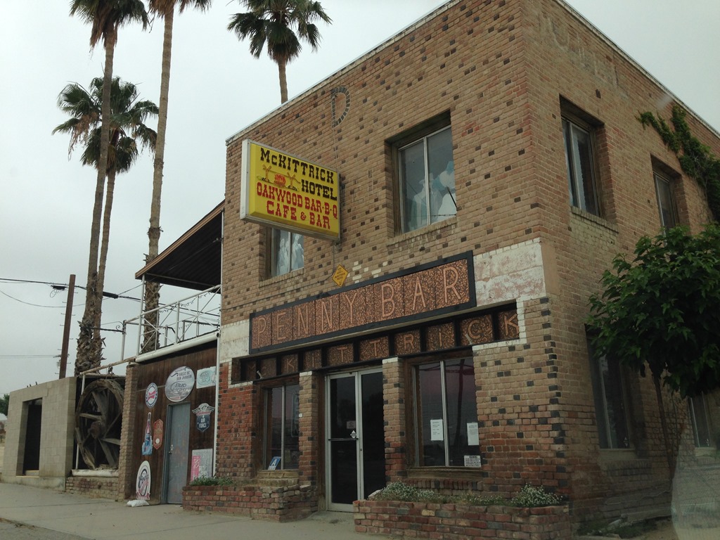
McKittrick, California Pop 115, Elev 1,056 ft.
Last chance saloon is McKittrick, California before 27 miles of hills through cattle country.

TripAdvisor gives good reviews for the Penny Bar at the McKittrick Hotel. The Penny Bar has been featured in many travel stories, including this New York Times piece.
The road goes rural after McKittrick. The drive is winding hill country over the next 25 miles across the Temblor Range until the road reaches the north side of the Carrizo Plain near California Valley.

California 58 West next services 70 miles, Highway 101 in 75 miles. The skies have me worried that the weekend rain storm might not have subsided yet.
California is covered in hills and valleys. There are some relatively flat portions between hill sections on Highway 58.
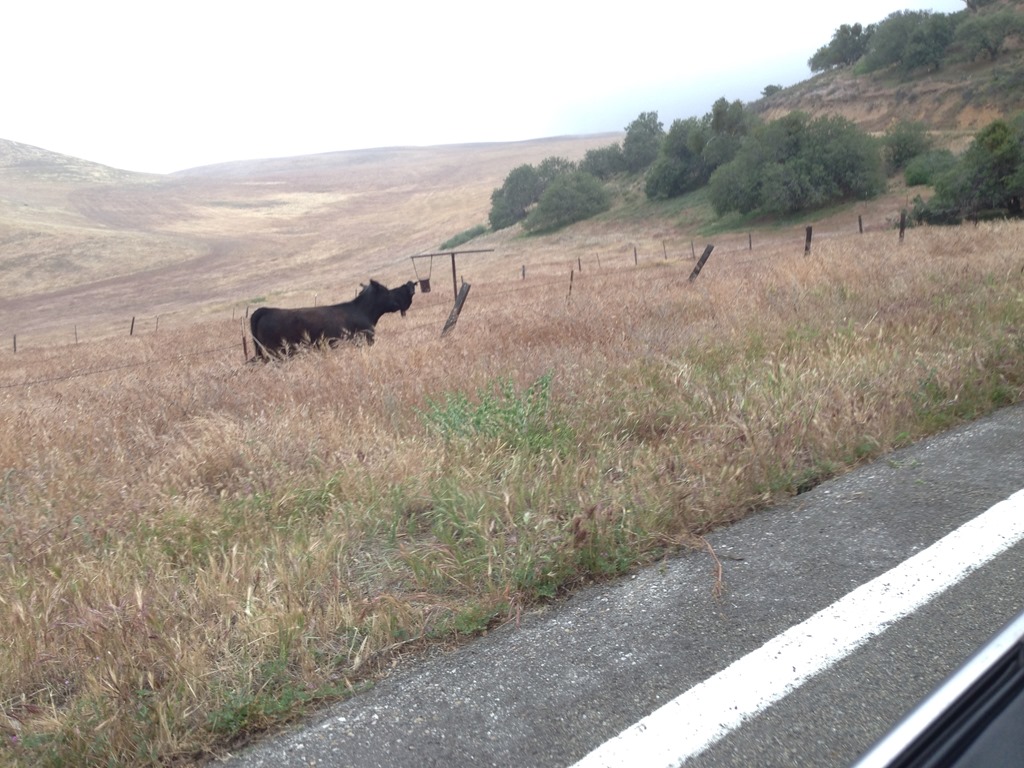
Up in the hills again, I noticed this guy is on the wrong side of the fence with no barrier to prevent him walking onto Highway 58. This is just one reason why you want to avoid Highway 58 in the dark. There were another ten or so cattle behind the fence. Stopping my car for a photograph startled this guy and he trotted back down to the fence line.
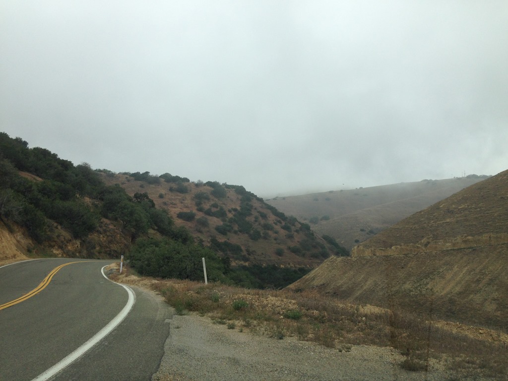
Highway 58 winds along the hillsides of the Temblor Range. The road winds around on a switchback carved into the side of the hill that is visible in the right side of the photo.
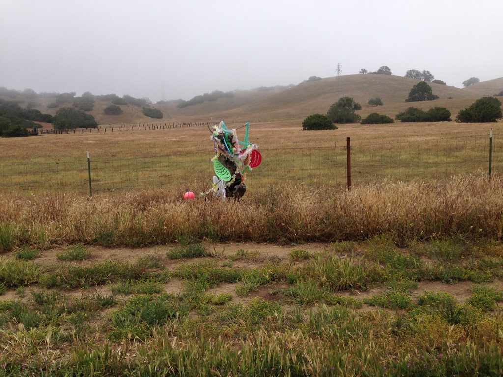
Highway 58 memorial flowers for a lost one to the road.
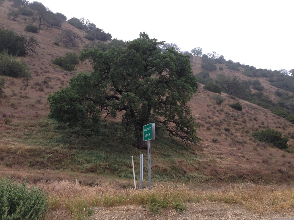
Highway 58 west enters San Luis Obispo County, California. Bragging rights for this oak tree on the SLO side of the county line.
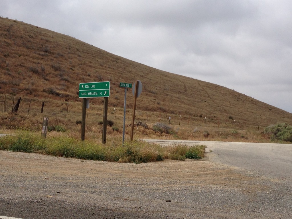
Soda Lake Road 9 miles, Santa Margarita 52 miles.
Soda Lake Road is the road to reach Carrizo Plain National Monument. There are no other signs here at this main intersection. I had no idea there was a National Monument in this area until I got home to Monterey and researched the Highway 58 sites I had passed by.

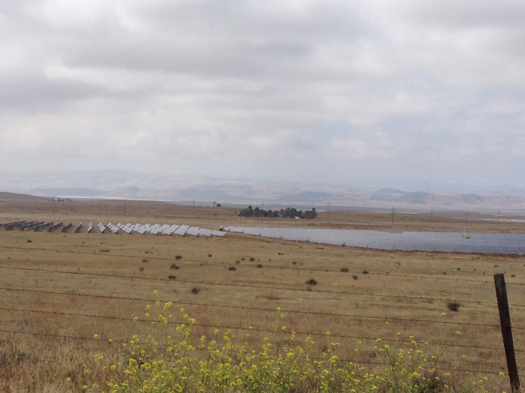
There were few safe places to stop on Highway 58 as I descended the hills with views above the valley below me covered in large tracts of solar panels. This photo is a view from the Soda Lake Road junction. In the center of the photo is a large array of thousands of solar panels. This is one of many solar panel tracts seen across the Carrizo Plain.
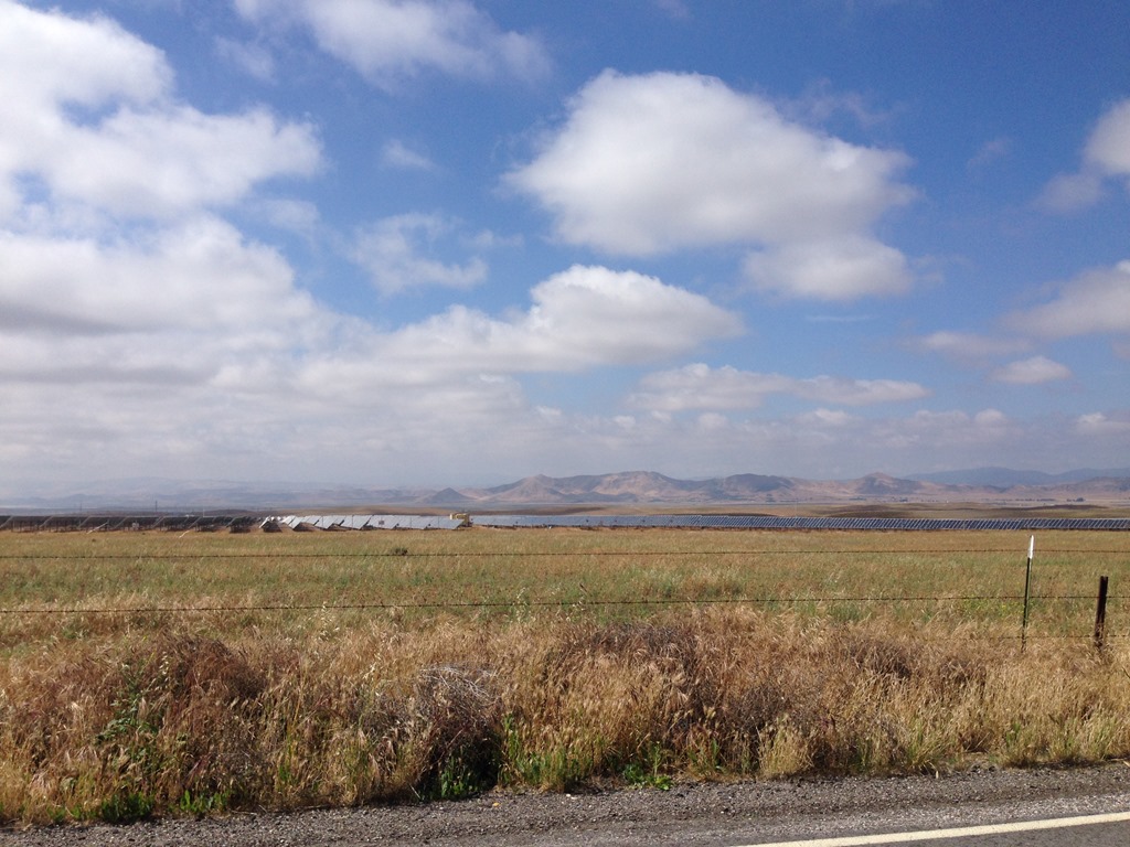
Another tract of solar panels on the Carrizo Plain. Just after snapping this photograph I spotted a pronghorn by the fence (pronghorns are often called antelope in the U.S.). I failed to snap a photo as it quickly bounded off towards the solar panels. It was the first time I had ever seen a pronghorn in California.
You would think that in a place with thousands of solar panels there would be some sunshine?
The Carrizo Plain is known as one of the sunniest locations in California and a particularly dry environment for its northern location in California. My day trip did not disappoint. The clouds broke and the most brilliant sun I had seen in several days of rainy weather over California shown down on the Carrizo Plain, helping to brighten up California for far more people than just me as I drove along Highway 58 west..
A fact sheet for California Valley Solar Power (CVSP) states it has a 250 megawatt solar power facility in eastern San Luis Obispo County providing enough energy for 100,000 homes. I have no idea if the solar arrays in my photos are part of CVSP, but the photos show where there are major investment interests in solar energy production happening with Carrizo Plain energy projects.
Driving on the San Andreas Fault
As I have said repeatedly, I had no idea what I was seeing as I was seeing it on this road trip. That is often similar when I visit major cities around the world. I photograph things that look interesting and uncommon to me and often study them later. After getting home to Monterey I learned the Carrizo Plain is one of the most studied areas of the world for evidence of tectonic plate earthquake science due to the visible landscape effects seen from the activity in the San Andreas Fault, which runs through the plain. Here is a California Institute of Technology earthquake auto tour guide for the Carrizo Plain area.
Undulating Highway 58 road surface is primary photo evidence I have that San Andreas fault runs through here.
More astounding to me than the undulating road was reading the 1857 Fort Tejon earthquake is estimated to have been twice as strong as the San Francisco 1906 quake. The Fort Tejon quake’s epicenter was actually in Parkfield, Monterey County, about 100 miles from Monterey. There was 27 feet measured in north-south displacement of land in the Carrizo Plain region due to the San Andreas slip-fault quake of 1857.
Monterey, California, on the west side of the San Andreas, moved closer to Alaska that year.
Highway 58 is relatively flat and undulating for several miles through the Carrizo Plain. At a couple of places you pass by civilization and even the Carrizo Plain Public Elementary School. It was this school name and not the signs for California Valley that clued me into the overall regional name for this unusual grassy plain. Fascinating to me was learning the Carrizo Plain is considered to be the best surviving example of what thousands of square miles of California’s San Joaquin Valley resembled only 200 years ago before oil wells and orchards and cities transformed the landscape.
California Valley itself was a real estate scheme for 7,200 land parcels of 2.5 acres each that went bust in the 1960s. There was an expectation that the California State Water Project would being water resources to the arid Carrizo Plain. Basically California’s plan for growth from the 1950s was to dam rivers in northern California and divert the abundant water based on the low population in those northern regions of California and divert water hundreds of miles to the south to fuel the needs of Los Angeles and rampant development in Southern California. I am amazed today at the wealth of economic activity in southern California for a region with inadequate natural resources.
That water never came to California Valley and the Carrizo Plain when route 46, some 25 miles to the north, was chosen as the route to develop for the California State Water Project pipes.
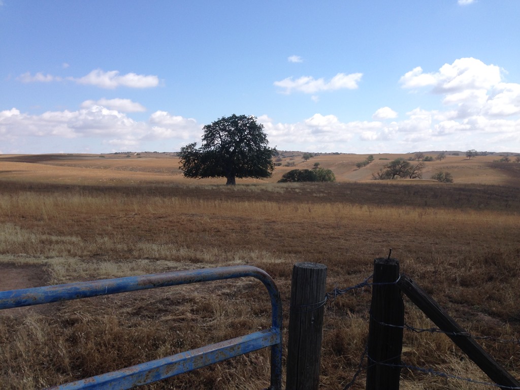
Cattle ranch country, San Luis Obispo County, California
The road ascends into the hills again west of the Corrizo Plain.
This is native Central Coast California to me in areas where there are few trees and lots of scrub. This is very similar to landscape around much of Monterey Bay.
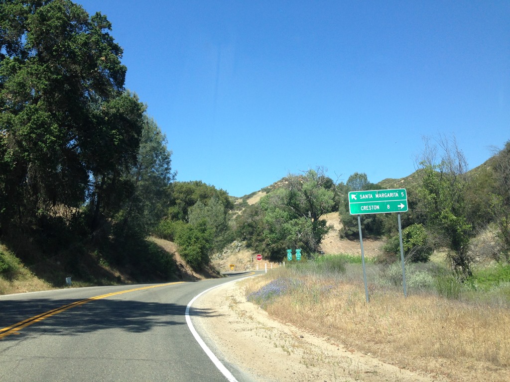
Highway 58 sign Santa Margarita 5 miles. There was a road 11 miles before this to Paso Robles, but I doubt it would be any quicker to reach US 101. The large cattle ranch signs on the few dirt roads gave way to ‘Winery’ signs as I approached Santa Margarita. Paso Robles is one of the fastest growing wine regions in the U.S.
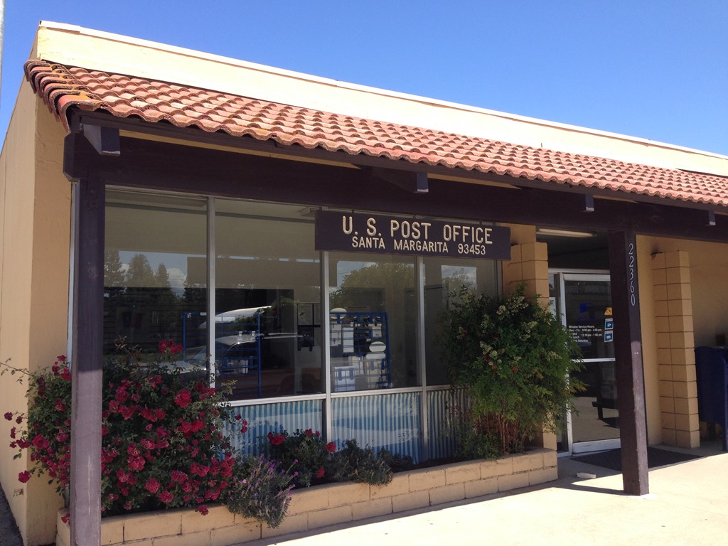
From Santa Margarita I was only one mile from the entrance to US 101. I’d never thought much of that exit sign at Santa Margarita in all the dozens of road trip drives I made over the years along U.S. 101 between Monterey and Los Angeles. Little did I know there was a unique part of California waiting to be discovered by me.
There are all kinds of places to see in California when you get off the main highways.
California has few roads to transverse the Central Coast mountain ranges separating Highway 101 and Interstate 5
California is a wrinkled state geologically. Mountains rise up immediately from the coastline to several thousand feet in many places along the Coast Ranges in most regions along 840 miles of California’s coast. The primary non-mountainous areas along the coast are places where major rivers scoured out their paths to the Pacific Ocean creating marsh wetlands. In these places seaports, farms and cities developed on the coast and around the fertile soil river valleys. These valleys developed into population centers for California with the major metropolitan areas of San Diego, Los Angeles, Oxnard-Ventura, Santa Maria, Monterey Bay, and San Francisco Bay-San Jose. These areas hold most of the state’s population in ten coastal counties from San Francisco to San Diego. 87% of California’s 38 million+ population are located in urban areas. Only 9 of 58 counties in California are primarily rural populations and those are the eastern and far northern high mountain regions of California.
Between San Francisco and Ventura, runs a 360-mile stretch of Highway 101, the primary highway traffic corridor along California’s coast. Most of Highway 101 runs through Santa Clara Valley and Salinas Valley with the Santa Cruz Mountains between San Francisco and Monterey Bay separating the coast from the Santa Clara Valley and the Santa Lucia Mountains separating the Big Sur coast of Monterey County from the Salinas Valley. Highway 1 is the road that hugs the coast from San Francisco to Santa Cruz and Monterey and along the Big Sur coast.
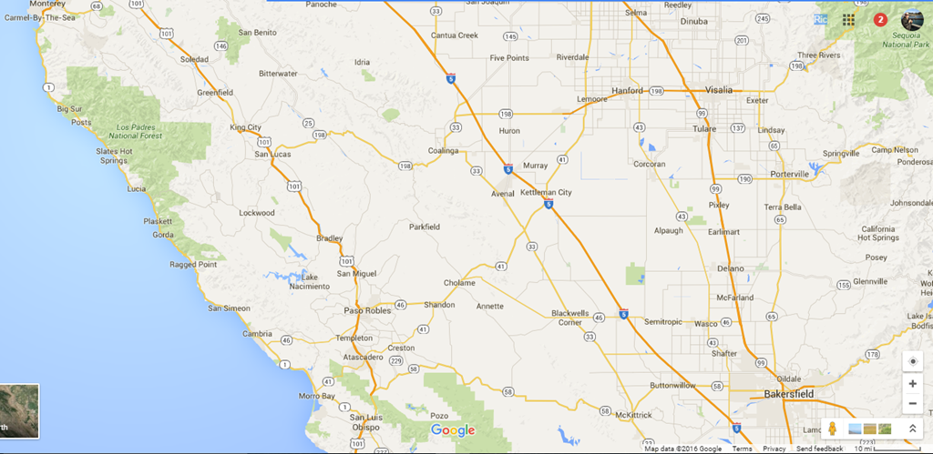
There are only a few main roads that traverse the interior coastal mountains called the Diablo Range and the Santa Lucia coastal range. These low mountains, mostly around 2,000 to 4,000 feet in elevation run 200 miles north to south from the east side of San Francisco Bay to San Luis Obispo County at Highway 46. There are only six highway routes over nearly 300 miles of central coast California to drive from Highway 101 to Interstate 5.
1. California State Route 152 in Gilroy is known as ‘Pacheco Pass’ at the south end of Santa Clara County.
2. Highway 46/41 at Paso Robles/Atascadero, south of the Salinas Valley in northern San Luis Obispo County. Technically, Highway 41 and 46 are different roads to different places with Highway 46 at Paso Robles connecting to Interstate 5 at Lost Hills and Highway 41 at Atascadero (15 miles south of Paso Robles) cutting northeast diagonally through the Santa Lucia hills east of Highway 101 to I-5 at Kettleman City. Both roads follow the same route for about 10 miles before Highway 41 branches off at James Dean Memorial Junction for the northeast route to Fresno and Highway 46 goes west to Bakersfield.
3. Highway 166 at Santa Maria in Santa Barbara County. This is the only other route I see on Google Maps with access to the Carrizo Plain.
When driving US 101 south, Highway 46 is about 150 miles south of Highway 152 in Gilroy. Highway 166 in Santa Maria is about 70 miles south of Highway 46.
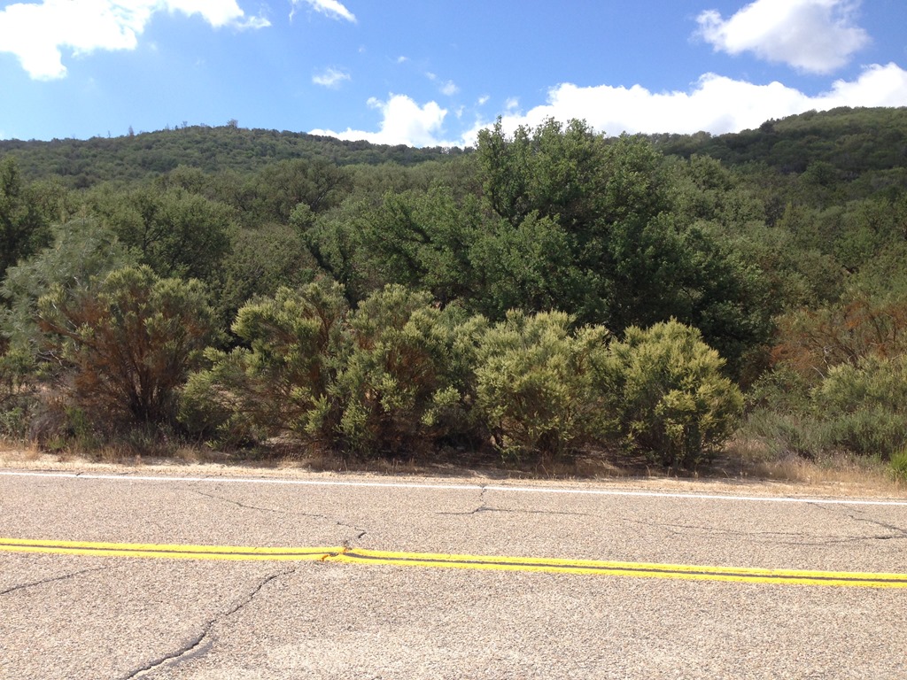
There are also a few secondary highway roads, like Highway 130 east of San Jose in Santa Clara County, Highway 198 east, accessed about ten miles south of King City in Monterey County, and Highway 58 between San Luis Obispo County, a few miles south of Atascadero and Kern County between 101 and I-5. Each of these roads involve driving along a significant number of switchbacks as you ascend and descend steep hillside slopes. These secondary highways should be avoided, unless good weather conditions are assured and you are comfortable with miles and miles of winding two-lane roads with steep cliff drop offs.
California’s coastal range mountains and hills are some of the least populated and inaccessible regions of the state between San Francisco and Los Angeles. Much of this land is designated and protected wilderness where condors, mountain lions and bears still roam.
California State Route 46 is the main route from Monterey County going south to Los Angeles via Interstate 5. SR 46 is reached driving Highway 101 south to Paso Robles in San Luis Obispo County (110 miles from my Monterey home), then cross the hills on SR 46. This road has James Dean Junction in a location at the intersection of State Route 41 and 46 honoring the death of actor James Dean near this spot as he was driving to Salinas to participate in an auto race in September 1955. Also near the same junction used to be a sign designating the San Andreas fault. I have not seen that sign in several years. I wonder if the road marker was stolen too frequently? Highway 46 is patrolled heavily by CHP and speeders along the dozens of miles of straight road crossing the valley are regularly ticketed. This road used to be quite dangerous even a decade ago as a two lane road and lots of automobiles passing trucks in games of chicken to beat out oncoming cars.
California 166 from Santa Maria to Bakersfield is a road I have not driven. It is a well-maintained highway thoroughfare from what I have read and it looks like there is road access from Highway 166 to the eastern end of the Carrizo Plain.
California Highway 130 out of San Jose is a road I tried driving once, but I turned around after a several miles after realizing it has many blind corners with barely enough room for two cars to pass on cliffs and no divider lines. Also chunks of pavement were collapsing off the cliffs. That is a road to drive at your own peril.
California Highway 198 is a road in Southern Monterey County I have driven a couple of times over the Diablo Range, south of Pinnacles National Park. I enjoy Highway 198 for its views of Pinnacles National Park mountain area. Continue east across the Central Valley from Coalinga to Visalia and the highway winds up the Sierra Nevada mountains into Sequoia National Park. Highway 198 meets Highway 180 at the Kings Canyon National Park visitor center and Hwy 180 continues on deep into the Sierra.Nevada where it dead ends at the launch point for high peaks wilderness hiking.
Loyalty Traveler – On the Road to Earth’s largest tree in Sequoia National Park (Nov 3, 2013).
Loyalty Traveler – Kings Canyon National Park – The mountains are calling and I must go (May 15, 2011)
Since California Highway 46 is a road I have driven numerous times and I was in no rush to get home on Sunday, as the weather was dry, my road route decision to drive via Highway 58 home to Monterey worked out fine. I have a feeling I will be driving Highway 58 again before long.

2 Comments
Comments are closed.