Today I saw clear skies for the first time in a couple of weeks. The sun appeared this morning once the Alaska Airlines aircraft reached about 1,000 feet in elevation over Monterey County, California. I have been spending my days these past two weeks in Monterey below the fog.
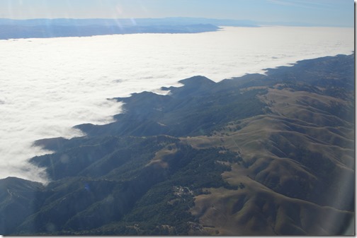
This morning I flew above the marine fog layer of Monterey County and snapped some lovely foggy photos.
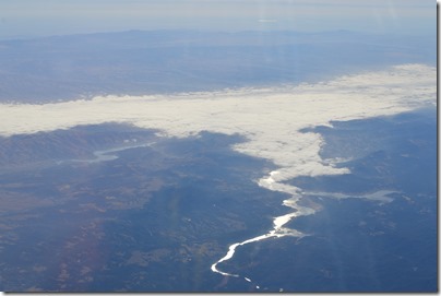
Salinas Valley fog seen from Alaska Airlines flight on May 29, 2015.
Friday while looking down at Monterey County on a flight from Monterey to San Diego, the Salinas Valley fog reached more than 100 miles inland from Monterey Bay. Salinas Valley, one of the world’s most productive agricultural regions with year round crops, is about 10 to 30 miles wide between the Santa Lucia Mountains of the California coast mountain range and the Gabilan Mountains, seen in the distance to the east. Fog-free mountain tops in the Santa Lucia range are between 2,000 and 3,000 feet in elevation here.
California’s geography of coastal mountain ranges, a 500 mile long relatively flat interior Central Valley from Bakersfield to Redding, bordered on the east by the Sierra Nevada in the south and Cascade Range in the north with mountains over 10,000 feet, creates two fog seasons in the state. During winter months, Tule fog is a dangerous driving issue in the Central Valley. Sometimes you can’t see more than 200 to 300 feet.
Fog is a year round phenomenon for coastal California. In Monterey the number of days with fog averages over 20 for July and August compared to just a few days in winter months. Check out the Film Monterey weather statistics. Clint Eastwood probably filmed his Monterey area movies in winter. November to April is when nearly all the annual rainfall happens along coastal California. The cloudy days of summer blocking out the sun are almost always due to the marine fog layer settling over the coastline.
Marine layer fog and summertime grays
Coastal California has marine layer fog that blows in from the ocean. This kind of fog appears year-round along most of California’s coastline. The summer months have the most days with marine layer fog on the coast of Central California when the inland valleys heat up and the cool ocean air is sucked over the coast. This is the fog we have experienced the past two weeks around the Monterey Bay.
The marine layer fog is what has prevented me from seeing much sunshine lately in Monterey. Several days have looked like it was raining outside with the streets and sidewalks wet. There were a few hundredths of an inch of rain this past week, but most of the dampness in the area has been heavy fog and not rain.
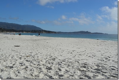
Carmel Beach August 1, 2013 at 3:59pm.
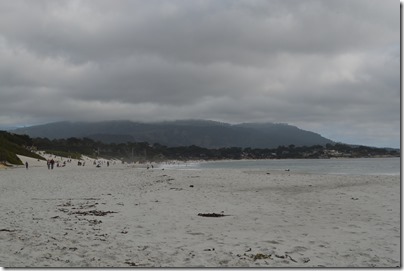
These two photos above and below show the rapidly changing weather on the California coast in summer. The first photo was taken at 3:50 pm at sunny Carmel Beach and 40 minutes later the marine layer fog had moved in and blocked the sun. The fog is usually accompanied with a drop in temperatures as the wind speed increases.
Carmel Beach August 1, 2013 at 4:40pm.
Central California’s coast rarely has rain in the summertime. I read trip reports every year where people describe the rain clouds quickly moving in on their summer California coast trip. Unless it is an El Nino year, then the clouds you see on the coast in July and August are nearly always only fog. Southern California is a different weather system with remnants of Pacific hurricanes traveling up from Mexico and these weather systems sometimes bring summer rains to LA and San Diego.
January is a great time to drive the California coast (when it is not raining)
One of the great bucket list trips many people want to do in their travels is drive the California coast. Most tourists make this trek in the peak season summer months, the same months with the highest probability of fog blanketing the coast. It is a matter of luck when driving Monterey to San Luis Obispo along the Big Sur coastline as to whether your drive will have 50 mile vistas or a day of gray.
January is actually one of the best times of the year to drive the California coast, if it has not been a heavy rain storms year that washes out portions of Highway 1 into the sea. January is the gray whale migration and when it is not raining, the skies are often brilliant and whale sightings common.
Whale spotting from Hurricane Point, Highway 1, north of Big Sur on December 22, 2013.
July 20, 2014 was a good summer day with little fog.
Alaska Airlines flight Monterey to San Diego
Monterey County’s largest reservoirs are more than 100 miles by road from Monterey. Lake Nacimiento, seen in the photo above and Lake San Antonio (visible in left portion of photo) catch the runoff from the the Santa Lucia Mountains on the eastern side of the coast range, east of Big Sur. The fog layer reached all the way from Monterey Bay to Paso Robles, about 110 miles south. The reservoir campgrounds in southern Monterey County commonly reach temperatures exceeding 100 F in July and August. Along the coast, most days in July and August begin with fog, the skies clear for several hours in the afternoon and then fog returns.
When the name ‘grunge rock’ labeled the Seattle sound in the early 1990s, I looked at the clothing style and thought that was how we always dressed in Monterey and along the northern California coast since you go outside in the morning in shorts, t-shirt, second shirt or sweatshirt when it is foggy, tie the sweatshirt around your waist when the sun comes out and the temperature is 60 to 70 F, then put the sweatshirt back on when the fog returns in the afternoon, along with the wind, and the temperature drops to the mid-50s with a chilling breeze.
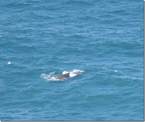
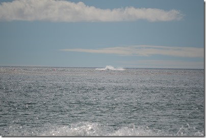
July can also be a wonderful time to visit California’s Central Coast. Last July 20, we sat on Carmel Beach watching porpoises swim 20 meters off the coast and breaching whales in Carmel Bay. The ocean water temperature was warmer than we ever recall and was comfortable enough for a short swim. The sea temperature along Central Coast California is usually wetsuit water.
Whale splash in Carmel Bay.
Just keep in mind that the central coast of California has the highest number of foggy days in July and August. There is a reason September and October are peak season for tourism with the warmest weather of the year on the central and north coast of California typically happening during these two months. October is when many of the all-time high temperature records happen on the coast in places like Monterey, San Francisco, Fort Bragg and Eureka.
The recent heavy rains and flooding in Texas have been blamed on El Nino. In California we are hoping the El Nino strengthens and brings rain to California for the 2015-16 winter season.
This might be a good year for touring California in July. Hopefully a strong El Nino will bring early California rains this year in August or September. A cloudy, rain day in August will be a welcome sight. Otherwise, we can expect the usual coastal fog on many days. August rarely misses that weather event around the Monterey Bay.


