Three historic light stations are located along the Cape Hatteras National Seashore of North Carolina with Ocracoke, Hatteras and Bodie Island lighthouses. Ocracoke lighthouse from 1823 is the oldest lighthouse in North Carolina and the second oldest in the USA. Hatteras lighthouse is the tallest lighthouse in the USA. Bodie lighthouse was blown up in 1861 by the retreating Confederates during the Civil War and reconstructed in 1872. What is it about lighthouses that captures the imagination of the public, most who have never been at sea in need of lighthouse signals? Ocracoke Lighthouse  Ocracoke Lighthouse is near the North Carolina ferry terminal for Ocracoke Island. There is a small parking area for a few cars and a walkway beside the picket white fence of a private island residence. An orange tabby cat was sleeping in the shadows on the walkway as I approached. The lighthouse is not open for regular tours. Cape Hatteras National Seashore encompasses much of the Outer Banks of North Carolina from Ocracoke Island in the south to Bodie Island in the north, about 80 miles along North Carolina Highway 12. The Ocracoke Island portion of the route in the south includes a ferry ride between Hatteras Island and Ocracoke Island. At the northern edge, US Route 64 bridge crosses the Roanoke Sound south of Nags Head.
 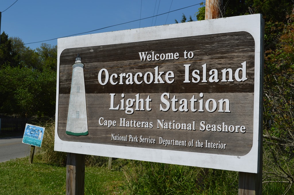 Ocracoke Inlet was mapped in 1585 when an English ship wrecked here. Edward Teach, aka Blackbeard the Pirate, sailed these waters in his ship Queen Anne’s Revenge outfitted with 40 cannons. During Blackbeard’s brief pirate career 1716-1718, his forces looted British, Spanish and French ships in the Caribbean and eastern seaboard. His ships even blockaded Charleston, South Carolina for ransom. Governor of Virginia Alexander Spotswood established and financed a task force to track down Blackbeard in November 1718. Two ships and over 50 troops commanded by Lieutenant Robert Maynard engaged the pirate and his crew of about 25 members in a sea battle at Ocracoke Inlet. Blackbeard knocked one ship out of battle with broadside cannon fire. A bloody engagement on the remaining British Navy ship saw Blackboard’s men board the British ship to be hit with a surprise attack from the majority of combatants hidden below deck. Some 20 of 80 participants in the battle died by cannon fire, guns and swords. Blackbeard was killed with numerous bullet and stab wounds in the battle November 22, 1718. His head was mounted on Lt. Maynard’s ship for the return voyage to Virginia. By the 1730s, Ocracoke Inlet was one of the busiest waterways on the eastern seaboard. Storms shift the sand bars in the Pamlico Sound and local knowledge of the waterway has kept local pilots employed for three centuries to assist navigation through these waterways. A lighthouse for Ocracoke Inlet was built on small Shell Castle Island south of Ocracoke in 1794 near the deepest water channel from the ocean to the inlet. Within 20 years, the shifting sands of Pamlico Sound made the Shell Island lighthouse obsolete. By 1818, the channel had shifted by nearly one mile. In 1822, the U.S. Government purchased two acres of land on the south end of Ocracoke Island and a new lighthouse was constructed and opened in 1823. The building today is this 1823 lighthouse and is the second oldest continuously operated lighthouse in the USA.
 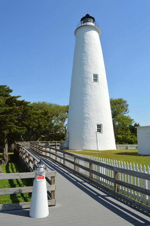 Ocracoke Light Station (1823) is 75 feet tall. The walls are brick, from five feet thick at the base to two feet thick at top. The solid white exterior is its traditional color. My photo taken the morning of May 9, 2014, a gorgeous and cloudless spring day, makes it hard to imagine the fierceness of the Atlantic in a major storm. Small lighthouse on walkway is donation box. Ocracoke Lighthouse served as an historical evacuation center for islanders during hurricanes. Cape Hatteras Lighthouse (original 1802, current 1870) Fourteen miles north on Highway 12 at the end of Ocracoke Island is the ferry to Hatteras Island. For over fifty years the ferry ride between the islands took 35 minutes. Hurricanes of the past three seasons changed the sand bars in Pamlico Sound and the current circuitous route between the island ferry ports has increased the ferry ride to about 50 minutes to navigate around sand bars.
  Fishermen standing on a sand bar in the Pamlico Sound a couple miles offshore from Hatteras Island, while a larger vessel navigates nearby in deeper water. Cape Hatteras is known as the ‘Graveyard of the Atlantic’ due to the offshore Gulf Stream current colliding with the Labrador Current, known locally as the Virginia Drift, that forces southbound ships into a twelve-mile long sand bar called Diamond Shoals. There have been thousands of shipwrecks here. U.S. Congress authorized the construction of Cape Hatteras lighthouse in 1794 and construction began in 1799. In 1803 a whale oil powered lamp was lit on a 90-ft. sandstone lighthouse. The original lighthouse was too short and not distinctively colored to be effective. There were regular complaints from sea captains calling it one of the worst lighthouses on the Atlantic coast. In 1853, the tower was extended by 60 feet to be 150 feet tall. The newer portion was painted red and the lighthouse was retrofitted with a Fresnel lens. The original lighthouse no longer stands. A new Cape Hatteras lighthouse was constructed in 1870 at which time the distinctive black and white stripe pattern was added. Each lighthouse has a distinctive pattern referred to as the daymark and a unique light pattern known as the nightmark. One of the popular activities at Cape Hatteras lighthouse is climbing the 268 steps to the top. The cost is $8 per adult and $4 for children (11 and under) and seniors (62 and older).
  Cape Hatteras lighthouse is the tallest lighthouse in the USA at 208 feet. Beach erosion brought the sea to Cape Hatteras lighthouse in 1935. The lighthouse light was replaced by a light on a 166 ft. steel tower and Cape Hatteras lighthouse was closed. From 1935 to 1950 the lighthouse for mariners was the Buxton Woods Tower. Beach stabilization allowed the Cape Hatteras lighthouse to resume light service in 1950, but by 1980 beach erosion brought the sea to the lighthouse once again. In 1999, the 1870 lighthouse was moved 2,900 feet away over 23 days to its current location on Hatteras Island some 1,500 feet away from the shore.
  Photo of Cape Hatteras lighthouse 2,900 feet away and 1,500 feet from shoreline. Surfer leaving the beach at site of old Cape Hatteras lighthouse. Bodie Island Lighthouse (original 1837, second lighthouse 1859 blown up in 1861, current lighthouse 1872; pronounced like word ‘body’.) Congress authorized in 1837 the exploration of a lighthouse location to supplement Cape Hatteras for navigation of the Outer Banks. Lieutenant Napoleon L. Coste of the revenue cutter Campbell determined Bodie Island to be a good location. It was another decade before land was purchased and a 54-feet tall lighthouse constructed in 1847. The project manager did not follow the construction engineer’s advice for the lighthouse foundation and within two years the lighthouse started leaning and finally was abandoned in 1859. A new 80-ft. lighthouse was built nearby and opened in 1859. Retreating Confederate forces blew up the Bodie Island lighthouse in 1861. The first two lighthouses were actually on Pea Island, south of the Oregon Inlet and Bodie Island. Pea Island has a National Wildlife Refuge.
  My drive along Highway 12 was getting kind of monotonous after leaving Cape Hatteras lighthouse and there was no place to turn off the two lane highway with Atlantic Ocean beach on my right and the Pamlico Sound on my left, in places scarcely more than 100 yards of sand dunes wide between the two bodies of water.
 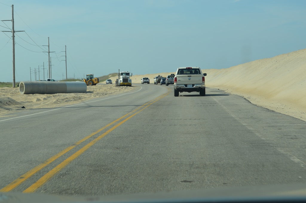 Pea Island was a chance to get off the road and take a hike without hiking beach sand. I get enough of that activity in California and I had already been on the beach at Ocracoke Island.
 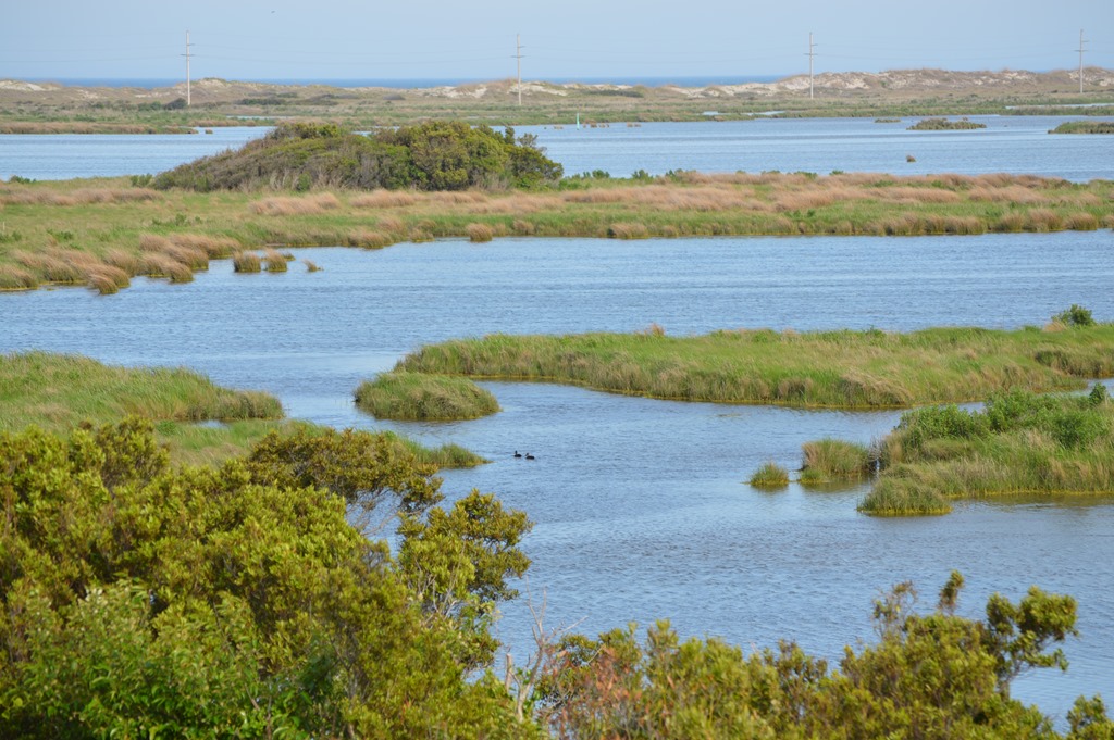 Pea Island National Wildlife Refuge One of the most memorable visual images of my North Carolina Highway 12 Outer Banks road trip was watching dozens of pelicans, gulls and other birds soaring the air currents over the bridge crossing the Oregon Inlet between Pea Island and Bodie Island.
  Oregon Inlet Bridge is a 2.5 mile bridge between Pea Island and Bodie Island. The birds soaring the wind currents in the steady breeze is an indicator of the local environment. Wright Brothers National Memorial at Kill Devil Hills is about 15 miles north of Oregon Inlet. In 1837, Bodie Island and Pea Island were the same piece of land when the lighthouse survey was conducted. In 1846, a major hurricane created Oregon Inlet separating Bodie Island. The first two lighthouses were built on what is now Pea Island to the south of the Oregon Inlet.
 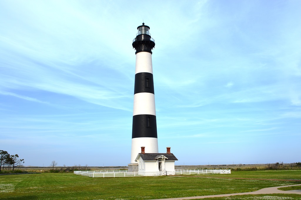 Bodie Island Lighthouse (1872) is 152 ft. tall. Bodie Island Light Station is set between a pine forest and freshwater marshland on the south end of Bodie Island near Oregon Inlet.
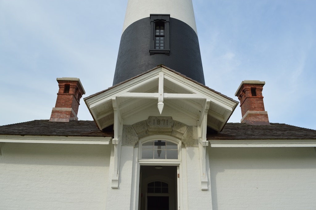
 Bodie Island Lighthouse is another lighthouse that can be climbed. I arrived 30 minutes after the last tour. The lighthouse stairs have only been open to public walking since April 2013. The wildness and isolation of the Cape Hatteras National Seashore ends just north of Bodie Lighthouse when Highway 12 enters Nags Head and the seashore development of the beach towns at Nags Head, Kill Devil Hills and Kitty Hawk change the environment from rural beaches on the eastern edge of the Atlantic Ocean into crowded tourist centers with retail shops, entertainment, restaurants and hotels among beach homes.
 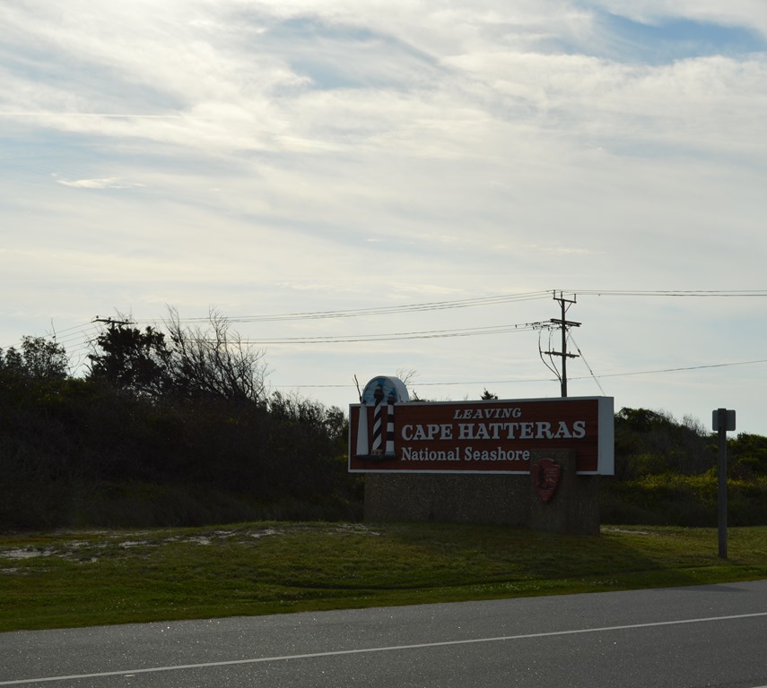 National Park Service Cape Hatteras National Seashore Ocracoke Light Station (1823) Cape Hatteras Light Station (1802, 1870) history and historical timeline Bodie Island Light Station (1847, 1859, 1872) ***** Ric Garrido of Monterey, California is writer and owner of Loyalty Traveler. Loyalty Traveler shares news and views on hotels, hotel loyalty programs and vacation destinations for frequent guests. Check out current hotel loyalty program offers across all the major chains in Loyalty Traveler’s monthly hotel promotions guide. Follow Loyalty Traveler on Twitter and Facebook and RSS feed.
National Parks
North Carolina
photography
road trip
Three lighthouses of Cape Hatteras National Seashore
- by Ric Garrido
- June 5, 2014
- 1 Comment
- 719 Views

1 Comment
Comments are closed.