“Bring your compass because it’s weird to have to eat your friends – Death Valley National Park” is my new t-shirt with an image of a compass rose and a silhouette of four hikers with sticks walking up a rocky ridge.
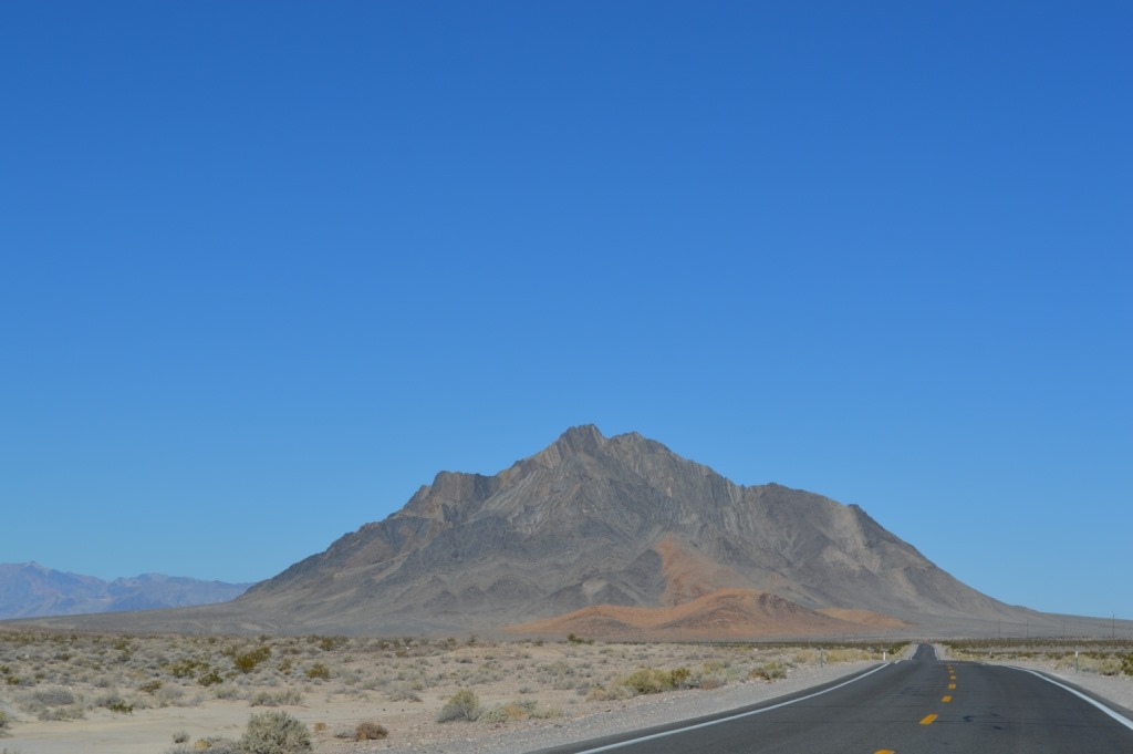
Death Valley is an immense landscape of rock and sand. Colors change as sunlight moves across the sky. The land area of Death Valley National Park is enormous at 3.37 million acres. This is 50% more land area than Yellowstone and more than twice the size of Everglades National Park and three times the size of Grand Canyon National Park. Alaska has larger national parks, but you can’t reach those open spaces in two hours out of Las Vegas and less than four hours from Los Angeles.
Check road conditions before you go.
There are four paved roads on the eastern side of Death Valley. From Las Vegas there are four routes into Death Valley. The most direct route is via Pahrump, a town about 60 miles from Las Vegas and half-way to Furnace Creek in Death Valley via Shoshone.
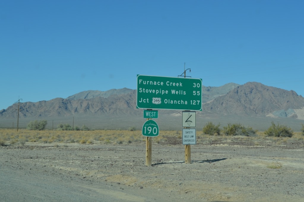
Turned out Highway 178, the road I was planning to drive from Shoshone, California into Death Valley was closed. I learned later that day the rainstorms in July washed out several roads in the park, including Highway 178 from the east into Death Valley and also on the western side of the park at Panamint Valley Highway 178 was closed. I had planned to travel in and out of Death Valley National Park on Highway 178. There was basically one main road in and one main road out using Highway 190 for my journey across Death Valley National Park.
I assume the July rain storms washing out the roads in Death Valley were the same ones that hit Las Vegas last July 19, the second day of the Hyatt-Mlife event when Kelley and I left town in the 108 F. afternoon heat and drove across the Mojave Desert heading home to Monterey about two hours before the deluge.
Highway 127 to 190 to Furnace Creek is actually a shorter route by 17 miles, but Highway 178, the closed road, would have taken me right by Badwater Basin, the lowest spot in the park and the USA at –282 feet below sea level.
The road is long through Death Valley and it is advisable to have a full tank of gas since it is easy to cover 150 to 200 miles on paved road making direct travel through the National Park area. There are three gas stations in the National Park with prices around $6.00 per gallon in October 2013.
Most Death Valley deaths I have read about in newspaper articles are people who ventured off the paved roads and found themselves stranded in the desert heat. This is serious wilderness country. Do not travel alone in the backcountry without another vehicle or alerting rangers to your route.
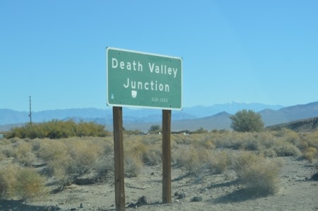
Death Valley Junction to Highway 395, the main north-south route across California and Nevada on the eastern side of the Sierra, is 127 miles east-west across Death Valley National Park.
The road sign here is still about 3,000 feet elevation. Highway 190 drops to sea level in the 30 miles to reach Furnace Creek where the road exits the Funeral Mountains and opens up in the long valley surrounded by high mountains.
The reason Death Valley becomes so hot is the air is trapped by mountain ranges on all sides. You have to cross mountain passes at 4,000 to 5,000 feet high to reach Death Valley.
Dante’s View is a 13-mile road detour from Highway 190 before reaching Furnace Creek that takes visitors to the top of the Black Mountains overlooking Badwater Basin. This is one of the easily reached premier spots in Death Valley for photography. Plan at least an hour to drive 13 miles to Dante’s View, take photos, and back out to 190 again. A quick hike if the weather is suitable adds more time.

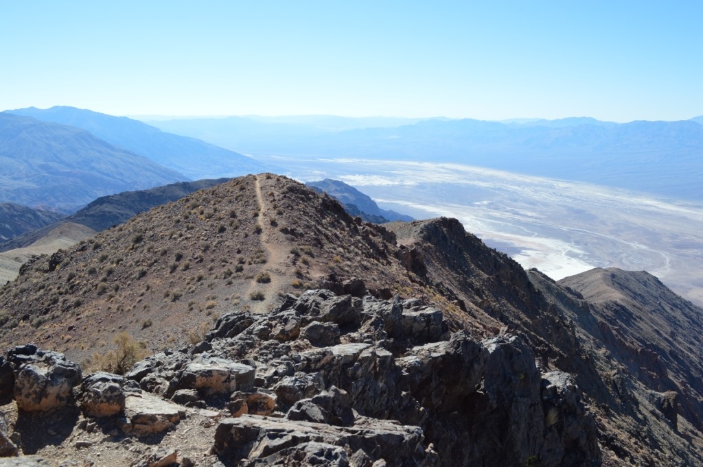
Dante’s View of Badwater Basin at –282 ft. below sea level and Telescope Peak at 11,049 ft. is the highest peak in the Panamint Mountains and Death Valley National Park. The little rain that happens in Death Valley runs downhill out of the mountains and into the basin. Dry river flow tracks can be seen running down the mountains.
There are some short hiking trails from the parking lot of Dante’s View. The temperature was actually cold enough at 60 F. and blowing wind to put on a sweatshirt and take a hike across the rocky landscape. Spending some time away from the people satisfied with the parking lot view was a chance to be alone looking over Death Valley.
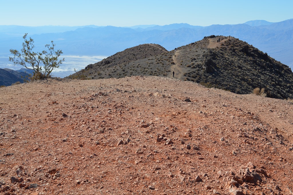
Dante’s View looking south in Death Valley. Highway 178 runs along the eastern edge of the valley at the base of the Black Mountains, part of the Amargosa Range. Highway 178 washed out in July and remains closed south of Badwater Basin which is 17 miles south of Furnace Creek, the central services area of the park.

Dante’s View looking north. Highway 178 is visible at base of Black Mountains. Furnace Creek is the dark patch in the valley in the upper part of the photo. The entire valley seen here is below sea level. This area baked at over 120 F for much of late June this year when it looked like the temperature might reach 130 F for the first time in 100 years. It topped out at 129 F on June 30, 2013.
From May through September the daytime high temperature is nearly always over 100 F. November to March the daytime high is typically in the mid-60s to mid-80s. My hands were chilled by the wind hiking around Dante’s View at 5,476 ft elevation above Death Valley before 11am when it was 60F. Three hours later at Furnace Creek Visitors Center the air temperature was 83F.
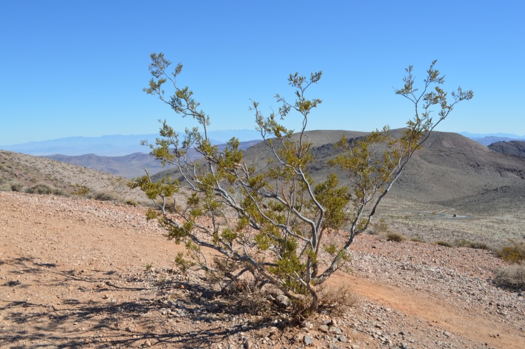
Death Valley National Park is the kind of place my wife has no interest in visiting. For me, the fascination with Death Valley is seeing the life forms that are able to withstand the heat and the dryness of the environment.
The big valley view is a scene of dirt and rock.
Up close there is life to be seen in this vast desolate desert landscape.
The road to Dante’s View is steep to ascend to 5,400 feet to the mountain ridge with a 15% grade on the last 1/4 mile to the parking lot.
Tarantula Spiders on Halloween
On the way to Dante’s View I spied a tarantula crossing the road. I lost sight of it by the time I stopped and backed up. Fortunately I saw another tarantula on the road driving back down the road from Dante’s View to Highway 190 and there were no cars around allowing me to stop and check it out more closely.

At the Furnace Creek Visitors Center I asked about tarantulas since I thought it was unusual to see a spider crossing the road going up to Dante’s Peak and then again going down. The fact that I even saw these tarantulas while driving in my car at about 25 to 35 mph indicates they are sizeable spiders.
The park ranger told me this is tarantula mating season and the males are out looking for a female who waits in her burrow for a suitable mate. Male tarantulas do not mate until near the end of their ten year life span. Female tarantulas live around 20 years.

Am I crazy getting close to this tarantula?
No.
This shot was taken from about eight feet away using a telephoto lens before the tarantula reached the shade of the roadside brush.
Mesquite Flat Sand Dunes
Death Valley National Park appears to be nearly all rock and gravel with pockets of scattered small scrub. There is one location on Highway 190, a couple miles east of Stovepipe Wells with large sand dunes.
Furnace Creek and Stovepipe Wells are 25 miles apart and the two locations in Death Valley with gas, food and lodging. I wrote a piece last May about lodging at Stovepipe Wells and Panamint Springs and links are at the end of this piece.
I visited Furnace Creek Inn and Furnace Creek Ranch this trip and I will follow-up with posts sharing photos of these two Death Valley resorts.

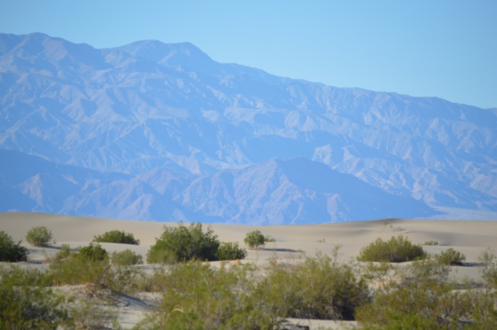
Mesquite Flats Sand Dunes is a windblown valley spot where the sand is trapped at the base of Tucki Mountain from the winds in the north and the winds blowing from the south. The sand dunes change shape each windstorm. The mountains seen in this photo are the Amargosa Range which surround Death Valley on the east with the Grapevine Mountains, Funeral Mountains and Black Mountains. I think these are the Grapevine Mountains seen in the photo, but they may be the north end of the Funeral Mountains.
One of the roads from Death Valley National Park to U.S. 95 at Beatty, Nevada goes over Daylight Pass (4,316 ft.) between the Funeral and Grapevine Mountains. This is the route to see Rhyolite ghost town near Beatty, Nevada. Rhyolite was the third largest city in Nevada in 1908 with nearly 10,000 residents. The town is an example of boom and bust when gold was discovered in August 1904 and the mining town was already dying out by 1910.
Panamint Mountains west of Mesquite Flat Sand Dunes.
Highway 190 at Stovepipe Wells is a little bit north and east of the center of Death Valley National Park. The mountains seen behind the sand dunes in the photo above are the northern Panamint Mountains. Highway 190 from Stovepipe Wells travels south and rises from below sea level to nearly 5,000 feet over Towne Pass (4,956 ft.) and then drops down to sea level again in the Panamint Valley, a parallel north-south valley to Death Valley.
Panamint Springs is the only services area in the western part of Death Valley National Park with a privately owned hotel, restaurant, bar and small lodge on the west side of Panamint Valley at the base of the Inyo mountains. The boundary of Death Valley National Park is just west of Panamint Springs, however, the next town with services is located another 50 miles west on U.S. 395 at Olancha if traveling south or Lone Pine if traveling north.
Coyote bids farewell
Last May I saw a coyote on the road east of Panamint Springs. On my Halloween day drive I saw a coyote in nearly the exact same spot. That kind of tripped me out. The road was empty of cars in a place where I could see several miles in front and behind me on the straight road across the valley. I stopped to check out coyote closely.
Before my trip last May I had read a guy’s story online about how he was trying to photograph a coyote from his car and the coyote jumped up and attempted to get in the car. That kind of freaked me out.
I took several photographs of this coyote as he circled around my car a few times while keeping the window rolled down just enough for my camera lens.
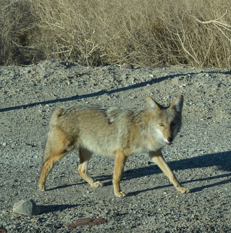
Coyote in Panamint Valley of Death Valley National Park.
This made my day seeing a large mammal in Death Valley National Park. I had seen something else crossing the road slowly a few minutes before meeting coyote which might have been a badger or porcupine, but the animal was hidden in the brush by the time I reached the location. One of these days I hope to come across desert bighorn sheep in the park.
After taking photographs and video for several minutes, I saw cars heading toward me and I drove on in hopes the coyote would head off into the desert, which it did.
Picking up speed I heard the sound of the wind in my car and only then did I realize that my backseat driver’s side window had been fully open the entire time coyote circled my car several times. I spent the next 30 minutes driving up the mountains out of Panamint Valley envisioning a gory coyote attack.
Between large tarantulas and hungry coyotes, I gave myself a good scare for Halloween as I headed out of Death Valley.
One of the most gorgeous scenes in California is driving U.S. 395 on the eastern side of the Sierra where the mountains rise up steeply to 10,000 ft. with some peaks over 14,000 feet.
I always plan to get out of a National Park at a preset time in my mind sooner than I find possible when surrounded by natural wonders. Like many other National Parks trips this year I ended up driving several hours after sunset to reach my hotel destination.
View of tiny Olancha sitting at the base of the Sierra in the fading light of day.
Related links and posts:
Death Valley National Park official website.
TBEX Toronto via Death Valley – Part 1 (May 29, 2013) This post describes Highway 178 from Bakersfield to Lake Isabella, over Walker Pass and to Death Valley with photos of Panamint Springs lodging area.
TBEX Toronto via Death Valley – Part 2 (May 29, 2013) This post has photos of Stovepipe Wells lodging and Badwater Basin, the lowest spot in the U.S.
Bottom to Top of California in Six Hours (May 17, 2013) This post describes driving through Death Valley and Scotty’s Castle in the northeast section of the park and then driving some remote roads crisscrossing the border of California and Nevada on the way to Mono Lake and Mammoth Lakes ski resort.
Furnace Creek Inn (to come) – I spent about an hour at Furnace Creek Resort on my Halloween day drive through Death Valley and an hour at Furnace Creek Ranch. These are the two main resort hotels in Death Valley National Park. I have lots of photos.
Furnace Creek Ranch (to come)
*****
Ric Garrido of Monterey, California is writer and owner of Loyalty Traveler.
Loyalty Traveler shares news and views on hotels, hotel loyalty programs and vacation destinations for frequent guests. Check out my page of collated current hotel promotions.
Follow Loyalty Traveler on Twitter and Facebook and RSS feed or subscribe to a daily email newsletter of Loyalty Traveler blog posts.

7 Comments
Comments are closed.