Three reasons I wanted to make a road trip yesterday around Monterey County and a drive south on Highway 1 along the Big Sur coast.
First, the desire to drive a paved road I did not know existed until a couple years ago called the Nacimiento-Fergusson Road linking Highway 1 on the Monterey County coast via paved road across the Santa Lucia coast mountain range to Fort Hunter Liggett and the historic 18th century Spanish Mission site of San Antonio de Padua (1791), a site I had never visited some 20 miles southwest of King City.
Seeing the California mission turned out to be the third reason for this 175-mile, 7-hour road trip.
Monterey County is one big space.
Secondly, I wanted a fresh look at the coast redwood tree coverage on the hillsides of coastal southern Monterey County. My road trip last week 40 miles north of Monterey to the Santa Cruz Mountains to hike around the second growth Sequoia sempervirens coast redwoods in The Forest of Nisene Marks State Park had me thinking about the changes to natural California since the California gold rush era of the 1850s. California as seen today in many places is starkly different from the California that existed 200 years ago.
Big Sur is evidence of the human impact on the environment.
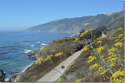
The 120 miles of central California coastline between Morro Bay in the south to Carmel-by-the-sea in the north was one of the most isolated regions of the country until the 1930s when the paved State Highway was constructed with a large number of bridges to cross the creeks and valleys of the Santa Lucia coastal range that slope downward into the Pacific Ocean.
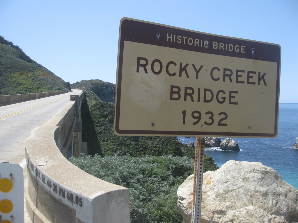
The coast road changed the Big Sur wilderness communities focused on logging and mining and cattle to a tourism based economy servicing travelers arriving to see the beauty of the mountains that drop into the sea.

Rocky Creek Bridge
The cars numbered higher than an average day driving south on Highway 1 Monterey to Big Sur. September and October are peak season around here. Little known fact to non-locals and even many locals is the record high temperatures for most of Central and North Coast California happened in the month of October.
I was around coastal California for several of those hot October days.
Yesterday was a mid-September day that looked clear around Monterey and looked clear to the south. Fog is always an obstacle and when the fog clears the urge to drive Big Sur takes over at times. Taking off from Monterey, the temperature was 63 F, climbed to low 70s by 11:00am; up to 82 in Big Sur 30 miles south on Highway 1 at 11:30am. The temperature dropped back to the upper 60s along the coast south of Big Sur and back up to 80 as I climbed Nacimiento-Fergusson road from the coast to 3,000 feet. On the eastern side of the Santa Lucia range the temperature topped 90 in the valley of the oaks.
Dozens of tourists were snapping photos of the Big Sur scenic coastline at roadside pullouts and vista points.
I was the guy with my back to the sea scanning the hills, valleys and skies. Turkey vultures, red tail hawks and two California condors were sighted.
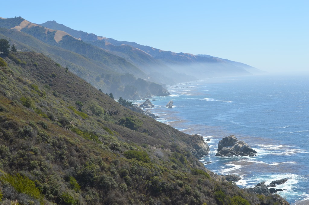
The Big Sur coast Highway 1 drive traverses dozens of narrow canyons of the Santa Lucia Range with north facing hillsides in the steep valleys supporting forests and groves of coast redwood trees. These hills and valleys of Big Sur are the southernmost range of the 450 miles of California and southern Oregon coast region supporting natural stands of coast redwoods.

Spotting a pair of California condors through binoculars was an added bonus of the trip. They were tagged and soaring over the coast ridge. Too far away though to get a photo with my camera.
Feels like pioneer spirit
Big Sur was a pioneer community before the State Highway was built in the 1930s. In many respects, Big Sur is still a modern day pioneering community of rugged people capable of living in an isolated community. The road washes out in places along the coast due to rockslides and mudslides during the heavy rain storms flowing in from the Pacific between November and April.
Most recently Highway 1 closed for two months from April to June 2011 when slides closed the road in both directions. That extended road closure is when I learned about the Nacimiento-Fergusson Road locals were driving three to five hours to reach Monterey and Carmel compared to about 45 to 90 minutes from various places along the Big Sur coastline when Highway 1 is open.
I felt yesterday was the time for another life installment of better know a road. It is kind of like Stephen Colbert’s ‘Better Know a District’, but more locally oriented in California country and in this case a road in my home base of Monterey County.
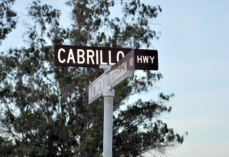
Nacimiento-Fergusson Road, Big Sur – Wikipedia

Wide path to the beach north of Limekiln State Park.
The road less traveled – Nacimiento-Fergusson Road
The road over the Santa Lucia Range is winding to say the least. I can’t in good conscience recommend this road since I feel to drive it places your life on a dangerous bet that no one else is going to round the cliff road blind corner at the same time as you. This is seriously remote country to have a head on collision.

Ridge top View of Pacific Ocean.
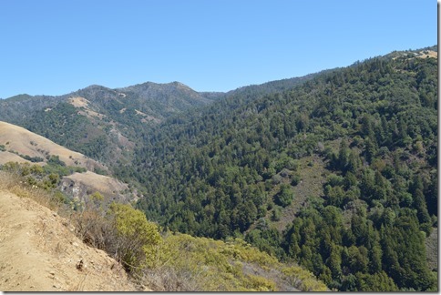
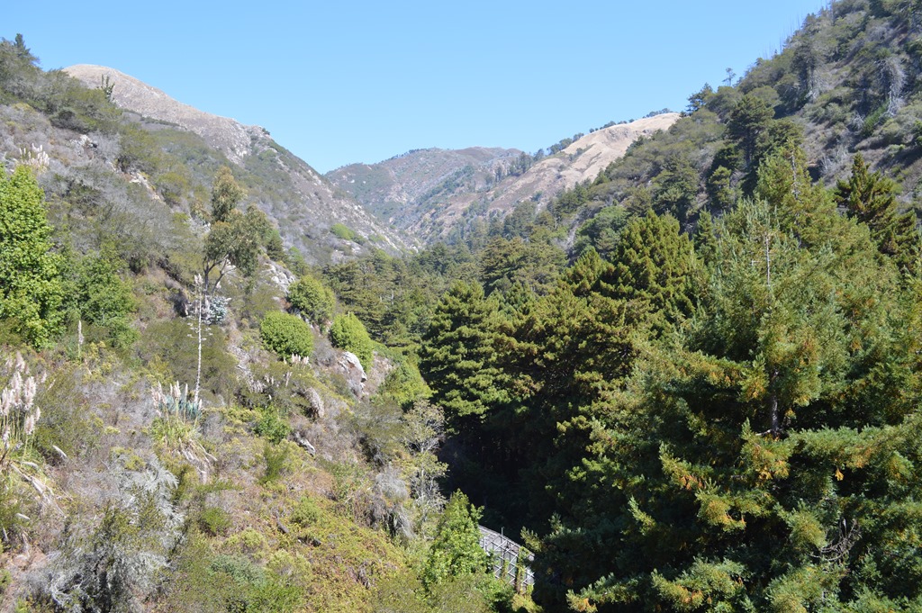
Looking east into the wilderness of the Santa Lucia Mountains. There are cougars and wild boar in these valleys.

Small goosepen burn in this roadside coast redwood tree.
The Basin Complex fire of June-July 2008 burned over 150,000 acres in the Santa Lucia Range and even down to Highway 1 near the popular Julia Pfeiffer Burns State Park.
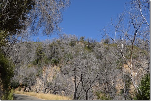
The burned forest of the Los Padres National Forest.
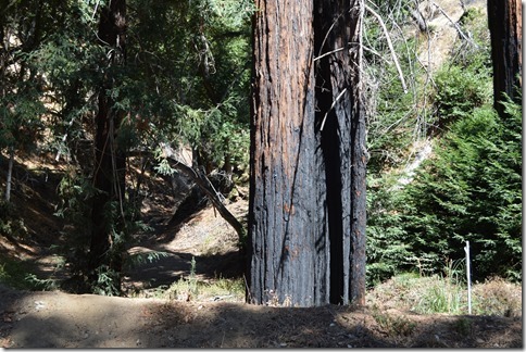
Burned coast redwood tree. Condors make their nest in redwood trees.

The living forest seen from high up on Nacimiento-Fergusson Road.
Nacimiento-Fergusson Road is a road that allows 20 mph as a maximum speed for about 15 miles from the coast. The road crosses steeply over the coast range up from the west and down to the east or up from the east and down to the west. Either way you better learn why there are low gears with numbers like 3, 2 and 1 on your automatic gear shift. This is a road that will test your skill at using all the low gears if you want to lay off burning your brakes on the extended steep downhill curves.
Ridgetop Naciemiento Road at the top of the ridge. It is downhill from here.
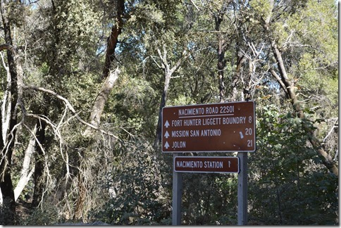
- Fort Hunter Liggett – 8 miles
- Mission San Antonio (1791 Spanish Alta California Mission 1791, rebuilt by William Randolph Hearst 1940s) – 20 miles
- Jolon 21 miles
- Nacimiento Station is a ranger fire station in Los Padres National Forest.
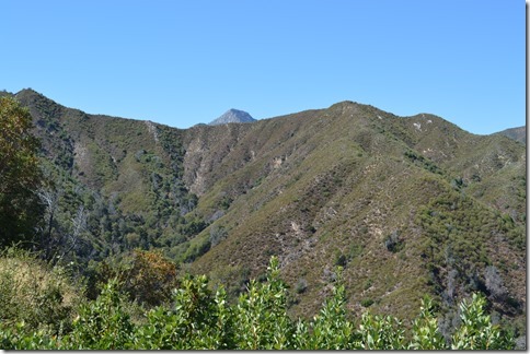
I think this is the top of Cone Peak rising up behind the ridge. Cone Peak features the steepest coastal elevation in the lower 48 United States, rising nearly a mile (5,155 ft.) above sea level, only three miles (5 km) from the Pacific Ocean. Cone Peak is the second highest mountain in the Santa Lucia Range.
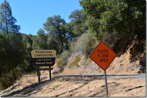
I drove by dozens of dry creek beds in the steep ravines during the 20 mile drive to reach Ponderosa Campground from the coast. I did not see another person in the campground.
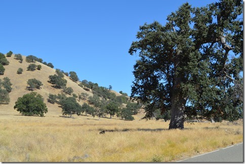
Valley Oak is a native tree to California that can grow more than 15 feet in diameter and reach an age over 300 years.
Fort Hunter Liggett Military Base occupies the hills east of the Santa Lucia Range. These hills and valleys hold thousands of old growth Valley Oaks.
I will follow up this post with more posts specifically about hotels in the Big Sur area, state parks and other sights along the Highway 1 route and Mission San Antonio de Padua near Fort Hunter Liggett.

Mission San Antonio in the valley of the oaks.
Ric Garrido, writer and owner of Loyalty Traveler lives in Monterey, California. Loyalty Traveler shares news and views on hotels, hotel loyalty programs and vacation destinations for frequent guests. Check out my page of collated current hotel promotions.
Follow Loyalty Traveler on Twitter and Facebook and RSS feed or subscribe to a daily email newsletter on the upper left side of this page.
6 Comments
Comments are closed.