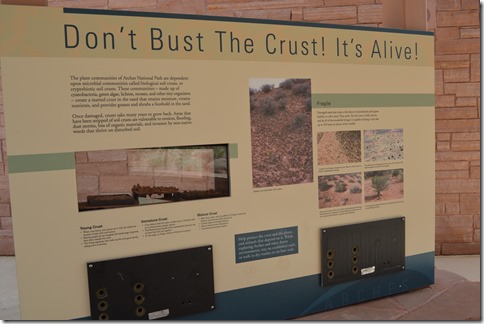
‘Don’t Bust the Crust! It’s Alive!’ is the message that greets you at Arches National Park Visitor Center. Microbial communities in the soil of the desert sands in Arches National Park make up a living crust of nutrients allowing larger plants to grow in the harsh winter and summer of the high desert environment at elevations of 4000 feet and higher.
This is the first of four posts on Arches National Park and Canyonlands National Park. The entrances to these National Parks are only six miles apart.
Part one covers the location of Arches in eastern Utah with some lodging information for Moab and Green River, Utah and Grand Junction, Colorado. This post in four parts gives some attention in this first post to discuss hotels, markets and services for the region around Arches and nearby Canyonlands National Park. Another two posts will focus on the imagery in Arches National Park. The last post will cover Canyonlands National Park.
- Part One – Arches National Park Scenic Road from the park entrance to Balanced Rock.
- Part Two – The Windows Section of Arches National Park where easy walking trails route through a high concentration of sandstone arches.
- Part Three – Sand Dune Arch
- Part Four – Devils Garden hiking trail at the northern end of the paved road in Arches N.P.
- Part Four – Canyonlands
Where is Arches National Park?
Arches National Park is in a remote section of eastern Utah.
Three days around Moab is what I recommend to take advantage of the region. Arches National Park can be two full days of hiking and viewing and Colorado River activities can be a full day in good weather.
Dead Horse Point State Park on the same road as Canyonlands has better views of the Colorado River.
Canyonlands National Park offers vistas of canyons within canyons within canyons and Green River views. The views are impressive at Canyonlands Viewpoints with the ability to see 100 miles on good weather days.
Canyonlands roadside pullouts and short adventures can fill one day simply with photo opportunities. Hiking down into a canyon is a bit more time-consuming.
My photos taken May 14, 2013 while driving and hiking around Arches National Park come alive to me with features I see in digital images I missed with my eyes in the Utah desert’s 90+ F degree bright sunlight of that day.
Arches National Park is a wonderland of red rock. I felt animistic energy all around me that day in May walking around the arches and stone outcrops in the high desert.
The park has areas of natural sandstone arches with over 2,000 catalogued arches. An arch has to be an opening of at least three feet to be counted. Arches National Park has one of the highest concentrations of rock arches in the world and these arches are primarily found in two locations within the park boundaries at The Windows and Devils Garden. Delicate Arch is supposedly the most photographed arch in the park. I never made it down that road before dragging myself away to visit Canyonlands National Park.
Pack plenty of Food and Water Supplies
Arches National Park has no food, gas or lodging within the park boundaries. There are fewer than 30 miles of paved road in the park and around 20 miles of dirt roads to reach the major viewpoint and hiking areas of the park.
There is basically one main paved 18-mile long road south to north into the park with two paved roads branching off the main road heading east a few miles to locations with a high concentration of large arches.
Official NPS Arches National Park Map link.
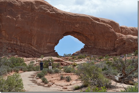
North Window Arch.
Only 50 campsite spaces at Devils Garden Campground, 18 miles from the park entrance, are available for regular camping permits. These sites tend to be reserved far in advance.
Where are the hotels?
Moab, Utah is the adventure playground town about five miles south of the main entrance to Arches National Park. There are no other towns nearby.
Moab’s location as the nearest town to Arches and Canyonlands National Parks offers visitors access to markets, restaurants, hotels, shops and numerous adventure trip businesses for the parks and Colorado River activities.
Moab is a small town of just over 5,000 year-round residents. Heavy tourism and Moab’s location and facilities make for high-priced hotel rates, often in the $150 to $200 range for brand hotels like Holiday Inn Express (IHG Rewards Club) or Hampton Inn (Hilton HHonors). Weekends have higher rates.
Kayak shows 36 hotels for Moab with 12 brand names in Best Western, Choice, Hilton, IHG, La Quinta and Wyndham hotel loyalty programs.
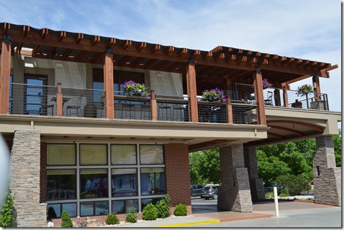
There are two Best Western hotels in town near the Visitor Center.
Best Western Plus Canyonlands Inn, Moab is the more expensive of the two Best Western properties in the center of Moab. This hotel has comparable rates to the Hampton and HI Express.
Colorado River Ranch Resorts
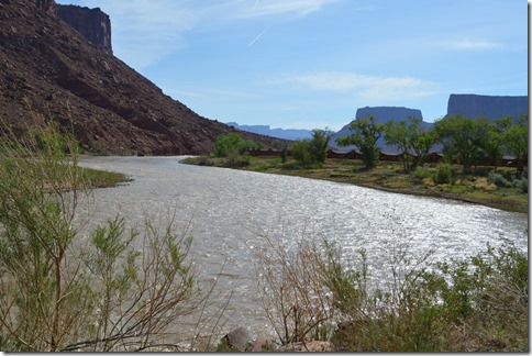
Sorrel River Ranch Resort & Spa is an independent lodge (AAA 4-Diamond)adjacent to the Colorado River on Highway 128 seventeen miles east of Moab. This is an upscale way to experience the regional area. Highway 128 is a scenic byway following the Colorado River for dozens of miles through red rock canyons. I passed by two ranch resorts driving Highway 128 along the Colorado River to Moab.
Red Cliffs Lodge is another award winning resort 14 miles east of Moab on Highway 128.
These two independent resorts run $200 to $400 per night in peak season.
Red Cliffs Lodge cabins beside the Colorado River off Highway 128, 14 miles east of Moab, Utah.
Green River, Utah is 50 miles north beside Interstate 70. Green River is a small town (population about 1,000 residents) with far fewer hotels than Moab, but far more than usual for a town this size. Traveling I-70 west of Green River, Utah covers one of the longest sections of interstate in the U.S. with no services for 100 miles.
I stayed at the Holiday Inn Express Green River in 2011 and that was fine. There are currently 12 hotels and B&Bs in Green River listed on TripAdvisor with Super 8, Knights Inn and Ramada (Wyndham Rewards), Comfort Inn (Choice Privileges) and HI Express (IHG Rewards Club). River Terrace is a nice independent hotel across the street from HI Express by the Green River and the most popular hotel in town according to TripAdvisor reviews.
Grand Junction, Colorado is 110 miles to the northeast of Arches. This is the place with all services and a large selection of lodging, 26 hotels and 13 B&Bs (TripAdvisor link), if you are traveling in that direction. Best Western, Choice Privileges, Hilton HHonors, IHG Rewards Club, La Quinta, Marriott, and Wyndham Rewards are in Grand Junction chains have multiple properties.
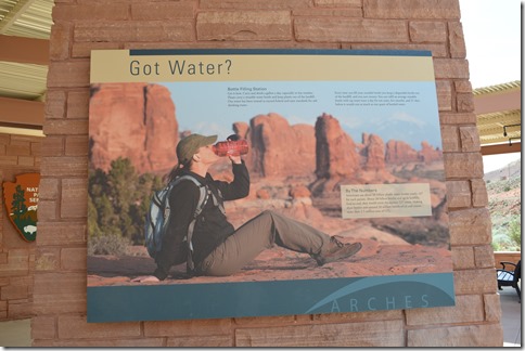
Got Water?
Arches National Park is in a remote section of eastern Utah. Fill the gas tank when you can and carry plenty of fluid and food with you. One gallon of water per person per day is recommended. Outside of a few towns, there are few water sources in an area that takes hours to drive across covering 200 miles of road on the interstate and hundreds of miles of other roads around the two National Parks of Arches and Canyonlands. There is only one location at Devils Garden in Arches National Park with water taps once you pass the Visitor Center at the park entrance.
Eight hours of hiking in the 90 F heat in mid-May with plenty of water revealed that water alone was not quenching my thirst. Heavy sweating and loss of body water requires electrolyte replacement. Vitamin and energy drinks like Gatorade and other brands sold in markets really help, in addition to water, when hiking on a hot day. Since my day hiking several hours in Arches with only water and feeling empty, I have carried electrolyte drinks for several subsequent hikes in the 100+F desert to supplement water and found the combination far more refreshing.
Remember this part of Utah is the area where Aron Ralston’s real-life adventure finding himself stuck and alone in a remote slot canyon for five days and nights and recreated for the big screen in Danny Boyle’s movie 127 Hours happened in Canyonlands National Park, Utah.
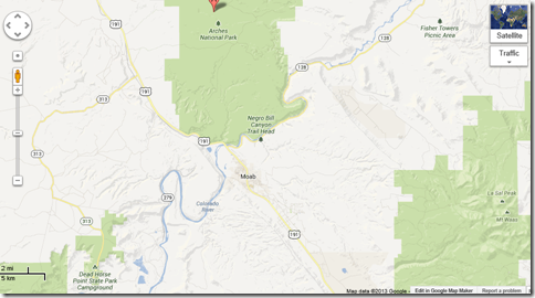
Google Maps with Pin A showing Green River, Utah off Interstate 70.
Arches National Park is in center of map with town of Moab directly below.
Canyonlands Island of the Sky visitor center is marked with a pin.
Grand Junction, Colorado is the largest city (population 60,000) in the region and 110 miles from Moab.
Entering Arches National Park
The entrance to Arches National Park is five miles north of Moab on the right side of Route 191 and the north entrance to Canyonlands National Park is about eleven miles north of Moab on the left side of Route 191 at Highway 313 to Island in the Sky and Grand View Roads.
Highway 128 follows the Colorado River and the southern boundary of Arches National Park. This is a remotely located scenic route if traveling to or from Grand Junction, Colorado.
Arches National Park Visitor Center
Arches is the result of millions of years of sandstone fracturing and weathering; these days primarily by water.
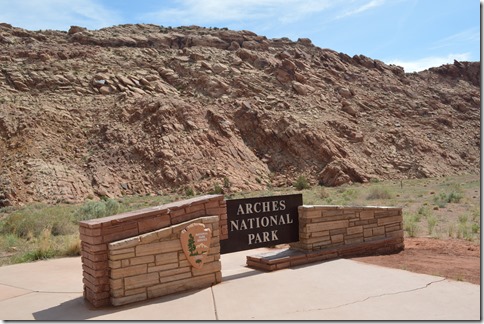
Arches National Park entrance sign.
Arches National Park has a $10 per vehicle fee or $5 per bicycle/motorcycle.
Arches was designated a National Monument in 1929 by President Herbert Hoover. National Park status was granted in 1971.
Arches Visitor Center is a place to load up on water if you don’t already have a good supply. There are only a couple places in the park with water taps.
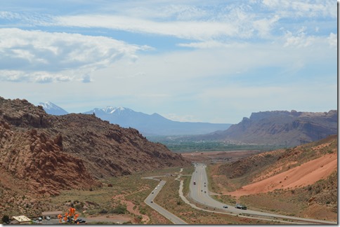
Looking south to Moab in the valley from Entrance Road Arches National Park. Arches Visitor Center in lower left. La Sal Mountains in distance.
Arches Scenic Road climbs up immediately after the visitors center parking lot from 4,000 feet to about 5,000 feet on the plateau. The main areas for arches are about 12 to 20 miles from the entrance.
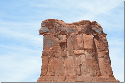
Sheep Rock, Arches National Park
Scale is difficult to envision in photographs. Sheep Rock formation seen above is 440 feet high.
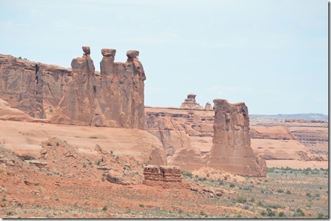
Sheep Rock and Tower of Babel are easily seen from the main road in Arches.
Three Gossips (center left) and Sheep Rock (center right).
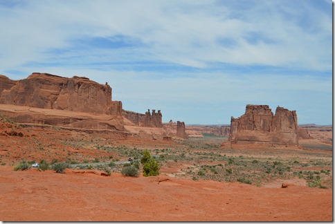
These photos were taken from the La Sal Mountains Viewpoint road pullout. There are only certain locations where vehicles can park off the main road. Arches Scenic Drive is a narrow two-lane road with limited sections allowing vehicles to pass. Cyclists on the road need to be watched for at all times.
The Organ and Tower of Babel on left. Sheep Rock and Three Gossips in center seen from La Sal Mountains Viewpoint. Arches Scenic Road travels between these features.
Petrified Sand Dunes
The area of Arches was an immense sand dune desert 200 million years ago. Sediment deposited over the dunes and compressed the sand, then quartz and calcite cemented the ancient dunes to create Navajo Sandstone.
Erosion of the overlying layers of sediment has exposed these petrified dunes.
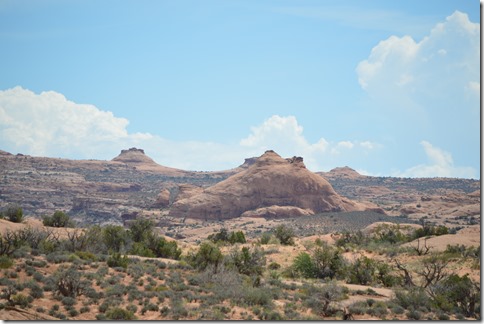
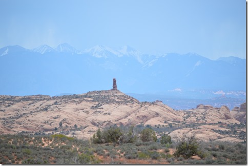
Natural hoodoo on the sandstone with rain clouds over La Sal Mountains – Arches National Park, Utah.
Balanced Rock
Balanced Rock Trail is a popular parking lot stop with a relatively short and easy hike around the rock.
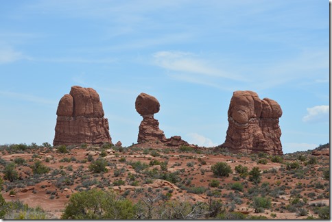
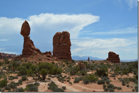
Balanced Rock is 128 feet high. The rock perched on top is slick rock of Entrada Sandstone and the base is mud rock from the Carmel Formation. Those geological terms mean little to me. Basically the mud rock erodes faster than the slick rock and eventually Balanced Rock will collapse.
Balanced Rock, Arches National Park
The Windows Section
After an hour in the park I still had not reached the main areas of sandstone arches. I had photographed some arches from a long distance.
The first side road off the main scenic drive heads right to reach The Windows area of natural arches. This road is just past Balanced Rock, ten miles from the entrance of the park.
This is where the trip to Arches National Park really takes off as my energy level surged while hiking around the numerous arches at Windows.
Part 2 – Arches National Park – The Windows.
Part 3 – Hot Desert, Cool Rocks, Arches National Park (Sand Dune Arch Trail)
Part 4 – Devils Garden Trail, Arches National Park (Landscape Arch)
Part 5 – Canyonlands National Park
Ric Garrido, writer and content owner of Loyalty Traveler, shares news and views on hotels, hotel loyalty programs and vacation destinations for frequent guests.
You can follow Loyalty Traveler on Twitter and Facebook and RSS feed or subscribe to email newsletter on the upper left side of this page.



2 Comments
Comments are closed.