Today has been a day of extremes. In six hours I traveled from 190 feet below sea level at Furnace Creek in Death Valley National Park to 9,000 feet in a room at the highest lodge in California at Mammoth Mountain in the Eastern Sierra range.
The extreme temperature range in six hours peaked at 104 in Death Valley with hot air blowing through the long valley between noon and 2pm to 37 degrees and blowing snow on the mountain at Mammoth Lakes at 8pm.
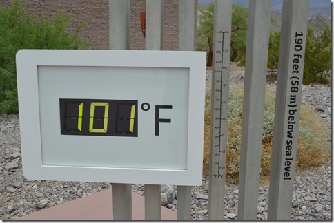
12 noon temperature at Furnace Creek Visitor Center, Death Valley National Park. Three days ago, on Monday, May 13, 2013 the temperature reached 118 degrees F. Furnace Creek holds the record for the highest verifiable temperature on earth at 134 F. recorded July 10, 1913.
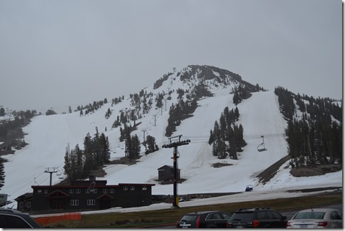
Mammoth Mountain, Mammoth Lakes, California at 37 degrees F at 9,000 feet elevation when I arrived at 8 pm.
What a long, strange day it’s been.
My day started in Las Vegas, Nevada. Then I drove to Death Valley, California, then back to Nevada and over Lida Summit, then back to California for a drive through Fish Lake Valley which crosses back into Nevada again, then finally back to California where I will remain for the rest of my drive home to Monterey.
Taking the Back Roads
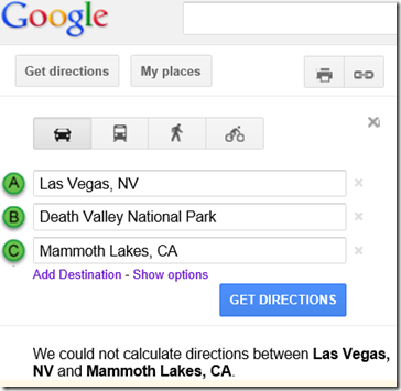
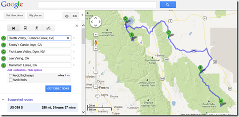
The routing for my back roads trip is even beyond the ability of Google Maps.
This road trip does not compute on Google Maps.
Google Maps for Death Valley National Park Furnace Creek to Scotty’s Castle at the northeastern edge of Death Valley to Fishlake Valley that runs along the eastern side of the White Mountains to Highway 120 at Lee Vining, California which is the launch point for Tioga Pass through Yosemite National Park. Poor weather caused me to delay Tioga Pass for a day and head south to spend the night in Mammoth Lakes.
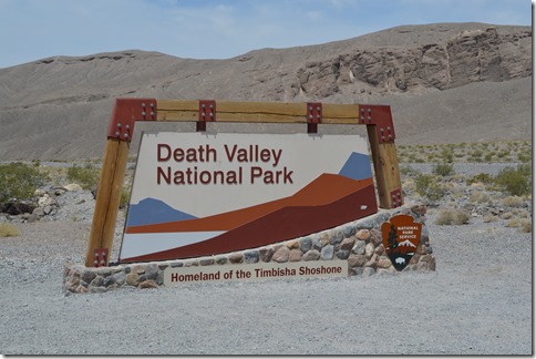
Death Valley National Park
Death Valley is in the rain shadow of the high Sierra mountains.
The tallest peak in the lower 48 states is Mt. Whitney (14,505 ft.) and the lowest point in North America is Badwater Basin, Death Valley at 282 feet below sea level. These two geographical points are only 85 miles apart, however, mountains between these two points make that distance meaningless, except by air travel.
Traveling by road is farther. The Badwater Ultramarathon sees runners race 135 miles from Badwater Basin to the Mt. Whitney Portal at 8,300 feet in a 48-hour race in 100+ F degree temperatures through Death Valley. This year the race will be July 15-17, 2013.
Death Valley’s location east of the Sierra Nevada places the desert in the rain shadow of the high Sierra peaks. Death Valley receives only 2 inches of rain per year and is the driest location in North America.
Badwater Basin is 13 miles south of Furnace Creek to reach the lowest spot in North America, but I was heading north and I had no desire to descend another 92 feet and possibly a degree or two higher temperature than what I experienced at the Furnace Creek Death Valley Visitor Center.
There are a few places for lodging in Death Valley National Park. Most National Parks ramp up for summer travelers. Death Valley’s off-season is summer. The Inn at Furnace Creek has closed for the season, except to accommodate tour groups. I met a manager of one of the Death Valley hotels last year who said European tour groups love to come when it bakes in August.
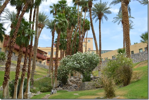
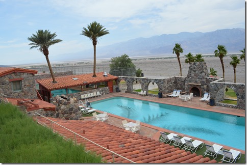
Furnace Creek is an oasis in the Death Valley desert.
If it had been any hotter I might have taken my chances with an illegal swim ![]() .
.
The Inn at Furnace Creek swimming pool.
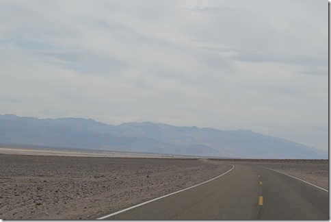
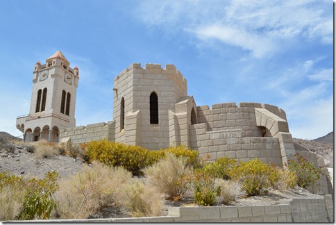
Scotty’s Castle is a bizarre site to find at the northeast end of Death Valley after driving 50 miles with nothing but rock, small scrub and hot air.
Scotty’s Castle exemplifies living large in America.
Remember that these are just my impressions of the road trip today and I will write up a full piece on Death Valley National Park in the coming weeks.
Scotty’s Castle is the end of the park and it is back to Nevada when you leave Death Valley by that road. Driving through Death Valley only added about 70 extra miles of road compared to staying on US-95 North, the main road for Las Vegas to Reno travel. From Death Valley I returned to US-95 North, but only for about 17 miles before heading west again on Nevada State Route 266 back towards the White Mountains of the Eastern Sierra and a lonely drive through Fish Lake Valley.
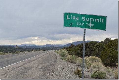
Lida Summit, 7,480 feet on Nevada Highway 266.
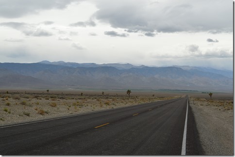
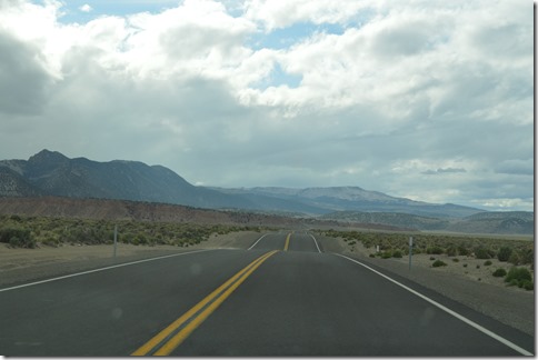
Just me and the Joshua trees in a huge desert on this lonely road. I saw only five cars and trucks in two hours of driving to and through Fish Lake Valley. The White Mountains in the distance hold the oldest living tree known on the planet, but the location is kept secret to the public for its protection. The ancient bristlecone pine tree is estimated to be 5,062 years old.
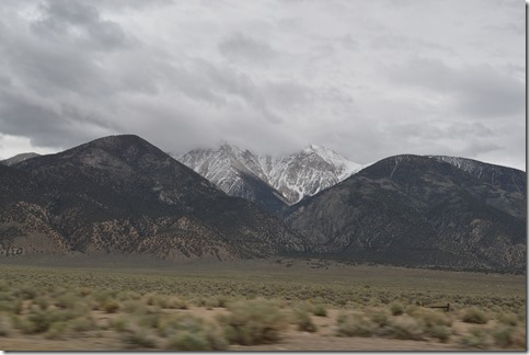
Boundary Peak 13,147 ft. (left) is the highest mountain in Nevada. Montgomery Peak 13,441 is actually a higher peak on the right, but that mountain is in California.
Wheeler Peak 13,065 ft. in eastern Nevada is the second highest peak in the state. Wheeler Peak lies in Great Basin National Park and there is a paved road on that mountain that ascends to over 10,000 ft. Driving up Wheeler Peak was one of the highlights of my 2011 road trip from Monterey, California to Denver, Colorado. There is a bristlecone pine grove on Wheeler Peak, but 2011 was a heavy snow year. My wife and I were hiking in July through snow without a map and abandoned the bristlecone pine trek.
Back in California for the high road home via Tioga Pass (9,943 ft.) in Yosemite National Park.
I repeated one of the wildest road rides I have ever done on California Highway 120 from Benton to Mono Lake. The sign says “Dips 5 miles” and it should say hold on to your steering wheel for the rollercoaster ride. I first drove this stretch of road on the 2011 ‘Brokeass Mountain’ road trip taking Highway 6 across Nevada. I have a video of the Highway 120 drive dips, but I’d probably lose blogger credibility if you heard me squeal when dropping over the road dips. Kind of like a Howard Dean moment.
Road trip roller coaster over five miles of dips on Highway 120 between Benton, CA and Mono Lake.
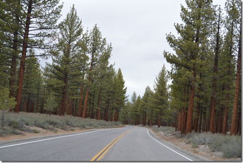
Sagehen Summit on Highway 120 is 8,139 feet in elevation and the temperature dropped to the upper 40s. This is the point where the hillsides of scrub turn to forest.
The weather turned bad just after I passed Mono Lake.
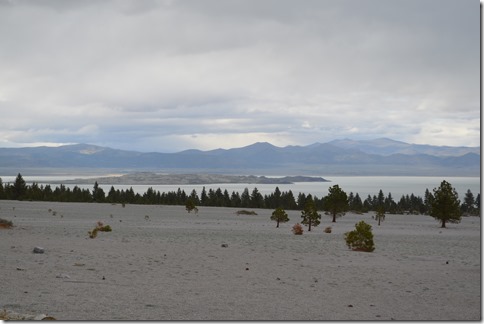
Mono Lake, California.
I decided to head south to Mammoth Lakes in the Eastern Sierra range to stay the night rather than hit snow and rain in the high mountains crossing the Sierra Nevada through Yosemite National Park.
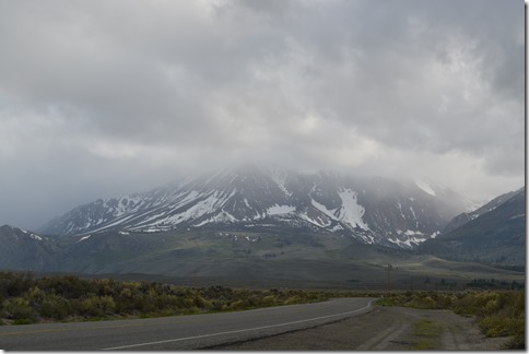
The high peaks of the Eastern Sierra shrouded in clouds.
Priceline saved me some cash tonight.
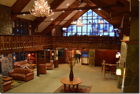
Last minute Priceline bids were my hotel strategy tonight with this still being spring conditions ski season in Mammoth Lakes. $80 has me in a ski resort lodge room with Aveda bath products rather than the Motel 6 which looked like the next best option in town for $65. That was better than spending 12,000 Starpoints for Westin Monache which was another option if Priceline had failed me.



5 Comments
Comments are closed.