Having been a school teacher for ten years I have a thing about being on time. This morning I woke up in the Comfort Inn Durango, Colorado. A nice hotel with a price under $80 after tax. And one stay away from 8,000 points with Choice Privileges stay two times promotion through May 15.
An email from Randy Petersen Thursday night reminded me the Boarding Area blogger conference started at 3pm Friday, May 10. I had it in my mind the conference opened at 7pm.
Colorado is one wide state and I still had over 300 miles of driving to get from Durango to Colorado Springs.
For the first day this week I woke up to clear skies all around. Colorado Highway 160 goes across Colorado to I-25, yet Google Maps indicated driving through New Mexico was the fastest route.
The countryside of Colorado was so gorgeous outside of Durango that I decided to stay on Highway 160 even if it meant an extra hour of driving. Starting at 7am, I figured seven hours of driving would get me to Colorado Springs at 2pm in time to check into Cheyenne Lodge Resort (complimentary of Randy Petersen for conference attendees) and make it in time for Randy’s opening session.
Beauty is in the Eye of the Beholder
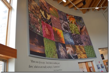
Utah has a beauty that not all people find appealing. I loved this quote I saw in the Grand Staircase-Escalante National Monument Visitor Center in Escalante, Utah:
“When one of us says, ‘Look, there is nothing out there,’ what we are really saying is ‘I cannot see.’ “ – Terry Tempest Williams
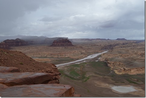
Colorado River at Glen Canyon, Utah.
The stark beauty of Utah is not everybody’s definition of beauty in the way that the lush Rocky Mountains of Colorado give broad inspiration.
Pagosa Springs looks like a town that is booming in real estate ventures. The place has a resort feel. Being just an hour into my six or seven hour drive, I did not even stop to take pictures. Well, actually I tried to take a photo in Pagosa Springs only to realize I had left the memory card for my camera in the computer from last night’s photo dump.
I stopped for gas at the end of town in Pagosa Springs and retrieved my memory card and fueled up on gas so I could drive all the way to Colorado Springs. When I parked the car in front of the gas station store window to use the toilet I saw in the store window reflection my passenger side car headlight was out. Not only was I pressed for time to make it to the opening of the Boarding Area conference, BAcon, in Colorado Springs by 3pm, but now I had to figure out how I was going to get my headlamp bulb replaced over the weekend before heading back home to California on Sunday.
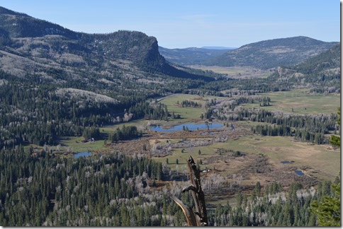
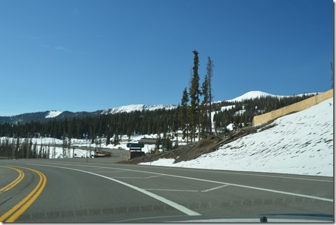
Heading up to Wolf Creek Pass, Colorado (10,857 ft.) in the San Juan Mountains between Pagosa Springs and South Park, Colorado.
Climbing up Wolf Creek Pass with two lanes was not too bad, but coming down with a single lane and a big rig truck slowed me down. I guess the mountains are the time limiting factor that had Google Maps suggesting a faster route through New Mexico.
Wolf Creek Pass (10,857 ft.) Colorado Highway 160.
Wolf Creek Pass was the only real climb of the 300 mile drive. If you have not driven the high plateau lands before, then you might be surprised to learn how far you can drive on relatively flat land in the high mountains. Highway 160 East is relatively flat for about 100 miles after coming down Wolf Creek Pass with speed limit at 65 much of the way and many drivers (not me ![]() ) going faster.
) going faster.
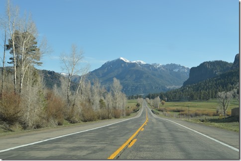
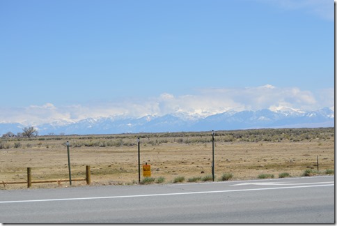
Colorado Highway 160 is one of the most scenic drives I have taken in my trips across Colorado. Interstate 70 is the fast route through the Colorado Rockies. Highway 160 has the vantage point of seeing the Rockies from miles away and in better perspective than I-70.
Rocky Mountains view from Alamosa.
In Alamosa I stopped again for a bathroom break. Coffee, juice and lots of water were taking its toll on my bladder. Then, pulling out of the McDonald’s parking lot, I noticed an auto parts store across the street. And across the street from the auto parts store was a car service shop.
Thirty minutes later I was back on the road with a working headlight thanks to the kindness of Town & Country Auto Mall in Alamosa. Big shout out to those guys.
While the young mechanic was fixing the headlight, he asked if I had been to Great Sand Dunes National Park. He commented that it might not be that interesting to me since I was from California and probably had already seen sand dunes.
In fact, I grew up in the sand dunes of Monterey Bay and spent many a day losing myself deep in the dunes when I was a teenager in the 1970s; before they built the Highway 1 freeway closer to the beach dunes in Marina and the remaining sand dunes were turned into California State Parks with restricted access to allow dune plant restoration.
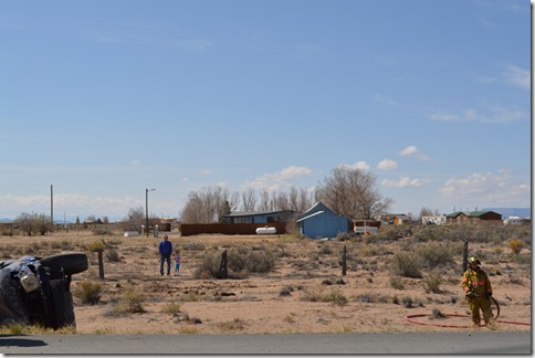
With the car back in working order, I was ready to speed on to Colorado Springs. Turns out that I probably did not get delayed at all from the thirty minute auto service stop since right outside Alamosa there was a car rollover wreck just being cleared from the highway.
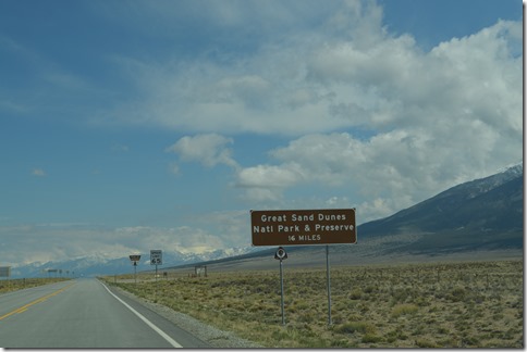
About 15 miles east of Alamosa I saw the sign for Great Sand Dunes National Park as I whizzed by. There were no other cars on the road and my mind thought 16 miles is pretty close to reach the National Park entrance and this is a remote area that I may never pass by again. I made a u-turn and turned on road 150 for the National Park.
Great Sand Dunes National Park – 16 miles.
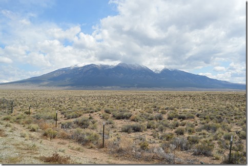
A pullout right off Highway 160 had informational displays and I stopped to check them out and photograph the impressive mountain before me.
Mount Blanca (14,365 ft.) is the fourth highest mountain in the Rockies and the 8th highest in the 48 states. What is particularly striking about this mountain is its prominence, rising 7,000 feet above the San Luis Valley.
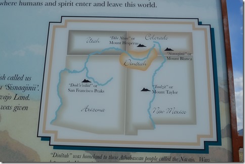
Even more significant is the informational sign I stopped to read states this is one of four sacred mountains to the Navajo. ‘Sisnaajinii’ or White Shell Mountain is the eastern boundary or doorway into Navajo Land.
Dinetah are the Navajo People and four sacred peaks mark their land. Wars between the Utes and Navajo forced the Navajo to more western lands.
Another sign tells the story of how the Colorado Utes lived in this area of the San Luis Valley when the first Spanish arrived in 1598 with horses. The Utes adapted to life with horses for hunting and warfare.
The Utes skill in combat kept permanent European settlement out of the San Luis Valley until 1851, just a few years after this valley became part of the United States in the land annexation following the Mexican-American War of 1846-1848.
On to Colorado Springs
Realizing that I would lose an hour by going all the way to the National Park and then have no time to hike and explore and still make the conference on time for the opening of BAcon forced me to get back in my car to drive the final 100 miles to Colorado Springs without visiting Great Sand Dunes National Park.
Yet, I feel I learned so much about this sacred valley and mountain from reading two informational signs. My decision to make a u-turn on Highway 160 and take ten minutes to be educated about Mount Blanca and the San Luis Valley provided a worldly experience into American history and indigenous peoples’ culture.
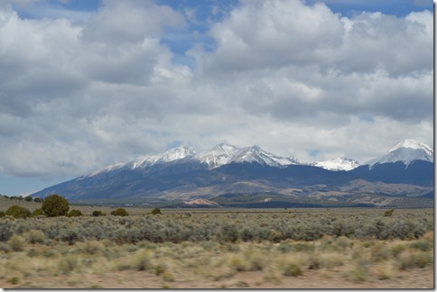
Mt. Blanca, San Luis Valley, Colorado seen from Highway 160 east of Fort Garland.
I arrived at the hotel at 1:30pm, checked in, cleaned out five days of car trash I’d accumulated over 1,600 miles of driving and made the opening session at 3pm.


5 Comments
Comments are closed.