The sign outside the Cesar Chavez National Monument in Keene, California said Tehachapi Loop 3 miles. My assumption that this was an alternate route to the town of Tehachapi instead of getting back on California Highway 58 was correct. My assumption the road was a three mile drive to the town of Tehachapi was about ten miles off.
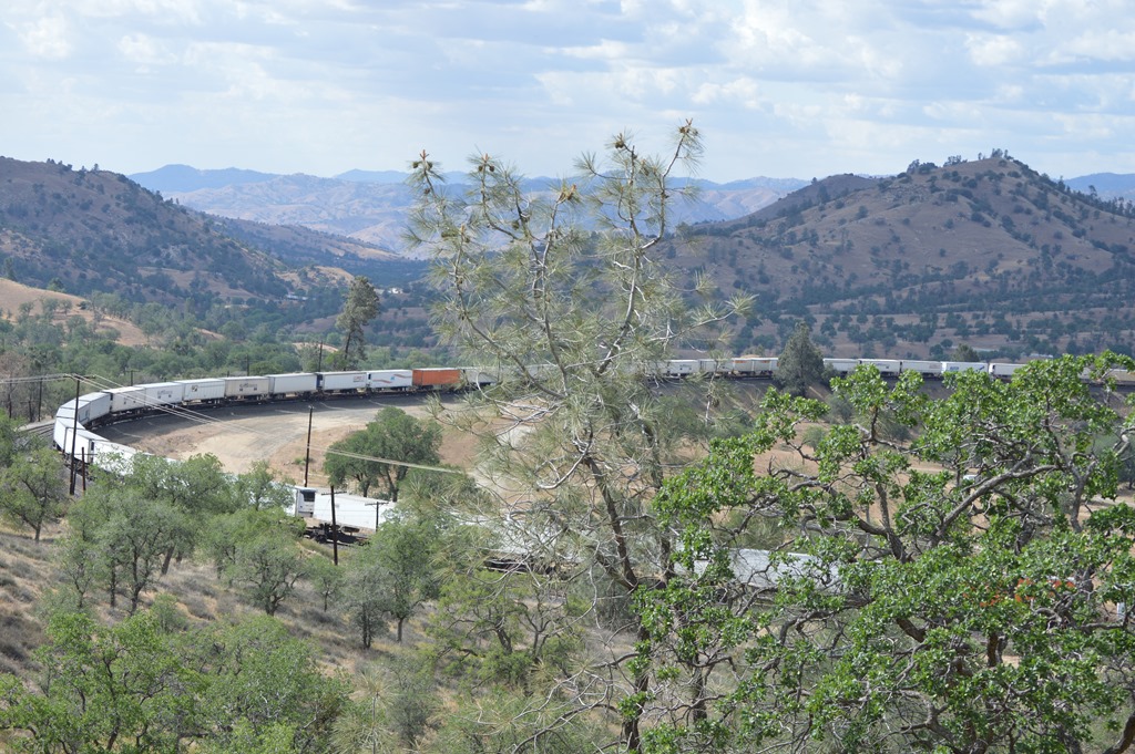
Tehachapi Loop is a train track and considered a historic engineering marvel. The loop was constructed in 1874-76 by 3,000 Chinese laborers who dug tunnels and constructed bridges to allow trains to cross the Tehachapi Mountains and connect San Francisco with Los Angeles by railroad in the 19th century. Supposedly the railroad spurred the growth of Los Angeles.

Tehachapi Pass Railroad Line National Historic Civil Engineering Landmark.
I wondered why the train was moving so slowly?
The Tehachapi Loop is where the railroad track actually loops in a circle to allow a steeper gradient or something like that. I read a few pieces on the web and still I do not know why there was a need to loop the track. A train 4,000 feet long passes over itself between the tunnel and the end of the train.
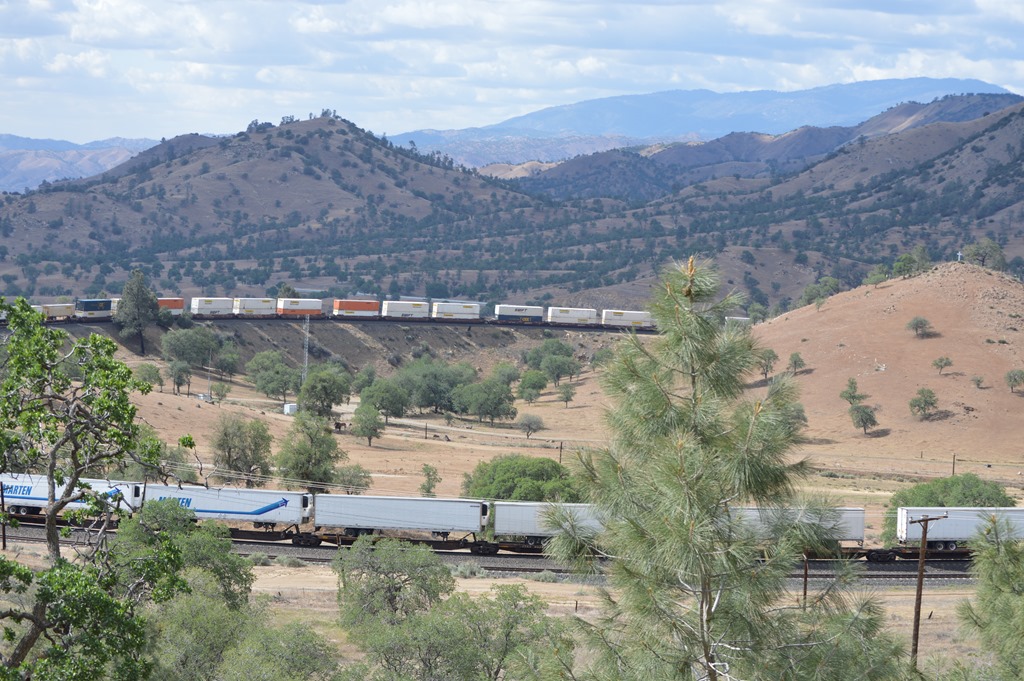
The train I was watching was coming from the eastern Mojave Desert to the western San Joaquin Valley and going downhill to enter the tunnel.
Trainspotting is not generally my idea of fun, but I am glad I stopped to see this engineering marvel.
The more I learn, the more I realize that Chinese laborers built the California we have today from the railroads across the mountains to the delta levees of Central California that controlled the seasonal Sierra snowmelt floods and allowed the valleys to be farmed.
I have to thank Cesar Chavez and the fact that I do not have a GPS for taking me on this great detour to see the Tehachapi Loop.
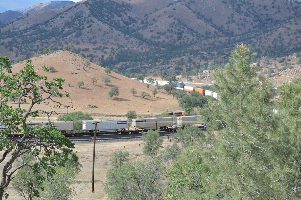
While it is hard to see in this photo, the engine for this train has looped around the hill and is actually beside the train cars following behind over thousands of feet of rail track.
One of the best parts of this ten mile or so detour from Highway 58 is the alternate road is much higher up on the mountainsides and there are views down to Highway 58 about 1,000 feet below. Tehachapi Pass is 4,000 feet, so I assume the Tehachapi Loop road from Keene to Tehachapi ascends to about 5,000 feet in elevation.
The Tehachapi Pass wind farm on the ridges east of the town are a sight to see.

Tehachapi Wind Farm.
The landscape changes dramatically in just ten miles from the trees of the western side of the Tehachapi Mountains to the Mojave Desert scrub on the east.
Springtime and the Joshua Trees are flowering in the desert.
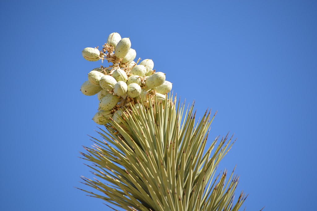
Joshua Tree flowers.
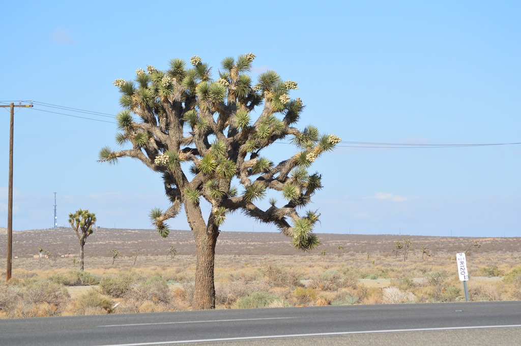
Joshua Tree in Mojave Desert off Highway 58.
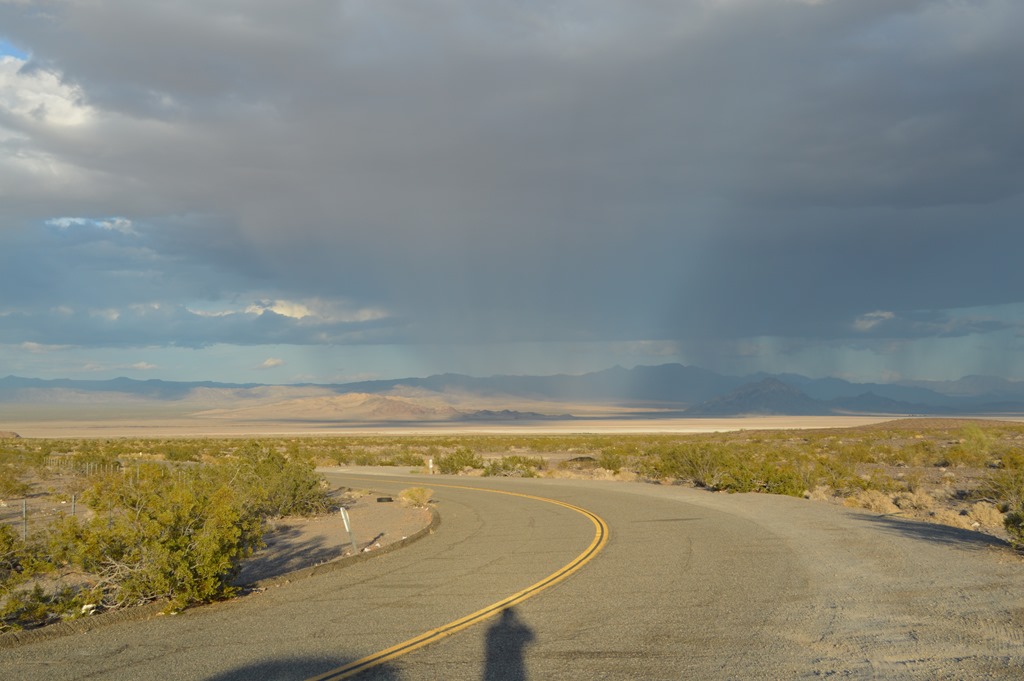
Tehachapi Pass is 250 miles from Monterey and that is only the halfway point to Las Vegas. There was still 250 miles of Mojave Desert to cross.
Rain clouds were all around California on the drive yesterday. Dark skies and heavy showers could be seen in multiple locations across the desert where visibility is often 30 miles or more.
Rainbows are usually ephemeral moments of color.
Yesterday I watched a rainbow move across the Mojave Desert for nearly 30 minutes.

Rainbow over I-15.

What made it especially cool is I could see the full arc of the rainbow touching the desert floor on both ends and there was even a second rainbow.
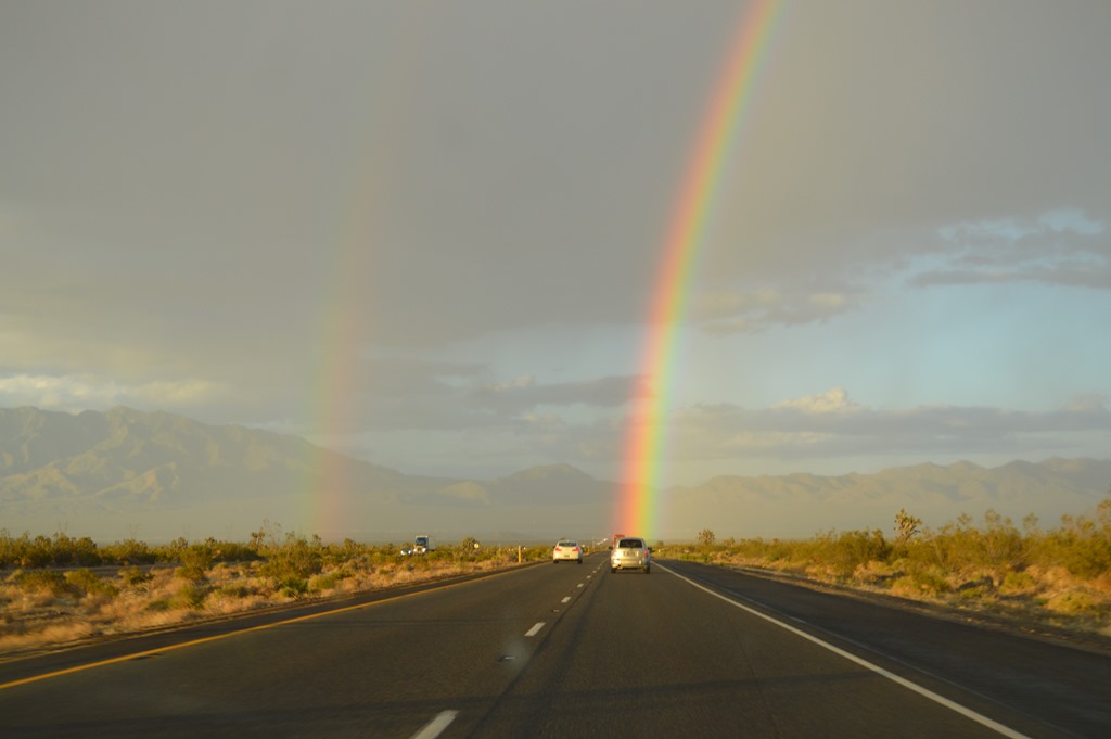
Beam me up Scotty.
A pot of gold in California just a couple of miles ahead of my car on I-15 east of Baker.
********
Tomorrow I will share a little about Zion National Park. The Zion Canyon views were an incredible sight. My photos did not seem to capture the immensity and colors.
Hopefully I won’t be snowed in at Bryce Canyon for tomorrow’s journey.
The temperature dropped from 73 degrees in Zion today down to 36 degrees when I arrived in Bryce Canyon during an intense hail, lightning and thunder storm this evening. About an inch of hail piled up on the ground and it looks like winter here tonight with cars and roofs covered in white.
5 Comments
Comments are closed.