Pinnacles National Park is 60 miles southeast of where I live in Monterey, California. Pinnacles refer to the massive rock spires and crags dotting the landscape of the park in the Gabilan Range.
This is condor bird country and there are talus caves; large boulder ceiling caves in narrow canyons filled with bat colonies of many different species.
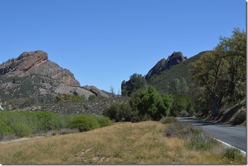
Pinnacles National Park, California.
The Gabilan mountains are a range of hills and small mountains, 1,000 to 3,455 feet in elevation, stretching about eighty miles along the eastern side of the Salinas Valley of central coast California. The rock formations in the Pinnacles are the remnants of an ancient volcano field that shifted north over millions of years from the other portion of the volcano field located about 200 miles south on the eastern side of the San Andreas fault. The similarities found between rocks in these two locations hundreds of miles apart along the San Andreas fault in California helped establish plate tectonics theory.
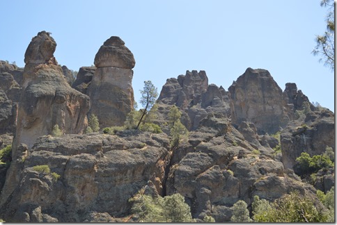
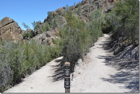
High Peaks Trail, Pinnacles National Park.
Pinnacles National Park is about 100 square kilometers of land in the Gabilan Range.
Realizing only this past week that a new National Park was in easy driving range motivated me to take my first excursion out to Pinnacles in decades.
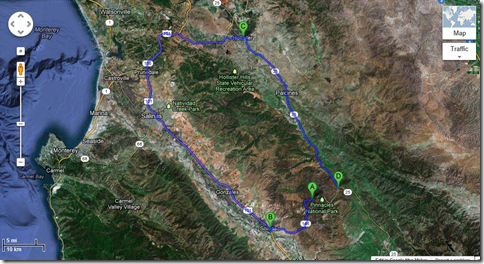
Google Maps shows 97 miles of highway roads from West Parking Lot [A] of Pinnacles National Park to the East Entrance [D]. The Pinnacles west parking lot is the terminus of the western portion of Highway 146 accessed via Highway 101 at Soledad, California [B] in Monterey County.
Pinnacles East entrance is where the campground is located. East Entrance is 30 miles south of Hollister, California [C] along Highway 25 where California state route 146 eastern portion goes into Pinnacles National Park.
Hiking trails cross the peaks to connect the eastern and western roads to Pinnacles, however, there are no roads crossing through the park. To hike between the east and west CA 146 roads is about five miles and several hours.
The driving distance between the east and west sections of California 146 is as short as 65 miles going south to King City and a mountain road through the Gabilan Range to reach Highway 25. This is far more rural driving on narrow roads along the southern route to Highway 25 and not roads you want to drive in the dark.
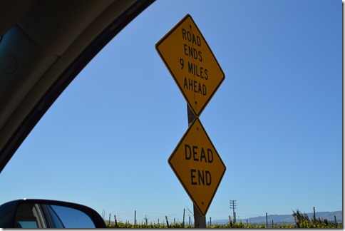
California State Route 146 west portion is a nine mile road from Soledad to its terminus in Pinnacles National Park.
Soledad is the western access point to Pinnacles National Park. Soledad is one of the original California mission towns established in 1791.
Many people associate Soledad with some of California’s major prisons. The prisons are a $500 million a year business in this city of under 30,000 residents. The state prisons are north of town and not too visible from Highway 101 or the route to Pinnacles National Park.
Personally I would like to see the route to Pinnacles National Park through Soledad be rerouted so as not to pass by all the town schools.
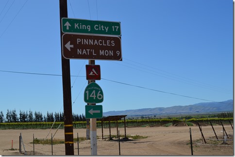
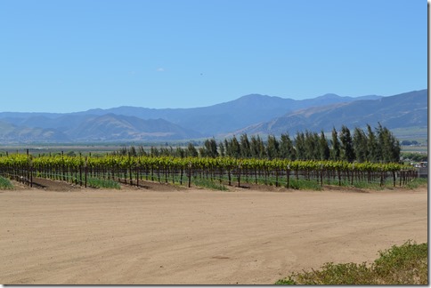
After weaving through Soledad neighborhoods the road enters vineyards nestled at the base of the Gabilan Range where CA 146 road turns into the hills.
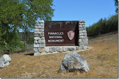
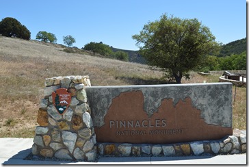
All signs still read Pinnacles National Monument.
Santa Lucia Mountains are the coastal range of mountains on the western side of Salinas Valley with several peaks above 4,000 and 5,000 feet.
View at California SR 146 in Soledad looking west across the Salinas Valley to the Santa Lucia Range. These are the mountains of the Big Sur coastline. Junipero Serra Peak at 5,853 ft. is visible in this photo.
California SR146 west portion is nine miles in length to its terminus in Pinnacles National Park.
House of Representatives California Democrat Jackie Speier wants seniors to pay more than $10 for a lifetime pass for National Parks entry. Do you really think the National Parks Service has money for new Pinnacles signs?
Pinnacles National Park legislation was signed by President Obama on January 10, 2013 creating the park’s new official designation. Pinnacles National Monument has existed since 1908 by proclamation of President Theodore Roosevelt. The original National Monument of 2,080 acres was a small parcel and less than 10% of the current 26,606 acres of Pinnacles National Park.
There were no roads to the Pinnacles National Monument until the 1920s and many of the trails were established in the 1930s by CCC workers.
The Gabilan Range runs northwest to southeast on the eastern side of the Salinas Valley in Monterey County. There are several peaks over 3,000 feet like Fremont Peak at 3,173 ft.
Fremont Peak seen from Spreckels, California on west side of Salinas Valley.
Salinas is located near the north end of the Gabilan Range. The city of Salinas (pop. 150,000) is at the base of the Gabilan Range in the distance. There are no skyscrapers in Salinas to see rising above the valley floor.
Soledad is about 25 miles south of Salinas.
Hiking between the roads on the east side and west side of the park is only a trek of a few miles, yet driving the roads between the two entrances is 65 to 97 miles depending on the route taken.
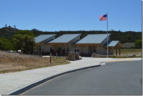
Pinnacles National Park West Entrance Visitors Center.
Pinnacles National Monument sign still in place April 16, 2013.
The visitor center is where you pay $5 per vehicle admission fee. The center has a 13 minute film on the park, some displays and exhibits and a small gift shop section in one corner. There is no food café.
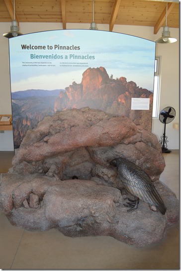
Condor exhibit at Pinnacle Visitor Center.
My objective was a condor sighting.
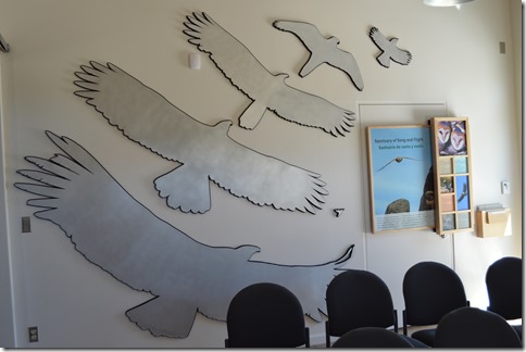
The visitor center has a wall display in the film room showing the relative wingspan of large birds.
I have seen three condors in confirmed sightings by wing tag number in the past six years. Each time I am amazed at how much larger the condor’s wingspan (9 ft.) is than the turkey vultures (6 ft.) commonly seen and the second to largest bird outline on the wall exhibit at Pinnacles.
The road past the Visitors Center winds through the hills a few more miles from the visitor center to the end of the road at the Chaparral Trailhead parking lot. The road is narrow with only a few spots to pull out between the Visitor Center and the parking lot. There are numerous blind curves and driving slow and carefully to one side of the road is desirable.
82% of the Pinnacles National Park land is chaparral, small brush vegetation that is adapted to survive extremely dry and hot summer temperatures.
There are also woodlands in the park.
The rock outcrops with little soil are the geologically unique feature to Pinnacles National Park.
Juniper Canyon Trail, Pinnacles National Park.
San Andreas fault earthquakes over millions of years tumbled rocks in narrow canyon spaces to create talus caves. Talus caves are the openings between rocks that have fallen down into a pile, often at the bases of cliffs.
These cave formations in Pinnacles National Park are home to several species of bats. A large portion of the caves are closed off to visitors in summer season to allow undisturbed care of newborn bats.
I did not make it to the caves on this week’s day trip to Pinnacles.
Hiking up Juniper Canyon Trail to get near Condor Crags was my objective. The elevation gain is 1,215 feet and a strenuous hike on a maintained trail.
Take plenty of water. I rationed my liter of water over three hours and it was only a 62 degree today. Pinnacles frequently tops 100 degrees in summer months.
Juniper Canyon Trail is 1.8 miles to the summit where there is a picnic table and outhouse.
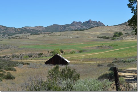
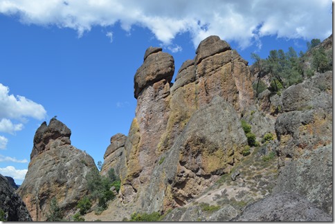
Pinnacles are the remains of an ancient volcano in the Gabilan Range.
And what is on the other side of a 90 minute walk up the Juniper Canyon Trail?
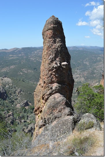
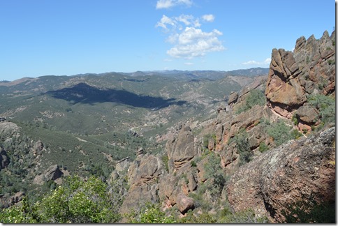
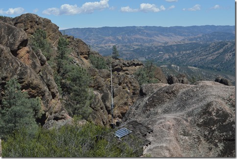
On top of the Pinnacles at end of Juniper Canyon Trail looking east deep in the Gabilan Range.
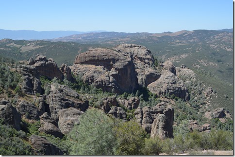
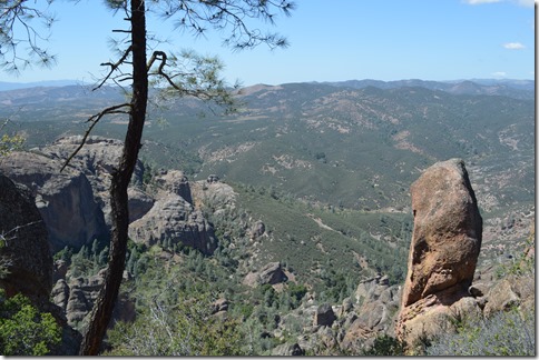
There are great vista and photo opportunities in the High Peaks. I did not see any condors.
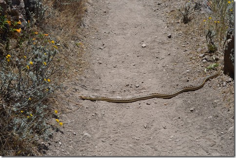
I did cross paths with a snake on the hike back down Juniper Canyon Trail.
Who crossed the trail first, the snake or me?
I waited to see the tail of this 4 to 5 ft. long snake since I am not all that familiar with different snake species. No rattle on this large and non-venomous gopher snake.
View from High Peaks on Juniper Canyon Trail in Pinnacles National Park.
After 30 years I made it back to this natural wonder in my backyard of Monterey County and San Benito County.
Two more trips to Pinnacles National Park should allow me to visit Balconies Cave Trail on the west side of the park and drive over to the East Entrance and hike the Bear Gulch Cave Trail.
Hopefully another condor sighting will be in my future.
Here is a post from December 2012 when I came across two condors feeding on a sea lion carcass at Soberanes Point in Garrapata State Park on Highway 1 about 10 miles south of Carmel.
Wild California Condors of Big Sur (12/12/12)
National Park Week is April 22-26 with free admission to all parks in the National Park System.



4 Comments
Comments are closed.