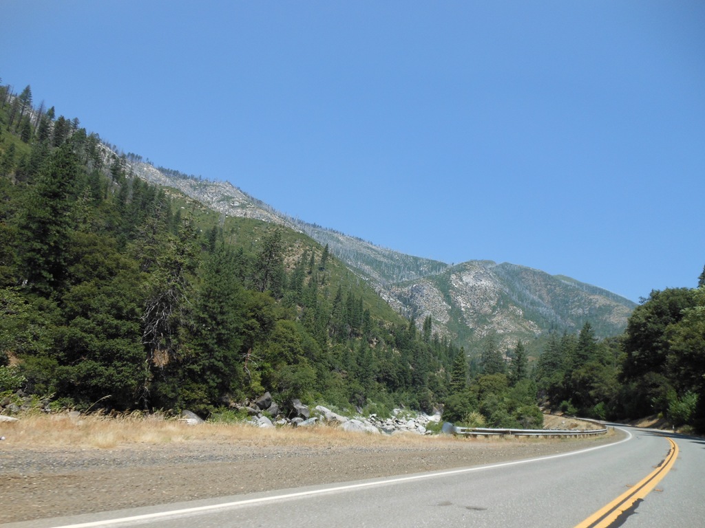
Highway 70 was a new experience for me and I snapped photos of sites that seemed eye-catching. Apparently I photographed the most popular scenery along the route according to the Plumas County, California tourism website.
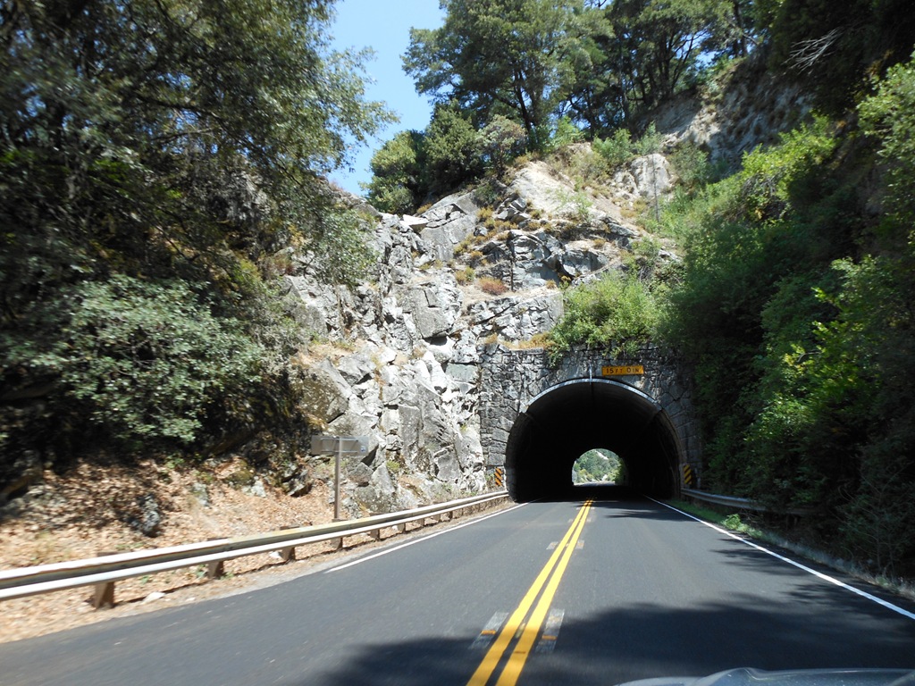
This short tunnel through the mountainside enticed me to photograph.
There was gold and riches to be found across hundreds of miles of the California Sierra Nevada in the 19th century gold rush era. Gold and other valuable minerals and elements changed the state of California economically and ecologically.
Mining used vast amounts of wood. If the minerals hadn’t run out in the 1800s, the Sierra Nevada trees cut for timber to build mine structures, housing and equipment might have been exhausted first.
Opening the Sierra Nevada: 1848-1900
The discovery of gold at John Sutter’s mill in 1848 began a series of boom-and-bust cycles of resource utilization. During the 1850s, the Sierra Nevada produced nearly half the worlds gold output and spurred an enormous migration to California. By 1860, the 25,000 gold miners had collected the easily accessible placer gold deposits, and many miners left or shifted to other resource-related work. Twenty years of hydraulic mining begun in the 1850s created an enormous amount of sediment and altered the river systems for decades. Large areas of the foothills were cleared and converted to farms and grazing lands to supply the growing population of California and Nevada. More land in the Sierra Nevada was under cultivation in 1860 than in any year since.
Thousands of acres of forest were cut each year to provide timber for mining structures and houses. The completion of the trans-Sierra railroad in the 1860s allowed timber to be sold to the growing Central Valley, and even San Francisco, in addition to local mines and towns. Timber harvests for the Sierra Nevada region during the late 1800s averaged over 500 million board feet, with most coming from the western foothill region. By 1880, over 1.5 million acres of pine forests had been cut or burned in the western foothills. By the late 1800s, the foothill landscape was a mix of cutover forests, grasslands, burned areas, and agricultural fields. In the higher elevations, difficult access and lower prices for species other than the pines limited timber harvesting and the associated fires that affected the lower forests.
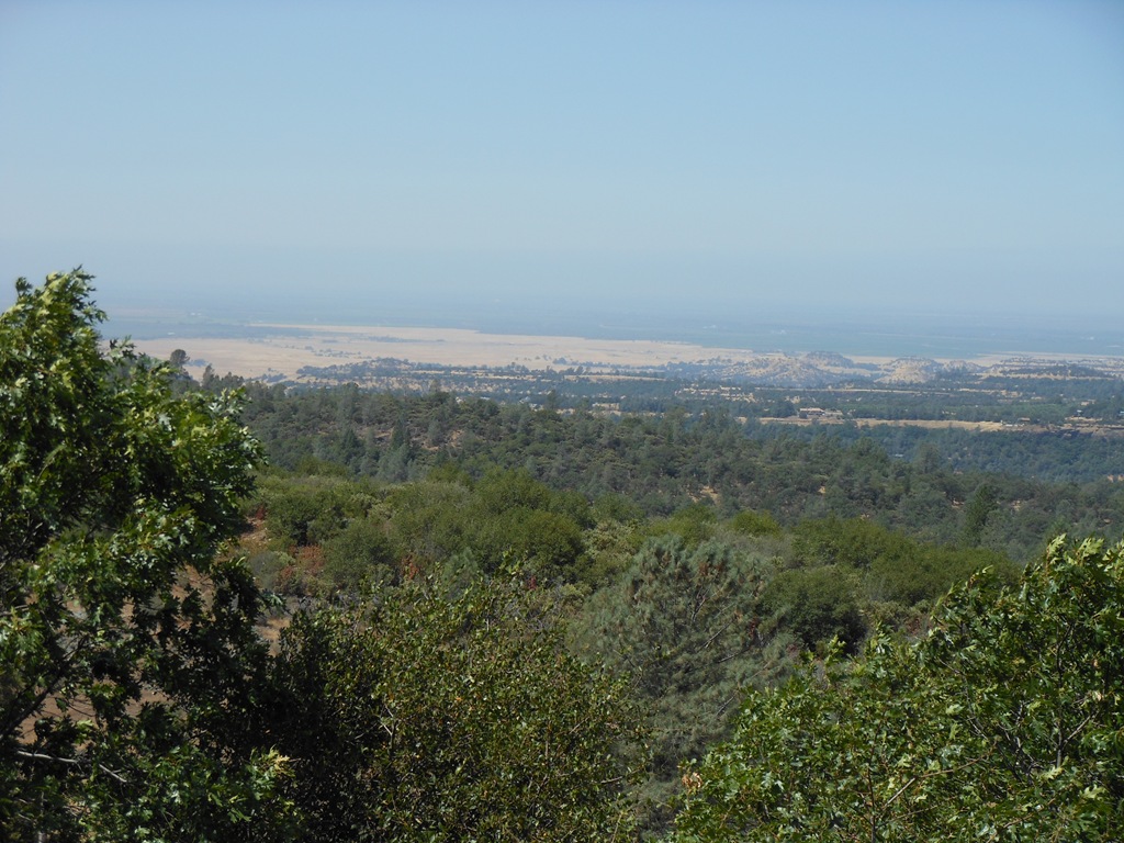
View from the western foothills of the Sierra Nevada into the Central Valley around Oroville.
Deforestation of mountainsides to provide timber for fuel and structures changed the natural landscape of California.
The California Gold Rush Environment
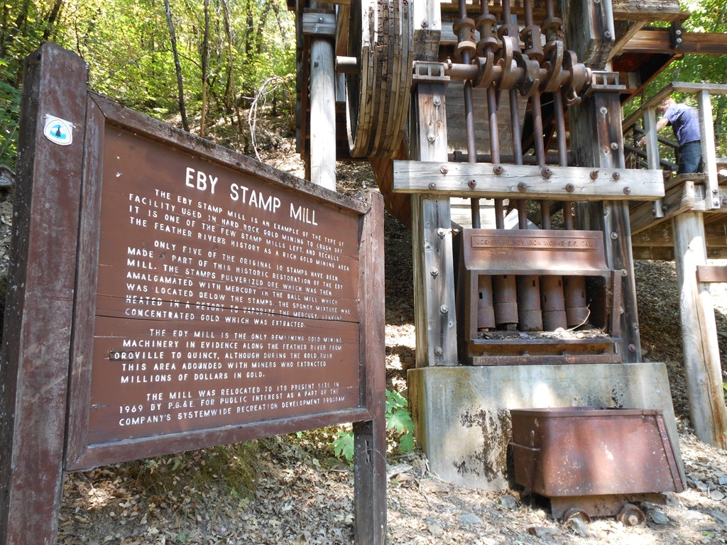
The Eby Stamp Mill at Belden Town on California State Route 70. There is a cabin-sized room on top of the machinery.
Eby Stamp Mill sign
The Eby Stamp Mill is an example of the type of facility used in hard rock gold mining to crush ore. It is one of the few stamp mills left and recalls the Feather River’s history as a gold mining area.
Only five of the original 10 stamps have been made a part of this historic restoration of the Eby Mill. The stamps pulverized ore which was then amalgamated with mercury in the ball mill which was located below the stamps. The spongy mixture was heated in a retort to vaporize the mercury, leaving concentrated gold which was extracted.
The Eby Mill is the only remaining gold mining machinery in evidence along the Feather River from Oroville to Quincy. although during the Gold Rush this area abounded with miners who extracted millions of dollars in gold.
The mill was relocated to its present site in 1969 by P.G. & E. for public interest as a part of the company’s systemwide recreation development program.
I guess the PG&E campsites around California today were part of that systemwide recreation development program of the 1960s.
Quicksilver in the Rivers
Gold extraction was highly polluting to Sierra Nevada rivers. Mercury was used extensively for gold extraction. Ten miles south of San Jose, California was the largest mercury production site in the U.S. at New Almaden Quicksilver Mine and the area is now a Santa Clara County park.
New Idria Mercury Mine in San Benito County, 50 miles or so east of my home in Monterey, California was the second largest mercury production site in the U.S. and currently is on the EPA Superfund Site list for the nation’s most needed interventions to clean up the 8,000 acres of contaminated mining environment from over 100 years of mercury production.
The history of gold mining in California’s Sierra Nevada Motherlode began with the Gold Rush of 1848/49 and is well known. Mercury, mined mainly in the Coast Range, was used to amalgamate the gold. Between 1848 and 1981, 88% of the mercury mined in the United States came from the northern Coast Range of California. The map on the right shows the historic extent of gold, silver, and mercury mining in California. Mercury contamination from mining activities persists to this day and contributes to the mercury that accumulates in fish. Other sources of mercury include emissions from the burning of fossil fuels and oil refining, the deposition of those atmospheric emissions, municipal and industrial wastewater discharges, and urban runoff.
California government document – California Water Quality Monitoring Council
Water is a gold currency equivalent in California today.
The Feather River contributed to the wealth of California with gold in the 1800s and is currently a cash crop for Pacific, Gas & Electric utility company in California.
This drive along CA SR70 was an eye-opener to see PGE signs for 100 miles of highway along the Feather River and Lake Almanor. PGE is not only a utility service provider. This company has major land holdings and is in the campground business.
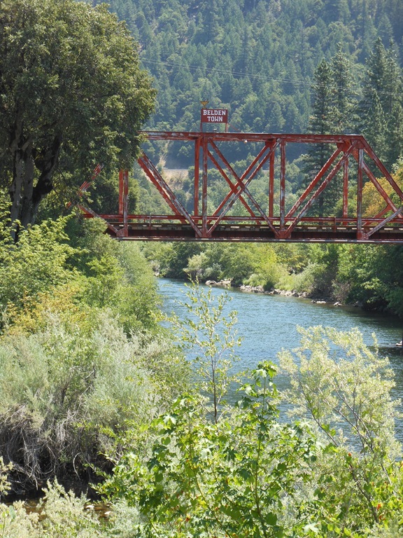
Belden Town is where the Eby Stamp Mill is located near a PG&E hydropower facility.

Historic Belden Town bridge (1912) and P. G. & E. Belden Powerhouse on left.
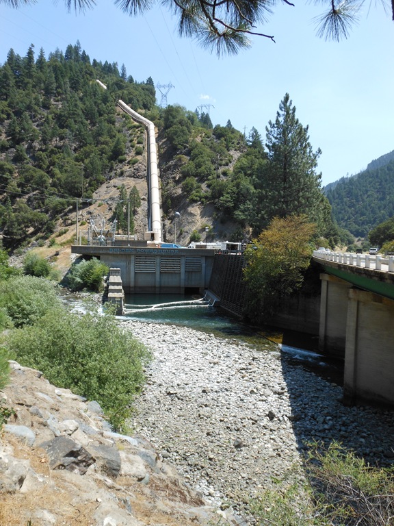
Dams and powerhouses along the Feather River generate electricity from water.

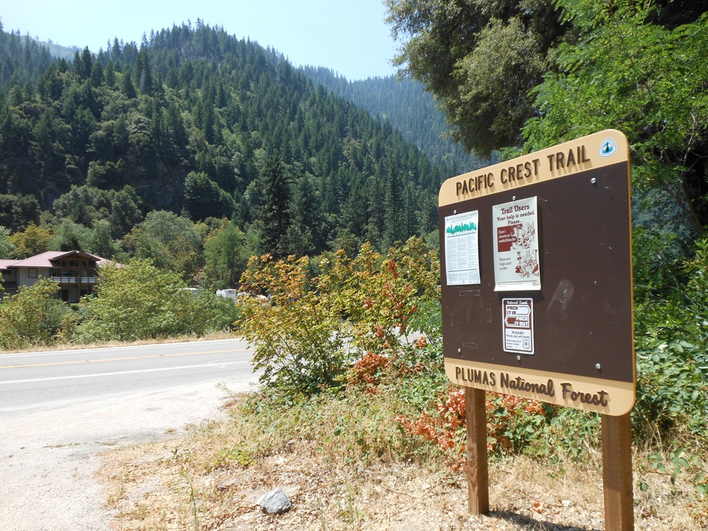
These are the types of photos that tend not to be included by backpackers trekking the Pacific Crest Trail that runs from Mexico to Canada and crosses the Feather River at this point by Belden Town.
The Belden Town Resort and Lodge on the Feather River offers a riverside getaway in the Sierra. Belden Town also holds several summer music festivals.

Sunset Campout Festival July 13-15, 2012 Belden Town, California.
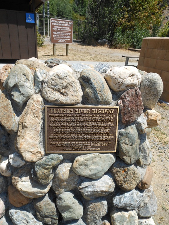
The Feather River Highway opened to traffic August 14, 1937. The 70 mile stretch of road originally cost 8 million dollars to build. One of its main claims to fame is the road has the lowest elevation pass across the Sierra Nevada range of California. A February 1986 flood resulted in major damage to the highway costing 10 million dollars to repair.
The floods of 1986 are one of my personal experiences as a student living in Davis, California. One of our friends who worked as a large animal veterinarian was evacuated from the Marysville area when a levee broke. There was plenty of flooding that winter after several days of steady rain over the Presidents weekend holiday.
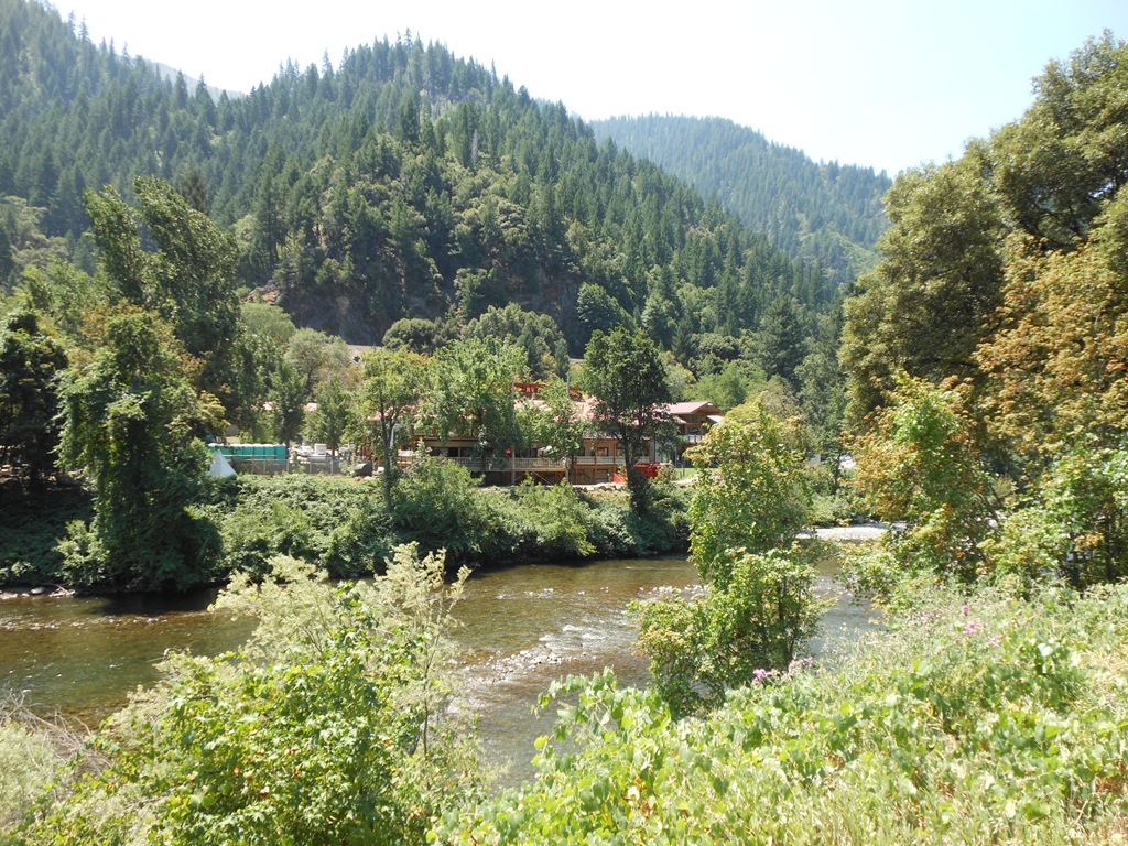
Belden Town Lodge & Resort on Feather River, California.
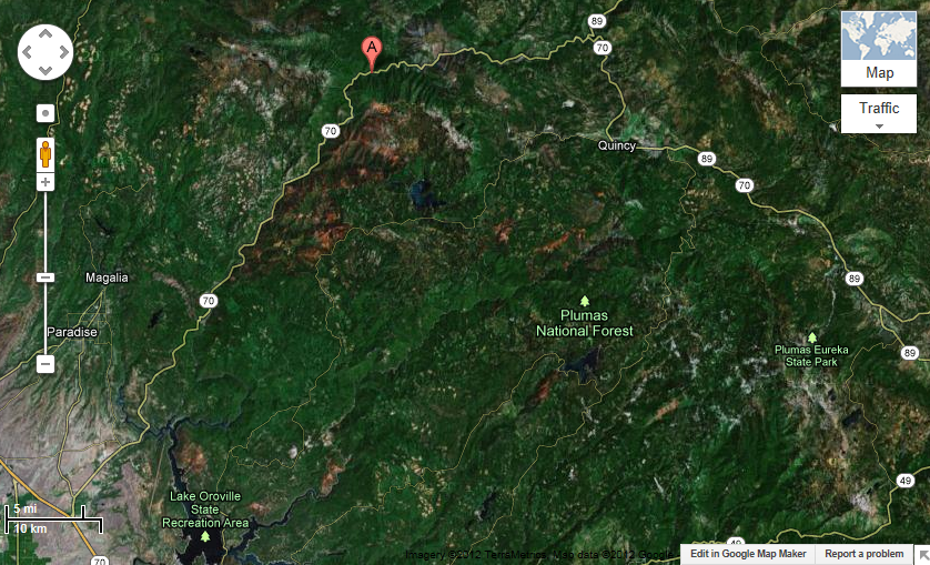
Google Maps showing Belden Town on Highway 70.
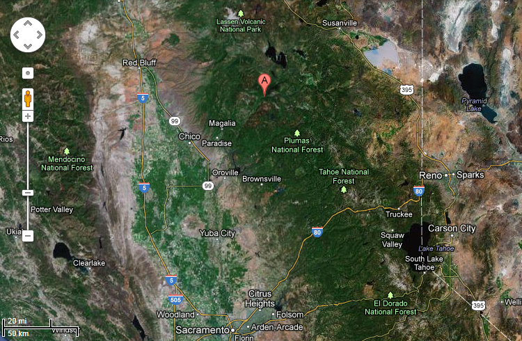
Highway 70 and Belden Town relative to Sacramento and Lake Tahoe.
Route 89 to Lassen Volcanic Park kept me from making it to the Plumas County historic town of Quincy on this trip.
The northward drive on Highway 89 also marks the transition from the northern Sierra Nevada Mountains to the southern Cascade Mountains.
The Sierra highways and Cascade highways tend to be very different driving environments. The Sierra is hairpin turns and lots of up and down whereas the Cascade roads tend to be long, straight roller coaster roads through dense forests.
I have more to share from my road tripping in the Cascades with Lassen Volcanic National Park, my hotel stay at the Running Y Ranch Holiday Inn Resort outside Klamath Falls, Oregon and a visit to Crater Lake National Park where I dipped in the volcano water. I was surprised to learn swimming is allowed at Crater Lake – if you can tolerate the water temperature.
Ric Garrido, writer and content owner of Loyalty Traveler, shares news and views on hotels, hotel loyalty programs and vacation destinations for frequent guests. You can follow Loyalty Traveler on Twitter and Facebook and RSS feed.

2 Comments
Comments are closed.