Pacific Grove and Pebble Beach are the western front of the Monterey Peninsula. Pacific Grove is the northwestern
portion and Pebble Beach is the southwestern portion of the arm of forested land reaching out into the Pacific Ocean of Monterey Bay.
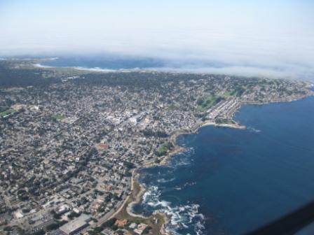
This photo was taken during a flight out of Monterey Airport (MRY) in 2010 and shows Pacific Grove with the Stanford University Hopkins Marine Station at the bottom. Monterey Bay Aquarium is just out of the picture. Lovers Point in Pacific Grove is center right. The beaches at top are by Spanish Bay Resort, Pebble Beach. Asilomar and Point Pinos in upper right are in the fog.
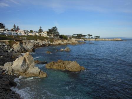
If there is one word to describe Pacific Grove as a culture, perhaps it is “traditional†in the sense of being hometown USA traditional Americana culture with a uniquely California flavor. This is a town where the school kids participate and march in the civic parades and festivals. Pacific Grove is nature’s garden by the sea where the surf meets the rocks. Ocean View Blvd., past the Monterey Bay Aquarium is the primary drive, walk, cycling route for scenic views on the Monterey Peninsula.
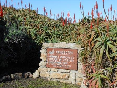
Pacific Grove calls itself Butterfly Town USA. I have seen pictures of Monarch butterflies in the millions in Mexico. I have never seen more than a few Monarch butterflies at one time in Pacific Grove. There are supposedly about 25,000 butterflies that arrive in October.
While you might not see butterflies walking the coastline of Pacific Grove, there is a guarantee you will see many types of marine mammals and birds. I have never been to another environment where there are more sea mammals by the shore in a populated area than around the Monterey Peninsula. A person taking time for gazing at the sea along the five miles from Monterey Fisherman’s Wharf to Cannery Row to Lovers Point in Pacific Grove and around Point Pinos to Asilomar Beach
is guaranteed to see California sea lions, harbor seals, sea otters and cormorant birds. Most days you will see California brown pelicans flying overhead and gliding above the waves. There is a chance you will see deer in the woods and on Pacific Grove golf course.
If you are lucky you may see porpoises and whales. Most of the whales I see in California each year are sighted from
Asilomar Beach in Pacific Grove between December and April when the gray whales migrate south in the fall and winter months to Baja Mexico and travel north again in the spring months. The past month has offered the most gray whale sightings I’ve ever seen from the beaches of Pacific Grove and the LA Times reported December 2011 was the most gray whales spotted for three decades in southern California.
Hopkins Marine Station
Just to the west of Monterey Bay Aquarium is Stanford University’s Hopkins Marine Station in Pacific Grove. This is the area that was once known as China Point before the Chinese were relocated around 1906 to present day Cannery Row. The Hopkins Marine Station is restricted access. The beach at Hopkins is a marine life refuge where there are almost always dozens of harbor seals sunning themselves in the sand.
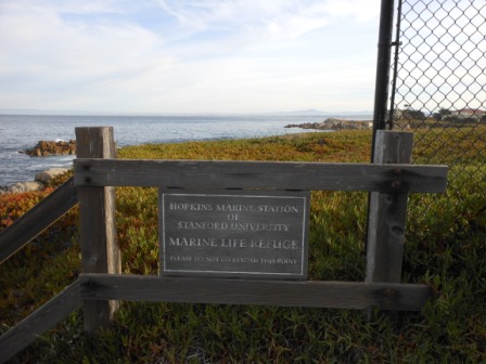
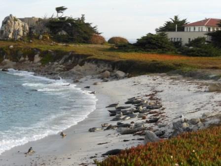
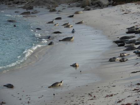
Last summer I saw porpoises playing here one day at Hopkins Marine Refuge. The picture below shows the typical summer fog pattern for Monterey Bay. The center of the Monterey Bay is frequently foggy in summer months as seen in the porpoise photo.
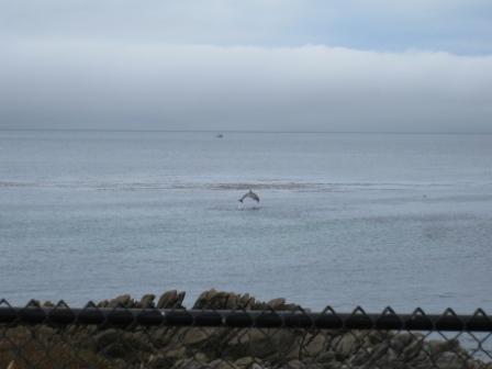
I live in the sunbelt area of Monterey about a mile from the sea. Typically the fog rises up from Pacific Grove to the ridge of hills dividing Monterey from Pacific Grove and does not cross down the hillside to cover Monterey. Our microclimates on the Monterey Peninsula leave sections of Monterey with hundreds of hours more sun each year than sections of Pacific Grove less than a mile apart. Pacific Grove is one of the foggiest locations in the area since it sticks out into Monterey Bay. December and January are the months with the least hours of fog in the area.
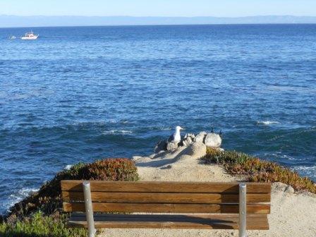
Ocean View Blvd. in Pacific Grove offers unmetered and unrestricted free parking along most of the shoreline. This stretch of road also houses some high-end B&Bs for ocean view lodging like Martine Inn, Green Gables Inn and Seven Gables Inn.
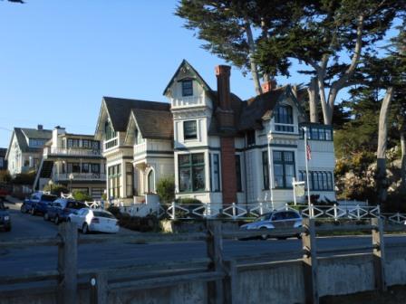
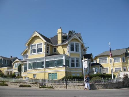
Monterey Bay Coastal Trail extends from Marina to Lover’s Point Pacific Grove in a dedicated bike path over ten miles in length.
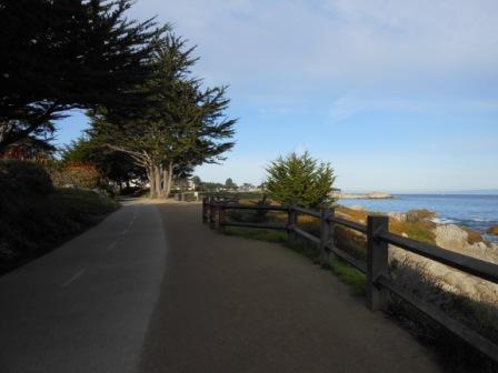
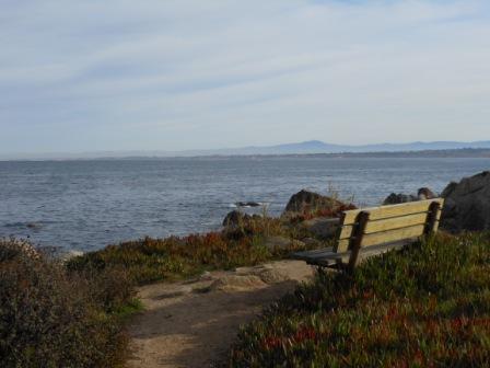
The Pacific Grove section of the coastal trail has numerous benches by the shoreline for resting and gazing at the sea.
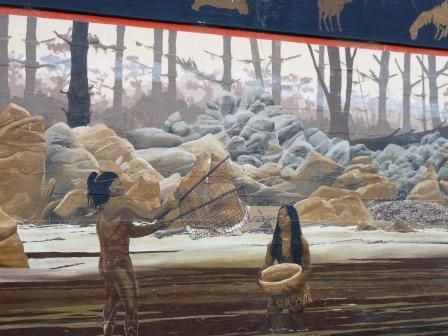
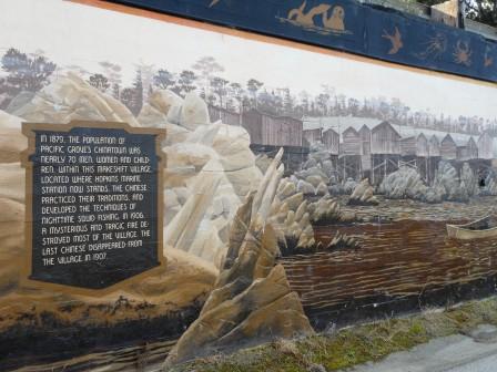
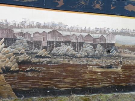
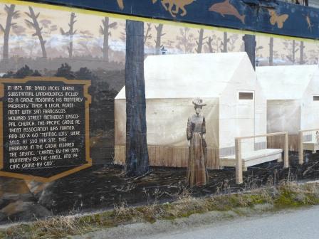
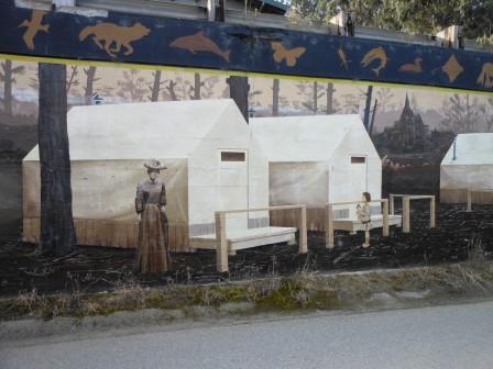
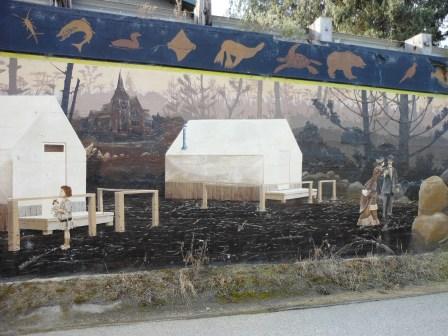
AÂ Pacific Grove history mural is located along the Monterey Bay Coastal Path between Hopkins Marine Station and Lovers Point.
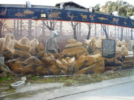
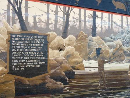
The native people of this coastal area – the Rumsien Ohlone and the Esselen – lived in a world of natural beauty and abundance for thousands of years. Their way of life was drastically changed by the arrival of the Europeans. Those who survived adapted to their new world, and today, many descendants of these original people feel strong ties to their ancestors and to this land.
In 1879 Pacific Grove’s Chinatown was nearly 70 men, women and children. Within this makeshift village, located where Hopkins Marine Station now stands, the Chinese practiced their traditions, and developed the techniques of nighttime squid fishing. In 1906, a mysterious and tragic fire destroyed most of the village. The last Chinese disappeared from the village in 1907.
In 1875 Mr. David Jacks, whose substantial landholdings included a grove adjoining his Monterey property, made a legal agreement with San Francisco’s Howard Street Methodist Episcopal Church. The Pacific Grove Retreat Association was formed, and 30′ by 60′ “tenting lots†were sold, at $50 per site.
This paradise in the grove inspired the saying, “Carmel-by-the-sea, Monterey-by-the-smell, and Pacific Grove-by-God.
Pacific Grove is one of my favorite places to be when the big waves roll into town. There are benches by the sea to watch spray
entertainment on the rocks.
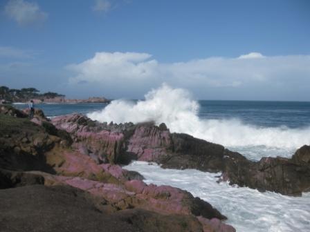
The waves in 2010 were something spectacular when 25+ ft. waves hit the coast of Pacific Grove. Mavericks annual big wave surf contest occurs off Half Moon Bay about 80 miles north. The Mavericks surf contest window began yesterday for the 2012 event. Not all years have big swells and the surf event was not held in 2011. When big swells arrive and perfect conditions converge on the California coast for big waves, the call goes out that Mavericks will happen with 24 hour notice to bring big wave surfers to California from around the world.
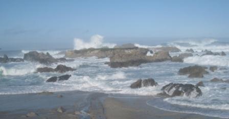
I happened to photograph the coast of Pacific Grove on the same day as the last Mavericks surf contest February 13, 2010 when the wave faces of 50+ feet were the largest in the event’s history.
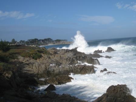
Yesterday I took a photo at Point Pinos Pacific Grove when a publicized wave warning was issued for 12 to 15 ft waves making dangerous conditions for the coast of the Monterey Peninsula.
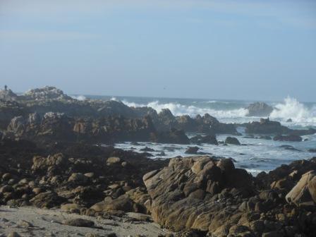
A person is standing on the rocks on the far left of picture. The day of Mavericks on February 13, 2010 also brought waves of incredible height that can be seen peaking behind these same rocks at Point Pinos, Pacific Grove.
This Pacific Grove article has crashed once before when I originally posted the piece on Boarding Area December 24 and now the post is acting up again in WordPress. This post ends here by necessity as I can’t add more photos. I will follow up with more on Pacific Grove and Asilomar State Beach in a separate post.
This is the fourth post of my “At home he’s a tourist†series for locations here on the Monterey Peninsula.
Point Lobos Walk in Why visit Monterey and Hyatt Carmel Highlands in December? (Dec 6, 2011)



3 Comments
Comments are closed.