The clarity of light in the cold months of California and the desert Southwest epitomizes the phrase ‘on a clear day you can see forever’. Plus, California looks slightly green in places after days of November rain. These were nice days for a 1,000+ miles road trip from Monterey to Vegas over Thanksgiving week.

Point Lobos, California after the rain storm.
Last week was my first 1,000+ miles road trip across California in two years for a family reunion at Thanksgiving in Las Vegas. The distance between Monterey, California and Las Vegas is a little over 500 miles. About half the drive between Las Vegas and Monterey is across the Mojave Desert, until Highway 58 tackles the lower mountains in the southernmost part of the Sierra Nevada range at the Tehachapi Mountains.
Holiday Inn Express Tehachapi was on the most recent IHG Rewards Club PointBreaks list. I booked a hotel room a month ago for 5,000 points to break up the drive on the way to and from Las Vegas. Turned out to be a real benefit since heavy rain followed us much of the way from Monterey to Tehachapi.
The day after Thanksgiving we drove straight through from Las Vegas to Monterey in 9 hours for the road trip home. I canceled the Holiday Inn Express PointBreaks reservation. My wife drove the final 260 miles from Tehachapi to Monterey allowing me to snap photos from the passenger side of the car.
Las Vegas to Monterey road trip in annotated photos.
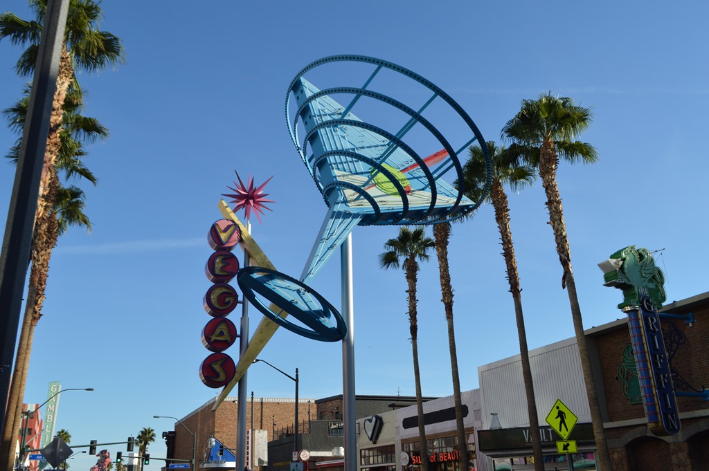
Las Vegas Fremont Street in daylight.
Fremont Street is old Las Vegas before the glitzy theme resort casinos lined the Las Vegas Strip. Golden Gate Casino at 1 Fremont Street opened as Hotel Nevada in 1906.
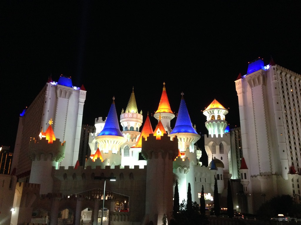
Excalibur, an MGM Resort on the Las Vegas Strip sits between New York New York and Luxor pyramid.
Kelley and I almost stayed in a suite at Luxor this trip, but I chose instead a one bedroom suite at Wyndham Vacation Resorts Grand Desert one block off the Strip. We walked to Mandalay Bay one night to the RÍ RÁ Irish pub for a Black Donnellys concert. That was one of the best free shows in a bar I recall ever seeing. A 3 hour show is a piece of cake for the Guinness World Record guitarist who played 114 consecutive hours a few years back.
I snapped dozens of night photos on the walk to and from Mandalay Bay and Wyndham Grand Desert with my iPhone. Excalibur is the cheapest of the MGM Resort hotels on the Strip. While the inside might not be too fancy, the lights outside at night are an impressive sight. After walking around the perimeter of MGM Grand Resort to get to our Wyndham hotel, we truly know what it means to be one of the biggest hotels in the world.
Last time I was in the MGM Grand I was a party guest in the inner resort sanctum.
Loyalty Traveler – Inside the Mansion at MGM Grand Las Vegas (July 19, 2013).
On the Border in Primm, Nevada

Primm, Nevada
Primm, Nevada is about 50 miles southwest of Las Vegas and the border town on the Nevada state line with California. The flight distance between Monterey and Las Vegas is 375 miles, but that is an air route over the Sierra Nevada mountain range. Crossing the state of California in an east-west direction by road is all about traversing mountain ranges from the Pacific coast to the Sierra. Road travel adds another 150 miles to the distance since routes through mountain passes mean directionality changes for highways across hills, mountains and deserts along the way.
Mt. Charleston, Nevada is 11,916 ft in elevation and due west of Las Vegas. Interstate 15 highway out of Las Vegas to southern California heads southwest to Primm. About 15 miles west of Primm is a mountain pass at 4,730 feet, simply named Mountain Pass, California.
Mojave Desert

Mojave Desert, California
The Mojave Desert was a beautiful drive in pleasant weather. The temperature was probably 50 degrees at 10 am. Hard to imagine what it would have been like 150 years ago to traverse this vast desert in summer, but that thought always come to mind sometime during the desert crossing in my car. I have driven this same stretch of Interstate 15 several times in July and August when temperatures were above 115 F. Once I stopped at this same spot and there were wild burros grazing.
Loyalty Traveler – Crossing the Mojave Desert to Las Vegas (Jan 7, 2013). This was my road trip when I saw the wild burros and a double rainbow in the Mojave Desert.
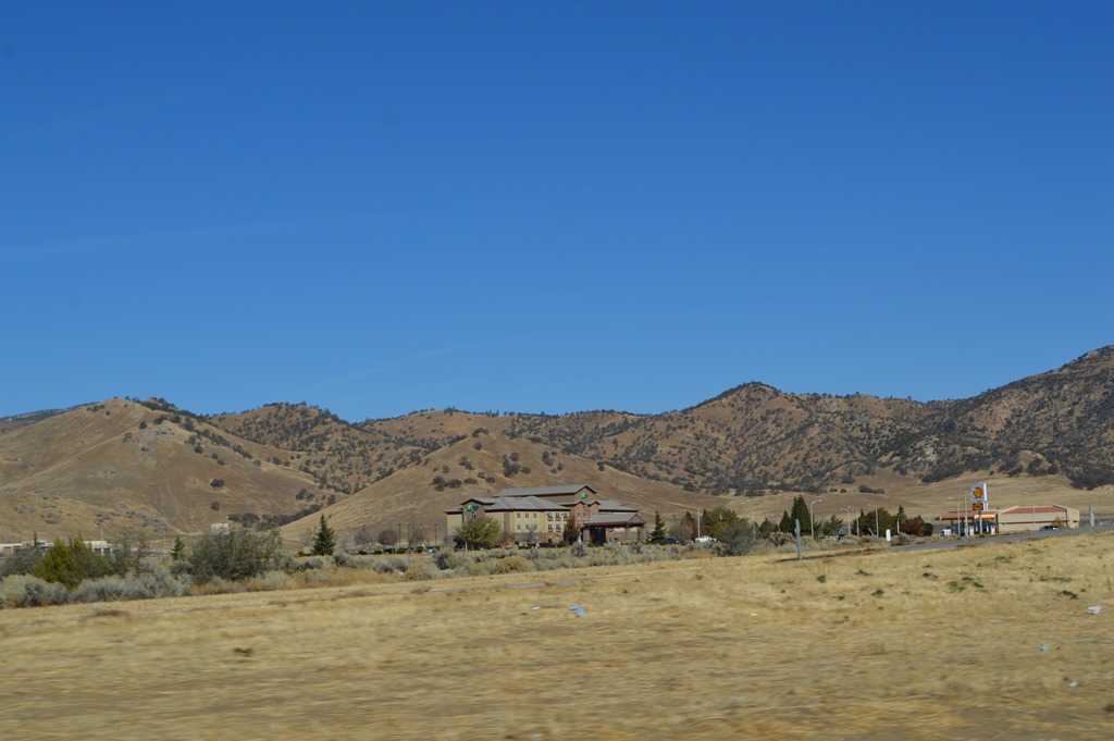
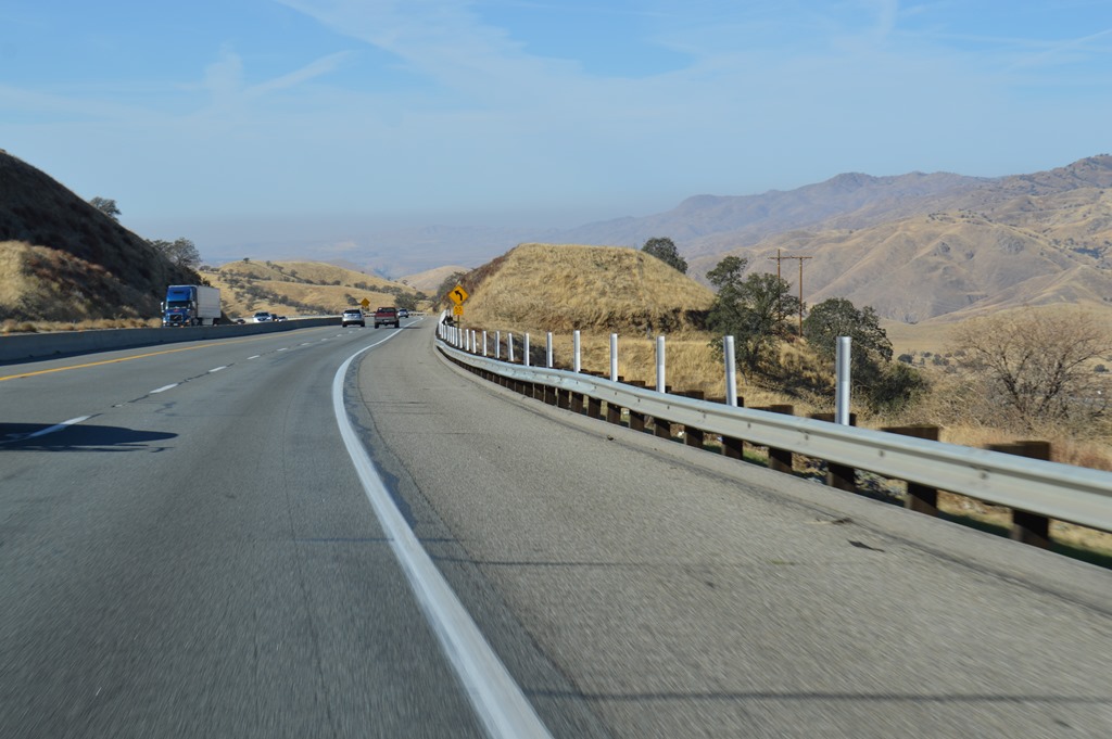
Tehachapi, California
Tehachapi Pass is the lowest elevation route and historically the easiest land transportation route between San Francisco and Los Angeles. The first railroad link between San Francisco and Los Angeles opened in 1876 after theengineering construction feat of the Tehachapi Loop. Interstate 5 over the Grapevine is now the main route to Los Angeles.
Loyalty Traveler – Trainspotting on the Tehachapi Loop (May 8, 2013).
There are several more photos in my Tehachapi Loop post including one of the Tehachapi wind farm, one of the largest in California and the commercial aircraft stored in the Mojave Desert.
Holiday Inn Express Tehachapi, California.
Tehachapi at 4,000 feet in elevation offers relief from the heat of the Mojave Desert 10 miles east and Bakersfield in California’s Central Valley 35 miles to the west. The mountains are grasslands and cattle country. The community of Tehachapi with 15,000 residents in the hills is a place I enjoy staying on my road trips to Las Vegas compared to the big city of Bakersfield with its horrendous air pollution. Bakersfield consistently earns top honors for worst air quality in the U.S.A.
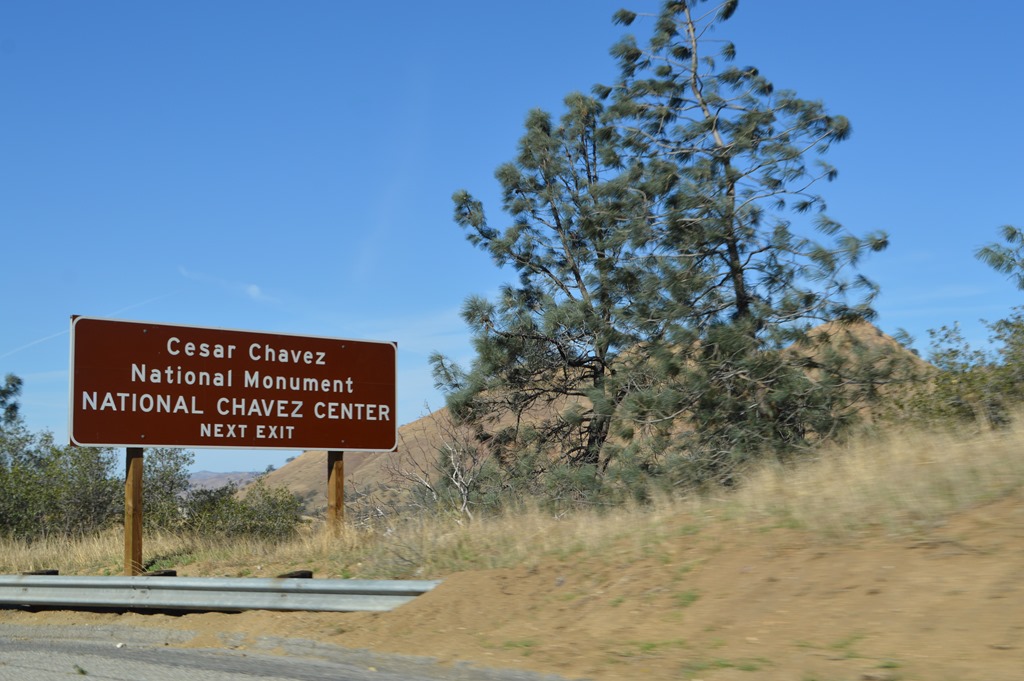
Cesar Chavez National Monument, Keene, California in the Tehachapi Mountains off Highway 58.
Loyalty Traveler – Cesar Chavez National Monument (May 7, 2013).

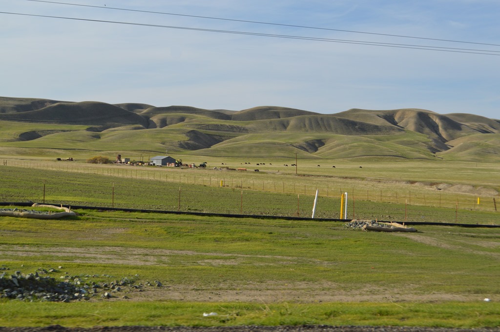
View north from Highway 58 of Tehachapi Mountains and southern Sierra Nevada range in distance
Bakersfield, California
Descending from Tehachapi at 4,000 feet to Bakersfield at 400 feet in California’s Central Valley coincided with a drop in air quality and clarity. In some places around Bakersfield the Sierra Nevada mountains were obscured by smog. Bakersfield and surrounding communities create an agriculture-based metropolitan center of 400,000 residents.
Highway 58 descent into Bakersfield.
Bakersfield has two types of notable commercial ventures with oil and agricultural. It might surprise people unfamiliar with Bakersfield to see oil pump jacks in the middle of fruit orchards and wine vineyards.
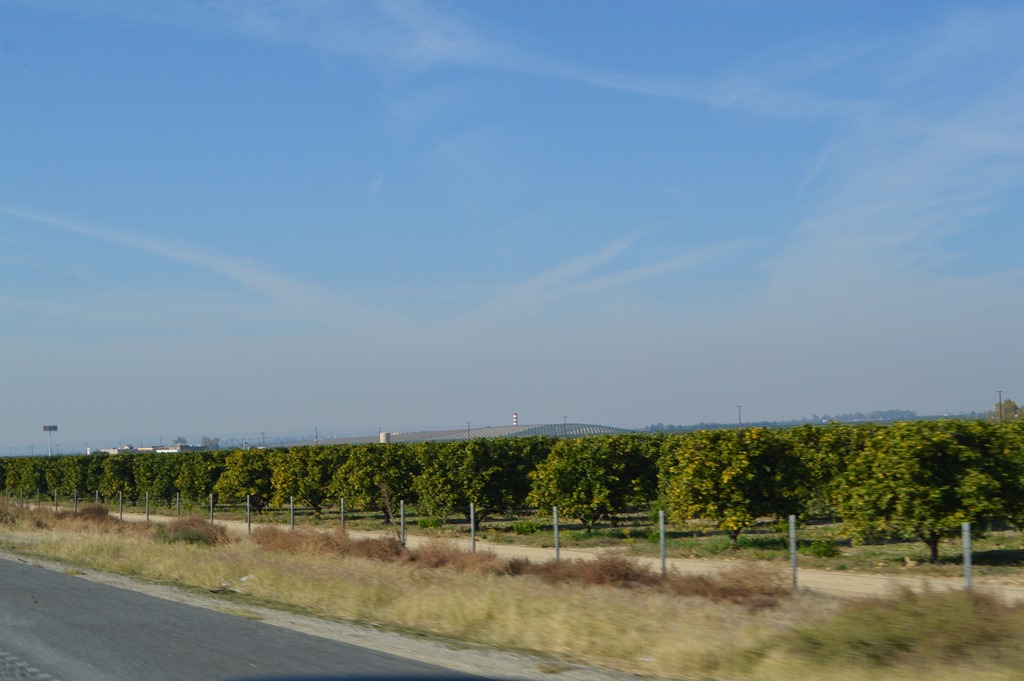
Bakersfield, California fruit orchards
From Highway 58 we drove 20 miles north on Highway 99, California’s main artery connecting Central Valley cities for hundreds of miles from Bakersfield north to Sacramento and beyond. From Highway 99 North we exited onto Highway 46 for the westerly drive across the Central Valley to Monterey County.
The landscape of California’s Central Valley is hard to imagine before the extensive plumbing engineering of the 19th and 20th centuries transformed the environment. Tulare Lake in the Central Valley was once the largest freshwater lake west of the Mississippi. The lake in the valley was named for tule rush along the marshy shores. Tulare Lake was maintained by rivers fed with Sierra snowmelt each year and Central Valley lakes were lined with marshlands and fisheries used by Native Americans for centuries. Large tule elk and grizzly bear resided in the Central Valley. Millions of birds used the marshlands as stopover grounds along the Pacific flyway.
Tulare Lake was farther north of Highway 46 in the Central Valley. West of modern day Bakersfield were Kern Lake and Buena Vista Lake fed by the King River. One of the great drives in California today is Highway 180 in Kings Canyon National Park to the headwaters of the King River deep in the high Sierra.
Loyalty Traveler – Kings Canyon National Park – The mountains are calling and I must go (May 15, 2011).
Within a century of the 1850s Gold Rush era, Tulare lake was drained and water rechanneled to grow vast acreage of crops in the fertile Central Valley soil.
California Highway 46
California Highway 46 is a 111-mile east-west road crossing the Central Valley from Highway 99 in the east to Paso Robles Highway 101 in the west. After 25 miles of valley orchards west of Highway 99, Highway 46 crosses Interstate 5, the main north-south transportation corridor for California.
The drive along Highway 46 northwest of Bakersfield passes by miles and miles of fruit orchards.
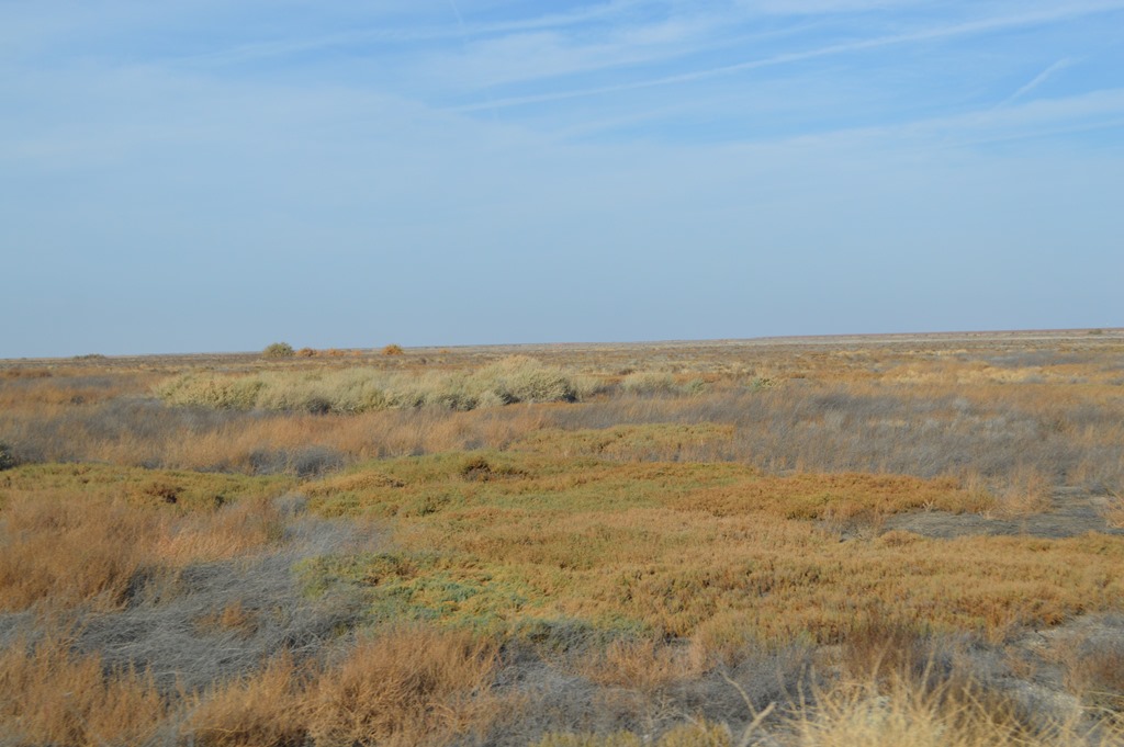
Is this how the natural landscape appeared 200 years ago in the Central Valley of California ?
Lost Hills, California
Lost Hills, a small agricultural and oil workers community of about 2,500 residents, is the only town on the 100 miles of road between Wasco and Paso Robles. People I meet who have never been to California often seem to imagine a highly populated urban environment based on a TV perception of Los Angeles and San Francisco. The reality is most of California is rural with long distances between towns.

Lalo’s Mercado and Carniceria, Lost Hills, California


Water tank behind green sports fields reads “You Have Found Lost Hills”.
Green grass sports fields in the middle of the Central Valley is a luxury considering the annual rainfall in this part of California is only about 5 inches.
California Aqueduct
The California Aqueduct passes through Lost Hills. The state’s major plumbing project is a water channel funneling the state’s water lifeline from northern rivers through the Central Valley farmlands and beyond to the large population centers of Southern California where millions of residents live in an arid ecosystem.
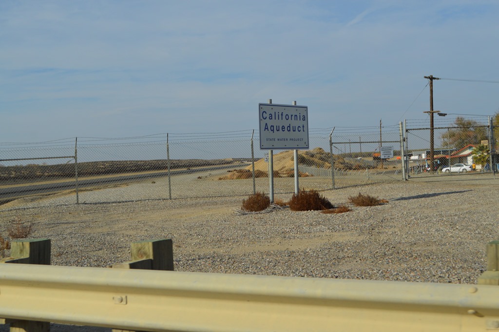
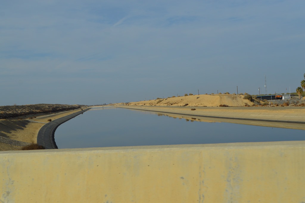
California Aqueduct at Lost Hills
Black Gold in California
One of the central problems in the 2007 Daniel Day-Lewis movie There Will be Blood is the effort to build a pipeline across the Central Valley to transport oil from the Bakersfield region to the coast. I usually recall that movie at some point when driving Highway 46.
Lost Hills is oil country. Lost Hills Oil Field has the sixth largest oil reserves remaining in California. The oil field was discovered in 1910, about the same time period as the early setting for the movie There Will Be Blood.
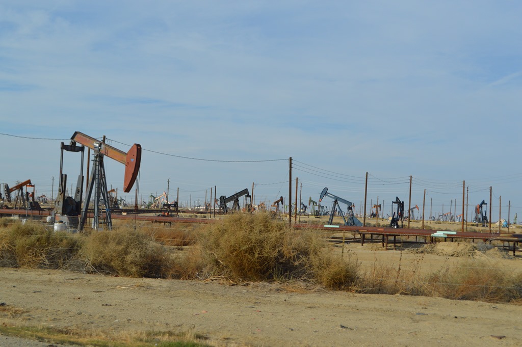
Lost Hills Oil Field
West of the Lost Hills oil fields are several more miles of fruit and nut orchards.

These days most of Highway 46 west of Lost Hills is four lane road.
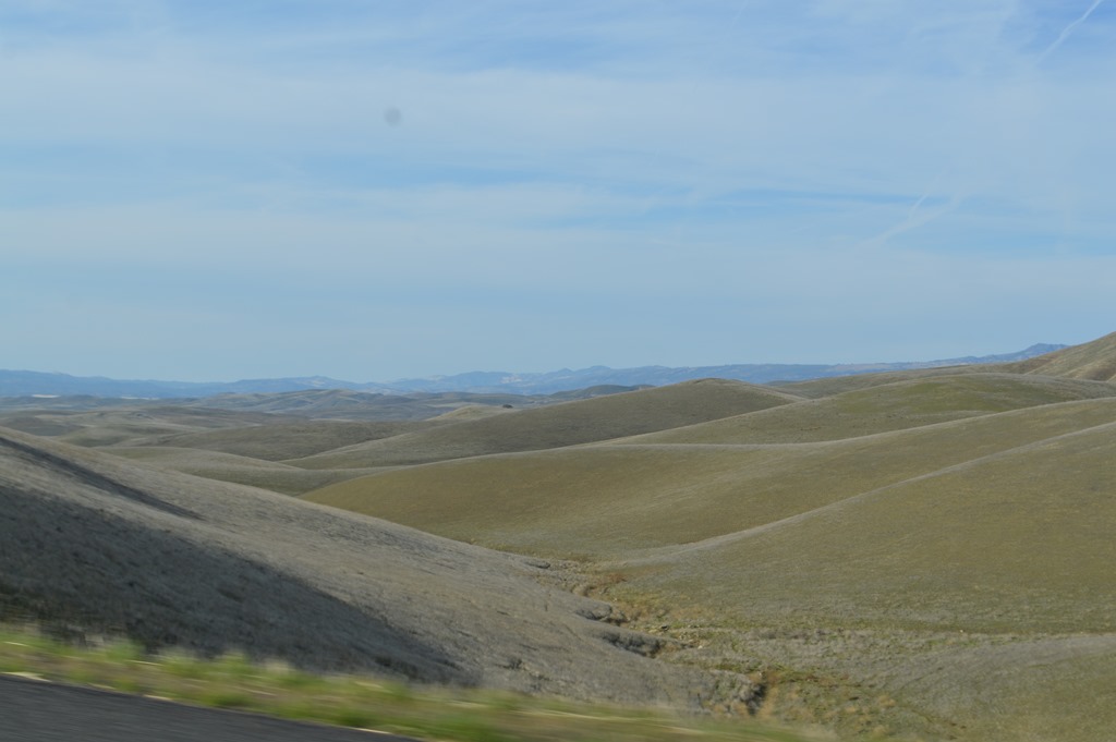
San Andreas Fault, San Luis Obispo County
A decade ago there was a sign on Highway 46 marking the San Andreas Fault. I assume it was repeatedly stolen and they simply stopped replacing the highway marker. The hill country separating the Central Valley from the coast range mountains reveals the undulating topography of the land surrounding the San Andreas fault.
Near the San Andreas Fault in San Luis Obispo County, California.
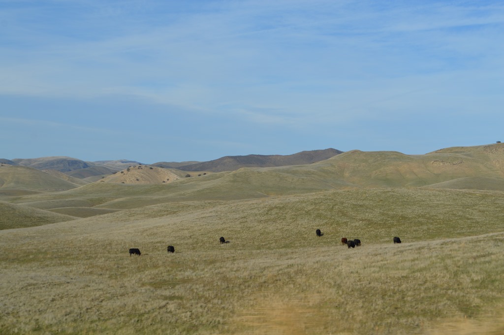
This is primarily cattle grazing country. The green grasses covering the hills are only colorful during the rainy season from November to April. The rest of the year the hilly landscape is various shades of brown.
Highway 46 was a notorious stretch of road for decades with cars passing trucks at high speed on the flat two-lane highway. The junction of Highway 46 to Bakersfield and Highway 41 to Fresno is where actor James Dean died in a car crash Sep. 30, 1955. The highway intersection is named James Dean Junction Memorial.
Rural living in San Luis Obispo County about 25 miles east of Paso Robles.
Paso Robles, California
Paso Robles is what we thought of in Monterey as a cowboy town in the 1980s. These days more cattle grazing land is being cultivated into vineyards each passing year. There are currently more than 200 wineries around Paso Robles.
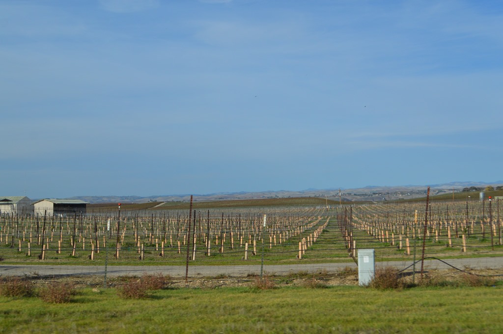
New vineyard planted in Paso Robles wine country.
Mission San Miguel
In Paso Robles Highway 46 intersects with U.S. Route 101, the primary north-south coastal highway for California. Highway 101 passes through the Salinas Valley of Monterey County. The world famous drive 135-mile drive on Highway 1 along the Big Sur coast from Monterey to San Luis Obispo attracts millions of visitors each year. I live beside Highway 1 in Monterey. Paso Robles is 110 miles from my home via Highway 101 and takes less than 2 hours to drive. Continuing west from paso Robles through 20 miles of hills and mountains forming the Central Coast Range to Highway 1 on the coast and driving home to Monterey via the Big Sur route would take 3 to 4 hours.
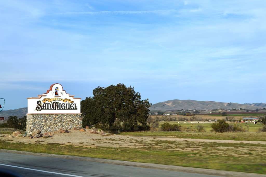
Mission San Miguel beside Highway 101.
There are 21 California Missions along the 600-mile Mission Trail from San Diego to Sonoma, north of San Francisco. Mission San Miguel is one of the easiest to access in a small town beside Highway 101 about 10 miles north of Paso Robles.

Mission San Miguel – 1797.
Salinas Valley, Monterey County, California
Similar to Paso Robles, southern Salinas Valley has many square miles of vineyards. Many of the Napa Valley wineries 200 miles north source their grapes from Monterey County.
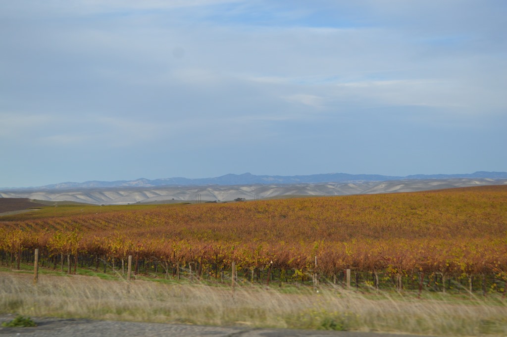
Salinas Valley Vineyards in Monterey County.
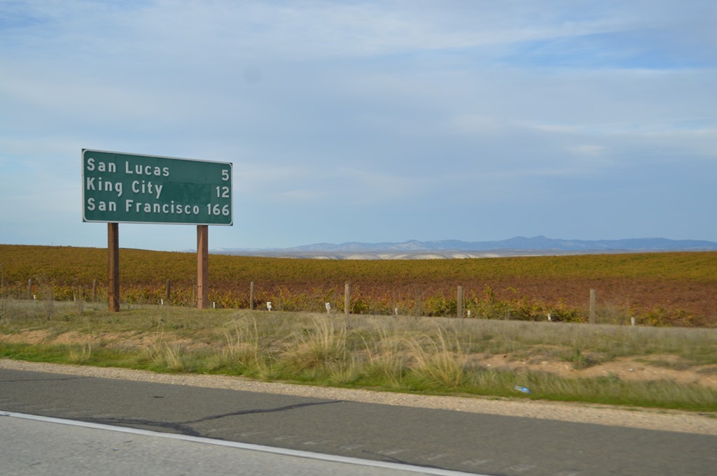
King City 12 miles, San Francisco 166 miles and another 80 miles to Monterey.

Pinnacles National Park is located in the Gabilan Range mountains east of the Salinas Valley.
I have posted two articles about Pinnacles National Park from 2013.
Loyalty Traveler – Bear Gulch talus caves of Pinnacles National Park California
Loyalty Traveler – Pinnacles National Park west side entrance
Monterey – Home Sweet Home
My wife and I are California coast dwellers. Most of her life she has lived near the ocean, aside from living inland at Davis, California five years for college and work. She hates road trips across California’s interior and especially trips across the Sierra Nevada. We have driven a few times from Monterey to Denver and a couple times across country from California to Maine. She says she never wants to make a cross-country drive again, whereas, I love the freedom of driving the back roads of America through flyover country.
We are fortunate to have the opportunity to travel frequently to other places, while never feeling sad about returning home to Monterey.
Monterey is home. I was born here. Kelley moved to the Monterey Peninsula from San Francisco when she was five. We love the natural beauty, small town and wildlife found here on the Central Coast. We tried living in several other places over the years, but once we found our way back to Monterey in 2001 after 17 years away, we knew in our hearts the Monterey Peninsula is where we belong.
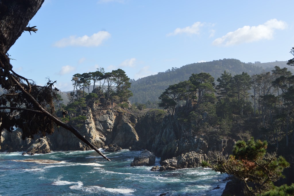
Point Lobos State Park located eight miles south of Monterey.
I spotted several gray whales from Point Lobos heading south over the weekend. The cycle of life here on the central coast means the whales are passing by the Monterey Peninsula in December and January on their annual migration to Mexico.

2 Comments
Comments are closed.