Two things about Napier, New Zealand stand out for me on my fifth day in the area. First are the multitude of song bird species I hear whenever my hotel window is open or I walk around the beach and into town. Turns out I am a little far from town and it takes about an hour to walk into the town center, but it sure is a beautiful multi-sensory walk. The air carries the sounds of singing birds and the smell of spring flowers with seascape vistas from every angle. The second aspect of Napier I have found equally pleasing is the number of locals who, after a simple exchange of greetings as I passed by, turned my casual greeting into a drawn out conversation sharing aspects of this area with me, while I share tales of California and the USA.
What would typically be simple greetings turned into quick friendships with offers to lend me a bicycle, share a meal and meet for drinks. There are some very laid back and trusting people here. I don’t know if that is something a tourist would typically find in the big city of Auckland.
Perfume Point, Ahuriri, Napier, Hawkes Bay, New Zealand
This region of New Zealand is called Hawkes Bay.
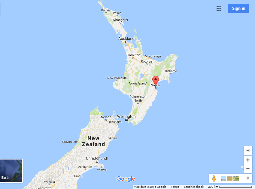
Napier, New Zealand on Hawkes Bay (Google Maps).
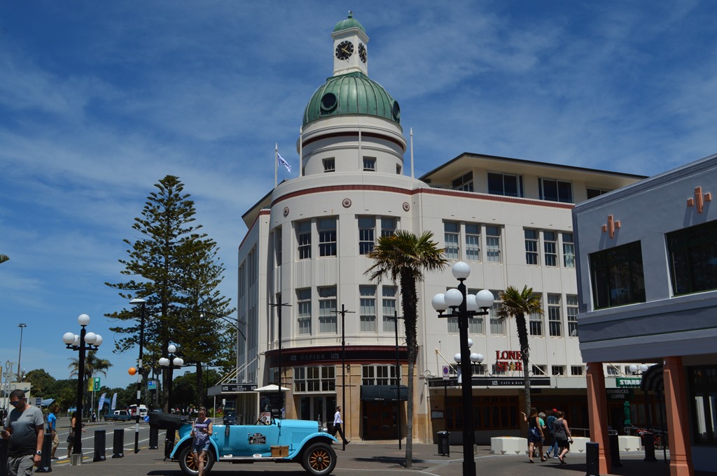
Napier is a tourist destination due to its extensive Art Deco architecture comprising most of the buildings in the town center. The city of Napier is about 60,000 residents. The two main cities here are Hastings and Napier with an urban population of about 131,000, making it the sixth largest population center in the country. Hastings is a major agricultural hub for the country and Napier is one of the main sea ports for central New Zealand. The area is about a 5.5 hour drive from Auckland, which is a drive I almost made when JetStar canceled my flight Monday. Instead, I was able to get a seat for the one hour flight on a later departure. My arrival at Hawkes Bay Regional Airport marks the first time I walked from an airport to my hotel in town, about a mile away.
While the city is filled with tourists interested in Art Deco architecture, the reason I chose this destination was probably due more to its historical significance as the site of New Zealand’s greatest natural disaster. On February 3, 1931 the cities of Napier and Hastings were leveled by a 7.8 earthquake. The epicenter was only 12 miles off the coast from Napier and the shaking intensity was a maximum 10.0 on the Mercalli Intensity Scale. Nearly all masonry buildings in the city of Napier collapsed and much of what remained was subsequently consumed by fire.
This area of New Zealand has a striking resemblance to Humboldt Bay in northwest California, a place where I lived off and on from the early 1980s to 2001. During the 1980s and 1990s I experienced several earthquakes including the Mendocino quakes in April 25-26, 1992 with three earthquakes, the strongest 7.2. That earthquake had a maximum intensity of 9, but I was in Eureka, 40 miles away from the most violent shaking. The initial and strongest quake happened while I was spearheading a teacher education conference in a hotel and the motion of the immense Red Lion Inn building scared the shit out of me and hundreds of other conference attendees. It seemed like the building might very well collapse, but it didn’t. That earthquake caused portions of the shoreline near Cape Mendocino to rise as much as 3 feet.
Here in the Napier region of New Zealand, the landscape saw a significant change in the 1931 earthquake with the land rising up more than 7 feet. The uplift of land resulted in a large inland bay, the Ahuriri Lagoon, rising high enough that most of the land in the lagoon came up to the surface. Hawkes Bay/Napier airport is built on land that was underwater before the 1931 earthquake.
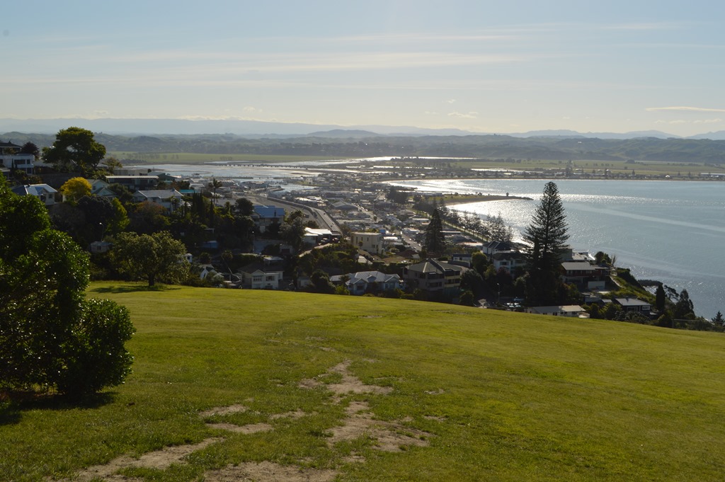
View of Port Ahuriri and Westshore from Napier’s Bluff Hill Lookout. The green spaces in the distance surround the Ahuriri Estuary. Before the 1931 earthquake the entire area was a large inland lagoon with a narrow opening to the open sea. Whaling ships used this lagoon as a port in the mid-19th century.
Humboldt Bay, California is a large shallow bay with a similar small opening to the Pacific Ocean between long narrow sand spits.
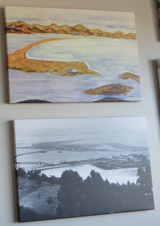
Ahuriri Lagoon and Westshore pre-1931.

Comparison map of the extent of Ahuriri Lagoon before(left) and after(right) the 1931 Hawke’s Bay earthquake. (Wikimedia – Author CrashestoAshes)
There is a fascinating exhibit at the Napier Museum on the 1931 earthquake with a film of survivor stories and the rescue efforts in the hours and days after the earthquake. There were 256 recorded fatalities and thousands of injuries. One of the most interesting details to me from the earthquake stories was reported by the seamen of the Royal Navy Ship HMS Veronica, anchored at Port Ahuriri during the earthquake. A sunken sailing vessel rose out of the water and then descended again, a bad omen. HMS Veronica was lifted out of the water for several minutes before the sea water returned. This vessel is credited for sending out the distress call for immediate assistance and within hours ships set course from Auckland to Napier with medical personnel and equipment.
The ship’s bell from HMS Veronica in the city museum rings in each New Year for Napier.
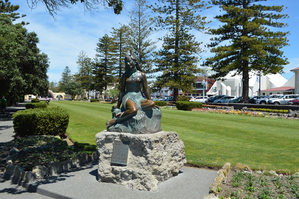
Maui statue on Marine Parade, Napier.
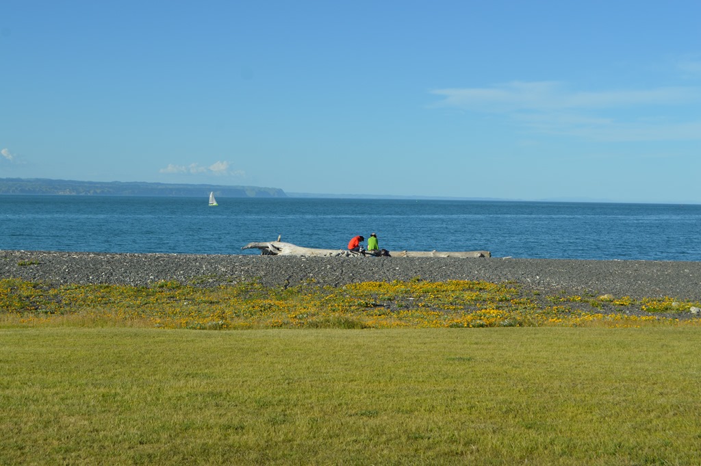
Historic photos of Napier show the Norfolk pines seen today lining the beach of Napier. The extensive grass lawns on the beach side of present-day Napier’s Marine parade sit atop the city rubble deposited on the beach following the 1931 quake.
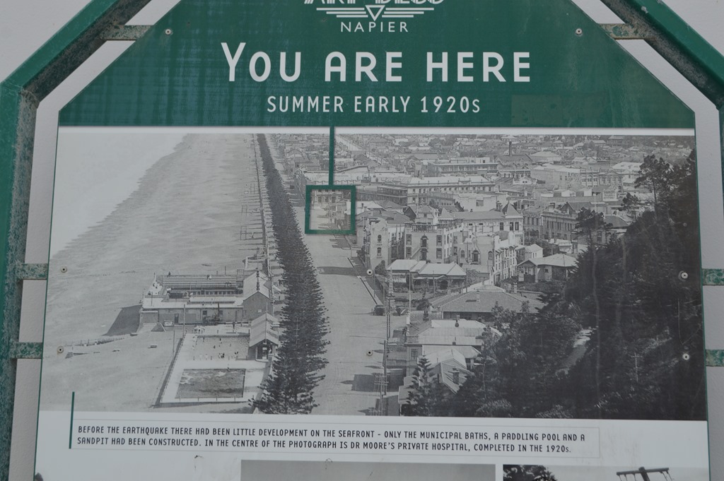
Napier Beach 1920s

Marine Parade and Napier Beach looking south to Cape Kidnappers
As one of New Zealand’s most important port cities, the entire downtown of Napier was quickly rebuilt during the 1930s in the popular Art Deco architectural style of the times. Art Deco architecture is seen throughout much of the United States, particularly for municipal administrative buildings constructed during the Great Depression years of the 1930s through federal public works projects. The significance of Napier is the high concentration of Art Deco structures within the city center today, makes Napier one of the world’s best examples of Art Deco architectural style.

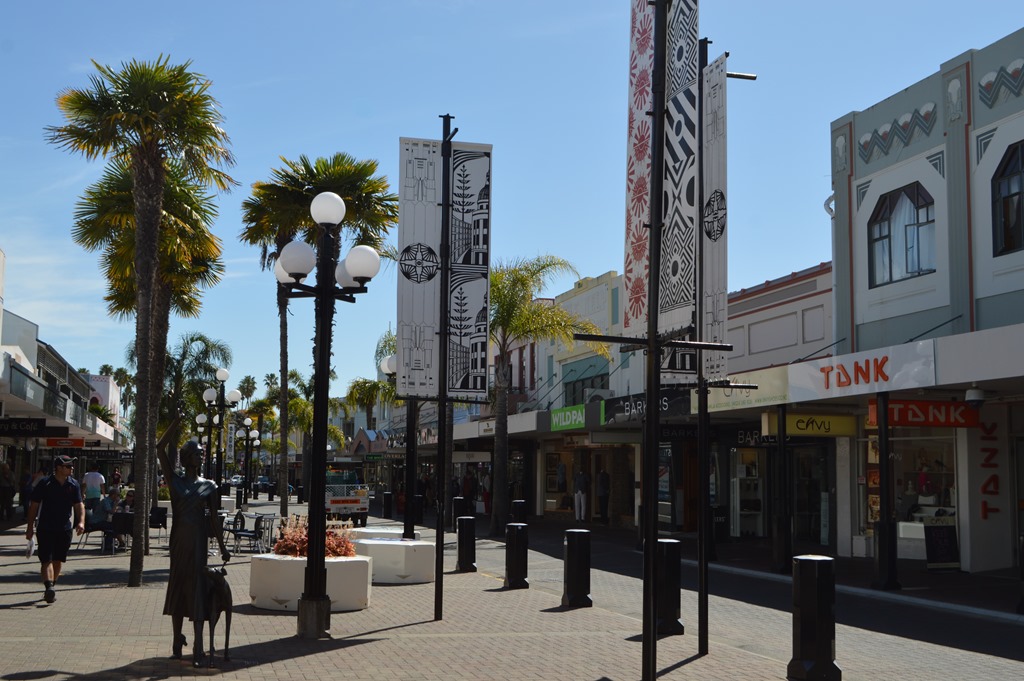
Napier City Centre Art Deco architecture.
Loyalty Traveler Travels – November 2016
New Zealand – North Island Auckland and Napier

Flying to New Zealand tomorrow Qantas $238 round trip SFO-AKL
Qantas Economy San Francisco-Sydney-Auckland hurtling through space and time
Qantas First Class Lounge Sydney Airport
Photo walk around Parnell Auckland
Hotel Review Quality Hotel Auckland Parnell
Hotel Review Econolodge Auckland City Central 6,000 points reward stay
Econolodge Napier, New Zealand – coolest Econolodge anywhere
Sunrise-sunset Westshore Beach, Napier, New Zealand
Napier, New Zealand earthquake history created Art Deco city

6 Comments
Comments are closed.