How they Saved the Old Growth Tall Trees of Congaree National Park.
Congaree National Park evolved out of the environmental movement of the 1970s. The land in this area of South Carolina is a forest floodplain regularly flooded throughout the year from rains that overflow the Congaree and Wateree Rivers. The indigenous native Americans died from a major epidemic of smallpox in 1698. Flooding kept the land from developing as farm land over the centuries.
By 1905 the Santee River Cypress Lumber Company had acquired ownership of much of the forest covered floodplain around Congaree River. Attempts to log the area were hampered by the perpetual dampness of the area. Only trees near the major waterways could be felled and floated. Logging operations ceased by 1915, leaving a large tract of old growth hardwood forest in the Congaree River floodplain area of central South Carolina.
In 1969, the price of lumber created renewed interest in logging the Congaree River basin. Clear-cutting started in 1974 and ignited local individuals and the Sierra Club to protest and campaign for protection of Congaree’s old growth floodplain and swamp forest.
Congress created Congaree Swamp National Monument October 18, 1976 to preserve 15,000 acres of forest. On June 30, 1983 Congaree Swamp National Monument was designated an International Biosphere Reserve. In July of 2001 it was designated a Globally Important Bird Area, and on November 10, 2003 it was designated as the nation’s 57th National Park. – Congaree National Park history.
Tall Trees of Congaree
Congaree National Park boasts the world’s tallest tree for at least 15 tree species. I found an article in American Forests magazine from Summer 2009 describing the tall trees and the adventure of surveying these trees through swamp bushwhacking in the wilderness.
Another distinguishing feature of the Congaree is that many of its trees literally stand above all else. According to the Eastern Native Tree Society, based on direct tape drop or laser measurements by Will Blozan and Jess and Doug Riddle, Congaree boasts the tallest known specimens of 15 species! Emerging above the canopy layer is a loblolly pine that looks down on everything from 167 feet, just 18 feet shy of the Boogerman white pine in Great Smoky Mountains National Park, the tallest known tree in the East. Among the other first-place record holders for loftiness in the canopy are a sweetgum (157 feet), a cherrybark oak (154), an American elm (135), a swamp chestnut oak (133), an overcup oak (131), a common persimmon (127), and a laurel oak (125). No wonder Congaree is known as the “Redwoods of the East”!
The Swamp and the Floodplain
A swamp is a low-lying area saturated with water all year. A floodplain is an area of land a few feet above the adjacent river. When the river overflows its banks, the surrounding area temporarily floods. The Congaree River floods an average of ten times per year creating an extensive floodplain swamp.
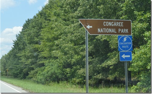
That regular flooding of the low lying area explains to me why I was seeing hurricane evacuation directional road signs 100 miles from the South Carolina coast.
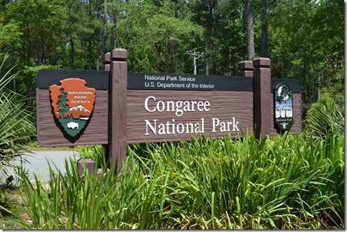
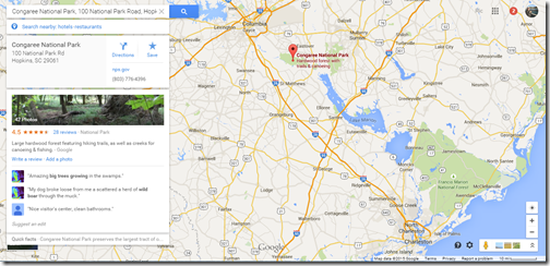
Only around 10,000 people visit Congaree National Park each month. This was a difficult park to locate in South Carolina, even though it is only 25 miles from Columbia, the state capital of South Carolina with 133,000 residents.
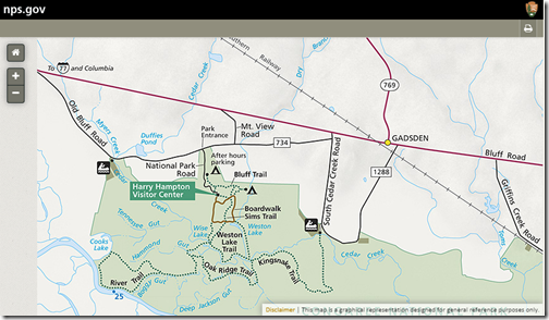
Map of Congaree National Park
Congaree National Park map. I approached from the east on Bluff Road to Gadsden, the only place where I had seen more than five houses in a place and as many churches all over the place for some 30 miles of driving. Access roads south of Gadsden were not marked with National Park signs when I was there June 2015.
Congaree National Park is easily accessible in dry weather with paved roads from Interstate 26, the primary Columbia-Charleston South Carolina route. Columbia is 20 miles to the northwest. Charleston, South Carolina is 100 miles southeast of Congaree National Park.
The main problem I had finding the park was the last sign I saw for Congaree was 13 miles away from the park. Without GPS I would have been unlikely to find the road to the park entrance. Even with GPS, I drove past two roads I was directed to turn down by the voice on my iPhone maps. I ignored my phone directions due to no signage for the national park. I refused to believe the access road to the National Park requiring a full left turn off the main road would not have a National Park sign. After driving another mile, I turned around and turned right on the unmarked road that took me to the park a couple miles away on another parallel paved road.
At the entrance to Congaree National Park, as I waited for a truck coming toward me on the two lane road to pass by, a plastic fast food drink cup was tossed out the window by a passenger in the passing truck.
Congaree National Park, the last big stand of bottomland hardwood trees
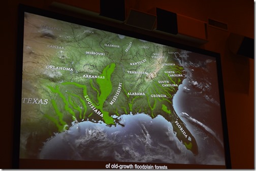
From east Texas to Virginia, there were 24 million acres of bottomland hardwood forest 300 years ago along floodplains for rivers. Forests were cleared and land became farms. Congaree National Park preserves the largest remaining tract of old growth bottomland hardwood forest remaining in the southeast U.S. The old growth foret in Congaree is fewer than 15,000 contiguous acres.
The forest canopy at Congaree averages about 100 feet, making it one of the tallest deciduous temperate forests in the world. Congaree old growth trees are taller than old growth forests found in eastern Europe, southern South America, Japan and the Himalayas.
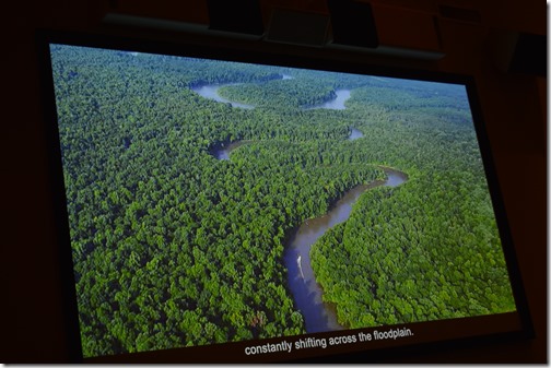
The floodplain feature of Congaree National Park results from a gradual elevation change of only around 20 feet over 20 miles of the Congaree River.
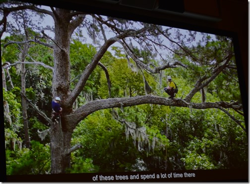
Images above are photos I took of the Congaree National Park Visitor Center film.
On the Boardwalk of Congaree
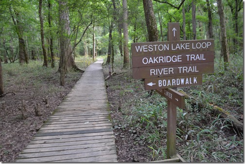
The Visitor Center video inspired me to brave the 93 degree afternoon heat of early June and take a hike on the 2.4 mile boardwalk extending out from the visitor center. The deer flies around the parking lot were the first impediment to enjoyment of the outdoors.
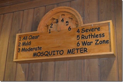
Mosquito Meter is marked between Moderate and Severe.
The visitor center sold a natural oils National Park brand insect repellant for $4.95 and it kept me bite free during a two hour hike of several miles in the swamp along the boardwalk and dirt trails.
Walking alone on the boardwalk in a swamp I did not know with sounds in the brush, bugs and birds clicking, buzzing and singing took my mind off the high heat and humidity.
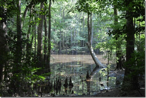
Wise Lake, Congaree National Park
The natural oils insect repellant worked wonders.
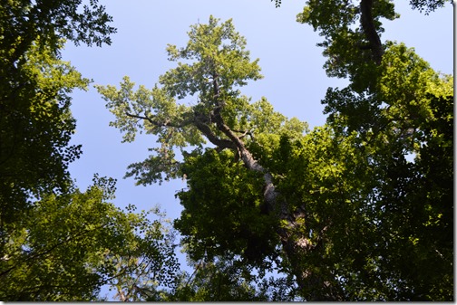
Trees are difficult to photograph and make interesting when your only vantage point is the ground looking up.
Congaree National Park is about 26,000 acres with about 15,000 acres of the park designated as wilderness area. Canoe transportation is one of the primary means of exploring the park.
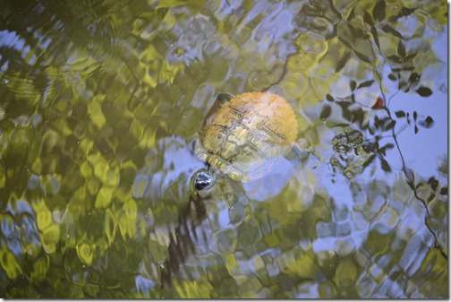
Turtle in Weston Lake, Congaree National Park
Congaree National Park was a great place to chill in the sweltering heat of a floodplain swamp on a June afternoon among the birds and the bees and the trees.




5 Comments
Comments are closed.