California had an environmental marine disaster yesterday when a ruptured oil pipeline that runs along the Santa Barbara County coastline leaked for several hours with tens of thousands of gallons of oil reaching Refugio State Beach three days before the Memorial Day holiday 3-day weekend.
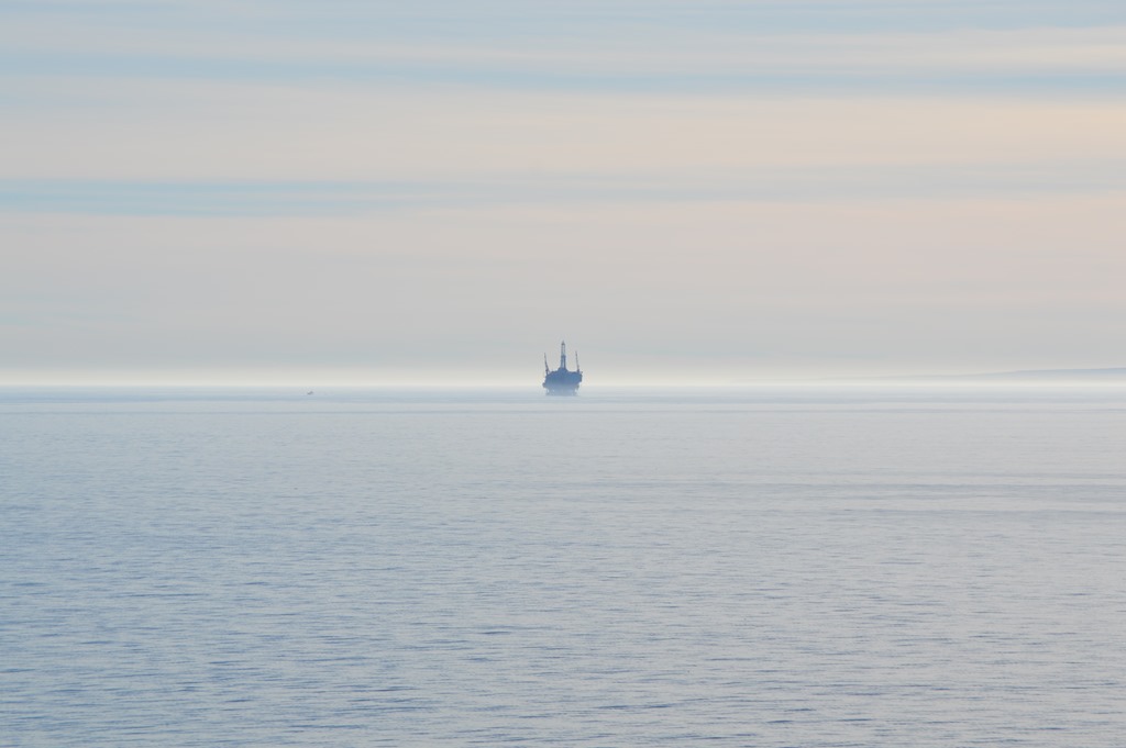
About 18 months ago when driving from San Diego home to Monterey, I stopped on one of the oil industry access roads for the All American Coastal Pipeline to photograph the oil rigs in the Pacific Ocean off Santa Barbara County. The oil is piped from the sea rigs to the coast and under the railroad tracks and Highway 101. This is a rural cattle and fruit trees region for 25 miles of coast north of University of California Santa Barbara until Highway 101 turns inland. Vandenberg Air Force Base, one of the primary missile bases of the U.S. military controls the coast north of Gaviota Beach until you reach the area around Santa Maria and Pismo Beach.
Offshore oil rigs are not present in California north of Santa Barbara County. Santa Barbara is a city of about 80,000 residents and is the most desirable coastal location in California within easy driving distance to Los Angeles in less than two hours.
Goleta is the last town north of Santa Barbara before about 20 miles of rural beaches, farms and ranches. Oil industry infrastructure is all around, but mostly unseen.
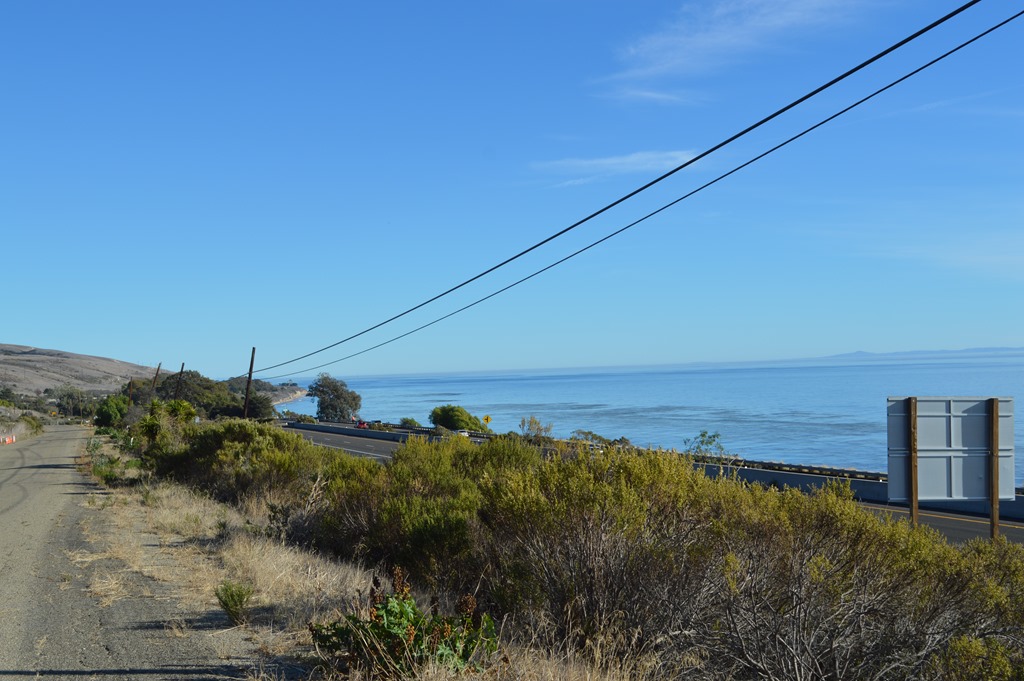
This photo is taken from the pipeline access road above Highway 101 between Refugio Beach and Gaviota Beach.

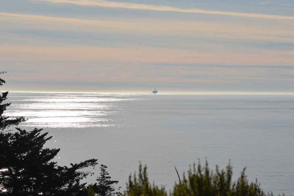
Channel Islands National Park is the land mass in the distance behind the oil platform.
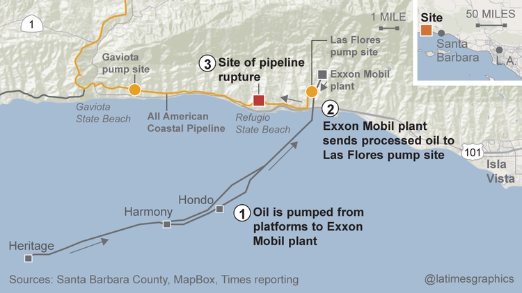
The offshore oil production platforms Hondo, Harmony and Heritage have produced over 500 million barrels of oil since 1981. Hondo set the record in 2010 for the deepest well by an offshore drilling rig at 7,000 feet below the surface.
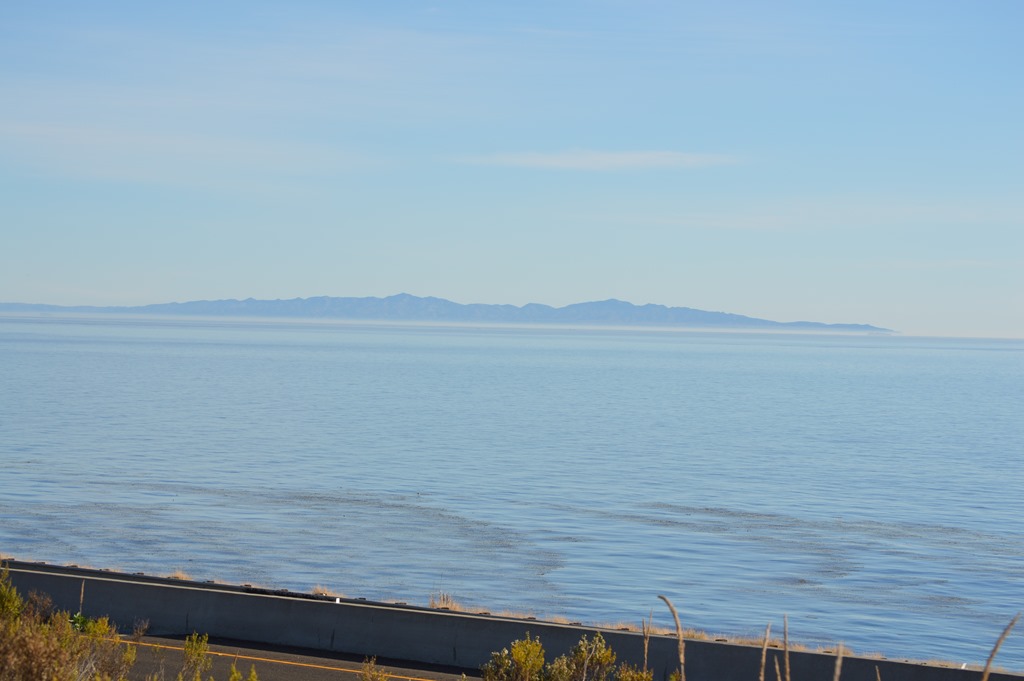
Driving Highway 101 along this stretch of coast is one of the most beautiful sights in California. The Channel Islands are in the distance. A nutrient rich kelp forest is growing in the sea here from the ocean floor to the surface providing habitat for many fish and marine mammals.
LA Times has a piece with the most information I have read so far on the oil spill and map graphics of the oil pipeline and area.
LA Times – Oil spill in Santa Barbara County may have released up to 105,000 gallons (May 20, 2015)
The difference between an oil spill here on the beaches of California compared to the Arctic, where Shell recently received drilling approval for new exploration, is there are people around Refugio State Beach to witness the horror of sea lions swimming through oil and pelicans on the beach unable to fly. The initial reports I read stated it was a beach visitor who first reported smelling oil fumes around the beach.
Another graphic in the LA Times piece shows previous oil spills for Santa Barbara area. This is one of the biggest spills since the 1969 offshore drilling disaster that spilled 80,000 to 100,000 barrels of oil into the sea and was California’s biggest environmental marine disaster of the 20th century.
Last year I went to Avila Beach, California for the first time. That entire town had to be rebuilt after they discovered oil had polluted the coastal town 25 years ago from years of oil leaking out of corroded pipes.
Loyalty Traveler – Remote, beautiful vacation land on California’s toxic central coast (March 24, 2014).

1 Comment
Comments are closed.