The landscape of southern coastal Georgia in late afternoon sunlight was one of the prettiest sights I saw on my Atlantic coastal road trip. Once I crossed the state line at St. Marys River into southern coastal Georgia, the landscape seemed different from what I had seen in northern Florida. U.S. Route 17 parallels I-95 for a more rural experience on a two-lane road running through pine forests and marsh grasses in between towns.
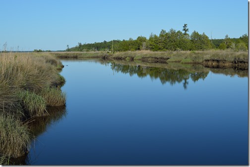
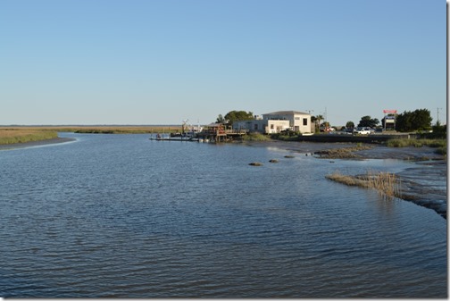
Boat ramp launch off U.S. Route 17 in southeastern Georgia.
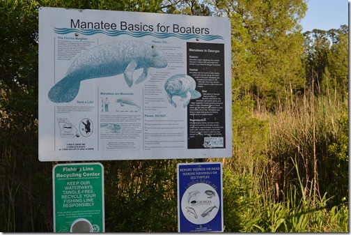
“Manatee Basics for Boaters” sign beside the boat launch provided information about manatee marine mammals that can be found along Georgia’s coast.
Manatees are an endangered species with an estimated 5,000 residing in Florida. They can’t remain in water that drops below 68 degrees F. Their native range is southeastern Georgia and Florida and they winter near hot springs or near energy plants with warm water discharge. An adult manatee is about 1,000 pounds in weight and 9 feet in length. They feed on sea grass and other aquatic vegetation. They are referred to as sea cows.
Manatees primary danger is boat strikes. Most manatees are reported to have propeller injury scars. In 2000 there were 78 manatees reported killed from boat and watercraft collisions. There are speed limits in some manatee waterways, however, most Florida counties have no manatee protection programs in place. U.S. Fish & Wildlife Service North Florida Ecological Services Office – Florida Manatee Recovery Facts.
I’d love to see a manatee in the wild. The upper St. Johns River in northern Florida is one area where the population of manatees is increasing with several hundred residing in the river.
No manatees or alligators were seen by me in the marsh.
Sidney Lanier Bridge U.S. Route 17 rises 480 feet over Brunswick River, Georgia.
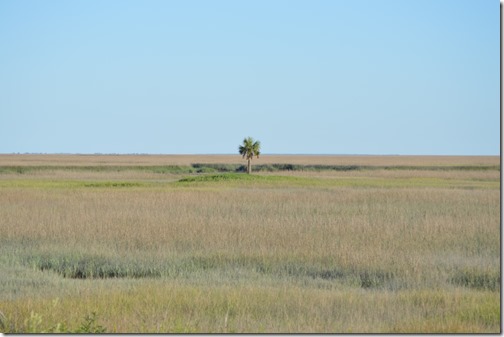
On of my favorite images was seen off the highway just before reaching the road cut-off to Jekyll Island and before taking the Sidney Lanier Bridge to Brunswick. There was a palm tree sitting all alone in a sea of marsh grass.
Lonely palm in Georgia.
A sign on the road leading to Jekyll Island read, “Jewel of Georgia”. Jekyll Island is mostly undeveloped as a state park. There is a good travel read on Jekyll Island on this blog Adventures with Lance and Erin.
In Brunswick, Georgia there was a road pull-out where about eight guys were crabbing from a dock. I stopped and walked out to the dock to chat. Along the way there was a sign about Georgia’s coastal marshlands and shoreline.
- 500,000 acres of estuaries.
- 3,400 miles of tidal shoreline.
- 100 miles of sand beaches.
- 14 Barrier Islands.
- 8 State Parks and historic sites.
- 13 State Wildlife Management Areas.
- 2 National Monuments.
- 1 National Seashore.
- 5 Federal Wildlife Refuges.
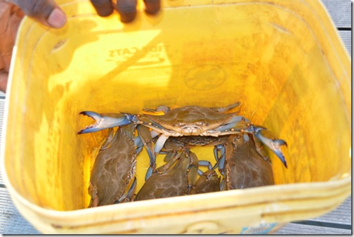
Blue crabs being caught off the dock with twine and chicken.
Brunswick, Georgia marsh where young guys were crabbing off the dock. One of the fishermen suggested I go to St. Simon’s Island for good scenery. There was less than 90 minutes of daylight left and taking a detour to St. Simons meant I would drive the remaining 80 miles to Savannah in the dark.
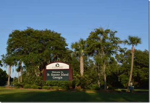
I headed to St. Simons Island. There were gorgeous old live oaks on St. Simons Island. The size of the old oak trees is even more fascinating since I read that the island was practically clear cut of live oaks for shipbuilding in the 19th century.
St. Simons Island, Georgia
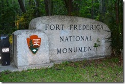
Fort Frederica National Monument is on St. Simons Island. The significance of the fort is this island was the British coastal defense for Georgia and in 1742 a battle here defeated the Spanish and ended Spain’s attempts to establish territorial control of the Atlantic coast north of Florida.
The park had closed at 5pm, two hours earlier than my arrival. A gate blocked the road.
James Oglethorpe (1696-1785) was the founder of Georgia. Oglethorpe was elected a Member of Parliament in 1722 and led the committee on prison reform. His criticism of England’s prison system was the urbanization of society and lack of opportunities for poor. He crafted a plan to develop an agrarian family-farm society of small landowners in Georgia. Indentured servants from England’s debtors prisons could start a new life and eventually become self-sufficient farmers. The colony of Georgia created in 1732 would also act as a buffer between South Carolina and Spanish Florida. Oglethorpe banned slavery in Georgia. This led to some slaves fleeing South Carolina for Georgia. In 1743, after Oglethorpe left the Georgia colony, the ban on slavery ended.
Charles Wesley was secretary to John Oglethorpe. His brother John Wesley arrived in Georgia as the Church of England Anglican religious leader for the colony. His first Sunday sermon On March 14, 1736 occurred under a great oak tree, ‘The Wesley Oak’ on St. Simons Island. He remained less than a year in Georgia finding his work ineffective among the colonists. Soon after returning to England, John and Charles Wesley founded the Methodist Church in 1738.
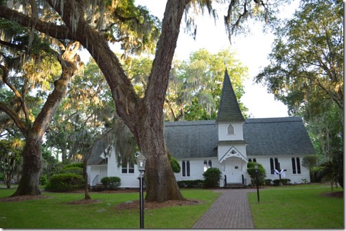
Christ Episcopal Church (1884) St. Simons Island. This congregation was established in February 1736 and this was one of the eight original Georgia parishes established in 1758. The first church built on this property in 1820 was nearly destroyed in the Civil War. Large oaks surround the church property today.
Darien, Georgia where once there were many trees.
In the fading light, Darien, Georgia was my last US Route 17 stop before jumping on I-95 to drive the remaining 60 miles to Savannah in the dark. Fort King George is the oldest fort in Georgia from 1721 and is now operated as a Georgia state historical park.
Darien was founded by Scottish Highlanders in 1736. The City of Darien was chartered in 1818. The Bank of Darien, also founded 1818, was the strongest bank south of Philadelphia with seven branches in Georgia.
Huge lumber mills along the Altamaha River made Darien one of the great eastern seacoast ports. Depletion of timber resources brought the logging era to an end in the early 1900s. These days Darien is a quaint small town one mile off I-95 known for its shrimping fleet and tourism.
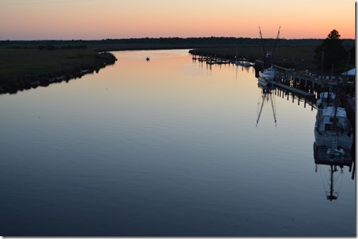
Altamaha River at Darien, Georgia.
A little over an hour later I arrived in Savannah and checked into Andaz Savannah, a Hyatt Hotel. Here is my review of the Andaz hotel: Hotel Review: Andaz Savannah Suite.
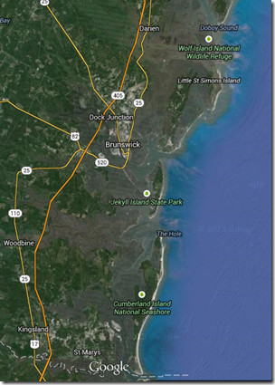
Google Maps St. Marys River to Darien and Golden Isles of Georgia, USA.
Atlantic Coast road trip May 3-11, 2014
Flying to a coastal Atlantic road trip adventure (May 3, 2014)
Jacksonville and the St. Johns River (May 4, 2014)
St. Augustine, Florida: History in Black and White (May 5, 2014)
Casa Monica St. Augustine, Marriott Autograph Collection (May 6, 2014)
Road tripping Highway 17 St. Augustine to Savannah, Georgia (May 13, 2014)
$15 to $20 per day in May for one-way rental cars out of Florida (May 7, 2014)
Notes from the Atlantic Intracoastal Road (May 9, 2014)
If I’m Ever Back This Way (May 9, 2014)




1 Comment
Comments are closed.