Some days I feel the need to disconnect from the virtual world that earns my living, turn off the computer, turn on my car, head over the hill to Carmel-by-the-sea and continue driving south on Highway 1 to the Big Sur where I tune back into nature.
Cell phone generally says “No Service Available” in most places along the Big Sur coast.
Even out here on the western front of California standing over the Pacific Ocean, miles from a store, cell tower or electrical connection, one can still connect to the web in a natural way.
 [click on image to enlarge]
An orange glow filtered my view of the outdoors for two days in Monterey as a controlled burn on the former Fort Ord artillery base was set to burn about a square mile of brush. This clears the landscape to find unexploded bombs left around since the base closure in 1994. The incredibly scenic ocean views and unique sand dune landscape of the Monterey Bay on California’s central coast was used as an artillery range for some seven decades from 1917 to 1994.
The burnt glow from the sky gave beautiful color reflections all around the Monterey Peninsula.
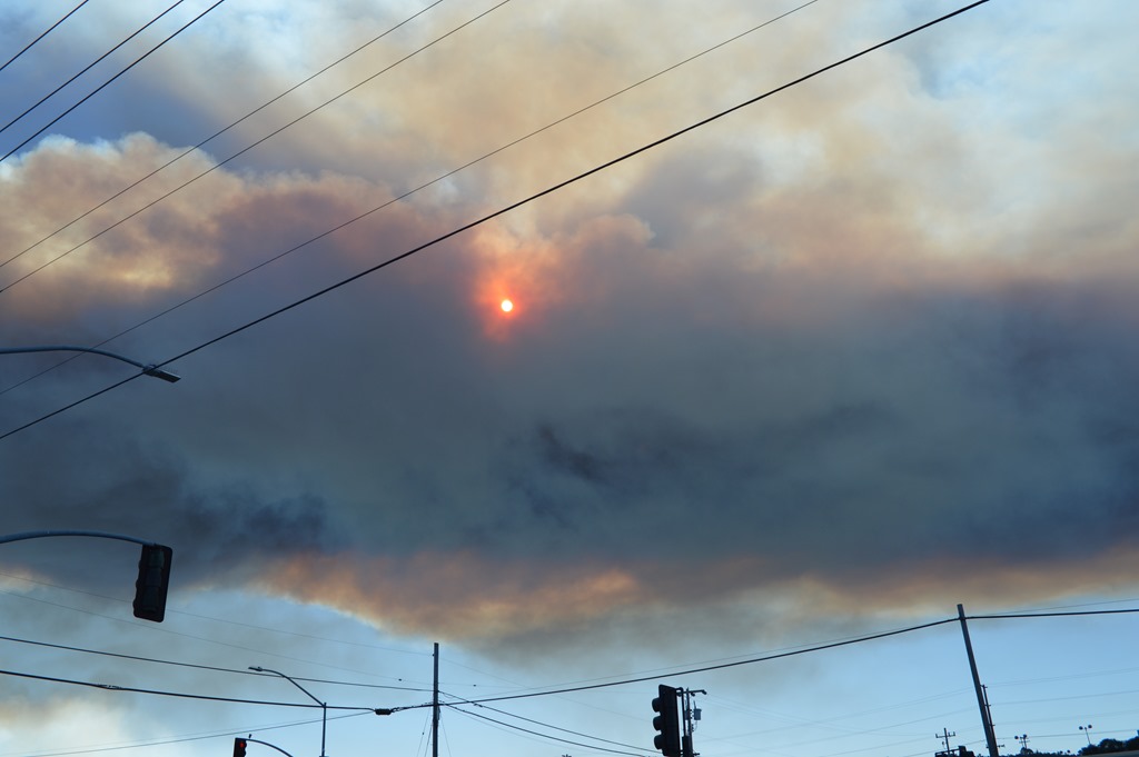
Fire Glow. Smoke from Ft. Ord fire made it a good day to get in my car and drive away from Monterey.
Unfortunately, the first ten miles I drove south were trailed by the smoke flowing south with me.
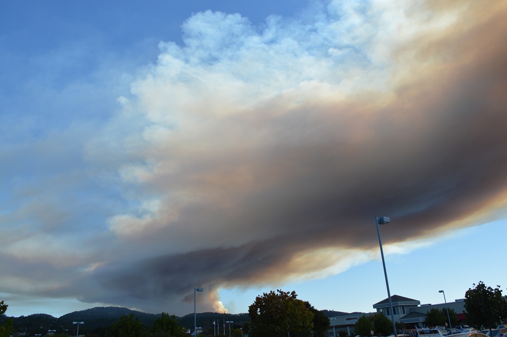
Carmel-by-the-sea Safeway parking lot looking north to the smoke heading south.
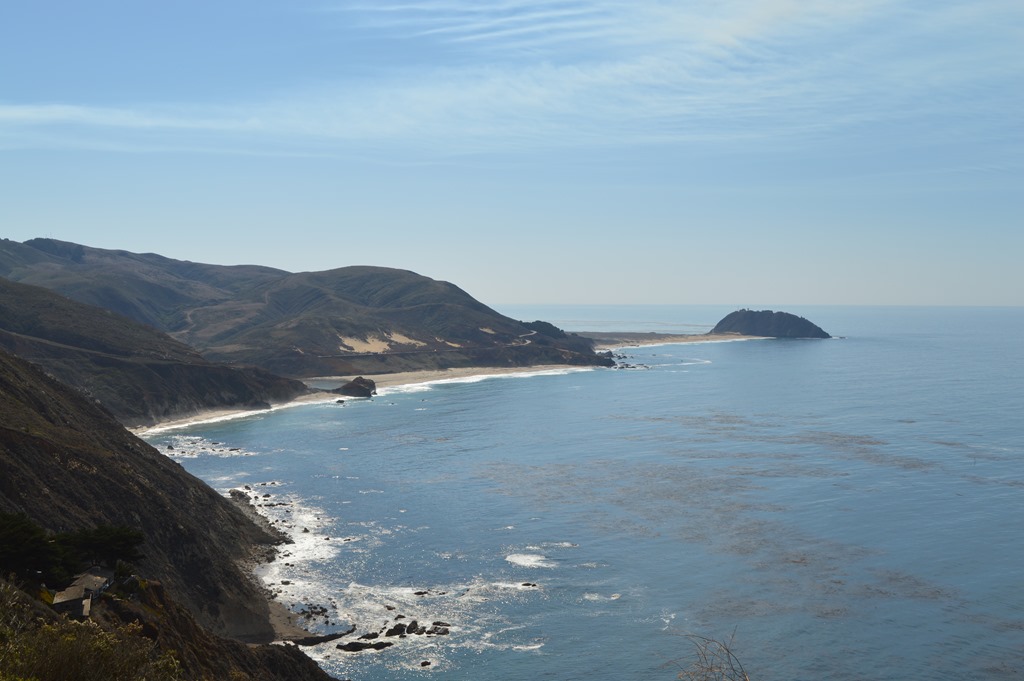
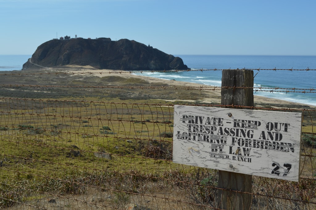
Another mile to reach Carmel River State Beach Monastery Beach, a beach directly off Highway 1 just before Point Lobos State Park, where most of the people who drown in these parts tend to drown.
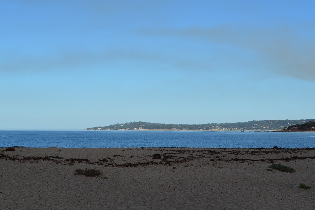
Monastery Beach, Carmel River State Beach looking across Carmel Bay to Pebble Beach.
There is a real Carmelite Sisters by-the-Sea monastery here across from Monastery Beach, hence the name.
Smoke over Monastery Beach, Carmel River State Park.
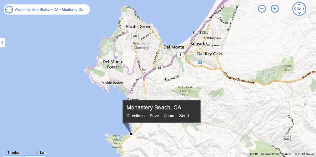
This Bing Map has a better display for my purposes than the Google Map with way too many place names. The controlled burn is in the upper right between Laguna Seca race course and Del Rey Oaks, north of Highway 68, the Monterey-Salinas Road.
I have to laugh at this Microsoft-Nokia map. This entire area is referred to as the Monterey Peninsula by locals, yet Monterey, the historic capital of Alta California from 1777 to 1846, and the town where the state of California was created by a Constitutional Convention in 1849, is shown as Del Monte on this map.
Del Monte Hotel was a great U.S. hotel resort built in 1880 and the Del Monte Forest is better known today as Pebble Beach while the land of the original Hotel Del Monte is now the United States Naval Postgraduate School relocated from Annapolis, Maryland in 1951.
California’s Most Historic Resort Hotel Del Monte is an 8-page PDF file on the Naval Postgraduate School educational website showing the history and magnificence of this historic hotel. Definitely an item to check out.
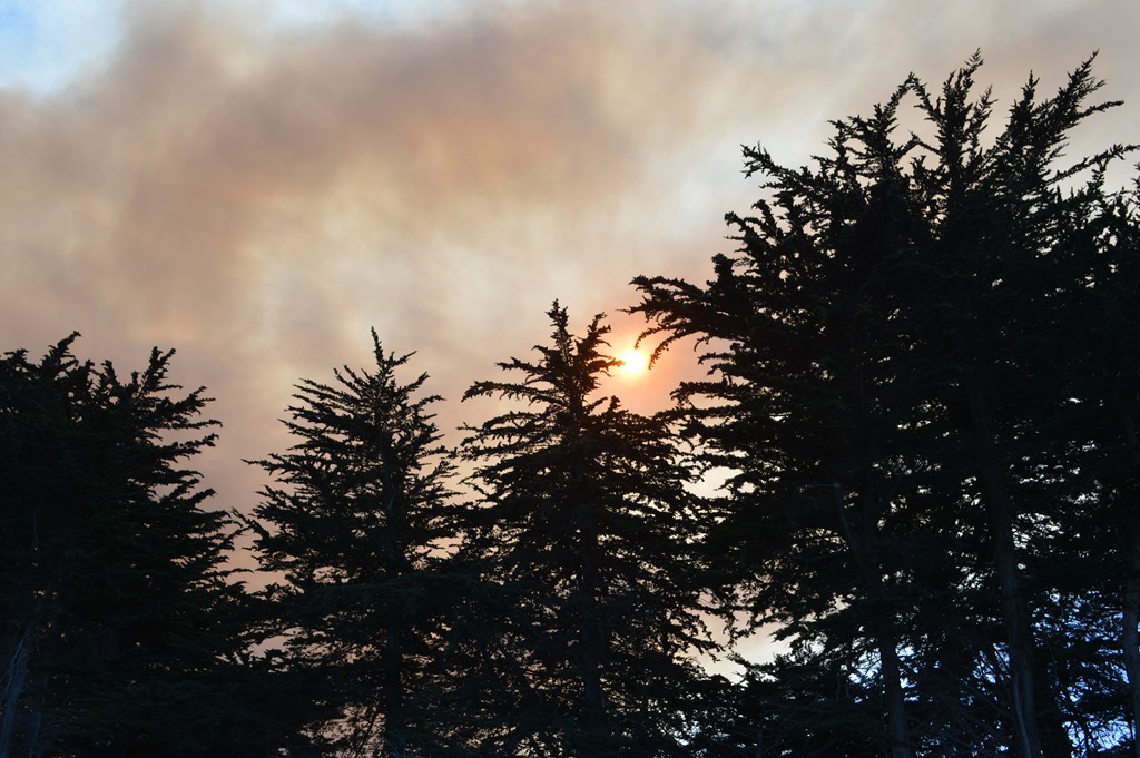
The mind wanders in Big Sur open space.
The smoke was wandering south too.

Hurricane Point looking north.
On Hurricane Point I watched through binoculars as a pod of 50 or so porpoises or dolphins ( I can’t tell the difference from 560 feet elevation) swam their way north. Check out this website showing a 360 panorama from Hurricane Point Highway 1, north of Point Sur.
Point Sur, nearly 30 miles from the fire revealed smoke-free skies.
A Monarch Butterfly fluttered its way north across my view at Point Sur, perhaps making the journey to Pacific Grove. Flutter is truly the word to describe the unpredictable motion of a butterfly in flight. I saw Monarchs in several places along the Big Sur coast, however, their erratic and constant movement made it too challenging for me to snap a photo of one. I did not see a resting Monarch.
Rental vehicles filled the road and restaurants on an 80-degree clear sky day in mid-October. This is perhaps the best week of weather in 2013. I sought respite in a quieter place than the common stopping points for Big Sur tourists at Rocky Point, Post Ranch Inn, Ventana Inn, Big Sur Taphouse or Nepenthe.

Henry Miller Memorial Library is a laid back rest area in the redwood forest.
Wi-fi too.
There was a concert outside in the forest here when I drove by three weeks earlier. The movie screen over the stage is regularly used for free film showings.

A 500-year old coast redwood tree fell through the fence in December 2012. The valuable wood may bring in as much as $200,000 sold as slabs.
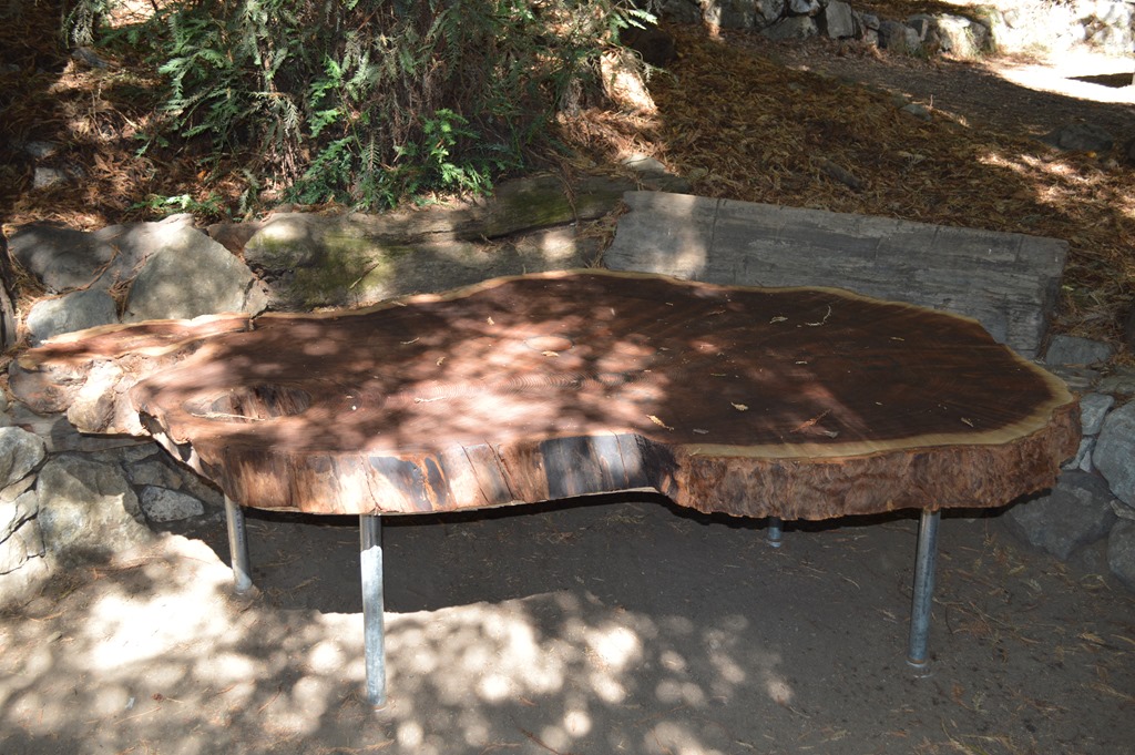
This table is one of the redwood slabs. I counted rings quickly and I could estimate they were in the hundreds of years.
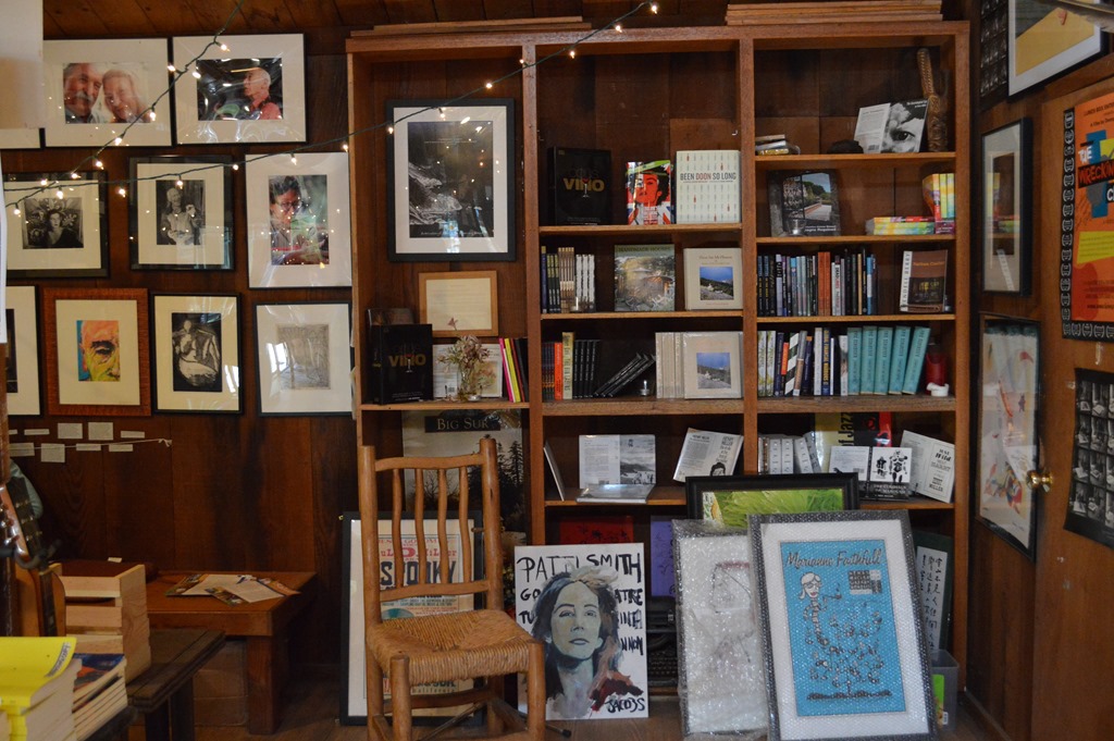
Inside the Henry Miller Memorial Library are cool records, books and memorabilia from Henry Miller’s career and life, along with works of other artists, musicians, entertainers and writers.
The guy working in the library, after being asked about the music playing inside at the time, was describing the music website where the visitor could download a 21-minute music show for free.

Theo the Cat chillaxing on the bench.
Next to the fence separating the Henry Miller Memorial Library grounds from Highway 1 were other redwood slabs from the fallen giant, resting like coffins on bails of hay, waiting to be claimed among the slab remnants of the deceased.
Redwood slabs graveyard. I inspected the body parts.
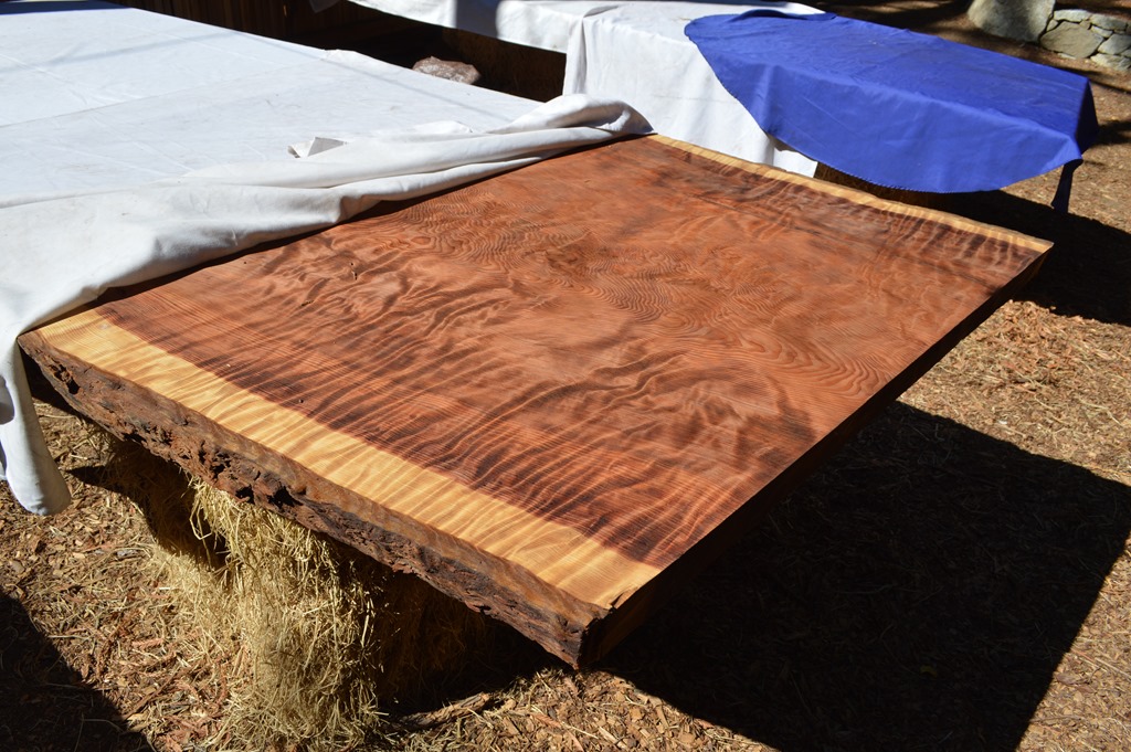
RIP December 2012 – Henry Miller Memorial Library redwood slab.
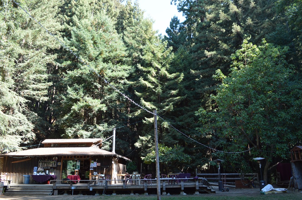
Henry Miller Memorial Library, Big Sur, California.
I paid my respects to art and nature, then headed south on Highway 1 across a few more coastal canyon bridges.

I got back to the garden of Julia Pfeiffer Burns State Park in a secluded place overlooking the Pacific. I had not sat there for the past couple years. A place reached by climbing over and ducking under the old cypress tree branches growing low to the ground to reach a rocky alcove on the cliffs looking to the Big Sur southland of Monterey County, California.

Julia Pfeiffer Burns State Park, Big Sur, California
Read Wikipedia if you don’t know Henry Miller, the American writer (1891-1980). His novel Tropic of Cancer was declared literature by the U.S. Supreme Court in 1964 after being banned from the U.S. since its publication in France in 1934. Henry Miller moved to Big Sur in 1944 and stayed some time.
Ric Garrido of Monterey, California is writer and owner of Loyalty Traveler.
Loyalty Traveler shares news and views on hotels, hotel loyalty programs and vacation destinations for frequent guests. Check out my page of collated current hotel promotions.
Follow Loyalty Traveler on Twitter and Facebook and RSS feed or subscribe to a daily email newsletter of Loyalty Traveler blog posts on the upper left side of this page.

2 Comments
Comments are closed.