I have driven across Utah six times over the past three years taking six different highway routes through the state. The feature of Utah I bet most travelers don’t realize is how mountainous the landscape truly is across the state. Driving across Utah usually means traveling at elevation of 5,000 to 8,000 feet with peaks over 10,000 feet visible from most locations in the state where the air is often clear enough to see over 100 miles.
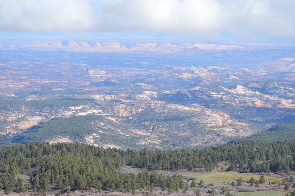
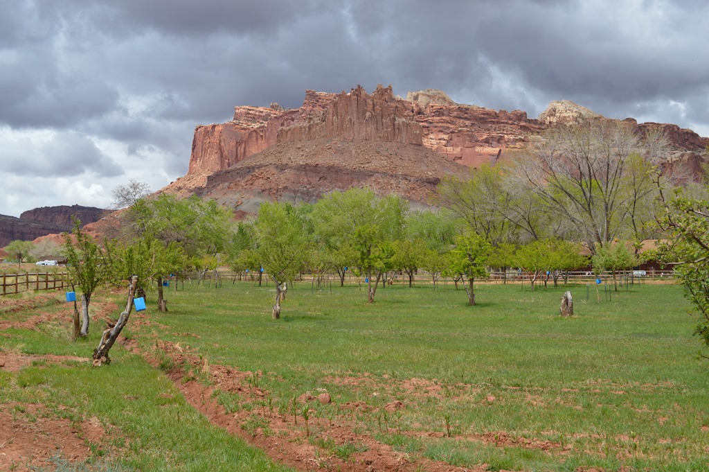
View from Highway 12 north of Boulder, Utah on the slopes of Boulder Mountain (11,317 feet) looking over the Grand Staircase Escalante National Monument, one of the last regions of the lower 48 states to be mapped by the U.S.G.S. About 42% of the state of Utah is federal land managed by the Bureau of Land Management.
This is tough country. There have been four reported deaths in the Grand Staircase Escalante National Monument over the past month, generally due to hikers running out of water and dying from heat exhaustion.
So is among four hikers to die this year while hiking in high temperatures in southern Utah. Three others died while hiking near The Wave rock formation in Kane County. On Monday, 27-year-old Elisabeth Ann Bervel died while hiking with her husband on their fifth wedding anniversary. Less than a month earlier, Ulrich and Patricia Wahli — 70 and 69, respectively — died of heat exhaustion.
Canyons within canyons
My trip last week through Utah was a fast two-day excursion on Interstate-70 to Interstate-15 between Denver and Las Vegas. Most travelers probably never venture off the Interstate to see the National Parks that are within a one to two hour drive from various points along the highway. Last week I was driving a moving truck and avoided stopping or traveling off the interstate. My landscape photos in Utah are from the previous three road trips with a trip in May 2013 giving me the opportunity to visit all five National Parks in Utah.
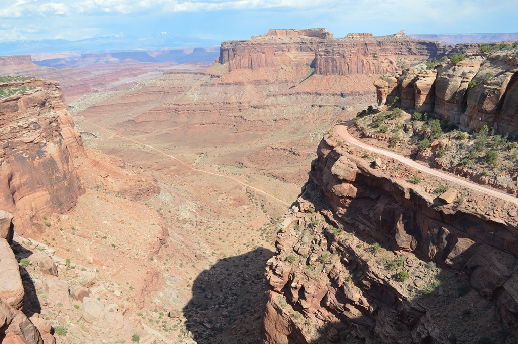
Canyonlands National Park is the least visited and most remote of the five National Parks in Utah. I met a hiker from Denver in May at nearby Arches National Park who told me he had hiked into serious trouble in Canyonlands when he took a wrong turn into a slot canyon and ran out of water after two days. He needed to be rescued. Letting friends and family know your plans is crucial in this remote wilderness country.

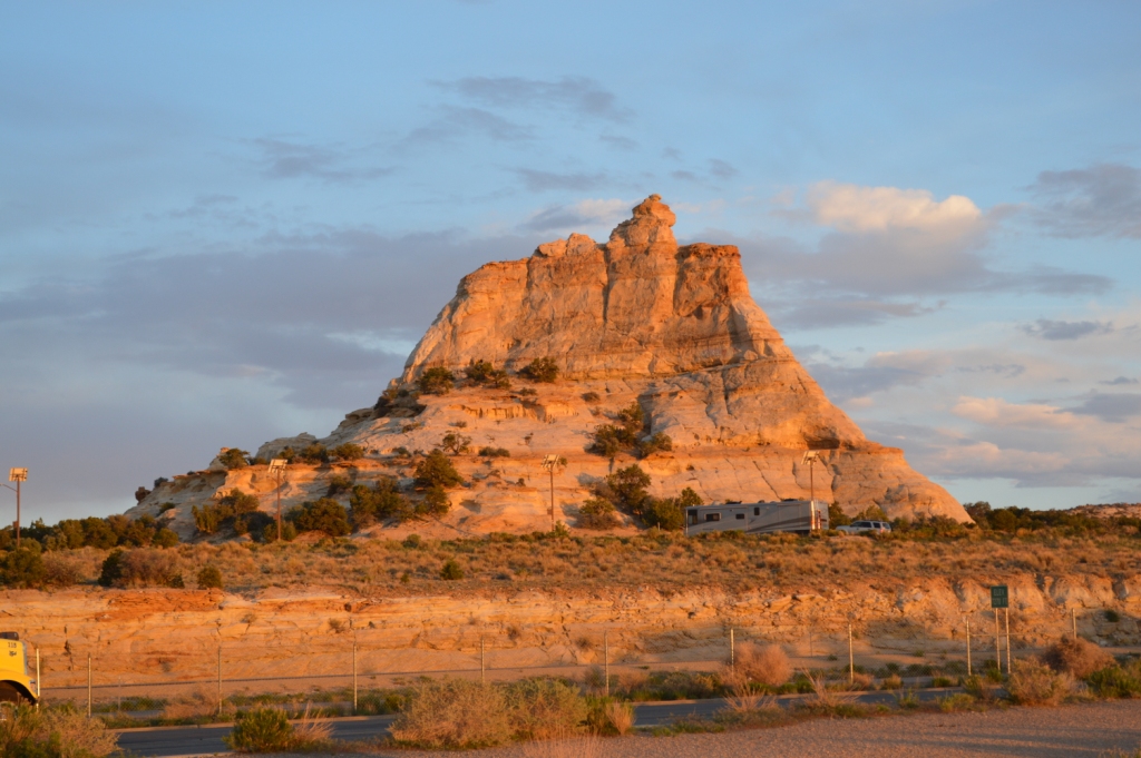
Henry Mountains were the last mountain range in the lower 48 states to be formally named by the U.S.G.S. in 1872 during the Powell Expedition. Joseph Henry was the first secretary of the Smithsonian.
I think many Americans have a historical image of Utah Mormon culture defining the state when it is actually a culture of America’s settlements that is apparent to me as a traveler through the rural parts of the state. Most of the historical landmarks in Utah mention settlement by Mormon pioneers in the 19th century. Then again, many of the historical markers of Nevada and California also mention Mormon pioneers. Travel around the American West and stop in enough places to learn history and the contributions of Mormons to western expansion of the U.S. is undeniable. There were some hardy folks crossing the deserts and finding land suitable for agricultural in the 19th century in some of the most remote lands in the country.
At Capitol Reef National Park there is the Historic Gifford Homestead Museum and Store, a Mormon pioneer cabin where staff inside also sell fresh baked pies. The original house was built in 1909 and the Gifford family lived in the house from 1928-1969.
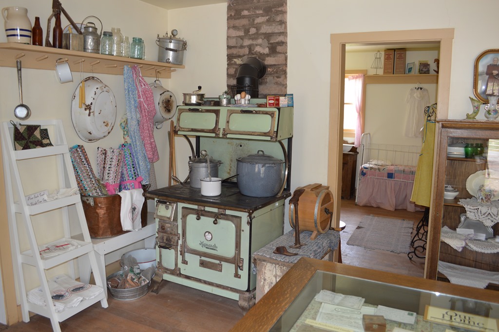
Inside the Gifford Homestead.

Few stores within 100 miles meant self-reliance in most aspects of life for Mormon pioneers.

The Fremont River provided water for irrigation to support a small Fruita Valley farming community in the early 20th century in the area now encompassed by Capitol Reef National Park.
Visitors to Capitol Reef National Park can pick fruit from the orchard trees in season. Next to Canyonlands, Capitol Reef is the second least visited National Park of the five parks in Utah.

Fruita Schoolhouse (1896) served as the school for community children up to 8th grade. The schoolhouse also served as the community center. The school closed in 1941. Inside the locked schoolhouse today the room is filled with desks and teaching materials.
The historic town of Fruita ended once the Gifford family transferred their farmland to the Capitol Reef National Park. The National Park Service now manages the land.
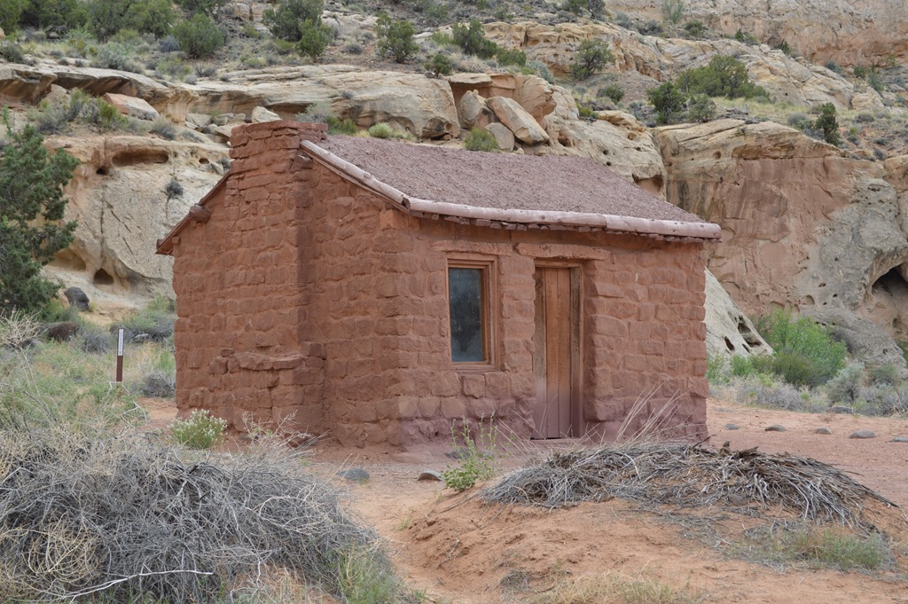
Behunin Cabin (1882) served as the residence for a family of ten, among the earliest Mormon residents of the area, until flooding of the Fremont River forced the family to abandon their home after the crops washed out.
Modern Radio Rocks over Utah Swells
One might think Utah is filled with Mormon Tabernacle Choir on the radio. There are some long stretches of highway in Utah with very few facilities like gas and lodging and markets to buy a cold drink. But nearly everywhere in Utah I was able to locate a radio station that rocks.
Taking long road trips exposes me more to country rock. I’d rather hear a good story being sung by a country rock lyricist to hold my attention on a six hour drive than hear AC/DC, Aerosmith and Cheap Trick for the thousandth time.
On the drive over the San Rafael Swell in Utah I heard a public broadcasting radio station play the same song twice. First the song version played was by Townes van Zandt, songwriter of Marie (YouTube link). Driving in a truck at 70 mph, the lyrics were kind of hard to make out, but the song was captivating with imagery of poverty and homelessness in America. Our days in Denver the week before had been an exercise of navigating around hard-living homeless folks on the streets as we stopped at numerous stoplights driving across the city day after day and fending off panhandlers.
The Utah public radio station followed that version of Marie with the same song performed by Willie Nelson (YouTube link). Willie’s enunciation and voice were clearer. I pulled into the rest area at Ghost Rock with tears in my eyes and a story picture in my head. I love storytelling songs.
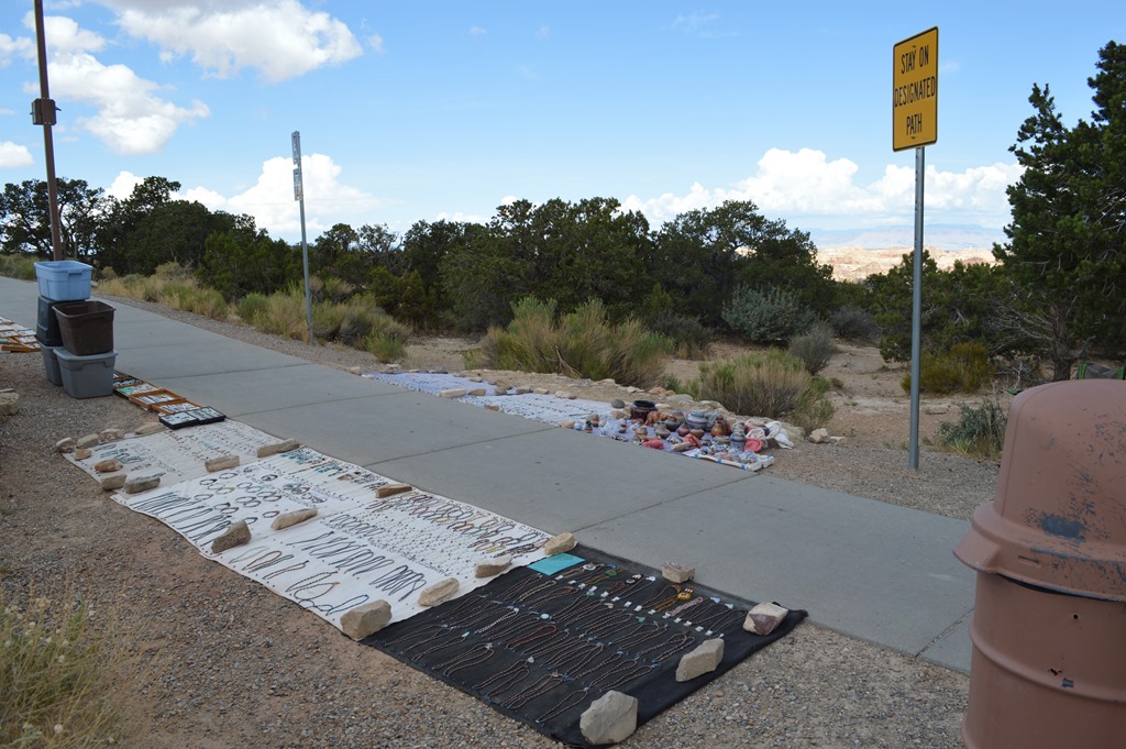
An old Native American woman had jewelry displayed by the sidewalk near the toilets at the Ghost Rocks rest stop area.
I snapped dozens of photos of sunset on Juniper trees at this location in May 2013, yet the photos seem to be missing from my computer in the ‘Mystery of Ghost Rock’.
Eureka Update – turns out I never downloaded the backup memory card photos after filling my primary 16GB card that day.

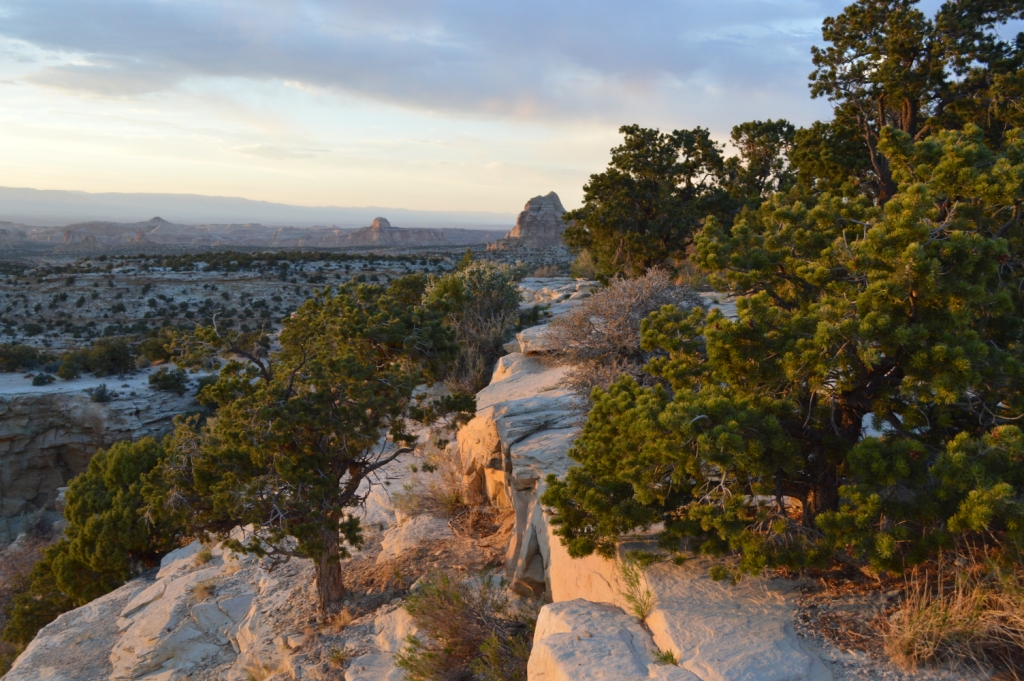
I-70 Ghost Rock Rest Area, Utah
Townes van Zandt died New Year’s Day 1997. A song like Marie reminds me of Woody Guthrie, Bob Dylan and Bruce Springsteen. It is kind of country outlaw music, and that seems so appropriate when driving the San Rafael Swell of Utah.
Between Fremont Junction and the junction of SR-24 near Green River, Interstate 70 crosses a geologic feature called the San Rafael Swell. The construction of the freeway through the swell is listed as one of the engineering marvels of the Interstate Highway System, with one engineer claiming this section as “one of the most significant highway construction feats of its time”.[1] The construction of I-70 through the swell required boring through many solid rock canyons, cliffs, and mountains.[14] The swell is noted for its sheer canyons and rock formations and is home to a large amount of exposed dinosaur remains. This includes the largest known collection of Jurassic era dinosaur remains at the Cleveland-Lloyd Dinosaur Quarry at the north end of the swell.
San Rafael Swell – Wikipedia Interstate 70 in Utah.
Utah is one of those places where Kelley and I look out over the same landscape, yet we see different things. Kelley sees rock and dirt and a place where death is around the corner. We saw a lot of road kill on the highways of Utah.
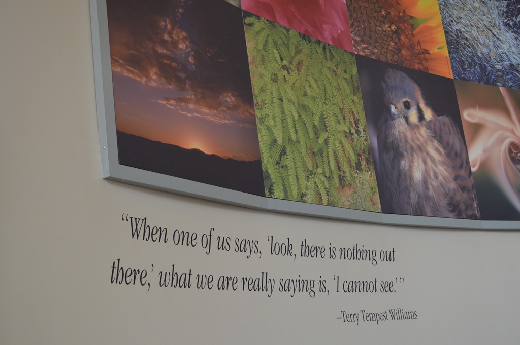
“When one of us says, ‘look, there is nothing out there,’ what we are really saying is, ‘I cannot see.’ â€Â — wall collage at Grand Staircase-Escalante National Monument Visitor Center, Tropic, Utah.
I look out over Utah and think this is still the frontier of America where the outdoors is challenging and adventureful with a raw and harsh beauty few travelers through the region ever experience.
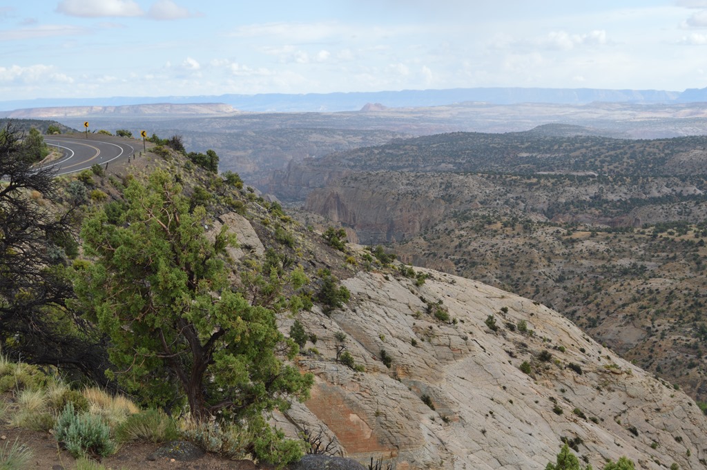
Highway 12 through Grand Staircase Escalante National Monument.
Richfield, Utah is a town of 7,500 residents and the largest town in south central Utah for 100 miles in any direction.
Monroe Peak and mountains in Sevier County south of Richfield rise to over 11,000 feet. Sevier County is 50% larger than the state of Rhode Island, yet has only about 20,000 residents.
Richfield, Utah is near the halfway point on the 1,000 mile drive between Los Angeles and Denver over Interstate 15 and Interstate 70. That seems to be the explanation why this small town has hotel brands in Marriott, Hilton, IHG, Best Western, Choice and Wyndham.
Ric Garrido, writer and owner of Loyalty Traveler, shares news and views on hotels, hotel loyalty programs and vacation destinations for frequent guests.
Follow Loyalty Traveler on Twitter and Facebook and RSS feed or subscribe to a daily email newsletter on the upper left side of this page.

2 Comments
Comments are closed.