U.S. Route 50 through Nevada is dubbed ‘The Loneliest Road in America’ based on a July 1986 Life magazine article.
This is the section of highway that Life magazine and the American Automobile Assn. called “the loneliest road in America.”
“It’s totally empty. There are no points of interest. We don’t recommend it. We warn all motorists not to drive there unless they’re confident of their survival skills,” the July issue of Life quoted an unnamed AAA counselor as saying about U.S. 50 in Nevada.
Los Angeles Times – August 25, 1986
Life on the ‘Loneliest Road’ : 287-Mile Stretch of U.S. 50 Is America Minus Tourist Traps – Charles Hillinger, Staff Writer
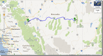
Yesterday, Kelley and I drove U.S. Route 50 from Carson City to Ely, Nevada on a clear skies day with the temperature mostly between 90 and 100F.
There are basically five towns along the 320-mile route. More towns if you start in Fernley, Nevada which is on the way if you begin in Reno, but out of the way if starting in Carson City on the main Route 50 Highway.
- Carson City (our mile marker 0)
- Fernley (34 miles east of Reno on I-80 and not on the U.S. 50 route from Carson City.)
- Dayton (13 miles east of Carson City.)
- Fallon (51 miles east of Dayton; 63 miles east of Carson City.)
- Austin (111 miles east of Fallon; 174 miles east of Carson City.)
- Eureka (70 miles east of Austin; 234 miles east of Carson City.)
- Ely (77 miles east of Eureka; 311 miles east of Carson City.)
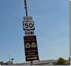
U.S. Route 50 in Carson City. The road follows portions of two National Historic Trails: The Pony Express Trail and the California Trail.
The Pony Express Trail
The Pony Express Trail is legendary Americana folklore of the wild west. The image of a sole rider on horseback crossing the desert at breakneck speed to deliver a mail pouch is what we were taught in school and in the media.
One piece of the real story for the Pony Express was the vital necessity for communication between California and the eastern part of the United States Union in the buildup to Civil War in the late 1850s and at the outbreak of war in April 1861.
The Pony Express allowed information to be transmitted between St. Joseph, Missouri and Sacramento, California in ten days travel in each direction. Stagecoach routes for mail took a month.
The first rider dispatched for the Pony Express left St. Joseph, Missouri on April 3, 1860.
The Pony Express ceased service October 24, 1861 once the transcontinental telegraph was completed allowing communication between California and the eastern states of the Union.
U.S. Route 50 and the Pony Express Trail
U.S. Route 50 crosses over the Pony Express Trail in several locations. I am sure there are Nevada historical markers about the Pony Express Trail, but we did not stop to see them. There was one location where there were large wooden markers on both sides of the road stating Pony Express Trail crossing, but these signs were in a location with no place to pull off to the side of the road. We whizzed by the markers at 70 mph.
Sharing the Road Trip Experience
Since this is a personal blog and not a magazine article, I will share one of the difficulties of traveling with my companion. My wife Kelley has very little interest in the history of the American west. Kelley whipped through the first three towns of Dayton, Fallon and Austin without stopping the car. Walking around in the 90 degree heat was not her idea of fun.
The town of Dayton was excusable since I was busy reading about U.S. Route 50 on my iPhone and totally missed the town. Fallon is ‘Top Gun’ country with a Naval Air Station in the middle of the Nevada desert.
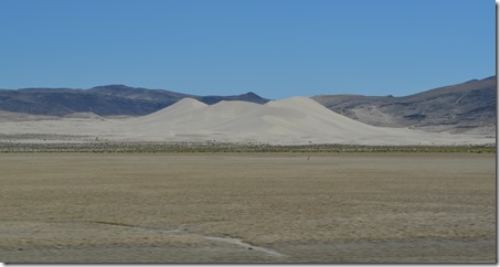
We zipped past an interesting geological location called Sand Mountain about 90 miles east of Carson City. A massive sand dune in the desert where there was no other sand around was an interesting sight to see.
Kelley rolled down her window to let me take a photo at 70mph.
Sand Mountain, Nevada is 600 feet high and two miles long.
By the time we reached the historic town of Austin, our driving relationship was getting a little tense.
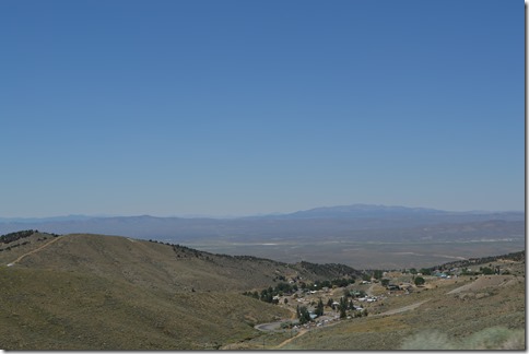
Austin is a remote, small town with a population around 450 at an elevation of 6,605 feet. Highway 50 rises up steeply in switchback fashion from Austin to Austin Pass at 7,484 feet. In the 1860s this silver mining town was the second largest town in Nevada with a population near 10,000.
Austin, mother town of mining camps, sprang into being after William Talcott discovered silver at this spot on May 2, 1862. Talcott came from Jacobsville, a stage stop six miles to the west on the Reese River, the first Lander County seat. He was hauling wood out of Pony Canyon directly below, when he made the strike that set off the famous “Rush to Reese.”
A town called Clifton flourished briefly in Pony Canyon but fast growing Austin soon took over and became the county seat in 1863. Before the mines began to fail in the 1880’s, Austin was a substantial city of 10,000 people. From Austin, prospectors fanned out to open many other important mining camps.
Austin Historic Marker
After driving through Austin without stopping, I told Kelley this is not the fun way to take a road trip. She told me I could do all the driving for the rest of the day over the next 300 miles and stop anywhere I wanted. The loneliest part of this U.S. 50 Highway road trip was when we stopped talking to each other for a couple of hours until we reached Ely.
If you want to see the five hour drive in desirable Kelley speed, less than ten minutes to cross Nevada, then I suggest you watch this finely filmed time-lapse video on YouTube of the U.S. Route 50 drive from Fernley to Ely in 9:31 min.
If driving alone I would have likely photographed every historical marker and old building along the road.
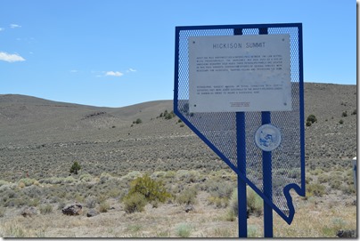
There are numerous Nevada historical markers dotting U.S. Route 50. Kelley pulled over to let me photograph this one at Hickison Summit describing how the indigenous people would hunt at this popular deer crossing. Just east of the marker there is a BLM park at Hickison Petroglyphs Recreation Area.
Nevada Historical Marker at Hickison Summit. The petroglyphs are just east of Hickison Summit.
Eureka, Nevada
Eureka, Nevada is 70 miles east of Austin.
Kelley and I lived in Eureka, California for ten years on California’s North Coast of Humboldt County. I have wanted to see the old mining town of Eureka, Nevada for a couple of decades.
The towns of Austin and Eureka are small and even at the slow 25 mph speed limit the passage takes about one minute to go through these towns. There are many historic brick buildings from the 1860s in Eureka.
Now that I was in the driver’s seat, we stopped for a walk through the old town Eureka. There is a Best Western hotel on the west end of town.
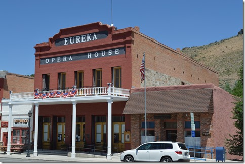
Eureka Opera House (1880)
Eureka was founded in 1864 by a group of miners from Austin, Nevada who found silver in these hills. Lead mining was even more significant to the economy. Eureka became Nevada’s second most important mining town in the 1870s, exceeded only by the Comstock Load that made Virginia City the largest city (population 15,000) in Nevada at the time.
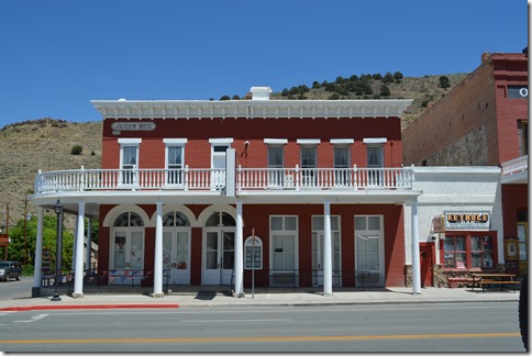
Jackson Hotel, 1877.
The sad thing about Eureka, Nevada in 2013 is this little town seemed to have a serious lack of a serious tourism economy.
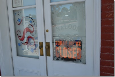
Sign on the door of the Jackson Hotel.
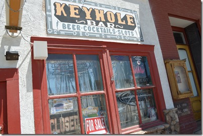
For Sale sign on the door of the Keyhole Bar between the Jackson Hotel and the Eureka Opera House.
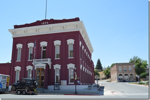
Eureka County Courthouse, 1879 and Eureka Historical Museum in background.
Eureka Courthouse – Built in 1879-1880 from locally fired brick and of sandstone quarried nearby, the Eureka County Courthouse remains a fine example of boom town Victorian opulence. This relic, scene of many famous trials, lives on in reflected glory of days of when Eureka was the first important lead-silver district in the United States.
Nevada State Historical Marker No. 60
The Lincoln Highway
Another marker I found in Eureka of historical significance is The Lincoln Highway marker. The Lincoln Highway celebrated its centennial 1913-2013 last month.
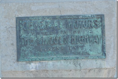
General Motors Section of the Lincoln Highway Eureka Unit Length 22 Miles.
The Lincoln Highway was a marketing idea to promote automobile travel by establishing a transcontinental route from New York City Times Square to Lincoln Park San Francisco.
A couple of years ago I saw a fascinating documentary called A Ride Along the Lincoln Highway. The link here is a 2:18 minute YouTube trailer for the film.
I happen to be writing this post from Tooele, Utah and I saw a sign for the historic Lincoln Highway last night a few miles from the Holiday Inn Express where we stayed.
Ely, Nevada
After Eureka, US Route 50 takes another 77 miles to reach Ely, Nevada, the final town on ‘The Loneliest Road’.
Ely is the only town with major tourist services besides Fallon, Nevada on this stretch of road.
Kelley and I stayed at the Ramada Copper Queen in Ely during our summer 2011 road trip to Denver. On that trip we drove U.S. Route 6 which is definitely Even Lonelier than the Loneliest Road In America. The link is my post of our Route 6 drive during the trip I dubbed our Brokeass Mountain Road Trip.
US Route 6 is truly a remote road across the center of Nevada where we saw only a handful of cars and trucks during the five hour drive. There were far more cyclists on US 50 cycling the highway yesterday than we saw vehicles on US 6 back in 2011. On the 2011 trip we continued on U.S. 50/U.S. 6 to Great Basin National Park and a drive up Wheeler Peak where the paved road ascends to over 10,000 feet on the 13,065 ft peak. I described that adventure in this post Earth’s Oldest Trees in Great Basin National Park Nevada.
In Ely, Kelley and I had a sit-down meal at Prospectors Casino and resumed talking to each other again over a good, but somewhat expensive meal for Nevada.
Free roaming Mustangs of Nevada
I had hoped to have the opportunity to visit Mustang Monument Eco-Resort about 90 miles north of Ely, Nevada. That did not work out for this trip.
The country around Ely just looked like ideal wild horse mustang country as we drove north heading to Wendover and the Holiday Inn Express Tooele, Utah, another 230 miles northeast.
Over half of the mustangs, free roaming horses numbering around 34,000 in the U.S., are located in Nevada.
Once Highway 93 diverged with one route traveling north and past the Mustang Monument and our route heading northeast to Utah, the road had emptied of nearly all vehicles. This was truly the loneliest section of road we drove all day.
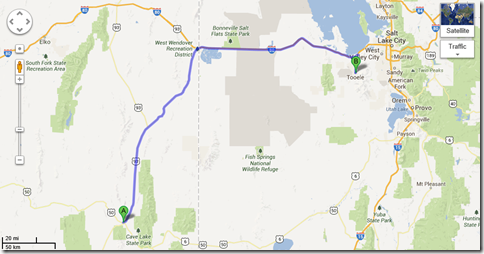
Google Maps US Highway 93 from Ely north to I-80.
We kept our eyes out for a glimpse of horses in the scrub. The evening sunlight made for beautiful colors on the desert landscape tapestry.
I said to Kelley, “I just want to see at least one horse in the Nevada desert, although five together would certainly be a better sight.”
Kelley had seen two wild horses from U.S. Route 50. I was driving and missed them. In 2011 we saw two mustangs in western Nevada from U.S. Route 6.
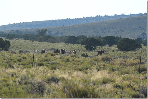
And then I spotted horses off the road grazing around some bushes.
Free roaming mustangs off U.S. 93.
Kelley questioned whether these are truly wild horses since they seemed to be interested in us and came closer after we had been standing by the side of the road for several minutes.
Wild mustangs or not?
Doesn’t matter much to me. My wish had come true.
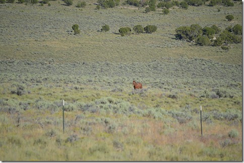
Lone horse on the east side of U.S. 93 across from the larger group.
Ric Garrido, writer and owner of Loyalty Traveler, shares news and views on hotels, hotel loyalty programs and vacation destinations for frequent guests.
Follow Loyalty Traveler on Twitter and Facebook and RSS feed



8 Comments
Comments are closed.