The Truckee River is a place I swam on sweltering summer days in the middle of the city of Reno as a teenager. Paiute Indian friends took me camping a couple of times in large boulder outcrops hundreds of yards from the shore around Pyramid Lake, the Great Basin desert sink where the Truckee River terminates at the end of its journey down the Sierras from Lake Tahoe.
There was little recognition happening when I drove by places where I think I once lived in Reno, Nevada. Freeways, shopping malls, and new business parks did nothing to stir memories of places from when I lived in the ‘biggest little city in the world’ for a few months in 1978.
Water was a running theme of my summer road trip from Monterey to Denver. Sitting in bed at the Holiday Inn Reno Sparks with a AAA Guidebook and Maps and Google to look up highway drive reviews aided my search for the most desirable route across the Sierra Nevada for our trip home.
Interstate 80 and U.S. Highway 50 around Lake Tahoe both lead to Sacramento. We really did not want to drive through Sacramento on our way back to Monterey. Besides, U.S. Highway 50 and Interstate 80 are the only roads I had driven across the Sierra Nevada prior to driving Tioga Pass Road in Yosemite National Park for the outbound route to Denver on this road trip.
I wanted to drive one of the other Sierra Nevada road crossings. There are very few roads crossing the Sierra Nevada Mountains of California over its 400 miles north-south range and 70 miles in width. The southern end of the range has Mt. Whitney, the highest peak in the lower 48 states at 14,505 ft.
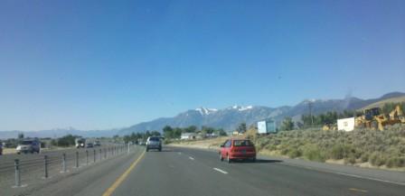
Heading out of the Holiday Inn Reno-Sparks
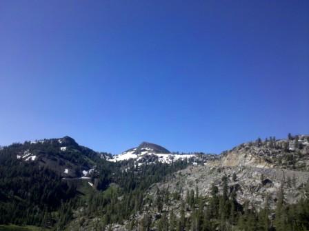
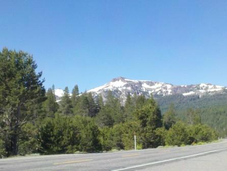
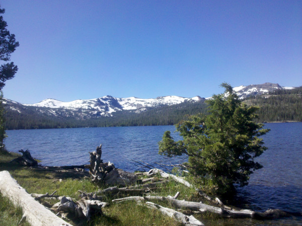
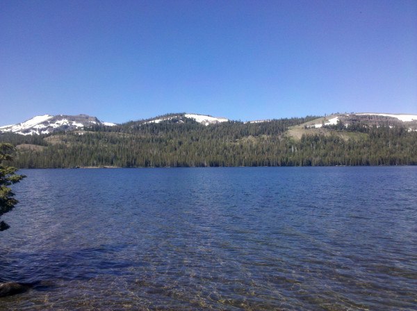
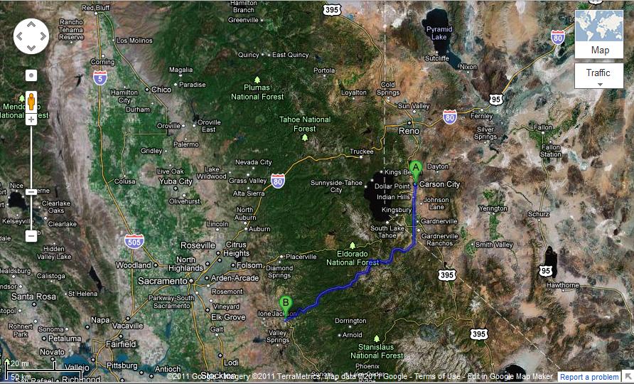
Driving from Reno south are three paved, mostly two-lane state highways crossing the Sierra Nevada Mountains between Lake Tahoe and Yosemite National Park with California Highways 88, 4 and 108. Every east-west road has a summit pass and they are all high elevation and relative to each other are higher the farther south you go to cross the mountain range.
There is nearly a 200 mile stretch of mountains in the southern portion of the Sierra Nevada Mountains where no east-west roads cross the range between Highway 120 Tioga Pass at Yosemite National Park and Highway 178 Walker Pass by Lake Isabella northeast of Bakersfield where the highway crosses near the southern end of the range. Kings Canyon National Park offers a road deep into the western canyons of the Sierra Nevada in the middle of this wilderness and I described the Highway 180 drive last May.
North to South Sierra Nevada Highway Crossings
- Interstate 80 – Donner Summit = 7,259 ft.
- U.S. Highway 50 – Echo Summit = 7,377 ft.
- California State Highway 88 – Kit Carson Pass Highway = 8,573 ft.
- California State Highway 4 – Ebbits Pass Highway = 8,730 ft.
- California State Highway 108 – Sonora Pass Highway = 9,624 ft.
- California State Highway 120 – Tioga Pass Yosemite N.P. = 9,945 ft.
- California State Highway 178 – Walker Pass – 5,250 ft.
- California State Highway 58 – Tehachapi Pass – 4,065 ft. (route to Las Vegas from central California)
The mountain passes increase in elevation heading south with no roads over the high mountains in the southern portion of the Sierra Nevada range south of Yosemite. Here is a map showing only Sierra Nevada highway roads. Walker Pass and Tehachapi Pass are the southern end of the Sierra Nevada.
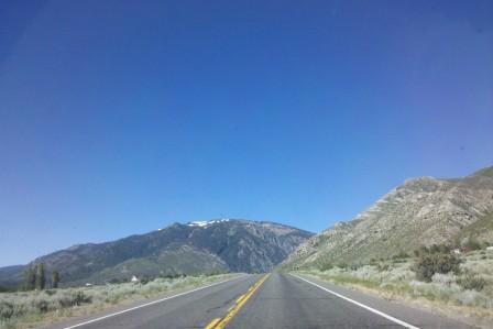
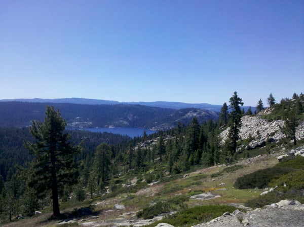
Highway 88 – Kit Carson Pass Highway
The Sierra Nevada physical geography is a gradual rise from the central valley of California to foothills and mountains from west to east. The highest peaks in the eastern portion of the range suddenly drop off into the Great Basin desert of eastern California and Nevada. The geological landscape of the Sierra Nevada creates unique weather conditions resulting in huge snowfall amounts in winter and strong wind currents year round.
The strong wind currents create ideal glider thermal soaring conditions in the area south of Carson City. Barron Hilton, grandfather of Paris Hilton and son of Hilton hotel chain founder Conrad Hilton owns the Flying M Ranch in Nevada. The ranch is a popular location for glider competitions and located about 60 miles south of Reno with its own airfield.
Steve Fossett took off from the Flying M Ranch the day he died in a 2007 solo crash about 65 miles south of the Nevada ranch and five miles west of Mammoth Lakes, California. A documentary I saw on the accident investigation showed extreme wind conditions were likely the cause of the crash in the high mountains of the Sierra Nevada.
Who was Kit Carson and why is a mountain pass in California named after him?
Seeing the name of Kit Carson got me wondering what the guy was doing in California. Carson River was one of the main water routes into the Sierra Nevada along the California Trail that pioneers reached after crossing the Forty Mile Desert from the Humboldt River that flows east to west in Nevada.
Wikipedia is my friend.
Christopher Houston “Kit” Carson truly was a legend in his own time. He was born in Kentucky in 1809 as the eleventh child of his father and the family moved to Missouri when he was one year old. They purchased land from Daniel Boone’s son. Kit’s father died when he was eight and he was apprenticed to a saddle maker at the age of 14 in Franklin, Missouri on the north bank of the Missouri River.
Franklin, Missouri’s location was the terminus of the newly created Santa Fe Trail used as a trade route between the United States and Mexico. The Santa Fe Trail followed the Arkansas and Cimarron Rivers across present-day Kansas and Colorado through Comanche Indian territory to reach Santa Fe, Mexico at that time and now present-day New Mexico.
Kit Carson signed on to tend livestock with a caravan heading to Santa Fe when he was 16 and stayed in Taos. In his twenties Kit lived the wild west mountain man life as a fur trapper/trader traveling across much of the western U.S. including Arizona and as far west as Sacramento, California and north into Montana and Idaho. He learned to speak Spanish and several Native American tribal dialects. Throughout the 1830s he trapped beaver throughout the western U.S. from Idaho to Colorado until the beaver became scarce and the economy hit recession reducing beaver pelt value.
In 1842 Kit Carson met John Fremont, son-in-law of Missouri U.S. Senator Thomas Hart Benton. Fremont worked with the Corps of Topographical Engineers and had spent several years mapping the Mississippi, Missouri and Des Moines Rivers. Fremont needed a guide for an expedition into the South Park region of the Colorado Rocky Mountains and searching the source of the Arkansas River. My Loyalty Traveler post ‘Driving by the 14ers South Park to Aspen, Colorado‘ has pictures and a description of Colorado’s South Park.
The five-month journey into the Colorado Rocky Mountains was written up by Jessie Benton Fremont, wife of John Fremont. From what I have read, Jessie Benton Fremont was the woman who elevated John Fremont’s political standing as her writing of her husband’s travels is what Congress received as John Fremont’s American West exploration reports.
Fremont received another commission to explore the American West for territorial expansion and with Kit Carson as guide they explored the Sierra Nevada of California and Cascade Range of the Pacific Northwest as far as Washington state from 1842 to 1846.
Jessie Benton Fremont’s Congressional reports made the two men national heroes.
Fremont’s reports were published by Congress and used as guides for the emigrant migration west in the 1840s and the routes to California during the Gold Rush era.
Kit Carson Pass on what is now Highway 88 in California was mapped in 1844 when John Fremont and Kit Carson attempted a winter crossing of the Sierra Nevada in February against the advice of local Indians. Fremont is reported to be the first white to see Lake Tahoe. The party successfully crossed the Sierra Nevada in about five weeks over what is now called Kit Carson Pass reaching Sutter’s Fort near Sacramento in early March 1844 with no loss of members from the exploration party. In 1849 Mormons heading back to Utah from California built a trail across Carson Pass. This route was the most traversed route across the Sierra Nevada during the California Gold Rush.

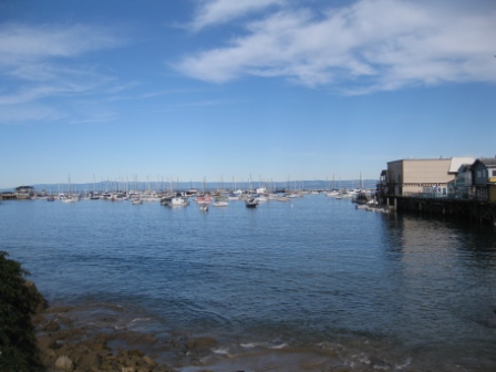
John Fremont headed out to California in 1845 and helped initiate the Mexican-American War of 1846 in California by establishing a camp with an American flag on a mountain peak overlooking Monterey Bay and Monterey, which at the time was the Mexican political capital of Alta California.

Fremont was evicted by threat of the Mexican military stationed in Monterey and he headed north to Oregon Territory, but soon returned after the war officially started and, as a lieutenant colonel in the California Battalion, he led assaults on San Diego and Los Angeles.
Kit Carson was dispatched east to to Washington D.C. to report the conquest of California by Fremont and Commodore Stockton. In New Mexico, Carson met General Kearney who ordered Kit Carson to lead his army unit across Arizona and back to San Diego, California. The Mexicans had recaptured San Diego and Los Angeles and Kearney’s unit helped recapture these towns for the Americans and end the war in California.
The Treaty of Cahuenga in January 1847 ended the California war and Fremont was appointed military governor of California by Commodore Stockton.
Kit Carson, having never made it past Taos, New Mexico the year before, was sent back to Washington, D.C. a second time to report the conquest of California to Congress and the President. He made it to D.C. and after briefing political leaders Carson was ordered back to California. The guy earned a lot of frequent rider miles before settling in Taos, New Mexico in 1849.
Fremont refused to turn authority over to General Stephen Watts Kearney in 1847, who was officially designated Governor of California by President Polk and the War Secretary. Fremont was eventually arrested and court martialed. President Polk commuted the sentence to a dishonorable discharge from military service. Fremont returned to California, settling near Mariposa. He was elected as one of the first two Congressional senators from California.
In 1856, John Fremont was the first presidential candidate of the Republican Party running on the anti-slavery and manifest destiny platform of “Free Soil, Free Men and Fremont.” The election of anti-slavery candidate John Fremont could have sparked the Civil War. Senator Benton, Fremont’s father-in-law and a powerful Democratic Party leader backed James Buchanan who won the Presidential election of 1856. Four years later Republican candidate Abraham Lincoln, who lost in his bid to be the Vice Presidential candidate on the Fremont 1856 ticket, was elected U.S. President and the Civil War ensued.
History lesson over.
There is far more historical information than travel information in this post. I found it interesting upon returning home to read how these historical figures played major roles in the places I drove across over the western states on this trip from Monterey to Denver.
This road trip helped me connect geography with political history in California and the western states. Road tripping gives a person plenty of time to observe and think.
Brokeass Mountain Road Trip, July 2011
Monterey, California – Denver, Colorado
- Yosemite’s Tioga Pass Road across the Sierra Nevada Mountains
- Westin Monache Resort Mammoth for year round vacations
- Even Lonelier than the Loneliest Road in America
- Earth’s Oldest Trees in Great Basin National Park Nevada
- Less extreme than 127 Hours in Utah
- Brokeass Mountain Tour eastbound – Hotel Value at High Elevation
- Brokeass Mountain Tour visits Starwood in Denver
- Driving by the 14ers South Park to Aspen, Colorado
- Top of the Rockies on the High Road to Aspen – Independence Pass 12,095 feet.
- St. Regis Aspen – Too Late to Cancel
- Aspen, Colorado to Park City, Utah: Ghost lands of Buffalo Soldiers, Utes and Dinosaurs
- The California Trail across Nevada
- Homeward Bound – Carson Pass Highway 88 over the Sierra Nevada to Monterey

