The drive across Nevada I-80 is a drive I’ve made about a dozen times in the past thirty years. More than once I shared the joke with strangers along the way during this Brokeass Mountain Tour that 12 years had passed since Kelley and I drove Interstate 80 across Nevada and time fades away memories, especially when washed down with intervening years of beer.
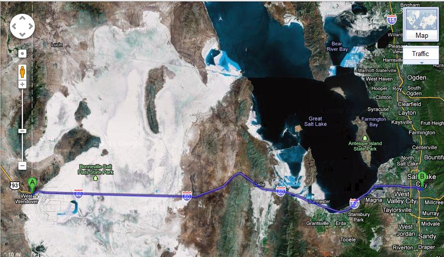
Salt Lake City to Monterey, California is 830 miles and a stopover in Reno is a convenient and generally cheap hotel place to rest before venturing up the Sierra Nevada Mountains into California. The drive from Salt Lake City to Reno is 520 miles on Interstate 80 with very few places to stop for gas and food. Wendover, Wells, Elko, Battle Mountain, Winnemucca and Lovelock are the six locations for services over the 500 miles of Great Basin desert and mountains ranges.
Leaving Salt Lake City
Salt Lake City is located on the southeastern edge of Great Salt Lake between the lake and the rugged peaks of the Wasatch Mountains at 9,000 to over 11,000 feet dominating the eastern skyline of the city.
I read an article as we drove out of Salt Lake City about Utah’s restrictive alcohol sale laws. The realization came to me that I spent about 42 hours in Utah, but never once tried to buy a beer. I bought a case of beer at Costco before leaving Monterey and I had a 12 pack of beer from Denver while driving west across Utah. Bar hopping in Park City might have been more of a challenge than biking down a ski slope.
The I-80 freeway rides up right against the Great Salt Lake for several miles, but highway concrete dividers were hard to see over for good views of the lake.

Those hotel commercials for “I should have stayed at a Holiday Inn Express” actually worked in our case. Kelley was back to her normal lovable self after two rough days as a couple driving in the mountains. She kept repeating to me as we drove across the Great Basin deserts, “Remember, I don’t like the mountains.”
Interstate 80Â out of Salt Lake City is flat.
There are some mountains on the southwest side of the Great Salt Lake in the Wasatch-Cache National Forest. Deseret Peak is 11,031 feet.
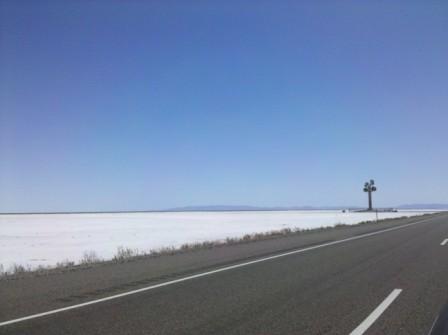
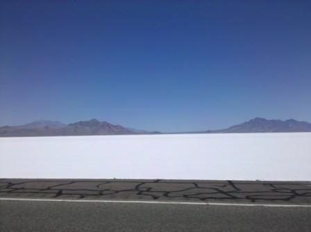
And on the other side of the mountains back to flat in the Great Salt Desert. This is home to Bonneville Salt Flats State Park in Utah.
Kelley actually drove all 500+ miles on the way to Reno, so I had the chance to take plenty of photos of Nevada desert lands. But looking at my phone pictures I see I didn’t.
West Wendover, Nevada
West Wendover, Nevada at the Utah state line is 120 miles west of Salt Lake City on Interstate-80.
A rude awakening results after crossing a hundred miles of Great Salt Lake Desert and physically flat miles and miles of salt flats to the blue horizon sky to find a poltical creation of commerce in the center of the desert replace the natural environment. The liberal laws of Nevada create an environment where for a couple of minutes deep in the desert the salt flats and mountain scenery are overshadowed by casino lights, hotels, fast food places, billboards and a neon flashing Strip Club sign visible from the freeway. Lap dances are just dollars away from the freeway.
Hotels, food and lapdances have kept West Wendover a bustling dot in the wild west for more than a century. AAA Guidebook says the area around Wendover is where US Air Force pilots trained for dropping the atomic bombs in WWII. The AAA map actually has large all cap font locator GREAT SALT LAKE DESERT, and in a smaller font shows Wendover Air Force Auxillary Field across the same desert lands of western Utah, south of Interstate 80. North of Interstate 80 is Hill Air Force Range.
And all this science I don’t understand
It’s just my job five days a week
    -Elton John – ‘Rocket Man’
In August 1983 Kelley and I drove back to Monterey from Denver on Interstate 80 leaving Salt Lake City at night after a rough day trying to sleep in a tent as we camped in the 100 degree heat of downtown SLC. We recall that trip as one of our stupidest travel ideas ever. The logic for our 1983 road trip in her Honda Civic with no air conditioning was to drive at night when it was cool and sleep during the day in a tent.
I recall every place we camped that trip as a sweat lodge endurance test.
The point of bringing up the 1983 trip is we saw a multi-million dollar light show crossing the Great Salt Lake Desert that night under Reagan’s watch. I estimate we saw missiles frequently shooting across the night sky for more than an hour in a display of fiery light I say rivaled any fireworks show I’ve ever seen. I think you need to have been in a war zone to have seen anything else like it.
Seeing the Air Force Testing Range on the AAA Utah map brought back that memory of a past desert crossing.
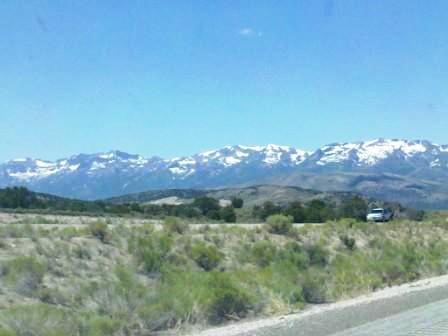
Pequop Summit
The highest point of Interstate 80 in Nevada is located in the sixty mile stretch between West Wendover and Wells where the road crosses the Pequop Mountains and Pequop Summit sits at 6,987 feet. Kelley had one day respite from the oxygen deprived air at 8,500+ feet. The Sierra Nevada still awaits as pioneers heading west to California for the gold fields discovered 160 years ago.
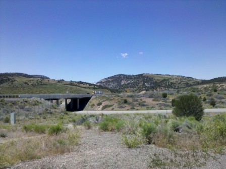
Since I mislabeled some photos in Utah in yesterday’s post, I will state that I am not certain this photo is Pequop Summit. It was taken at one of the summits on I-80 in eastern Nevada.
The California Trail

Humboldt River in Nevada begins as Humboldt Wells at a spring in the eastern Humboldt Mountains. These desert places are named for 19th century German scientist Alexander von Humboldt. I find it interesting to see so many western state place names for a man who primarily explored South America. The guy spent time with President Thomas Jefferson in 1804 in Washington D.C., but never traveled north of Mexico City in the North America interior. I studied several years at Humboldt State University in Arcata, California. I have also seen Humboldt University in Berlin.
The California emigrants in the mid-19th century traveled to Idaho and then headed south from Fort Hall on the Snake River near modern day Pocatello, Idaho. The objective was reaching the Humboldt River and following the river west from the Ruby Mountains for 300 miles where the river ends in the Humboldt Sink.
The Great Basin rivers all terminate in the basin region. Bear River is the largest and terminates in the Great Salt Lake. Humboldt River crosses much of Nevada, but terminates almost 100 miles from Reno.
The big story of the day while driving across the Nevada desert was a judge’s order stating the wild Mustang horse roundup could go ahead. Kelley and I saw wild horses when we drove east across Nevada on Highway 6, about 200 miles south of Interstate 80.
The roundup started as we were driving through Nevada and went through the month of August to round up 1,300 horses from a population estimated to be 2,200 horses in the region around the Ruby Mountains between Elko and Ely, Nevada. That is around 15% of the total wild horse population of Nevada. BLM says the area can only sustain 500 to 900 wild horses. 12 horses died in the six week roundup.
A federal judge refused to halt the roundup, but issued a temporary restraining order in the last week of the wild horse roundup banning mistreatment of the mustangs. An RJG.com piece on the Wild Horse Freedom Federation federal lawsuit against President Obama’s Interior Secretary Kenneth Salazar has YouTube video link with a 10-minute video showing a contractor working the BLM wild mustang roundup chasing horses in a helicopter August 5, 2011. One of the horses seen in the video was one of the 12 roundup deaths.
“I have my freedom but I don’t have much time
Faith has been broken, tears must be cried
Let’s do some living, after we die”
    -Rolling Stones – ‘Wild Horses’
Forty Mile Desert
Modern technology propelled us 500 miles across the desert stretches of Utah and Nevada in a mere eight hours with time to eat a fast-food meal and fill up the gas tank. The pioneer emigrants on the California Trail were doing well to make the journey in a month.
Traveling with oxen, mules, cows and horses required plenty of water and grass to maintain the animals. The emigrant trails west followed river sources. The most treacherous section of the California Trail journey was just one hundred miles from Reno. A few miles southwest of Lovelock, Nevada on I-80 is where the Humboldt River ends at the Humboldt Sink. Forty miles of desert with no water sources separate the end of the Humboldt River from the Truckee River that flows east from Lake Tahoe in the Sierra Nevada through Reno to drain into the Great Basin’s Pyramid Lake. Another more southerly route required a different forty mile desert crossing to reach the Carson River. Wagons had to be hauled across these forty mile stretches of desert that were lined in the 1850s with carcasses by the thousands before the railroad crossed Nevada.
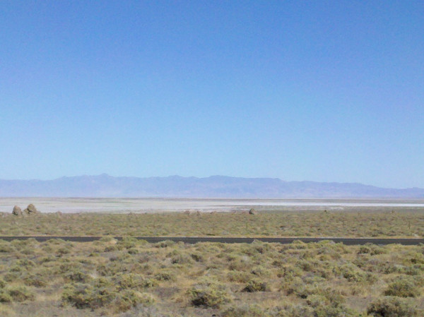
Forty Mile Desert, an alkali wasteland, was the most dreaded portion of the entire 2,000 mile California Trail journey according to a place marker at the rest area at the intersection of Interstate-80 and US Route 95.
A trail survey from 1850 counted:
- 1,061 dead mules
- almost 5,000 horses
- 3,750 cattle
- 953 graves
The California Trail route was most heavily used from 1849 to 1859. The completion of the transcontinental railroad in 1869 opened the west to far more emigrants.
Emigrant pioneers still required another month of travel from Forty Mile Desert across the Sierra Nevada into the Central Valley of California.
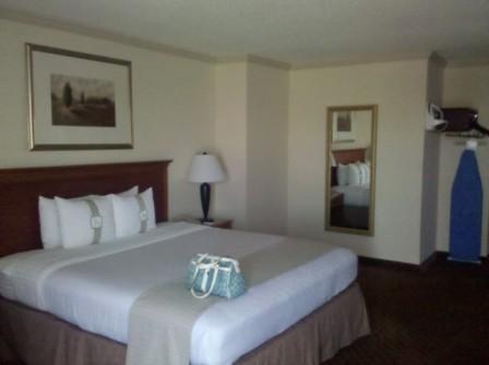
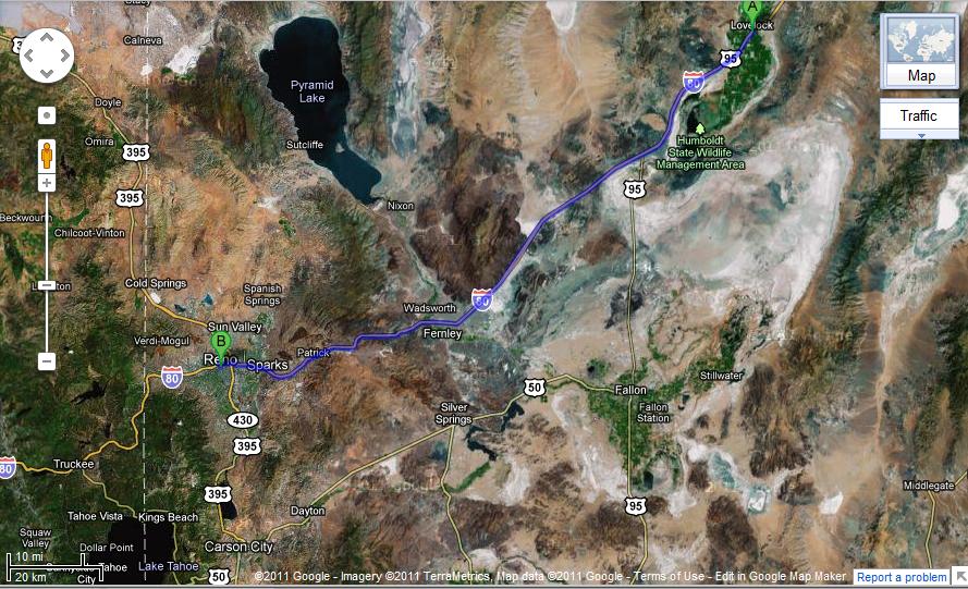
Kelley and I checked into the Holiday Inn Sparks-Reno on a PointBreaks night about 90 minutes later.
After a good night’s sleep we had one more off-the-interstate road journey remaining before arriving home in Monterey as I planned to take us over Carson Pass on Highway 88 over the California Sierra Nevada Mountains.
Brokeass Mountain Road Trip, July 2011
Monterey, California – Denver, Colorado
- Yosemite’s Tioga Pass Road across the Sierra Nevada Mountains
- Westin Monache Resort Mammoth for year round vacations
- Even Lonelier than the Loneliest Road in America
- Earth’s Oldest Trees in Great Basin National Park Nevada
- Less extreme than 127 Hours in Utah
- Brokeass Mountain Tour eastbound – Hotel Value at High Elevation
- Brokeass Mountain Tour visits Starwood in Denver
- Driving by the 14ers South Park to Aspen, Colorado
- Top of the Rockies on the High Road to Aspen – Independence Pass 12,095 feet.
- St. Regis Aspen – Too Late to Cancel
- Aspen, Colorado to Park City, Utah: Ghost lands of Buffalo Soldiers, Utes and Dinosaurs
- The California Trail across Nevada

8 Comments
Comments are closed.