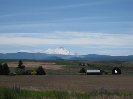
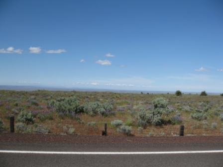
Highway 197 South out of The Dalles, Oregon crosses 60 miles of high desert sage country east of the Cascades.  A plateau of sage sprinkled with colorful spring wildflowers, cut with river canyon gorges and backed by snowcapped mountains is scenery to savor in a sparsely populated landscape.
I had a feeling of being the sole traveler on a long empty road. For the most part of the sixty mile drive I was the only car on the road, considering the number of times I stopped in the road and snapped photos for a minute or two with no other vehicle passing.
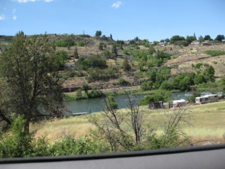
Maupin is a small town where Highway 197 crosses the Deschutes River in a steep canyon gorge with perhaps recently built houses on the high canyon edge.
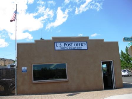
The remoteness of Maupin, about 40 miles south of The Dalles, reminded me of one store, too many churches towns where I taught school during the past couple decades.
Rafting the Deschutes seemed like the popular pastime activity as I saw several young adults in bathing suits walking around town during my slow cruise through Maupin as the road winds down to the canyon floor and crosses the Deschutes River, then back up the canyon wall again into the wildflowers, green spring grasses and sage of the desert plateau.
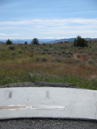
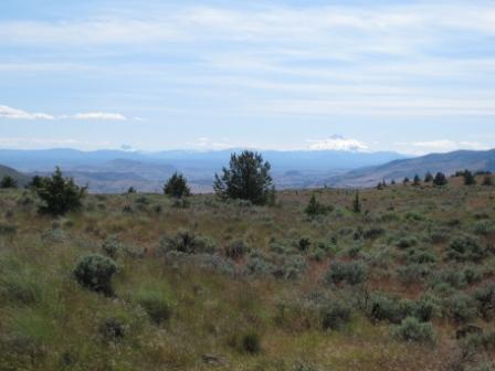
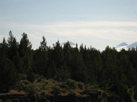
Criterion Summit is the high point of Highway 197 at 3,360 ft. There is a mountain marker viewpoint at this location on the west side of the road.
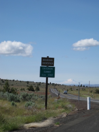
Mt. Jefferson in center photo is 10,445 ft. and probably about 50 miles away.
The view across the grasslands to the mountains was filled with bird songs.
“Miles from nowhere, guess I’ll take my time, oh yeah, to reach there.†– Cat Stevens –Yusuf Islam.
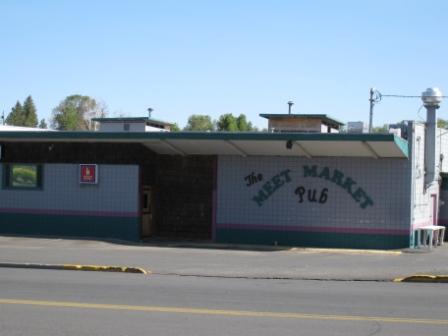
Madras is the first real city I drove through after driving 90 miles south of  The Dalles on Highway 197 and then rejoining Highway 97 after Criterion Summit. Madras has a Safeway market where I discovered there an incredible 4-day sale with great food discounts. The signs were everywhere in the store. Unfortunately, I was walking the aisles the day before the sale started and seeing all the much higher prices in effect.
Across the street from the Safeway Market is the Meet Market Pub. This could be a potential authentic Central Oregon cultural experience for the admission price of a beer. At least a clever name.
Down the road some miles I stopped the car and soon found myself walking on a road to nowhere.
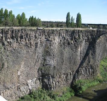
This Crooked River Bridge spans the gorge at 295 feet above the river.
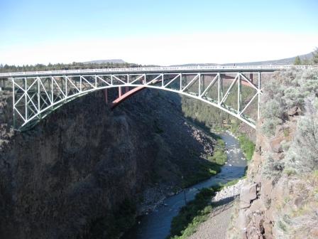
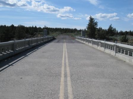
This deserted bridge was the only automobile bridge across the Crooked River Gorge from 1926 until replaced with an adjacent bridge for Highway 97 in the late 1990s. This old bridge now leads into sagebrush. The old Crooked River Bridge is open to pedestrians from the Peter Skene Ogden State Scenic Viewpoint 25 miles south of Madras.
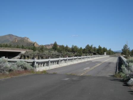
This is a remote area 11 miles north of Redmond, Oregon, the nearest city.
Take care when traveling out here to be safe.
Bend, Oregon
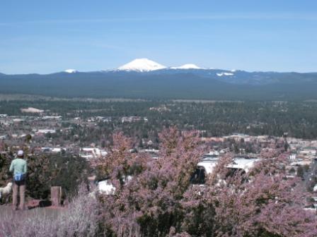
My first impression of Bend, Oregon was that it was perhaps close to the most beautiful part of Oregon. I drove through miles of suburbs, business parks and malls before finding the downtown area in this city of about 80,000. The city of Bend’s population grew 50% from 2000 to 2010.
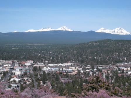
The real joy was a perfectly clear morning atop the summit of Pilot Butte. Too many people around Bend I fear will likely make the clear days like this less frequent.
The city of Bend was incorporated in 1905 with about 250 residents and 80 buildings soon after Alexander M. Drake arrived in the Central Oregon area in 1900 and purchased land as a real estate investment opportunity. This was a land of old growth trees. By 1909 the Bend area had a real estate boom from buyers in the eastern U.S. and the city grew with irrigation and electricity by 1910.
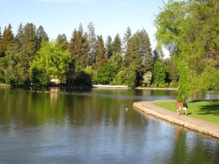
In 1920 the women of Bend gathered signatures for creation of a Bend city park. The tax measure passed and 10 acres were purchased for $20,000 and Drake Park was established with community effort to beautify the land for public use.
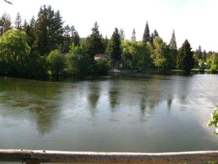
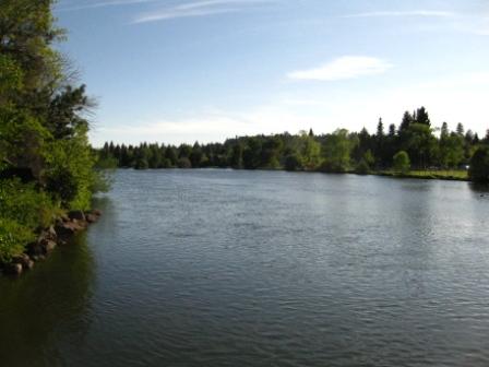
Drake Park sits adjacent to downtown restaurant and shops in Bend.
Second impression of Bend is this place is loaded with athletes. I don’t think I’ve ever seen so many people running downtown without a formal race or riot happening.
This is part of a series of Loyalty Traveler posts describing a road trip from Monterey to Vancouver, British Columbia for Travel Blog Exchange June 11-12, 2011. This post describes the high desert road through Central Oregon on Highway 197 and Highway 97 along the eastern side of the Cascade Mountains Range from The Dalles to Bend, Oregon.

1 Comment
Comments are closed.